A preserved shop, a poet-priest, and the duck-women of Vega

“Another twenty minutes and we would have made it”, says the First Mate. “As it is we are going to get drenched tying up.”

We are just arriving at the island of Myken. We have had a pleasant sail down from the Fleinvær islands, but for the last hour we could see the dark storm clouds gathering in the west. Now the heavens have opened.

“There’s another boat already there”, shouts the First Mate through the rain. “With a Canadian flag. We’ll have to go on the outside of the pontoon.”

It’s Harley and his family in their boat Prudence. We had heard of them last year when in Trondheim, but so far had not met them.
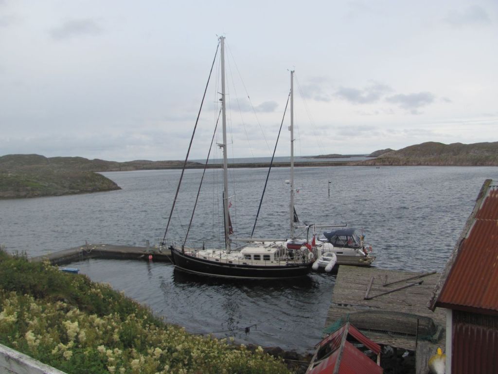
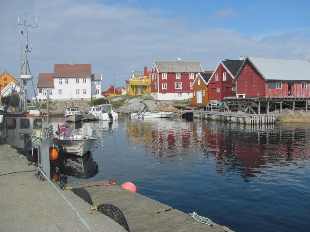
Prudence and Ruby Tuesday in Myken harbour.

“We’ve been here a couple of days”, Harley says. “But we are moving on first thing in the morning to Træna. It’s a lovely little island here, though. You’ll enjoy it. They have a distillery that’s worth a visit. And a restaurant and a museum. Everyone is very friendly.”

When we awake in the morning, Prudence has gone. After breakfast, we explore the village. There is a coffee morning in the grocery store.

“We meet here every morning for a coffee and waffle, and to do our knitting”, says one woman. “We’re trying to get a quilt finished by Christmas time. Visitors are welcome too.”
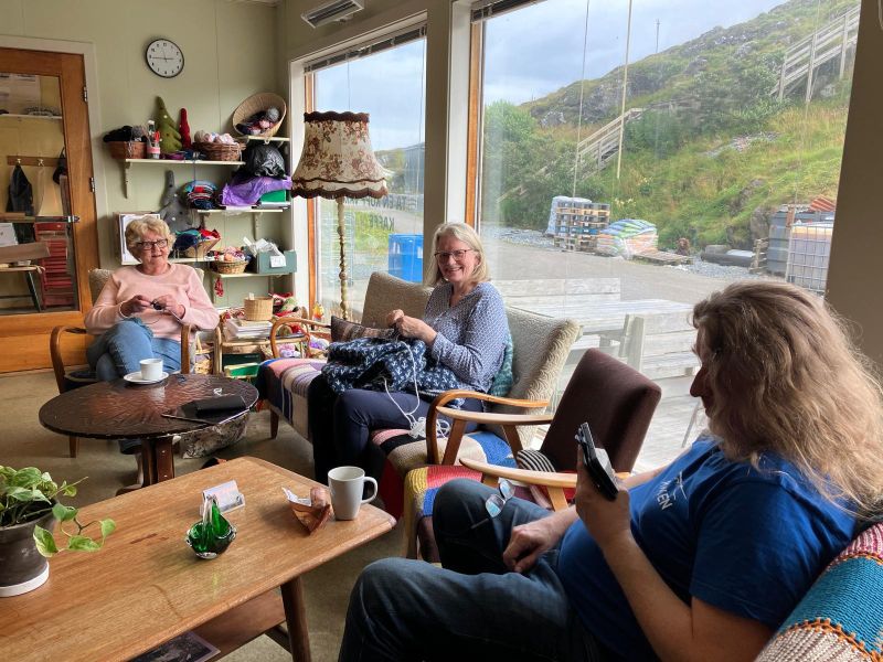
Daily coffee morning in the grocery store.

“There are only 16 permanent residents here now”, says another. “But a similar number of former residents who now live on the mainland still come every summer. And, of course, there are people like me that were born on the mainland, but who came here on holiday and loved it so much that they keep coming. I bought a small fishermen’s hut called a rorbu, and sell my glassware there.”

On the way back, we pass the distillery. At the other end of the village is the so-called ‘Distillery Cathedral’, a modern looking building where whisky tasting tours are offered.
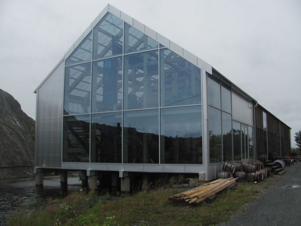
The ‘Distillery Cathedral’.

In the afternoon, we visit the Gamla Butikken, the ‘Old Shoppe’, at the end of the village. It used to be the village store, and has been preserved just as it was when it closed in the 1960s. Rather than the customers serving themselves and paying at the end, they tell the shop keeper behind the counter what they want, and he or she will go and fetch it.
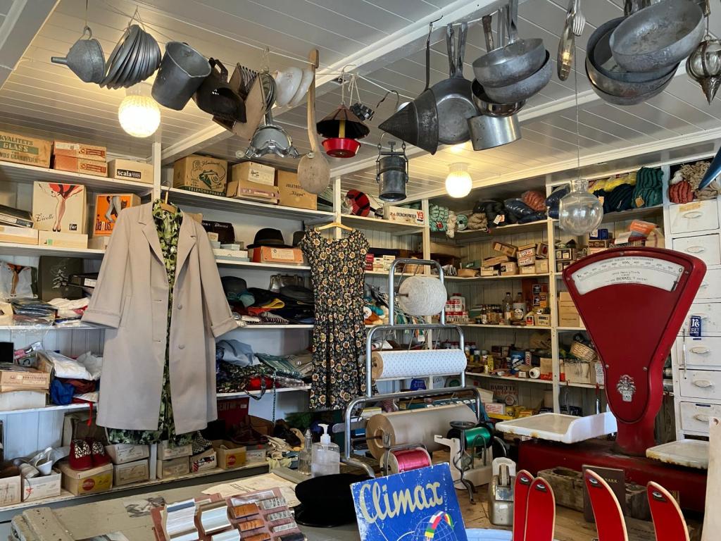
The Gamla Butikken.

“It was our grandfather’s shop, and his father’s before that”, Hannah tells us. “It’s been in the family for generations. When our grandfather died, our grandmother left it just as it was and locked it up. It stayed that way for many years, but one time when I was here I thought that it might be a good idea to open it as a kind of museum so that visitors can see what it is like in the old days. My grandmother liked the idea. The problem was that the building was becoming more and more derelict and it would have soon needed to be pulled down. She saw this as a way of preserving it.”

Hannah was brought up on the island, and still spends summers here, but lives in Bodø during the winter.

“What was it like being brought up on the island?”, we ask.

“I loved it”, she says. “There were quite a lot of people living on the island in those days, and there were several children my own age. We had a lot of fun.

“But the population started declining in the 1970s”, says her brother, who has joined us. “The government’s policy at that time was to do away with all these remote communities with their traditional low paying occupations, and persuade people to move to the cities where they could get better jobs and contribute to the nation’s wealth.”

“What about your father?”, asks the First Mate. “Was he involved in the shop as well?”

“No, he was a fisherman”, answers Hannah. “On a trawler. But he died while out fishing. Did you see the memorial in the middle of the village? He’s the one at the top. We don’t know the reason, but he had come off his watch at night, and was seen going downstairs to his cabin. But in the morning he was missing. His body was never found.”
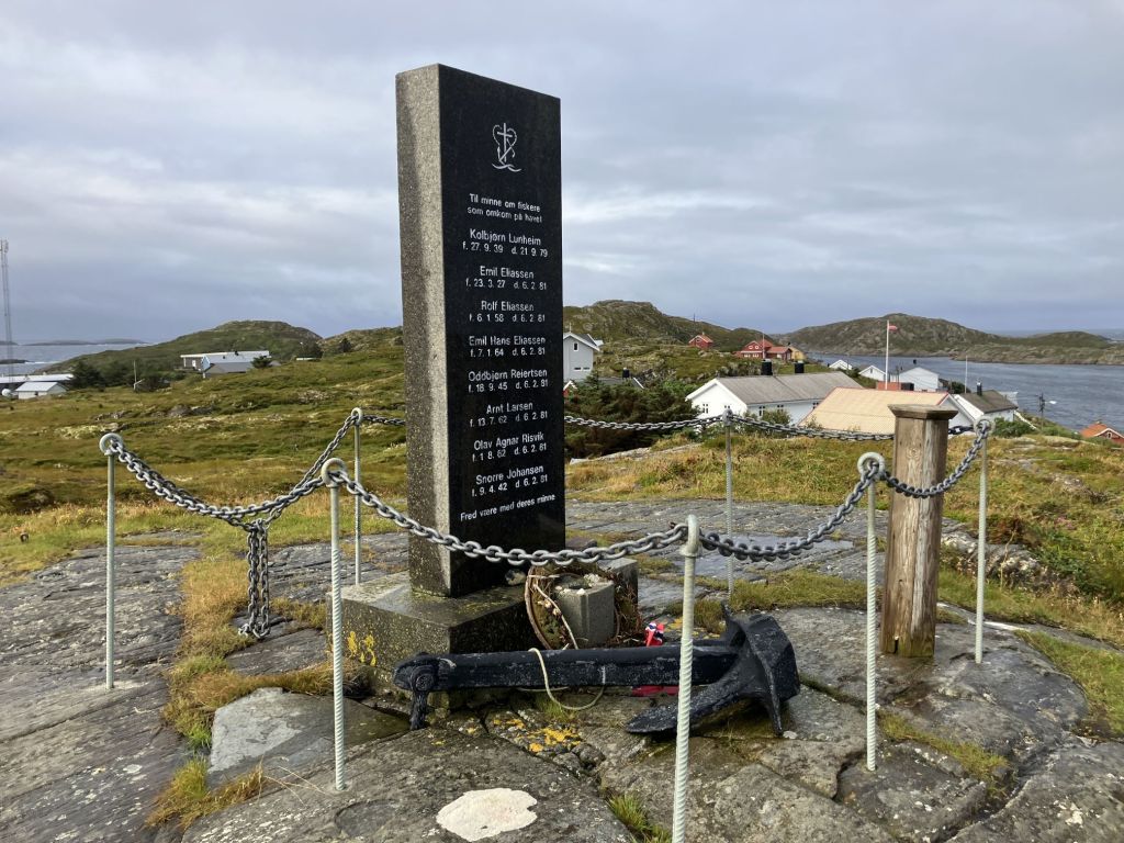
Memorial to those lost at sea, Myken.

“What happened?”, we ask.

“Well, it was presumed he had fallen overboard. But my brother here had a heart attack a few years ago, and we wonder if our father’s disappearance had possibly been something to do with his heart. Weak hearts can run in families, you know. But we’ll never really know for sure.”

“Who were the other names on the memorial?”, I ask.

“That was a boat that went down with all on board”, says Hannah’s brother. “A storm blew up, and they tried to make it back to safety, but they were too late. The storm caught them and the boat capsized. Not far from here. A father and his two sons and four others were lost. It was devastating for the whole community.”

“It just shows the perils of making a living from the sea”, says the First Mate after we leave. “I am not sure that I could have coped with it.”

—-

In the morning, we set sail for Sandnessjøen, 50 miles to the south. We pass Lovund on our starboard side doing volcano impressions.
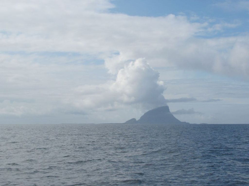
Lovund – volcano?

The wind strengthens in the afternoon, and we have a nice sail with the genoa only, arriving at Sandnessjøen in the evening.

The next morning we visit the Tourist Information Office to find out if there is anything we should see in Sandnessjøen.

“There’s not much here”, the man behind the desk in the Tourist Information admits. “It’s mainly a setting off point for trekking and skiing in the Seven Sisters. But one thing that might be of interest is the Petter Dass statue in the town centre. He was a Lutheran priest back in the 17th century, who was born on the island of Dønna across the fjord from here. He wrote a lot of texts and hymns, which were used right up to the present. He is seen as an important literary figure who put northern Norway on the literature map, so the town has made quite a thing of him.”
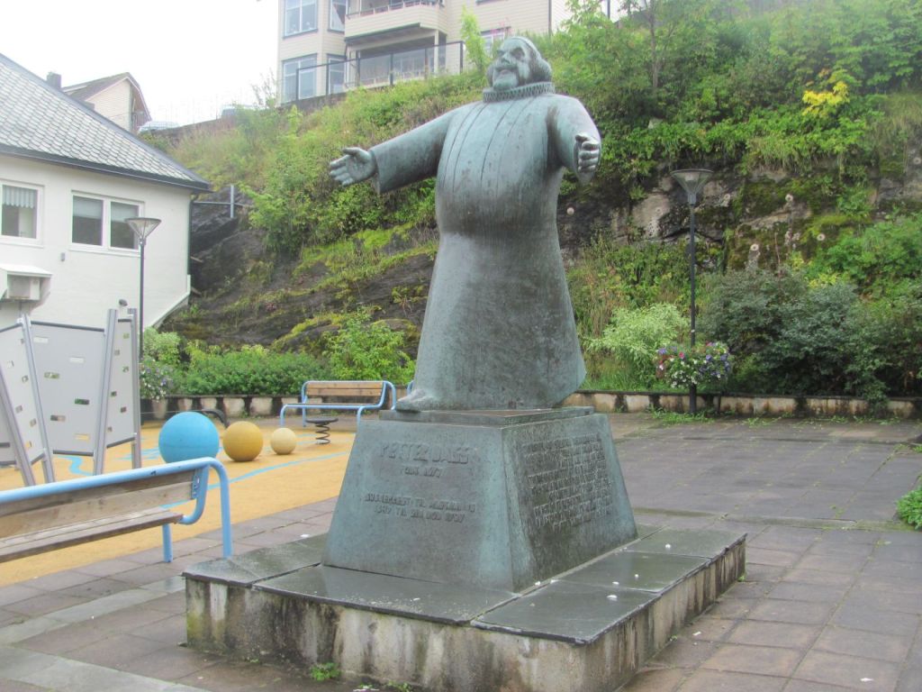
Petter Dass statue, Sandnessjøen.

“Yes, we keep coming across his name in our travels”, I say. “There was a Petter Dass walk on Lovund and a Petter Dass chapel on Træna.”

“Well, since you have your own boat, you might also be interested in seeing the giant statue they made of him on one of the skerries in the fjord”, the Tourist Information Man continues. “The base of it gets covered by the tide, so it really looks like he is walking on water. The story behind it is that the king requested him to give the Christmas sermon in Copenhagen, but for various reasons Petter didn’t receive the request until the day before Christmas. Myth has it that he made a deal with the Devil to fly him there in time in return for the Devil gaining the souls of anyone who fell asleep during the sermon. Of course, Petter gave such a powerful sermon that no-one fell asleep.”
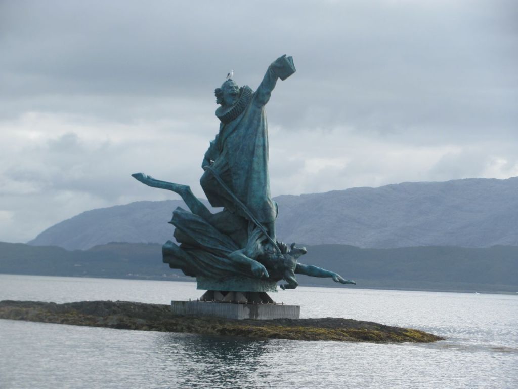
Petter Dass riding the Devil to Copenhagen.

In the morning, we push on southwards towards Vega. The wind is from the south-west, more-or-less just where we want to go, so we need to tack. It’s slow going, but we make some progress. We feel smug when we see other yachts pass us with their sails furled away and their engines running. Purists, us! Well, sometimes.
Between tacks, I recall a book that we had both read over the winter, Place of Tides, by James Rebanks. In it, he tells the story of Anna, one of the ‘duck-women’ of Vega. He spends a spring and summer living with her and her helper Ingrid, learning about her family, the history of the islands, and the decline of the eider-down tradition. It’s a delightful story about sense of place, loss of the old ways, and finding a way to live more deliberately and with purpose. We are both keen to visit Vega and learn more of this ancient practice and life on its archipelago.

The bulk of the island of Vega looms out of the haze, its top wreathed in cloud. We had initially planned to stay at the harbour at Igerøya on the east of the island, but the First Mate has been on the phone.

“I talked to the UNESCO Vega Archipelago museum”, she says. “They say the best thing to do is to come to Gardsøya on the north of the island. You can tie up right next to the museum. The problem with Igerøya is that you need to get a bus to the museum and they only run at certain hours. Gardsøya is much easier.”

I haven’t planned a route to Gardsøya, and to get there we need to thread our way through an intricate system of shallow channels and low-lying islands, all the time avoiding submerged rocks and drying mudflats. But we have good charts, and we decide to give it a go.

It’s a tortuous route, but at least it is well marked. We get good at identifying the marker poles and beacons and matching them with those shown on the charts. On either side, dark jagged lumps of rock slide past, and the depth falls on occasions to just a metre or so clearance below the keel. But somehow we make it, and soon we are edging our way gingerly into Gardsøya harbour and to the pontoon below the distinctive UNESCO museum. We are the only boat there.

“Well, that took a bit of concentration”, I say, breathing out. “But at least we made it.”
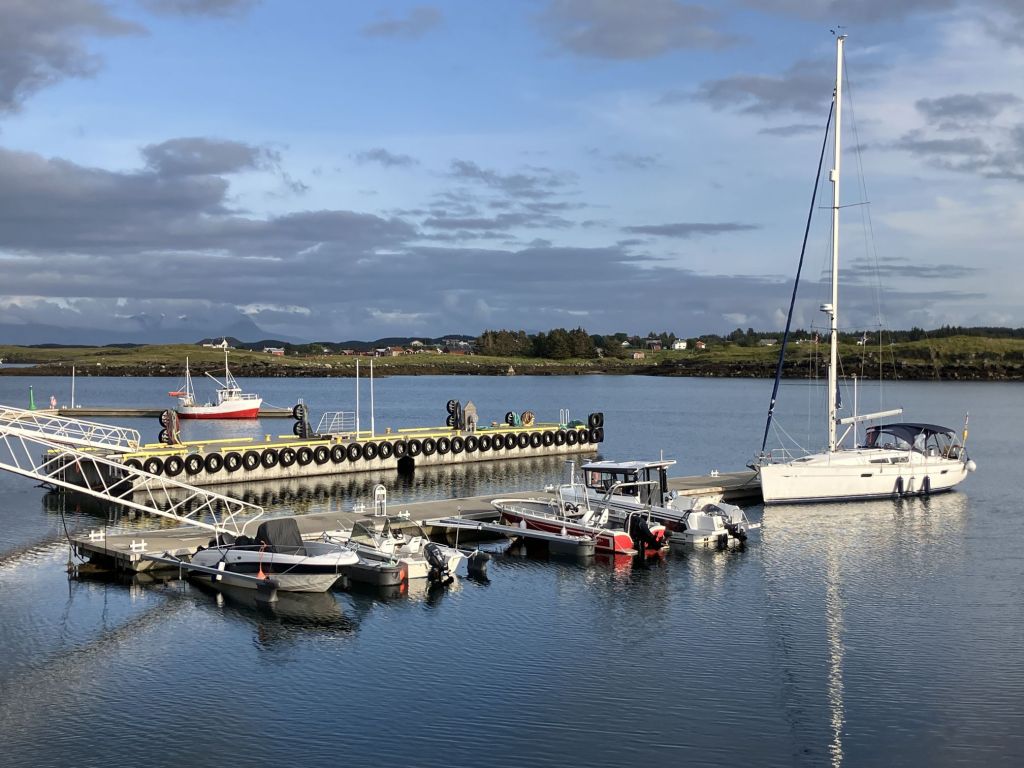
Gardsøya harbour, Vega.

Not long after we tie up, we see another boat entering the harbour.

“It has a British flag on it”, says the First Mate. “I wonder who it is?”

It turns out to be the Chairman of the Cruising Association, Nick, in his boat Spellbinder, along with his wife Sue, and two friends. We also belong to the Cruising Association.

“We were just thinking of having an eclipse-watching drink”, says Nick. “Would you like to join us?”

It’s partially cloudy, with patches of clear sky. Two G&Ts later, it’s completely cloudy, with no sun at all.

“Oh well”, I say. “It looks like the eclipse has been eclipsed. You can’t win them all.”
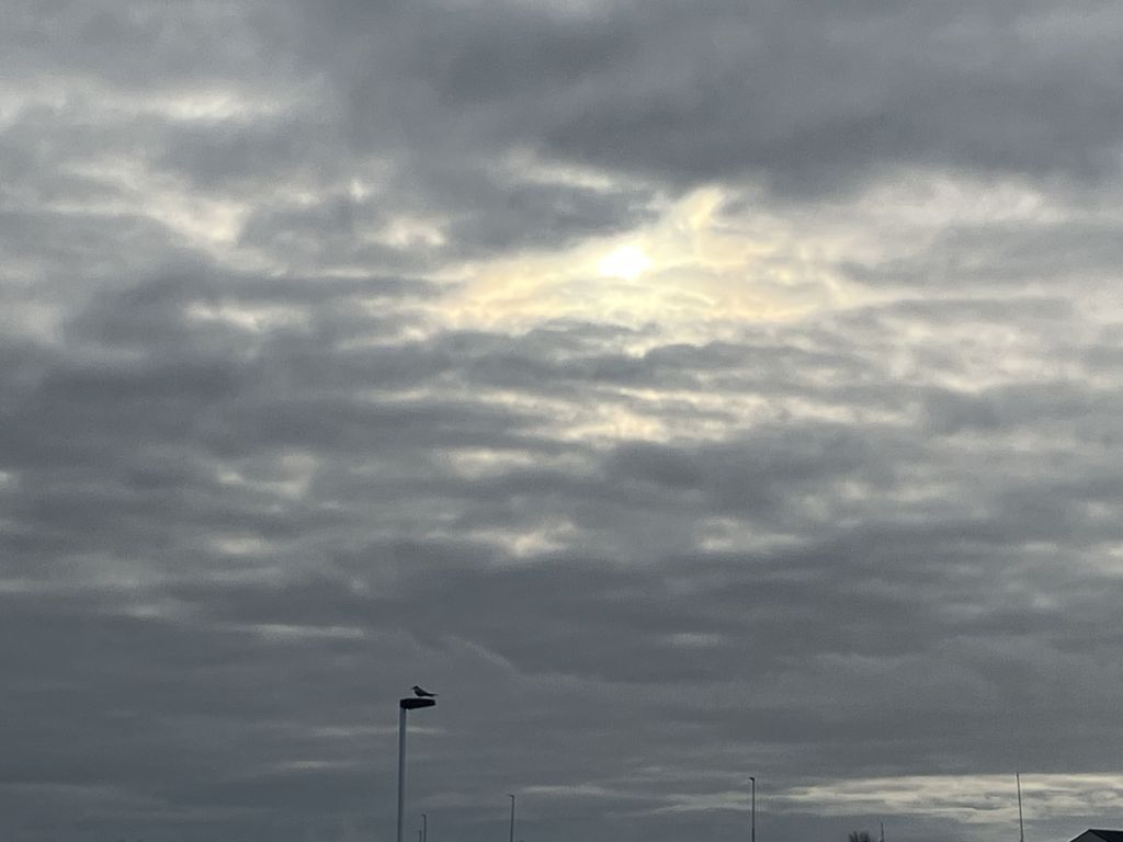
The eclipse that wasn’t. Even the birds didn’t care.

In the morning, we walk up to the museum.

“The UNESCO Vega Archipelago museum is a tribute to the sustainable way that generations of fishermen/farmers have lived in an inhospitable seascape near the Arctic Circle, based on the now unique practice of eider-duck down harvesting, and celebrates the contribution made by women to the eider down process”, the museum brochure tells us. “The Archipelago was included into the World Heritage List in 2004.”
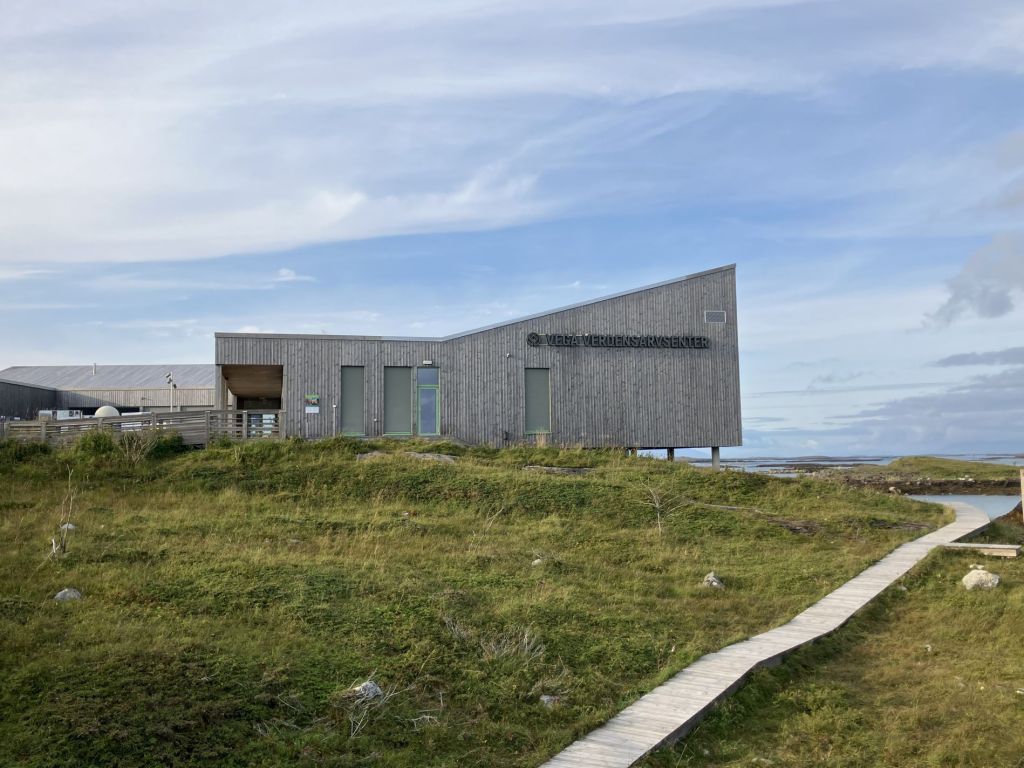
The UNESCO Vega Archipelago museum.

A film is just starting in the small cinema.

“After the ice retreated 20,000 years ago, the land started to rise”, it tells us. “Vega itself was settled by hunter-gatherers from Northern Europe about 11,000 years ago. But the low-lying islands and skerries didn’t really appear until much later. They weren’t settled until about 1500 years ago, when the fishing/farmer and eider-duck tending culture started to develop. By the time of the Viking era in 900 AD, the Archipelago was already an important centre for eider-down production. It has carried on since then to the present day.”
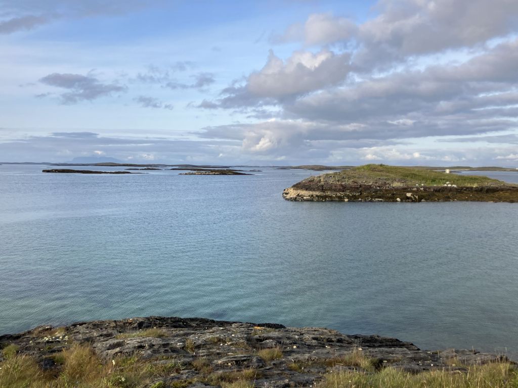
The Vega archipelago.

“The ducks return from their overwintering areas around March to mate, after which the females always return to the same breeding sites and the males leave”, the film continues. “The eggs are laid in May and June. After hatching, the ducklings stay in the nests for a few days before they venture to the sea, and swim with their mothers for the rest of the summer. Females and males meet up again in the wintering areas in late autumn to form new pair bonds.”
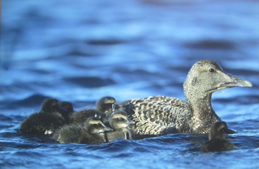
Eider duck mother and her ducklings.

“Over the years, the islanders learnt how to build small nesting houses to protect the birds, using seaweed to make the shape of the nest which the ducks line with their own down. At the end of the season after the ducks have left, they collect this down, clean it, and sell it. It takes 60-70 nests to make one eider down duvet. One duvet is worth as much as a cow. But it’s important to realise that these are wild ducks, not domesticated ones.”
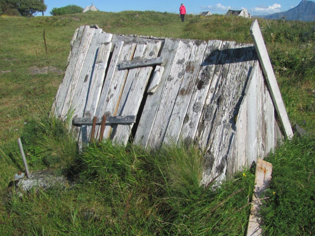
Eider duck house, Fleinvær islands.

“The population of the islands was at its peak in the 1900s. Then it started to decline due to government policies to encourage people to move to the cities for ‘proper’ work rather than persisting with these antiquated practices. But slowly this view changed, with the UNESCO World Heritage status now having given the archipelago a new lease of life.”

The film comes to an end, and we move on to the rest of the museum.

The section on the geology of the archipelago finally clears up a minor mystery for me. When we were on the Fleinvær islands, we had seen layers of rock that were pockmarked with cavities, but, not being a geologist, I had not been able to find a satisfactory explanation for what these were. Had they been where bubbles of gas were trapped in some volcanic lava long ago? It seemed unlikely, as most rocks on Norway’s coast are metamorphic rather than volcanic in origin.
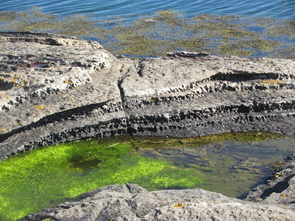
Layers of cavities, Fleinvær islands.

“The story starts 600 million years ago”, one of the panels explains. “Lime particles attached to slimy bacteria settled to the bottom of the ocean and were sandwiched between layers of sand and clay. Then when the two continents of Laurentia and Baltica collided millions of years later, the enormous pressures transformed the limestone into marble.”

“Marble is a relatively soft rock, so when these layers were exposed again, molluscs called piddocks burrowed into the marble to create a home for themselves to live in and to obtain raw material for their shells. Acid rain has since widened these pits and sharpened the edges.”

As we leave the museum, the man at the front desk stops us.

“Close your eyes and cup your hands”, he says. “I am going to put a ball of eider down in them.”

We close our eyes and wait. And wait. Nothing happens.

“You can open them now”, he says.

We open our eyes. In our cupped hands is a large ball of down. It weighs nothing.
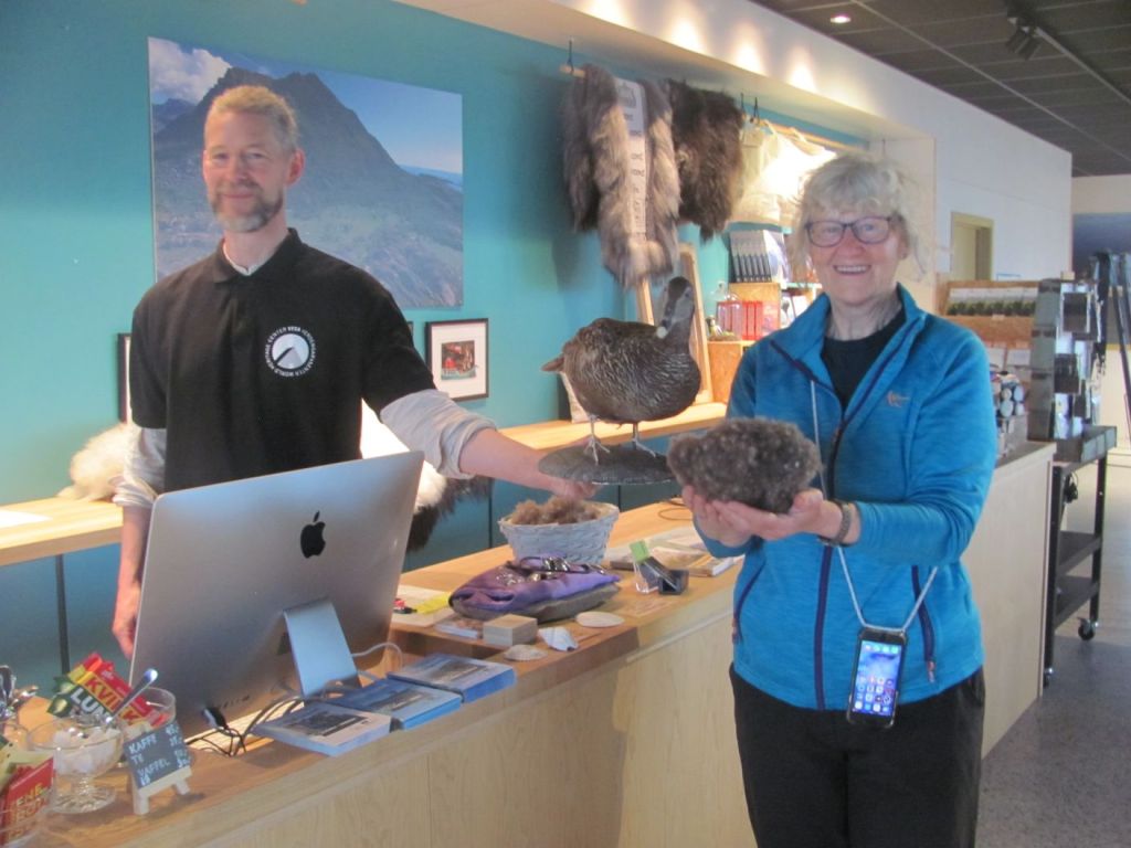
As light as a feather.

We walk slowly back to the boat.

“It’s interesting about the Norwegian government’s policies to move people away from the islands in the 1960s and 1970s”, says the First Mate. “It’s a similar story to what we heard in Myken. Discarding the old ways in the name of modernisation.”

“But I wonder if what they are doing now is truly sustainable?”, I say. “It’s good that these traditional practices are not being lost, but preserving them is dependent on an influx of money to keep them going. If budgets get tight, I wonder if that can continue?”
Sacred drums, a lone hiker, and a battle for steel

“There’s a bus to the museum and stone church”, I say, looking up from the guide book. “I think I might take it.”

We are in Harstad, a somewhat ‘no-nonsense’ functional town. We had sailed down from the island of Senja the day before in stiff winds and rather choppy seas, and are relaxing over a leisurely breakfast.

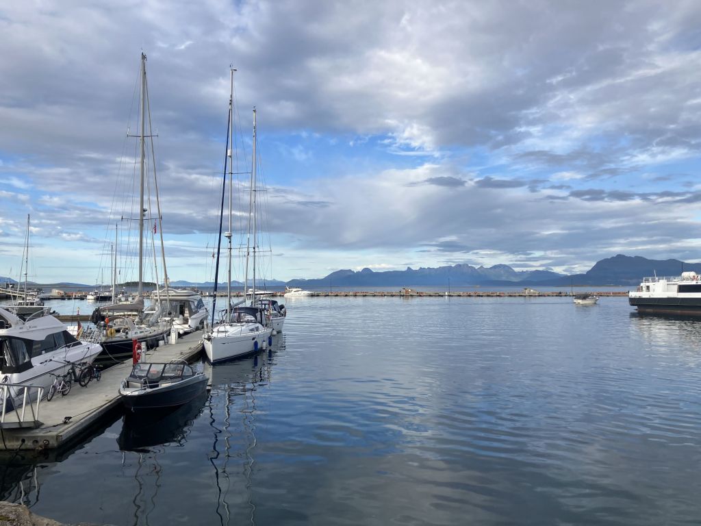
Tied up in Harstad guest marina.
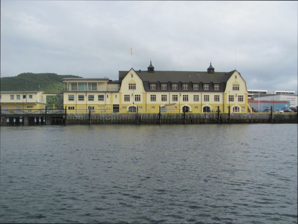
Former HQ of the Store Norske Spitsbergen Coal Company, Harstad harbour.

“You go”, says the First Mate. “I’ll stay here. I want to have a look around the town.”

I take the number 10 bus out to the Trondenes peninsula where the museum and church are located.

“We cover the history of the area from the Stone Age through the Viking and Middle Ages”, the girl at the desk tells me. “You can start through that door there and just follow the exhibits around. Don’t be frightened of the Vikings though. They are quite realistic.”

A Viking welcome.

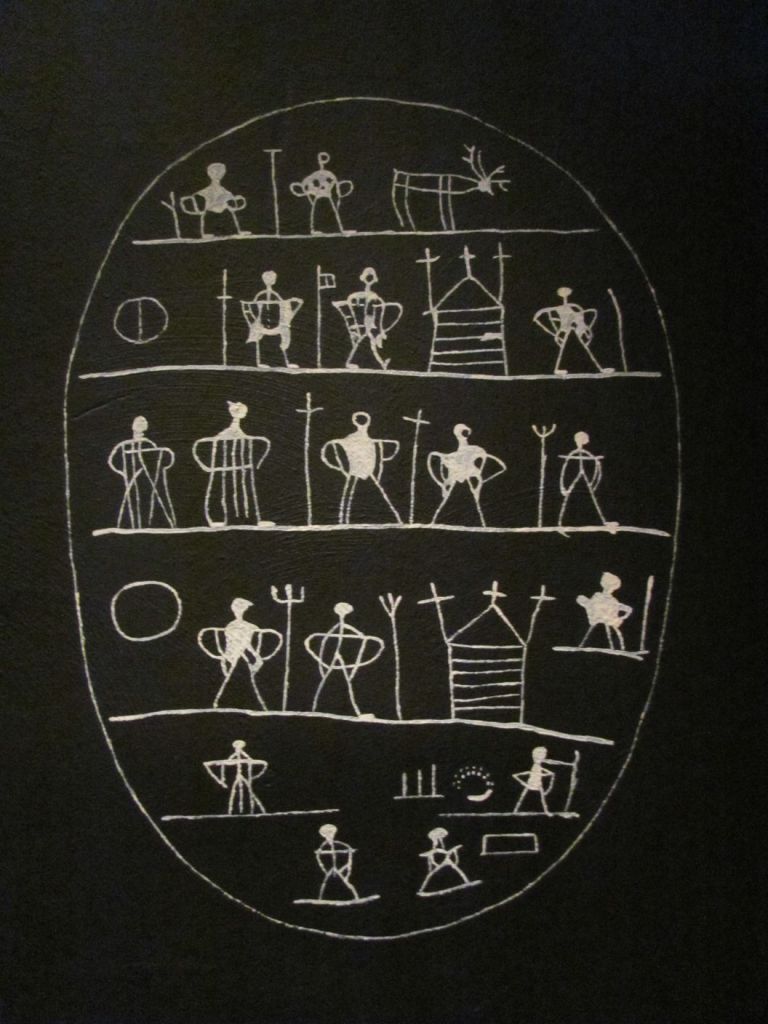
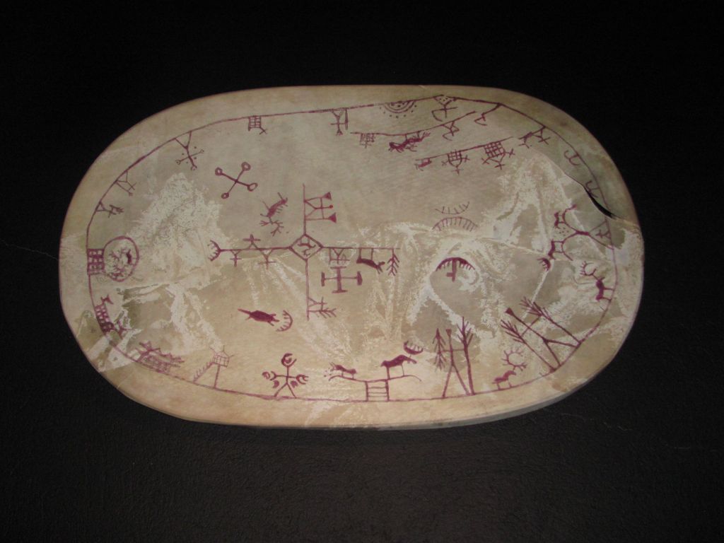
Of particular interest are Sámi drums. Made of reindeer skins stretched over a wooden frame or bowl, with various symbols painted on them, the drums are used by Sámi noaidi, or shamans, to enter into a trance during ceremonies, or to divine the future. Many individual households also have their own.

Patterns on a Sámi drum.

“The symbols represent a worldview of the cosmos, with the reindeer and their predators usually prominent”, the panel tells me. “Other symbols represent hunting, fishing and herding activities, along with mountains, lakes, people and gods. Often these are arranged in different layers representing heaven, life on earth, and the abode of the dead. When the noaidi went into a trance, he would be able to travel between these different worlds.”

Regrettably the early Christian missionaries saw the drums as sorcery and confiscated many of them. Those using them were sometimes even put to death, in an attempt to stamp out paganism. Fortunately modern Norway has a much more enlightened view to the Sámi traditional religion, and many of the drums that were confiscated have now been returned to their owners.

Sorcery?

“Unfortunately, the church is closed”, says the Front Desk Girl when I ask her the way to it. “But you can see it from the outside.”

I wander over and around it, but it’s a grey day, and I don’t see it at its best.

Trondenes stone church.

“You should at least tell your readers that it was built in 1435 to replace earlier churches, the first of which was built in the eleventh century”, says Spencer when I get back. “It’s the northernmost stone church in Norway.”

“I’m always amazed that they manage to find an -est for most things”, I say. “But yes, you are right. I should mention that. Wait a minute …”

It rains heavily in the night, but clears in the early morning to give a warm sunny day.

We decide to take the bus from Harstad down to Narvik to visit the War Museum, rather than sail there.

“Narvik is at the end of a long fjord which would add an extra 60 NM and three days to your trip”, ChatGPT tells me. “I’d recommend going by bus if you can.”

It’s a five minute walk to the bus station from the marina.

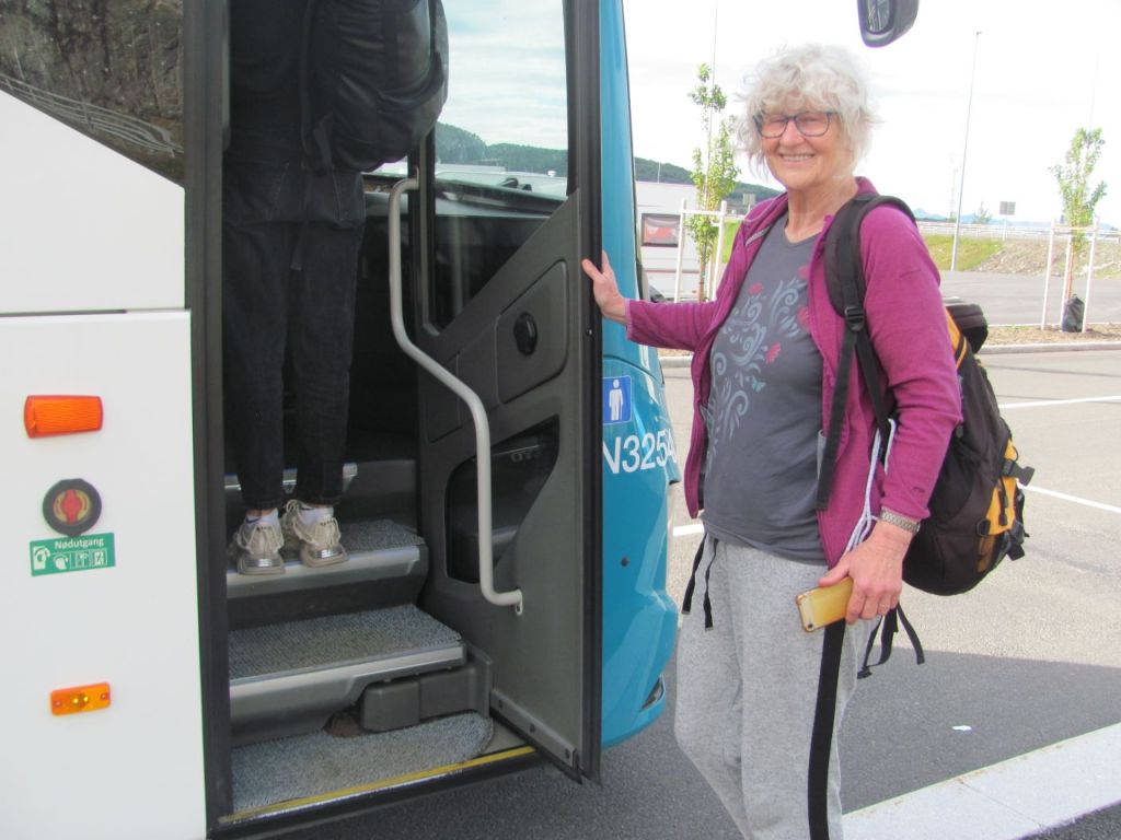
Catching the bus to Narvik.

“Excuse me, are you Kiwis?”, asks a voice as we clamber on. “I heard you talking and thought I recognised the accent. I’m a Kiwi.”

It’s a girl in her twenties. At the stopping place where we need to wait to change buses, we chat to her.

“I’m actually from Tauranga”, she says. “At the moment, I am living and teaching in Croatia. I’m just on holiday in Norway. My goal is to hike from Moskenes at the bottom of the Lofotens right up to Tromsø, avoiding roads as much as possible. It’s about 400 kilometres. I am doing it by myself, and staying in the DNT huts where I can. It’s taken three weeks so far. I had a few days off in Harstad to meet some friends, but am carrying on now.”

It’s obviously the thing for young females to hike alone along challenging routes in Norway. She is the second that we have met on our travels this year, the first being the Norwegian girl on the Svartisen glacier.

She picks up her enormous rucksack.

“I’ve got enough food in here to last me for five days”, she says, noticing my raised eyebrows.

“I like your solar panels on the top of your rucksack”, says the First Mate.

“Yes, they work surprisingly well”, she says. “I charge my phone and other electronic gadgets with them. Now, if you don’t mind, I need to get going. The trail starts from here just a couple of hundred metres up the road. There’s a hut I am aiming for about 20 kilometres from here. I’ll try and get there tonight. But my legs are tired, so I might have to sleep under the stars if I don’t make it.”

“I wish I was young again”, says the First Mate after she is gone. “There’s no way that I could walk 20 kilometres to a mountain hut carrying all that weight. Or really want to for that matter. But I have to admire her.”

“I am not surprised that her legs are tired”, I say. “What with the size of that rucksack.”

Waiting for the next bus at Steinlandsundet.

The next bus arrives and takes us through some beautiful scenery of forests, remote bays, and jagged mountains. Eventually we arrive in Narvik. It’s a five minute walk to the war museum. It’s part of the Narvik War and Peace Centre.

“The museum is in three levels”, the girl at the front desk explains, handing us our tickets. “The first level is on the actual battle of Narvik itself, the second is on the five-year occupation afterwards, and the third is more reflective on war and violence in general. You can start off on Level 1.”

“Sounds good”, says the First Mate. “Let’s go.”

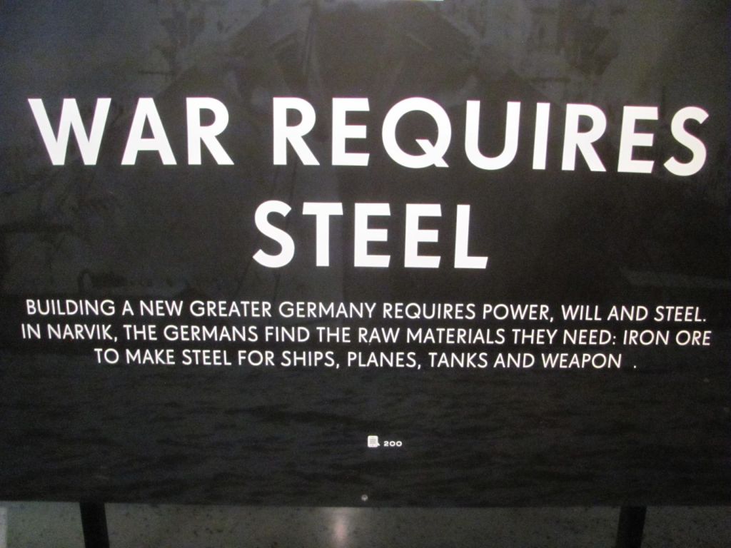
“War requires steel”, posters tell us, as a prelude to what the war in Narvik was all about. “And steel requires war.”

Hitler realised that if he was to make Germany a great nation with strong armed forces, he had to control the production of iron ore. Reserves in Germany were limited, and not of the highest quality, but neutral Sweden was a major exporter of high quality iron ore from her mines in Kiruna. The ore was taken across by rail to Narvik in Norway, as it was the closest port that remained ice-free in the winter on account of the Gulf Stream. Sweden had its own port, Luleå, but it freezes up during the winter.

“So, to secure supplies, Germany attacked Narvik in April 1940 by sea and captured it”, says the next poster. “But Britain also realised Narvik’s strategic value, not only because of the iron ore, but also as a base from which to control the shipping lanes of the North Atlantic. Battleships were sent to Norway to recapture the town and chase the Germans off.”

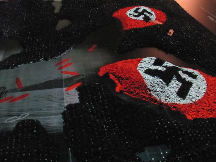
In the middle of the floor is a giant 3D model of the fjords and mountains surrounding Narvik.

Animated 3D model of the Battle of Narvik.

“A naval battle ensued between the Royal Navy and the Polish Navy on one side and the German Kriegsmarine on the other”, the voice-over says, as a projector shows the movement of the ships on the model. “Several ships on both sides were sunk. Many of these remain there to this day. A land battle also took place in the mountains around Narvik involving the Norwegians, British and French against the Germans. The British and her allies eventually regained control of the town.”

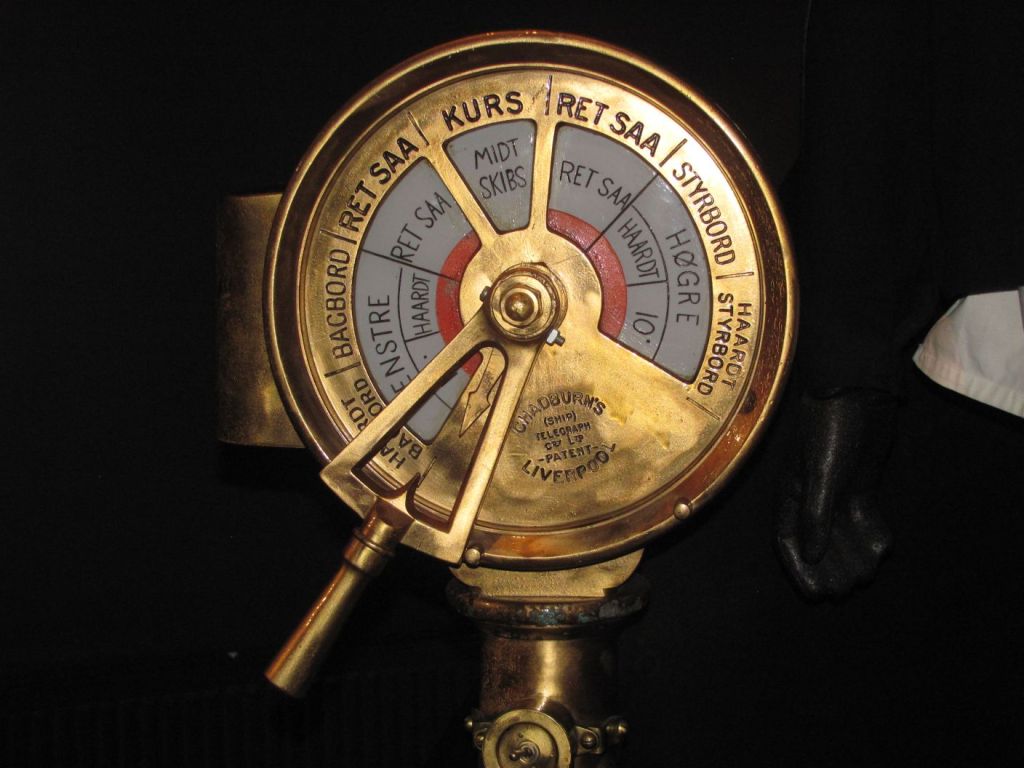
Engine room telegraph recovered from one of the sunken ships.

“But then the order came from London to withdraw”, it continues. “Extra forces were needed in France to stop it from being overrun. So the British relinquished control of Narvik in June 1940, leaving it for the Germans to retake and occupy for the rest of the war. Of course, the Norwegians weren’t very happy about this.”

Was that a good decision, I wonder to myself. By denying the Nazis steel to build their guns, tanks and ships, would the course of the war have been different?

“Yes, it would have” says Spencer, sitting on top of my backpack. “But probably not enough to have altered the overall outcome. High quality iron ore shipments from neutral Sweden to Germany would have been drastically reduced, for sure, as they could only come over the summer. But Germany had other supplies also, from occupied territories such as Luxembourg and Lorraine, plus its own reserves. It would have been more difficult for them without Narvik, but they would probably have managed.”

“But given that France eventually fell anyway”, I ask, “ maybe it would have been better to hold on to Narvik?”

“Possibly”, he responds. “But defending Narvik would have been costly due to the distance involved, and the need to cross the North Sea where there were increasing numbers of German submarines and warships operating. And in the event, Hitler committed large numbers of troops there to defend it, taking them away from other battlefronts. Academics have debated for years whether it was the best thing to do, and the jury is still out.”

We come to the level on the subsequent occupation. Life for ordinary Norwegians is discussed, including resistance to, and collaboration with, the occupying power. Many carried on with their normal jobs as teachers, railway workers, police, civil servants, and municipal officials, keeping essential services running. Many Norwegian businesses worked with the Germans building infrastructure, supplying food, repairing ships, and transporting military equipment. Some grew rich from such activities, others did it to survive.

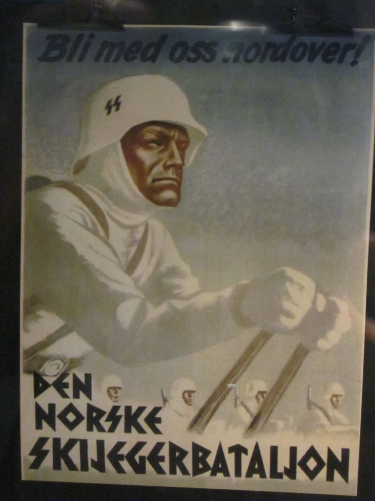
“But others actively helped the enemy”, the next poster tells us. “Some informed on neighbours and resistance members, some helped the security police, some even fought for the Nazis. Many women had relationships with German soldiers, with estimates of 12,000 children being born from such liaisons.”

Den Norske Skijegerbataljon, who fought on the side of the Nazis.

Punishment for collaborators after the war was harsh, ranging from fines and confiscation of property to prison sentences. Some were executed, including the prime minister, Quisling. Women suffered public shaming, head shaving, loss of jobs, and internment. Their children experienced discrimination.

Survivors tell their stories.

What would I have done under these circumstances, I wonder to myself. Would I have resisted at personal danger for my own life, or kept my head down? I am not sure. Is there any right or wrong side in war anyway? A lot depends on what the overall outcome is – if the Nazis had won, the collaborators would have been the ‘helpful ones’ and the resistance the ‘evil guys’. The victors write the history.

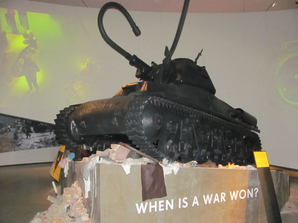
We move down to the Zona section. There the message is that Narvik was not just a battle for a railway and harbour, but that it was a small episode in the larger human story about how wars start, how they continue, and how they shape societies afterwards.

When is a war won?

The question is posed of when does a war actually end? The fighting may end when the shooting stops, but the aftermath has to be dealt with; survivors with trauma, societies dealing with collaboration and resistance, displaced people, and new conflicts arising from the old. The foundations of a post-WW2 order were put in place to ensure that such a war would never happen again – the partition of Germany, the creation of Israel, the strengthening of European cooperation, and the forming of the NATO alliance. But as well-intentioned as all this may have been, it has resulted in the Cold War division between the West and the East, the threat of nuclear war, and more recently has led to new wars in Ukraine, the Middle East, and Iran.

“It makes you wonder if the human race is doomed to a perpetual cycle of wars and conflicts”, says the First Mate. “I wonder if we can ever live together in peace?”

“Not as long as we have leaders who think their destiny is to enlarge their own borders and create empires”, I say. “They can twist the truth and con their people into believing what they are doing is right.”

We have reached the end of the exhibitions and take the lift back up to the reception level.

“Come on”, I say, looking at my watch. “We have to get the bus back to Harstad. It leaves in 20 minutes from the bus station. It’s the last bus of the day. We’ll need to hurry.”

We start walking, but the First Mate stops to take photos.

“We don’t really have time for that”, I say, keeping walking. I make it to the bus station with five minutes to spare. There’s no sign of the First Mate. I text her.

“I’ve gone to the bus stop where we got off”, she responds. “I thought that is where we would pick it up again.”

I tell the driver. “I don’t always stop at that one”, he says. “Only if there is someone there. You need to make sure that she flags me down. Otherwise I’ll go straight on.”

I text the First Mate. The bus sets off. From a distance I can see the bus stop. There’s no one there. Visions of staying the night in Narvik cross my mind.

Just as we are about to pass the stop, the First Mate appears from the doorway of a shop, and waves frantically. The bus stops.

“I just wanted to see if there were any bargains in there”, she says.

A ship in a bottle, a foreign spy, and sailing beyond the limit

“Waiter! Bring me a glass of red wine”, says the First Mate.

“Certainly, your Royal Highness”, I say. “And would the Shiraz be to your taste, ma’am?”
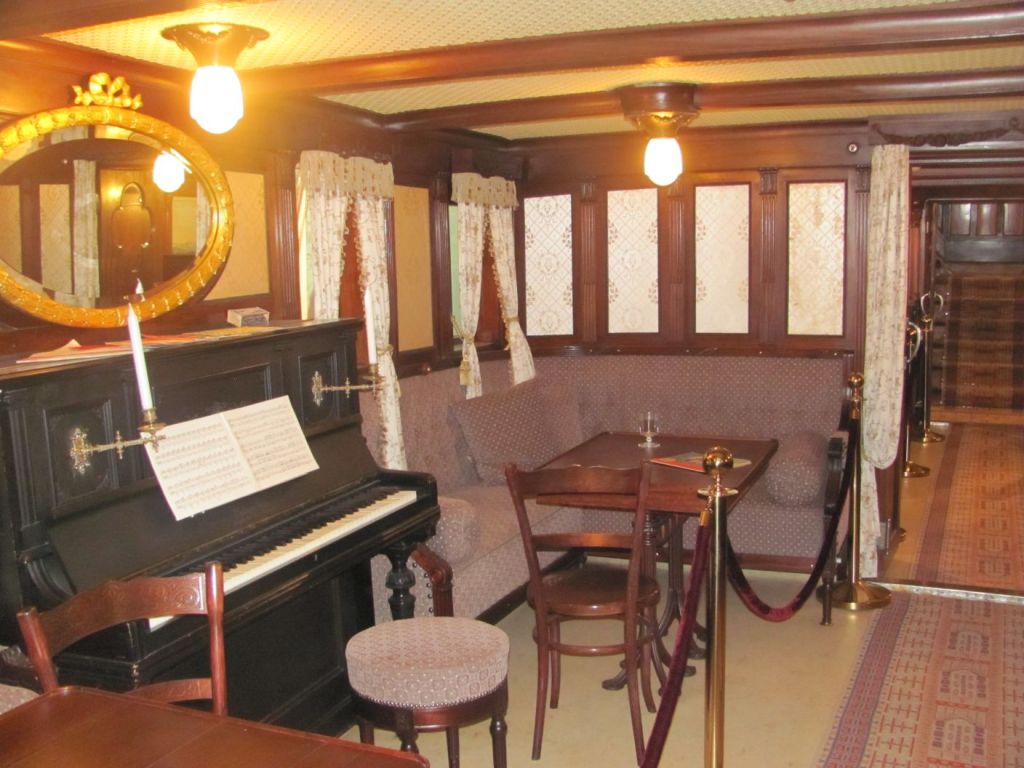
We are revelling in the luxury of the First Class lounge of the MS Finnmarken, one of the ships of the Hurtigruten line. Or at least it was. Nowadays, it is the centrepiece of the Hurtigruten Museum in Stokmarknes, covered by a giant glass enclosure to keep it safe from the elements.

First Class lounge of the MS Finnmarken.

“It’s really interesting to learn how it all started here in Stokmarknes”, says her Royal Highness. “Particularly as we keep seeing the Hurtigruten ships on our voyages. They’re quite iconic.”
They are indeed. We learn that steamship services were started by the government in 1826 to carry passengers, mail and freight up and down the coast, but these were slow, stopped at too many places, and didn’t sail at night. So in the 1880s, the government called for tenders to provide quicker services between Trondheim and Hammerfest with faster ships, stopping at fewer ports, and by sailing at night. But none of the local shipping companies were interested at first, as they considered sailing at night too dangerous.

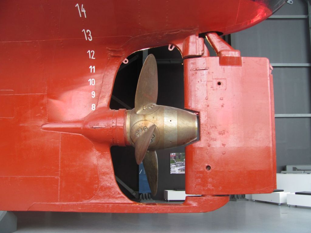
Propeller of the MS Finnmarken.

“Then one of the smaller companies, the Vesterálen Steamship Company, put in a bid which was accepted”, one of the displays tells us. “They had already made detailed sailing instructions of the unknown waters for themselves, and had less fear of sailing at night. And so in 1893 the Hurtigruten, or Express Route, was born. Mail delivery times fell from five months to seven days.”

The Hurtigruten ships helped open up the north of Norway to the rest of the country and the world. As late as the 1940s, most ports north of Trondheim were inaccessible by road. However, as roads were built and air services established, the need for the Hurtigruten declined. To survive, the company turned its emphasis in the 1960s to tourism, offering people a unique experience in comfort.

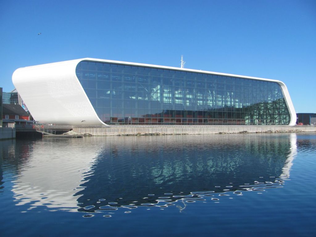
“I can see why the locals refer to it as ‘the ship in a bottle’”, says her Royal Highness, as we leave.

The MS Finnmarken in its glass ‘bottle’.

The next morning, we set sail for the next large town, Sortland. The winds are in our favour, and we have an exhilarating sail.

“Several people say that it gets a bit rolly in the main marina”, says the First Mate, studying the harbour guide as we approach. “Because of the ferry coming and going. But I’ve found another nice looking marina to the south of the town. It’s quite small, but they do have a guest pontoon. We could try that.”

We inch our way through the narrow entrance. It’s only a couple of metres on each side and 1.5 metres of water under the keel. But it’s enough, and we find a place on the hammerhead on the end of a pontoon to tie up. The harbour master comes over. We invite him on board for a coffee.

“I am a retired police superintendent”, he tells us. “I worked on cases all over this area. Mostly drugs-related. There’s a lot of it here. My name is Leif, by the way. As in Leif Eriksson, the first European to discover America.”

We talk about some of the Scandi-noir crime series that we have seen, and the fondness that Norwegians have for vanishing to their cottages at Easter time with a pile of crime novels to read. I mention that I had read somewhere the reason for it was because Norway is such a peaceful and crime-free country that people like to read about it in fiction.

He laughs. “I don’t really think that Norway is crime-free”, he says, taking another cinnamon roll. ”It’s just as bad as anywhere else. We’re just good at writing about it against the background of long nights and snowbound cottages, and making dark moody films about it.”

“But I am retired now”, he continues, “And I do photography. It’s always been a hobby of mine, but now I have time, I can do it properly. Mostly on the island of Andøya. It’s absolutely gorgeous there.”

“Yes, it is on our list”, I say. “We are planning to visit it after we leave here.”

“Tell you what”, he says suddenly. “I am not doing anything this afternoon. I would be happy to take you around Andøya and show you the best places that most tourists never see. It’s about a hundred kilometres up there and slightly shorter back. What about it?”

We are somewhat taken aback. A perfect stranger whom we had only met half-an-hour ago at the most, offering to take us on a 200 km round trip. And it was already mid-afternoon. Could this be for real?

We accept.

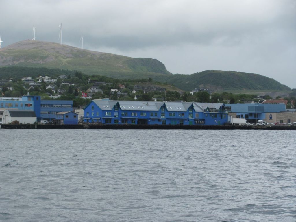
“You’ll notice that a lot of the buildings and houses in Sortland are painted in different shades of blue”, says Leif as we set off. “One of our artists had the idea of painting everything blue to symbolise the sea and sky. Of course, there was a lot of opposition from different townspeople, but somehow he convinced the local council to do it. Slowly local businesses and many residents grew to like it, and now it is quite a tourist attraction.”

The ‘Blue Town’.

I quite like it, I think to myself. It gives it a certain Je ne sais quoi.

“I sort of look on Andøya as my home even though I don’t live here”, Leif says, as we cross the humped bridge over the Risøysundet strait on to the island. “I come up a couple of times a week and know every nook and cranny. The landscape is stunning, and the light is different every time I come, so there is always something new to see. We’ll take the western road up as it is so much more wild, and come back down the eastern road.”

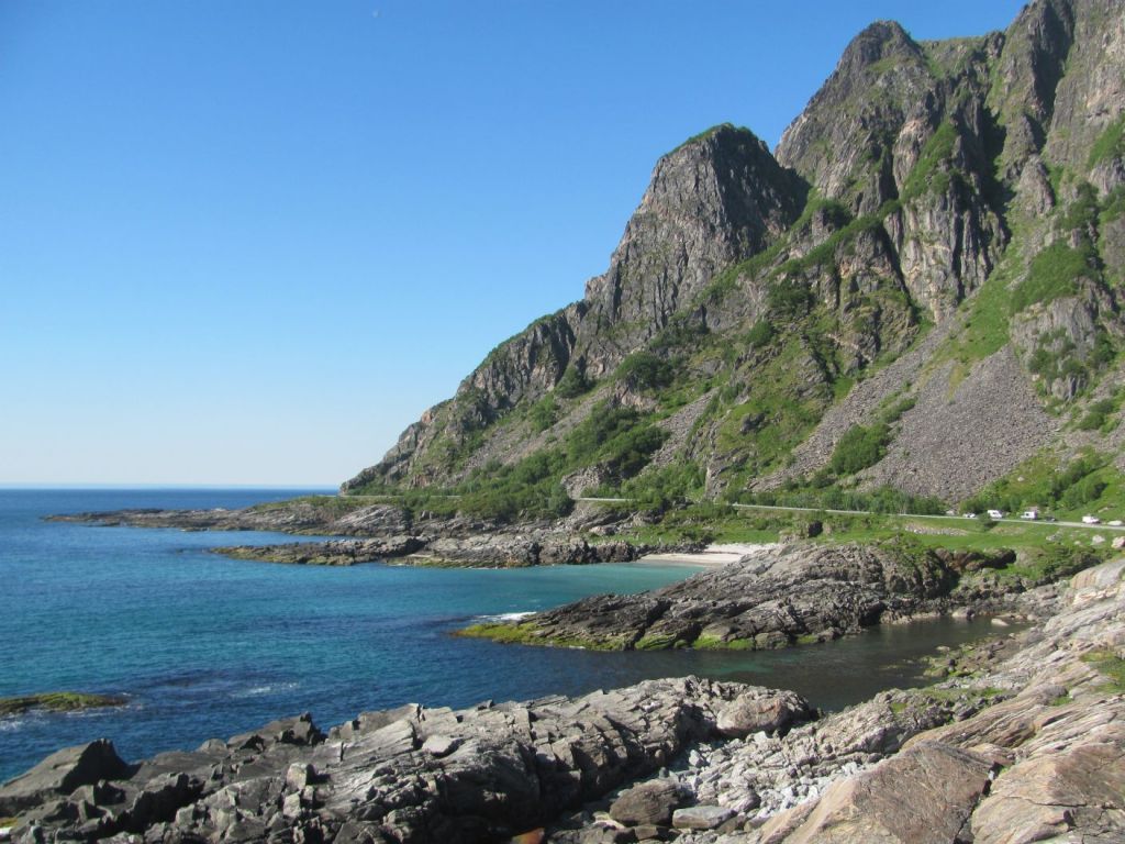
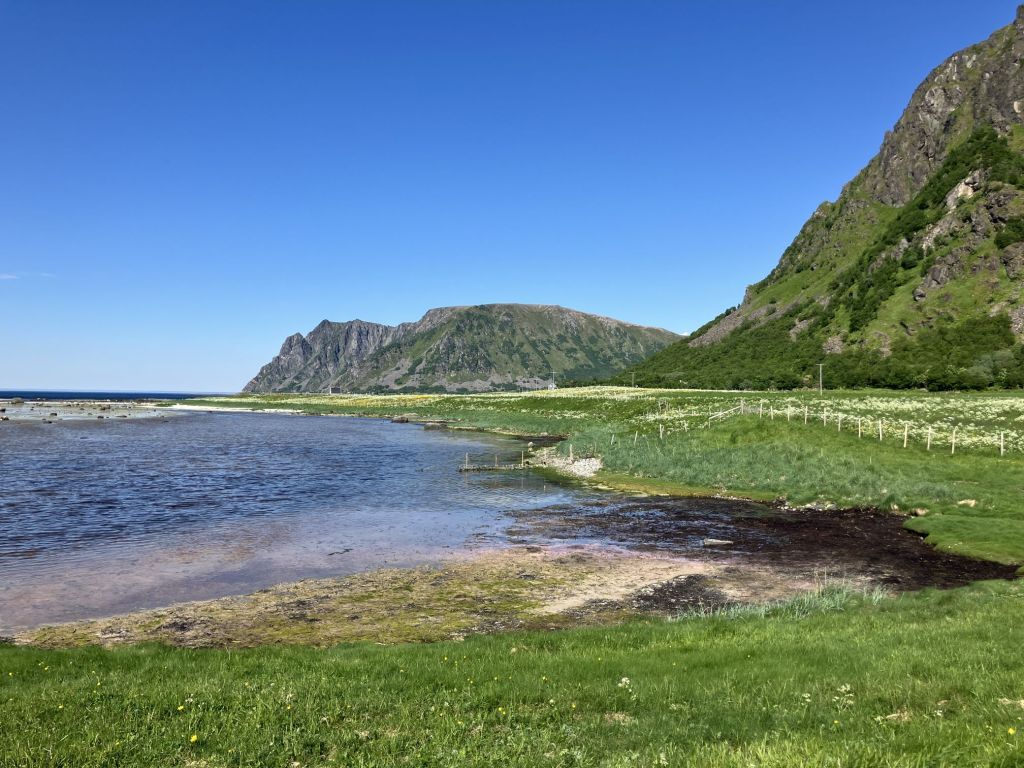
He’s right. The western road is wedged between the sparkling sea on the left, and high jagged mountains to the right that run the length of the island. We drive past stony beaches, their stones worn smooth by millennia of wave action, and past bogs and estuaries, the sulphurous smell of decaying seaweed assailing our nostrils. Far off to the west, we see the hazy outline of the island of Langøya, a white cloud hovering over it like a plume of smoke. It’s primeval.

‘Twixt mountain and sea.

Leif stops the car. “This is one of my favourite stops”, he says. “I’ve taken a lot of my photos around here. Shall we walk down to the beach?”

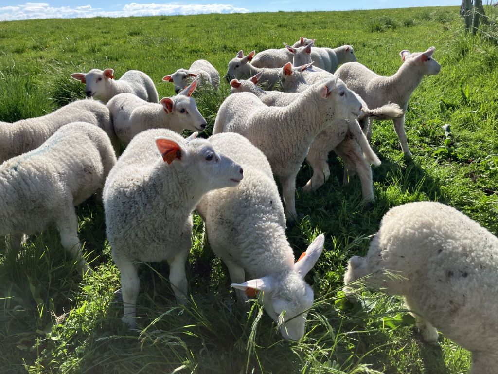
We follow a fence-line and cross a small stream. Immediately we are besieged by a flock of lambs, clamouring for attention, totally unafraid of us. We pet them, then try and move on. They follow us. Clearly they are familiar with humans, and we surmise that they have been weaned and missing their mothers, or orphans reared by hand-feeding from a bottle. Eventually they give up, and run back to where we first met them.

“Are you my Mum?”

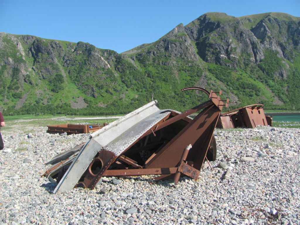
We reach a stony spit jutting out into the sea. On the stones lies the rusting wreckage of a fishing trawler, its parts strewn over the spit.

“There was a fierce storm here several years back”, Leif tells us. “This trawler was driven aground and broke up. Luckily no one was drowned. But the boat was destroyed.”

Victim of nature’s fury.

On the way back to the car, we pass a small backwater cut off by the low tide, and stop to watch oyster-catchers shrieking their high-pitched calls, and guillemots feeding in the shallows. A flock of barnacle geese flies overhead.

“Isn’t it beautiful?”, sighs Leif.

Island idyll.

I wonder about this unusual man who has befriended two strangers. He’s not what I imagined a police superintendent to be like. Part of me envies him for having found a part of the world that is so obviously home to him, and who sees beauty in it wherever he looks. And captures it through his photography for others to enjoy. What makes him tick? His job must have made him see the seedier side of life, perhaps he needs something now to balance that.

“I was married”, he tells us back in the car. “But am now divorced. I have a daughter who lives in Oslo. She loves coming back to Andøya to visit. But she wouldn’t live here. She likes the activity of the big city too much. That’s the problem up here – all the young people leave because the opportunities are so much better in the cities. Now, there’s something I want to show you here.”

He pulls up to the side of the road. We walk down a short path to an outcrop of rock.

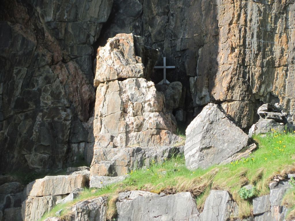
Natural pulpit.

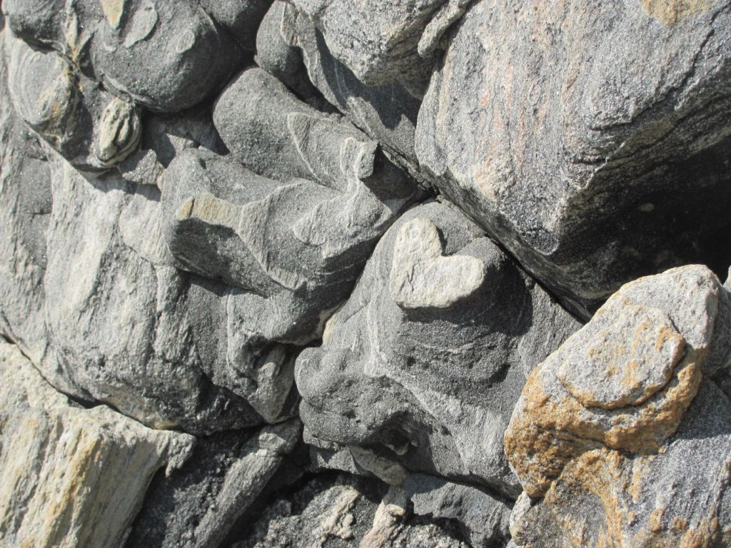
“It’s a small chapel”, he explains, pointing to a crucifix mounted on a ledge on the rock. “With a natural pulpit and altar. Bukkekjerka. It means Goat Chapel in Norwegian. It was originally a sacred site for the Sámi people who practised religious rituals here. They called it Bohkegeargi. More recently it has been used for Christian services. People even get married here. Look, there’s a shape of a heart in one of these rocks.”

For the newly-weds?

I sit on a rock and think of the ancient Sámi worshipping their gods in this sacred place –  Veralden-radien, the Ruler of the Universe and Sustainer of Life, Afruvvá, the Sea Goddess, Warner of impending storms, or Beaivi, the Sun God who brought warmth, light and new life. What has happened to all those gods now that the Sámi were converted to Christianity in the 1200s?

“Many Sámi kept their own gods even after they converted the Christianity”, says Leif. “Their thinking was that the Christian God only provided for them in the afterlife, whereas their gods looked after them while they were still living.”

It’s an interesting point of view, and somehow logical.

Sámi sacred site.

Further on, we pass the Andøya Space Centre.

“The first rocket was launched from here in 1962”, Leif tells us. “Not long after the Russian Sputniks. It is only used for launching small earth observation satellites for peaceful purposes. Nevertheless, back in 1995 one of the launches nearly caused a nuclear war as the Russians thought it was a nuclear missile launched from an American submarine. They went on to high alert, but then they realised it wasn’t heading towards Russia. Apparently they had been told that it was happening, but the message got lost in their bureaucracy.”

Andøya Space Centre.

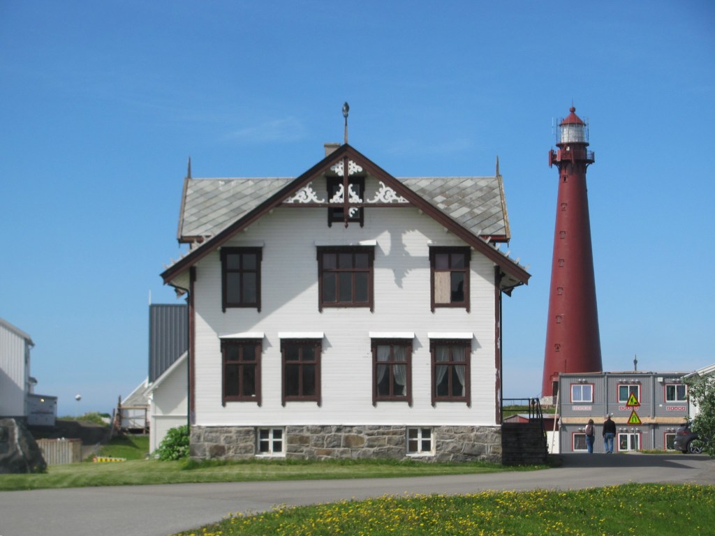
We eventually reach Andenes, a sprawling town of mostly military style housing. On the point is the iconic lighthouse visible for miles around.

Andenes lighthouse.

“I’m starting to get hungry”, says the First Mate. “Look, here is a pizzeria. Let’s get something to eat there.”

We order and sit down.

“Did you hear the story of the Chinese spy?”, Leif asks, as we chomp into our pizza slices.

“No”, we say. “What was that all about?”

“Well, just a month ago, they arrested a Chinese woman and charged her with trying to establish a satellite data receiving station near the Spaceport and military facilities”, he answers. “Apparently 22 tons of electronic equipment capable of downloading data from polar-orbiting satellites was imported and installed by a Norwegian front company. According to the papers, the woman bought a property nearby where the equipment was installed. She’s in prison at the moment, awaiting trial. It seems as though some Norwegians are also under suspicion.”

“It doesn’t sound very professional”, I say, spearing the last mushroom with my fork. “Importing 22 tons of electronic gear near to a military area and rocket launch site was bound to raise suspicions, surely?”

“Yes, you would think so, wouldn’t you?”, Leif says, “but that’s how it was reported. We are just waiting now to see what comes out of the trial.”

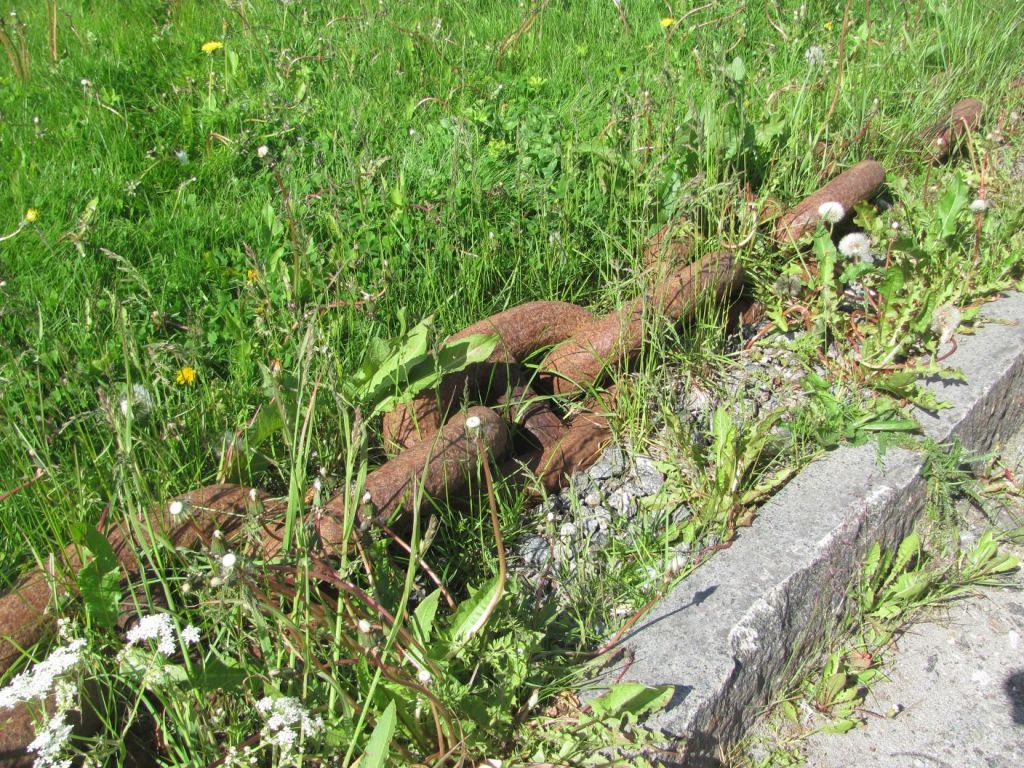
As we return to the car, we pass a rusty old anchor chain lying in the grass.

“That’s part of the anchor chain from the Tirpitz”, says Leif. “You know, the German battleship that was eventually sunk in 1944 near Tromsø. I have got one of the links at home.”

Part of the anchor chain from the WW2 German battleship Tirpitz.

“What a kind man”, says the First Mate when we are back at the boat that evening. “It was amazing how he wanted to show us his world. And seeing it from land with a local gives a very different perspective than from the sea.”

In the morning, we decide to stick to our plan of sailing to Andenes even though we had just been there the day before.

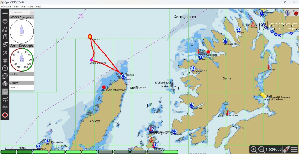
“It’s the easiest opportunity we’ll get to sail outside the 12 nautical mile limit”, I say. “That way we can reset the clock on the time we are allowed to keep Ruby Tuesday in Norway without paying duty. Don’t you remember that the police in Bergen told us we can do that?”

Two years in the maximum time we can import the boat on a temporary permit. However, sailing outside the limit, then back in again, counts as an export/import event thereby resetting the clock, giving ourselves another two years if we need it. We have to provide documentary proof that we have been outside the limit, so we photograph the GPS position, the chart-plotters, and the computer and tablet tracks.

Our ‘Customs Route’.

“Phew, I am glad that’s over”, says the First Mate, a slightly greenish tinge in her face caused by the swell. “Let’s go and see if we can see any whales.”

To the west of Andenes is the Bleikdjupet, a vast underwater canyon that plunges to more than 1000 m in depth. As the currents come in from the Atlantic, the sudden change in depth causes an upwelling of plankton, the favourite food of whales. All sorts of types gather here to feed.

Model of the Bleikdjupet, the vast underwater canyon west of Andenes.

We sail to the supposed hotspot and circle slowly for nearly two hours. Unfortunately, someone has forgotten to send the memo to the whales that we are there, and all we see is one minke whale. No sperm whales, orca, dolphins, or porpoises today.

“Well, at least a minke whale is not to be sniffed at”, I say. “It was exciting when we saw those in Scotland.”

Ancient Norwegians, the salted-cod city, and a deserted fishing village

“Yes, I am from Kristiansund”, says Lars. “Born and bred. It’s not the most exciting city, but it’s pleasant enough. Apparently it is where the first Norwegians are supposed to have lived, at least according to the archaeological evidence. It was first named Christiansund after the Danish-Norwegian King Christian VI in 1742, but the name was changed in 1877 to Kristianssund, then to its present spelling of Kristiansund in 1889. People often confuse it with Kristiansand in southern Norway, so we usually refer to it as Kristiansund N to indicate it is the northern one. We are heading back there now.”

Lars is the skipper of the boat tied up next to us at Håholmen. We are chatting to him as he gets ready to leave.

“We are still debating whether to get there by the outer route or to go round the island of Averøya”, I say.

“Both are fine”, he says. “But if you go around Averøya, you’ll go under the ‘Atlantic Road’, the road that connects many of the islands between Bud and Kristiansund. We are very proud of it. Some people think that it is a work of art – its sweeping arches and graceful curves are supposed to complement the natural landscape. It’s worth seeing.”

We leave a few hours after him, carefully following the perches marking the southern channel out of Håholmen. Soon we are at Storseisundet Bridge, the main bridge of the Atlantic Road. There is a strong current against us which buffets us from side to side, but we slowly make it through into Kornstadfjorden.

Approaching Storseisundet Bridge of the Atlantic Road.

There isn’t much wind, so we drift along at 2½ knots, Kornstadfjorden giving way to Kvernesfjorden, which in turn becomes Bremsnesfjorden. Soon the sun comes out, and we relax in its warmth.

Lars’ comment that the first Norwegians had lived around Kristiansund has intrigued me, and I think back to the book that I have just finished reading, Ancestral Journeys: The Peopling of Europe, by Jean Manco. In the case of Norway, the ice sheets had prevented anyone living there for thousands of years, but as the ice retreated around 12,000 years ago, two groups of hunter-gathering people had begun to move in – one group originating in south-east Asia and migrating along the northern extent of the ice across Russia, and the second migrating northwards from continental Europe through Denmark. Sure enough, they met in Norway roughly where Kristiansund is nowadays.

“I wonder if that means you can see a difference in their descendants in Kristiansund?”, asks the First Mate.

“It wasn’t really a clear cut border”, I say. “There was a lot of intermarriage, and of course people from both groups moved in both directions along the coast. But the ones in the north were the ancestors of the Saami people of today. In the south, it is more complicated, because the hunter-gatherers gave way to the Neolithic farmers around 3500 years ago bringing agriculture as they spread across Europe from the Near East, then later by the Indo-European peoples from Central Asia, who brought their language that became the basis of most of the European languages we hear today.”

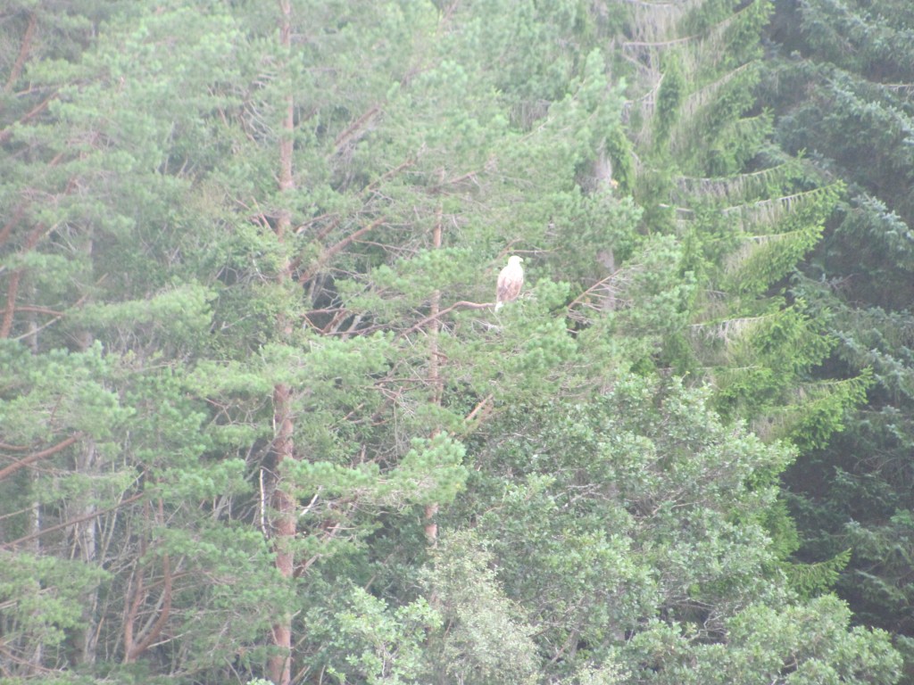
“Fascinating stuff”, says the First Mate. “So immigration has been going on for a long time, hasn’t it? Look, there’s a sea eagle in that tree.”

Wary sea-eagle.

The eagle lets us take a picture of her, then flaps off languidly.

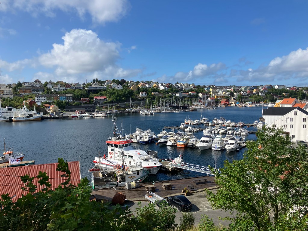
We eventually reach the Kranaskjæret Gjestehavn in Kristiansund. Lars is already there. He comes to give us a hand tying up.

“So you made it then”, he says. “Welcome to Kristiansund, the ‘salted-fish capital’ of Norway. It’s famous for its klippfish – you should visit the Klippfish Museum if you get a chance. It’s just over there, across the harbour.”

Kranaskjæret Gjestehavn, Kristiansund.

The next morning we walk around to the Klippfisk Museum.

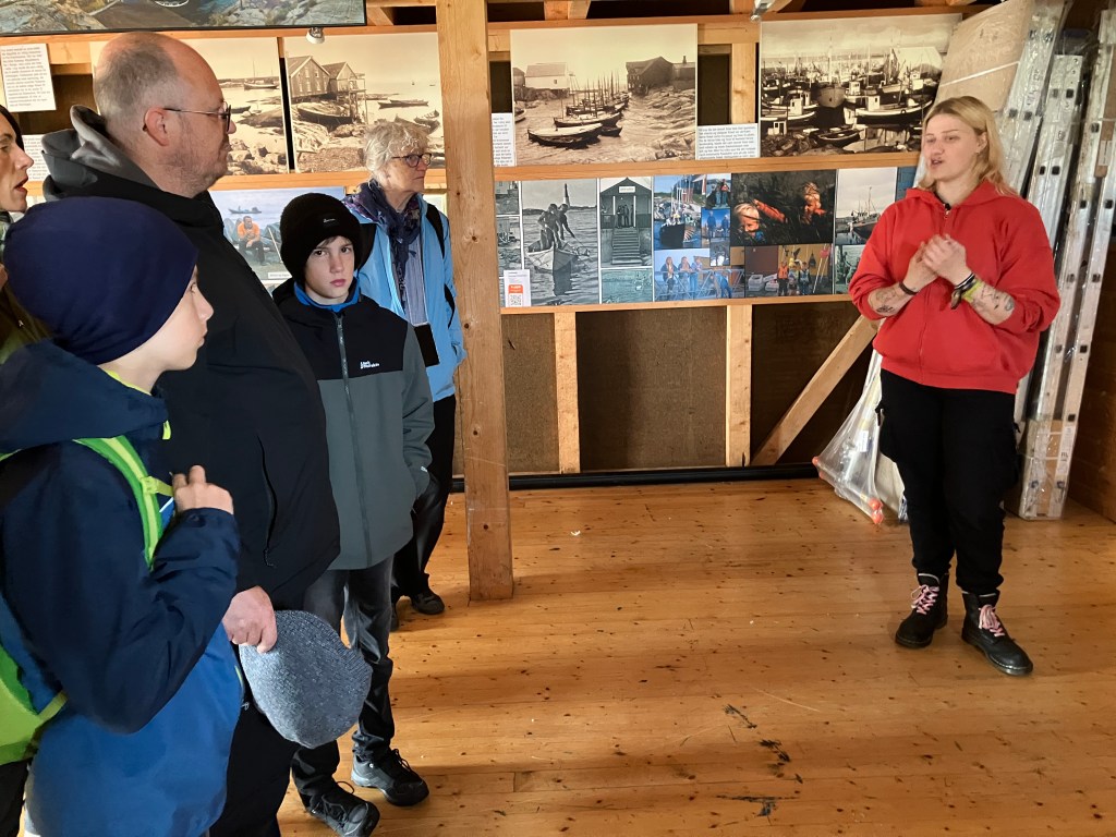
“Hi”, says the young man behind the desk. “Welcome to the Klippfisk Museum. Would you like to have a guided tour? It’s included in the price, and you also get a free bowl of bacalao to try afterwards.”

“It sounds like a good idea”, says the First Mate. “I always think that you learn a lot from these guided tours. You can ask questions if you don’t understand things. Especially when things are in Norwegian. Where do we meet the guide?”

“I’m your guide”, the young man says. “I’ll do my best. It’s just you two. My name is Arne, by the way.”

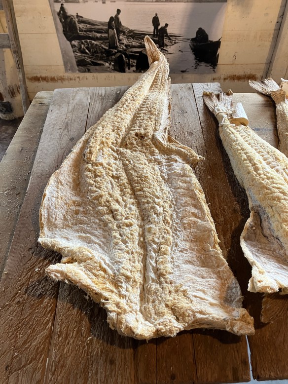
Klippfisk is basically any white fish that is salted and then dried in the sun”, he tells us. “Traditionally, they were laid out on rocks, hence the name klippfisk. Klipp translates as ‘cliff’ in Norwegian. Most of the time the fish used is cod, but it can also be pollack, saithe, or ling. Once it is dried, it will keep for several years.”

Klippfisk.

“The technique was developed in Spain, and was introduced to Norway in the late 1600s by Dutch merchants”, he continues. “Later the Scots also got in on the act – indeed, this very building we are standing in was built by a William Gordon from Cullen in 1749. He settled here and became fabulously wealthy buying and selling klippfisk. When he died, he left his wife and daughter £42 million, an absolute fortune in those days.”

“And not too bad these days either”, says the First Mate. “I think I need a new fishing rod. I’ve only caught one fish on this trip!”

“Good luck with that!”, laughs Arne. “But we shouldn’t forget the workers. Most of the hard work of salting and drying the fish was done by women – there is a statue honouring one of the Klippfiskkjerringa, or fish women, in the harbour. You should look out for it.”

A Klippfiskkjerringa, or fish woman (the one on the right).

“Was klippfisk all eaten here in Norway, or was it exported?”, I ask.

“It was exported all over the world, but the main markets were, and still are, Portugal, Spain, Brazil and Philippines. They are Catholic countries, and fish was an acceptable substitute for meat during Lent. Ships used to take the klippfisk to the Iberian Peninsula on the way out and fill their holds with soil for ballast on the way back. It was then emptied to make room for the next load. They say that most of the soil in the Kristiansund cemetery is Spanish soil.”

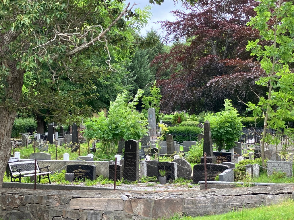
“A small part of Norway that will be forever Spain” (with apologies to Rupert Brooke).

“How do you cook it?”, asks the First Mate. “It looks too dry and hard to eat it as it is.”

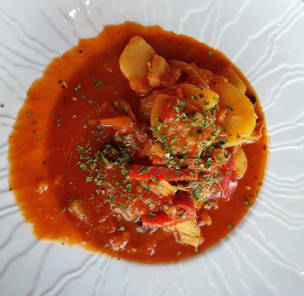
“Absolutely”, says Arne. “You need to rehydrate it by soaking it in water for a couple of days, replacing the water two to three times a day. That softens it and makes it much less salty. The classic Norwegian dish is boiled klippfisk with creamed peas and potatoes topped with a light cream sauce. However, another dish is bacalao, developed in Portugal, which is made by frying onions, garlic, and peppers in olive oil, adding tomatoes, sliced potatoes, olives, seasoning it with bay leaves, chilli and pepper, then pouring it over layers of the fish and simmering it until it is flaky and the potatoes are done. That’s also very popular here in Norway.”

Bacalao.

After the tour is over, we sit in the café and taste the small bowls of bacalao that he gives us.

“I read somewhere that the Portuguese have developed it much more since then”, says the First Mate in between spoonfuls. “By adding lots more ingredients, such as eggs, cream, or chickpeas, and either grilling, frying, or baking it, and using different spices, such as coriander or parsley. So much so that they are said to have 365 different varieties – one for every day of the year!”

In the afternoon, we decide to walk up to the Varden viewpoint overlooking the city. On the way, we pass a impressive looking modern building.

“It looks like a block of flats”, I say. “I wonder who lives there?”

Block of flats?

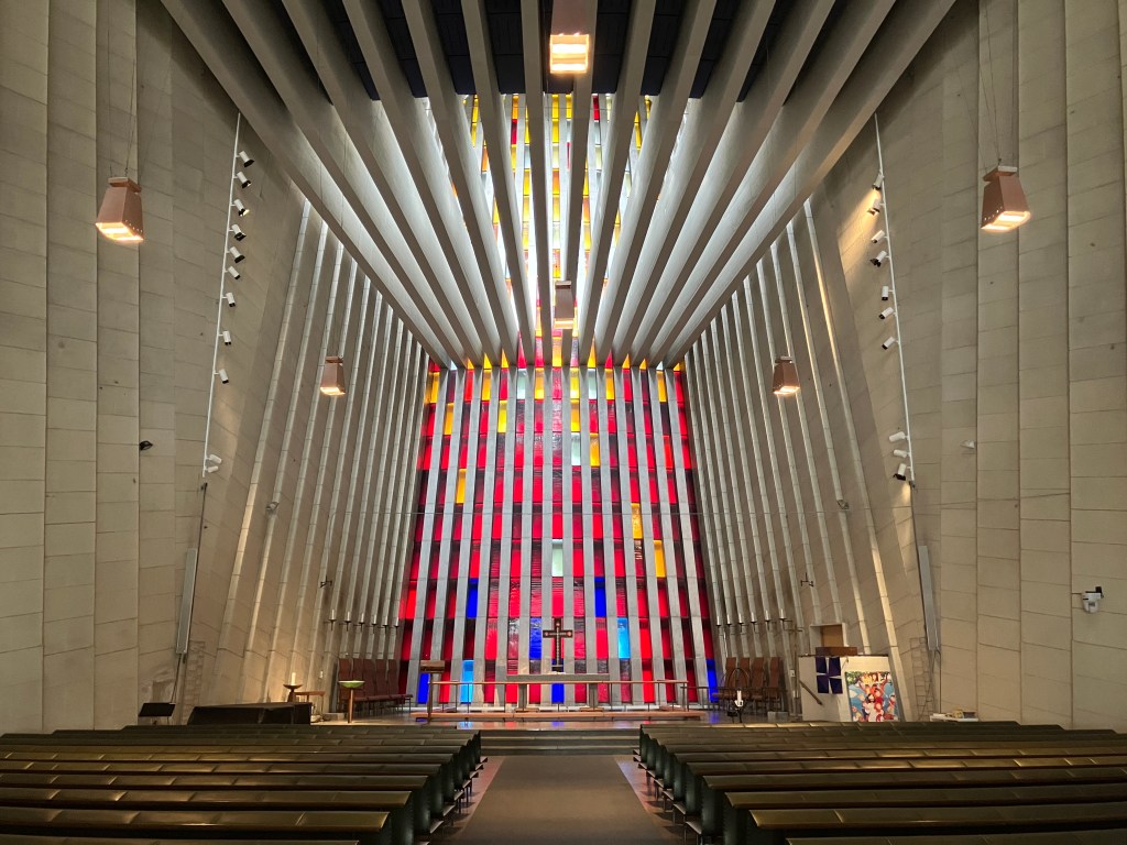
“It’s supposed to be a church”, says the First Mate, consulting the guide book. “Built in 1964 after its predecessor was destroyed by bombing in WW2. The most modern and daring one in the whole of Norway. Apparently it is worth having a look inside.”

Inside Kirkelandet Church.

“The theme is called ‘Rock Crystals in Roses’”, she whispers, once we are inside. “There are 320 coloured glass windows, and when the light strikes them, there is a burst of colours. The dark blue ones at the bottom represent man’s sinfulness, while the red, orange and white ones as you go up represent the process of enlightenment.”

Whether you believe the symbolism or not, it is certainly impressive. The ceiling beams and the side columns all contribute to the airiness and focusing of one’s attention on the chancel at the front.

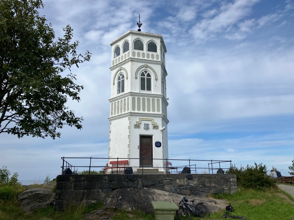
We eventually reach the lookout tower at the top of the hill. Entry is free. A woman opens the door at the bottom for us.

Varden watch tower.

“It was originally built as a watch tower to see ships coming to Kristiansund during the Napoleonic Wars”, she tells us. “Later it was the base station for an optical telegraph between Kristiansund and Trondheim. Be careful not to slip on the stairs. They are quite steep.”

The view from the top out over the city is magnificent. The walls between the arched windows are painted to give a panorama.

View over Kristiansund from the top of Varden watch tower.

In the morning, we walk down to the waterfront to catch the Gripruta, the ferry across to the island of Grip.

“It’s definitely worth seeing”, Andy had told us. “But there is no room in the tiny harbour for a sailing boat to tie up. You are best to take the ferry across.”

We had tried to book places on it yesterday, but the sea had been too rough and the ferry service had been cancelled. Today, however, it is running.

On our way to Grip island.

The trip takes about forty minutes each way. We are surprised by the number of people boarding, and surmise that some of them must be ones like ourselves who would have gone the day before but couldn’t. When we arrive at island, we are organised by a young woman who was on the ferry, whom we had thought was one of the passengers.

Hanna tells us about the history of Grip.

“My name is Hanna”, she tells us. “I am your guide today. My grandmother used to live on the island, and I can remember visiting her here when I was a child. So I have a personal connection with it. Nowadays it doesn’t have a permanent population, but most of the cottages are owned by former residents or their descendants.”

Cottages and harbour on Grip island.

“The island has been an important fishing community since around 900 AD. It became quite wealthy through exporting fish during Hanseatic times, and although the population did fluctuate due to the vagaries of fishing it probably always had a permanent population of around 200-300 people. But this could swell to 2000 people during the summer when fishermen would base themselves here rather that Kristiansund to be closer to where the fish were. However, the population eventually dwindled, and the last permanent residents left in 1974.”

Grip island.

“How did the island get its name?”, someone asks.

“Good question”, answers Hanna. “No-one really knows for sure, but one theory is that it came from the Old Norse word Gripar, meaning ‘to catch’, possibly referring to the fishing activities.”

“Does anyone own it?”, asks another person.

“Well, the first owner was the Archbishop of Norway”, she answers. “But in the 1500s, the King Christian III of Denmark seized it along with much other property of the Catholic church. It remained crown property until it was bought by a merchant called Hans Horneman in the early 1700s. Unfortunately this also gave him the fishing rights round about, and the fishermen had to sell him their catches at prices that he determined. They were more-or-less his vassals. These days it is owned and administered by the local municipality. Now if you just walk this way, we can see the church.”

Grip church on the highest point (10 m) of the island.

“The church was built around 1470 AD on the highest part of the island, an impressive 10 m above sea level”, she continues. “The idea was that any violent storm wouldn’t reach it. It seems to have worked – there have been some very severe storms over the years, often destroying several houses, but the church has remained standing.”

Paintings on the walls of the stave church.

The church is one of the stave churches that we had become familiar with by now, with the added distinction of being one of the youngest of such churches in Norway. At the front is the altar and a triptych.

The triptych in Grip church.

“The story is that the triptych was made in the Netherlands, but was given by a Princess Isabella of Austria”, Hanna tells us. “She was only 14, but was on her way to marry the King, accompanied by the Archbishop of Norway. The ship she was on encountered a severe storm and nearly sank. However, it did survive, which Isabella put down to the Archbishop being on board, so she gave the paintings to the Norwegian Church by way of thanks.”

We move on to the power station and fire station of the island.

“The island’s electricity comes from two diesel generators that run from 0700 in the morning to 2300 at night”, she tells us. “And the fire station has the world’s smallest fire engine.”

The fire station (left) and the power station (right).

“And over there is the Old Schoolhouse”, she continues. “Inside, you can still see the platform where the schoolteacher would stand. Nowadays, the building has been converted into a bar and café, and you can post letters there. Coffee, tea and snacks are also available.”

Old Schoolhouse on Grip (the one in blue).
Inside the Old Schoolhouse.

“It’s certainly all very picturesque”, says the First Mate as we carry our cups of coffee out and sit in the warm sunshine. “But I am not sure that I would like to have been brought up here. It’s a bit too cut off from the rest of the world.”

“If you had been brought up here, you wouldn’t have known anything else”, I say. “You’d probably be quite happy.”

Back to the bustle of modern life.

A Royal Navy attack, Bob Dylan’s boat, and a detested fortress

“We’ll have to change the courtesy flag from Swedish to Danish at some point”, says the First Mate emerging from the cabin with a bowl of muesli. “Here’s your breakfast. I’ll make a cup of tea when you have finished it.”

We are on our way to Ertholmene, the ‘Pea Islands’. We had left Utklippan in the half light of dawn, even before the sun was up, carefully navigating our way out of the narrow exit to the guest harbour only a little bit wider than the width of the boat itself. All was quiet, as far as we could see we had been the first to leave. Even the intelligent rubbish bins had seemed to be asleep. A fresh wind was blowing from the south-east, so we had unfurled the sails almost straightaway. Silhouetted against the red light of dawn, the lighthouse seemed to be wishing us a safe journey, as it had no doubt done to many sailors before us.

Leaving Utklippan.

“That’s a beautiful sunrise”, says the First Mate, bringing out two mugs of tea and sitting down beside me. “You don’t see that often.”

“That’s because you are not often up at this time”, I joke. “It’s the best part of the day. Peaceful and quiet.”

She’s a night owl, I am an early riser. A perfect combination.

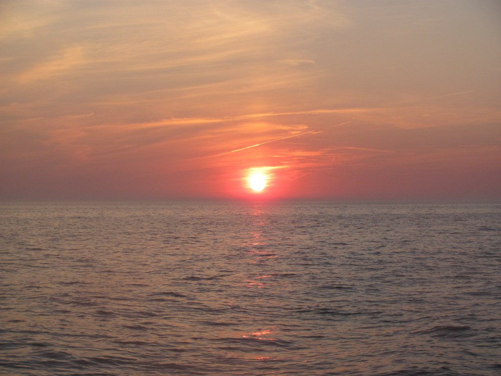
The sun rises over the Baltic.

We sail south-westwards on a comfortable close reach, the sea miles sliding smoothly under the keel. The hours pass.

“There’s a Swedish boat called Obsession following us”, I say, pointing to the chart-plotter. “I remember it being in Utklippan. It’s going faster than us, but I think that we have enough of a lead to get there first. We don’t want to lose our place at the ferry dock.”

We had called the harbourmaster at Christiansø earlier, to check that there would be enough space there for us. As it is only a tiny harbour, it can become very full at the height of the season.

“No problem”, he had reassured us. “The ferry goes at 1400h, so if you arrive just after then, you can tie up at the ferry dock. It’ll be free until 1000h the next morning.”

The wind strengthens, and moves round more to the east. We are now on a beam reach and doing 7½ knots. The sea also becomes choppier.

“Phew, this is a bit bouncy”, says the First Mate. “Can’t we go a bit slower? Look, there’s land ahead. It must be Christiansø.”

Christiansø is the largest of the islands of the Ertholmene archipelago, which belongs to Denmark. In fact, the whole archipelago is often referred to as Christiansø despite there being three other islands, two of which are designated as bird reserves and therefore out of bounds without a permit.

We round the south-eastern point of Christiansø, and the harbour suddenly appears, nestled in the narrow gap between two of the islands.

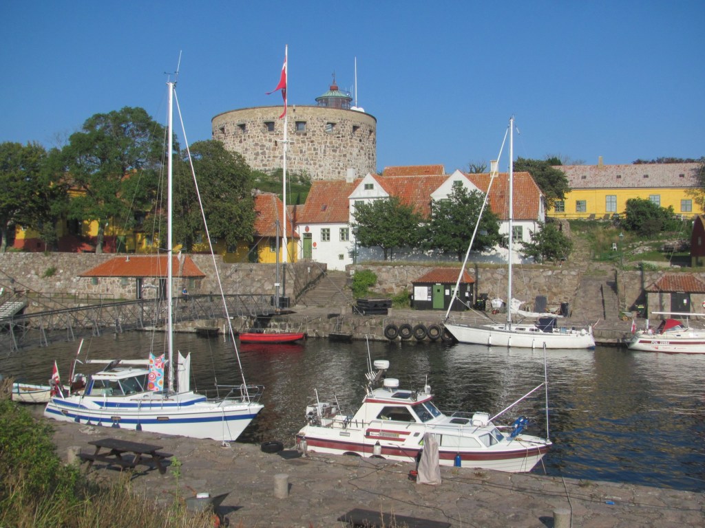
Approaching Christiansø harbour.

The ferry to the mainland is just leaving, and true to his word, the harbourmaster waves us to the place it has just left. About an hour later, Obsession arrives, and ties up behind us.

“I could see you on the AIS”, says the skipper. “I was trying to catch you up, but you had too much of a start on me. I’m Ingemar, by the way. I am on my way back to Malmö where I overwinter.”

I tell him that that is also where we have finally decided to keep Ruby Tuesday for the winter.

“It’s a good marina”, Ingemar says. “I grew up in Malmö. The harbourmaster is an old schoolfriend. He’ll look after your boat well.”

There doesn’t seem to be anyone else on his boat.

“I am sailing single handed”, he says, reading my thoughts. “I live in the south of France nowadays, and spend each summer sailing around the Baltic. I did the Stockholm archipelago this year.”

I am impressed. His boat is a 53-footer weighing 24 tonnes, dwarfing Ruby Tuesday. It can’t be easy to sail it by oneself.

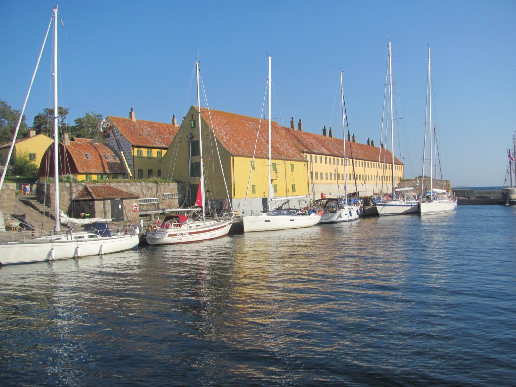
Tied up in Christiansø harbour.

“Coffee’s ready”, calls the First Mate from the cockpit. “Drink it up quickly. I want to go and explore the place.”

Christiansø was built by the Danish as a military fortification during the Swedish-Danish wars in the late 1600s. Part of the fortifications were two towers, both of which have been renovated and now contain museums.

Store Tårn (Great Tower), Christiansø.

“The English attacked the island in 1808 in what is known as the English Wars of 1801-1814”, one of the museum displays tells us. “They destroyed several of the fortifications and captured some of the Danish ships in the harbour, but were not able to capture the whole island, so they withdrew.”

The British bombardment of Christiansø in 1808 (by Arne Skotteborg-Frederiksen)

I am somewhat surprised, as I was not aware of war between Denmark and Britain. But Google tells me later that it was all part of the Napoleonic Wars, and that France and her allies were trying to prevent British trading vessels from entering the Baltic Sea. As Denmark was an ally of France at that time, Danish forts were considered legitimate targets. The Royal Navy had bombarded the city of Copenhagen the year before in an attempt to seize the Danish fleet to stop it from being used by the French. They had then moved on to Christiansø to prevent it being used as a base for state-supported privateers to attack British merchant shipping.

“Don’t worry”, says the harbourmaster with a grin. “It’s all history. We quite like seeing British boats here nowadays. As long as they don’t try and finish the job they started in 1808. But we don’t get many coming anyway since Brexit.”

We take a quick walk around the rest of the island. A foot bridge joins Christiansø with the neighbouring island of Frederiksø.

The foot bridge joining the two islands.

On Frederiksø is the Lille Tårn, or Small Tower, now a cultural museum.

Lille Tårn, Frederiksø.

In the morning, we need to leave before 1000h to make way for the ferry’s arrival. Obsession leaves first, easing away from the quay, and we follow her out of the narrow harbour entrance. Immediately, the wind picks up from the south-west, and we zip along on a comfortable beam reach, heading for the small harbour of Allinge-Sandvig on the island of Bornholm, 13 NM away. After a couple of hours or so, however, we enter the wind shadow in the lee of Bornholm, and the wind gradually dies to nothing. We drift for a while, but with the sails flapping listlessly, we are reduced to furling them away and motoring the last few miles into the harbour.

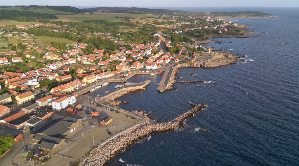
Allinge harbour, Bornholm.

“What about coming over for a drink later on?”, says Ingemar, as he helps us to tie up in front of Obsession.

“Sounds good”, I say.

Tied up in Allinge harbour, Bornholm.

There’s just enough time before then to have a quick look around the town. Originally a small fishing settlement, Allinge prospered in the Middle Ages from the Hanseatic herring trade, with masses of Baltic herring being shipped to southern Europe for Catholics to eat on their ‘meatless’ days. In 1946, it officially joined with the neighbouring fishing village to become Allinge-Sandvig.

Nowadays, the colourful houses and streets exude charm in the typical Danish fashion that we had grown used to in southern Denmark three years ago.

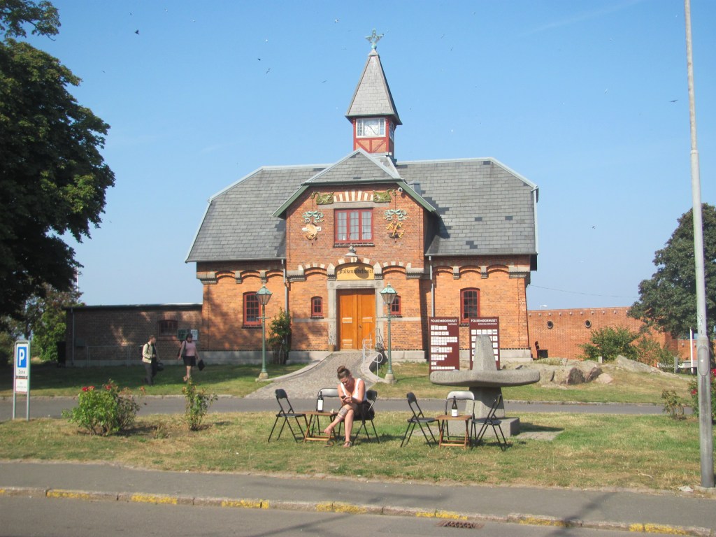
The Allinge Technical School was built in 1895 with the aim of training craftsmen. Currently it is used as offices.

Former Allinge Technical School.

The Public Meeting Dome can be rented for various events.

The Allinge Public Meeting Dome.

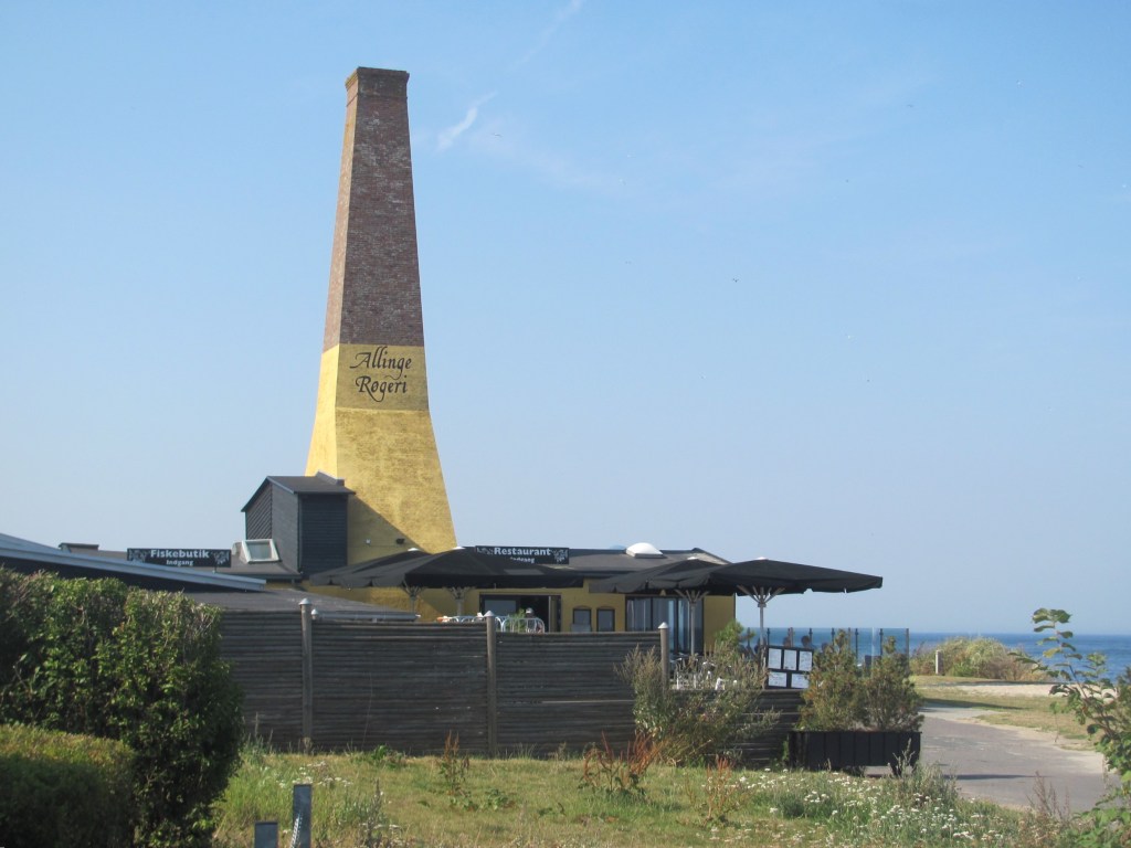
An the way back, we pass one of the two smokeries in the town.

Allinge Smokery.

“Welcome to Obsession”, Ingemar says, as we clamber aboard. “Yes, I am retired. But I have been sailing most of my life. I started off running charters in various places, including the Caribbean. Later I started a company making desalinisation equipment for the marine industry, removing the salt from seawater to make fresh water. The company did very well, and we ended up fitting our gear on a lot of the luxury yachts. One superyacht, for example, owned by a Russian oligarch, had two swimming pools – one for the adults and one for the kids, with the water for each coming from our desalinators. Anyway, I sold the company a few years ago, invested the money, and now spend the summers sailing.”

“I bet you could tell some great stories about the rich and famous?”, prompts the First Mate.

“I could, but I am not allowed to”, answers Ingemar with a smile. “Most of the jobs we did are covered by non-disclosure agreements.”

“Getting back to the Caribbean”, I say, “I read a fascinating book recently on a sailboat that was hand-built there. On the island of Bequia. A friend of mine who lives in Australia recommended it to me.”

“I know Bequia well”, says Ingemar. “It’s my favourite Caribbean island.”

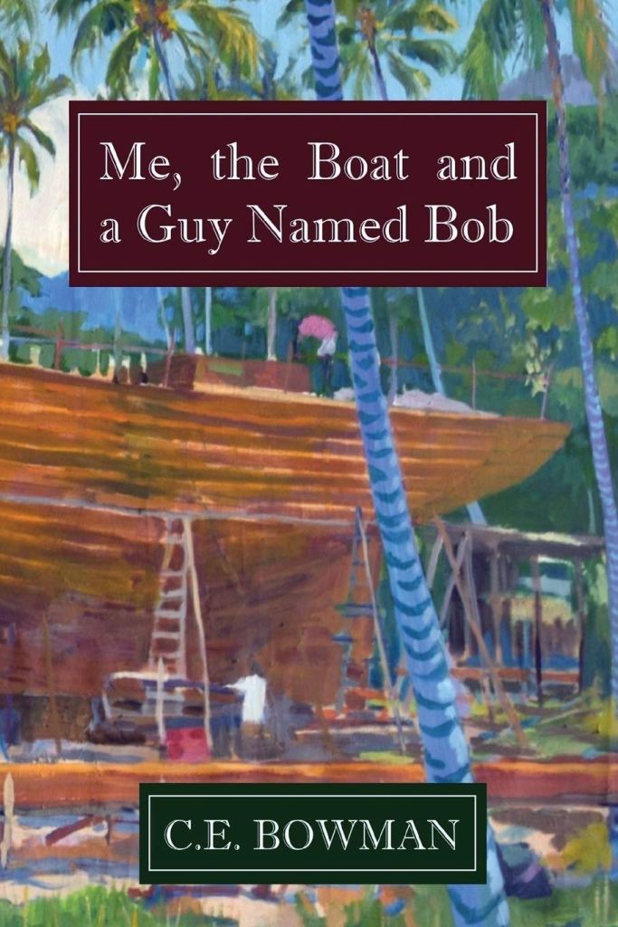
“The boat was built by a young Californian chap called Chris Bowman back in the 1970s”, I continue. “It was commissioned by Bob Dylan, but the agreement was that they would be joint owners of her. They named her Water Pearl. The book is called Me, the Boat and a Guy named Bob. It’s a good read.”

Ingemar’s brow furrows, as though he is trying to recall a memory from long ago.

“I knew Chris”, he says after a pause. “I was there on Bequia at the same time as him. I remember him building that boat. But didn’t she sink or something?”

“According to the book, she hit a reef at night at the entrance to the Panama Canal”, I say. “Despite their best efforts to rescue her, they couldn’t drag her off, and they had to leave her to break up. It was quite poignant really.”

”I wonder what Chris is doing now?”, asks Ingemar. “We didn’t keep in touch.”

“He lives in Western Australia”, I say. “My friend Tony met him at a book club meeting to which Chris was invited to come and talk about his new book. He married the girlfriend Vanessa of whom he talks about in the book, and they settled in Fremantle. She is Australian.”

“I remember her too”, says Ingemar. “It’s indeed a small world. I’ll have to buy the book.”

—-

The cold wind whips across the ramparts as the three figures furtively make their way through the dark shadows. Their years of imprisonment and the cruelty of their captor have sharpened their resolve, and now, with the fortress guard lulled by the monotonous night watch, the time for escape has come.

The woman unrolls the crude rope she had fashioned from bedsheets and drops it over the wall, trying to put the roaring of the sea below out of her mind. Weak from his illness, her husband ties it around his waist, and the woman and the servant slowly lower him over the side, the linen straining under the weight. Reaching the grassy mound at the base of the fortress wall, the man unties the rope and tugs it to signal that he is safe. The woman and servant follow, climbing down by themselves. The three pause for a minute to regain their breath, wrap themselves in the bedsheets for warmth, and with one last look at the ramparts to see if they have been discovered, disappear down the rocky path to the sea.

In his haste, the servant falls and twists his ankle, his cry echoing into the night. Lights and faces appear on the ramparts of the fortress, the alarm is raised. As the escapees pass a local inn, a dog begins to bark. The innkeeper, aroused from his sleep, is about to investigate, but, seeing the three white figures passing eerily by, believes he is seeing ghosts, and pulls the blankets tighter over his head.

The fugitives continue their escape, but they are hindered by the injured servant. Eventually, as dawn breaks, they reach the nearby harbour of Sandvig, but just as they are about to board a small boat that will take them to safety, the fortress guards appear. Their brief taste of liberty is over, and the couple are returned to the grim confines of Hammershus, their fate now darker than ever.

“It’s a good story, isn’t it?”, says the First Mate in my ear.

We are in the museum at Hammershus Fortress on the north-western tip of Bornholm, and I am reading a panel on the daring escape of one Leonara Christina Ulfeldt in 1660, a member of the Danish royalty who was imprisoned in the imposing fortress along with her husband, Corfitz, who had been accused of treason.

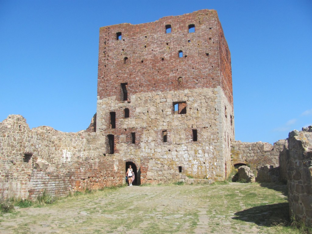
Hammershus Fortress ruins.

We had cycled over from Allinge harbour that morning, puffing our way to the top of the hill on which the Fortress was built in the 1200s. The largest in Scandinavia at the time, it was built when there were major struggles between the king and the church in Denmark, and served as a stronghold for the church. Over the years, various kings did manage to conquer it several times, but weren’t powerful enough to keep hold of it, and it was always surrendered back to the church. Until Frederik I, that is. In 1525, he decided that enough was enough, and chased the archbishops out of it for good.

“It’s amazing how powerful the church was at that time, isn’t it?”, says the First Mate. “They must have been terribly wealthy.”

Hammershus Fortress, Bornholm.

“Frederik I then gave it to Hanseatic merchants from Lübeck”, the next panel tells us. “However, despite their own wealth, the merchants taxed the local population heavily and coerced them to provide labour to extend the fortress. The people did rebel against them, but their uprising was brutally put down.”

Then in 1576, the King installed his own vassals there to use as an administration centre with courtroom, prison and gallows, with the proviso that they restore it, but they ended up taking the taxes from the local people to line their own pockets and letting the fortress fall even further into disrepair. It was during this time that Leonora and Corfitz Ulfeldt were imprisoned there.

The ‘Mantel’ Tower, where the Ulfeldt couple were imprisoned.

“Wow, you can sort of see why the local people on Bornholm had a deep loathing of the castle”, says the First Mate over a coffee at the end. “Everyone seemed to do all right out of it except them.”

“But I read that Bornholmians nowadays are quite proud of its dark history, and are helping to restore it again”, I say. “They think it is worth preserving.”

On the way back, we cycle past Sandvig harbour where the Ufeldt couple hadn’t escaped from.

“If the servant hadn’t twisted his ankle, they might have been able to get away”, says the First Mate. “As it was, she had to spend the next 22 years in solitary confinement.”

Sandvig harbour today.

We arrive back at the boat. Someone seems to be waiting for us.

“Wow, is that your boat?”, he says. “I was just admiring it. Have you come all the way from Britain? I saw your flag. I’m Jason, by the way, and this is Harold. He has been walking a lot today and is a bit tired.”

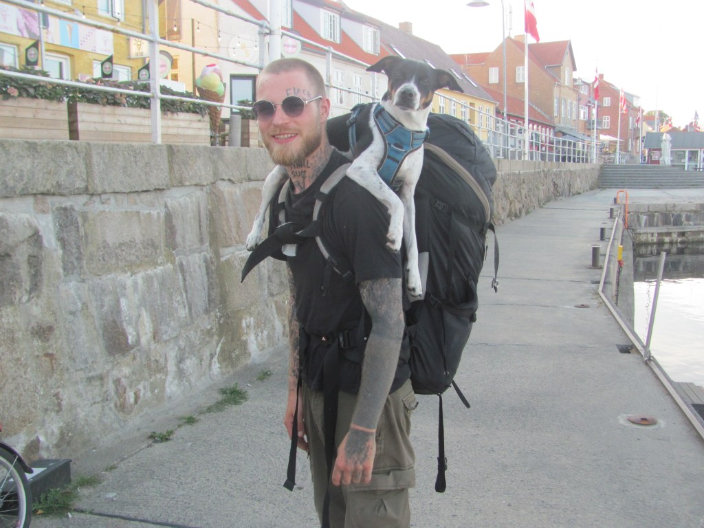
Jason & Harold.

Harold looks a bit dejected, but on hearing his name, manages a bark.

We tell them that we have sailed from Britain, but it has taken four years to do it. Our plan is to explore as much of Europe as possible by sea, but we are in no hurry. At the moment we are doing the Baltic.

Harold pricks up his ears.

“Wow, that is so cool”, says Jason. “I am a poor student from Copenhagen, but I have decided to take a year out and hitch-hike around Denmark first of all, then we’ll see how we get on after that. But I would love to do it by boat. You have inspired me to work hard and save up, and do something similar.”

Harold wags his tail.

“I think he’s spotted a mink over there”, says Jason. “There’s a few of them around.”