The Island of Gometra

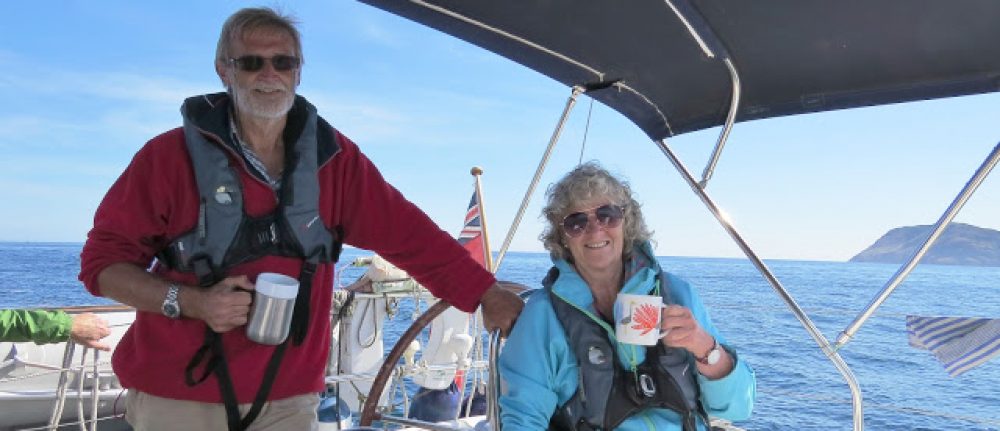
“There’s something I find quite attractive about these remote Scottish islands”, says the First Mate, taking a sip of her coffee.

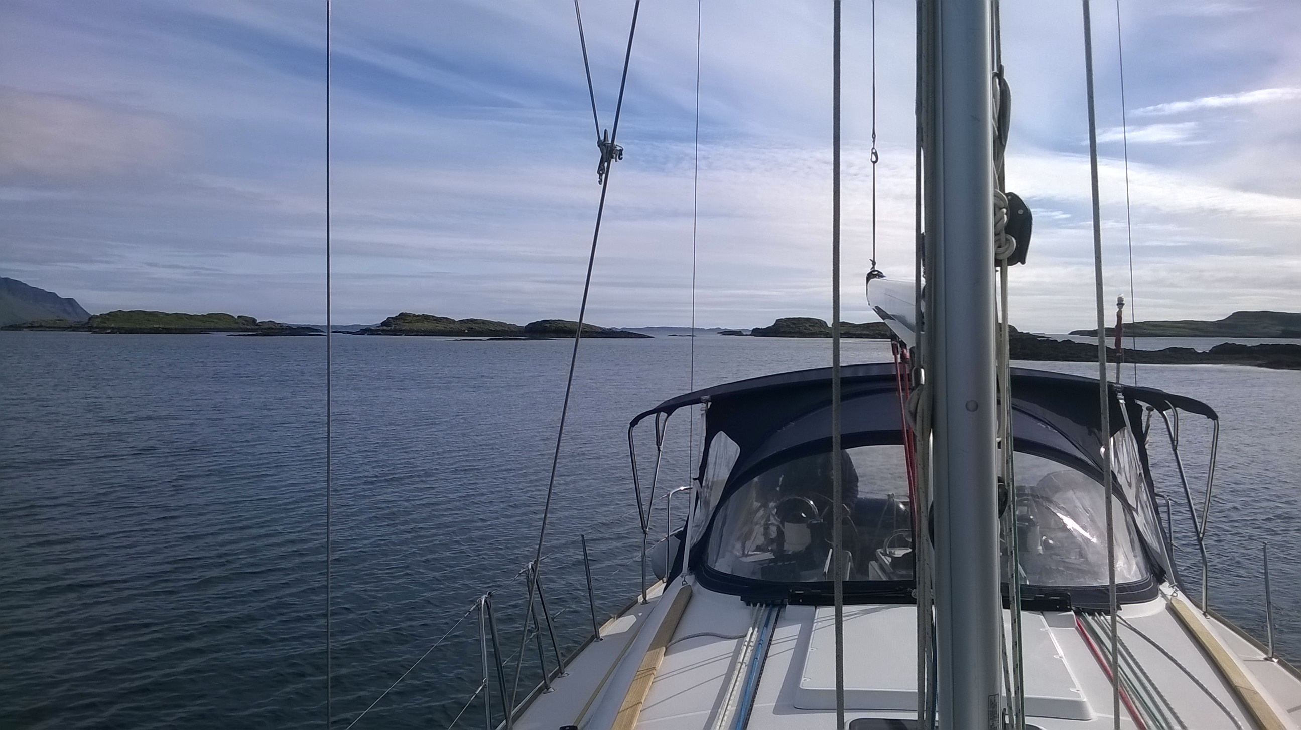
We have just anchored in the small southern harbour of the island of Gometra on the west coast of Mull, and are sitting in the cockpit basking in the sun. On some rocks to the side of us about half a dozen seals have the same idea, looking for all the world like curved bananas that didn’t quite meet EU regulations. We are the only boat here, and apart from one small cottage on the shoreline, we could be the only humans in the world.

Anchored in South Gometra Harbour.

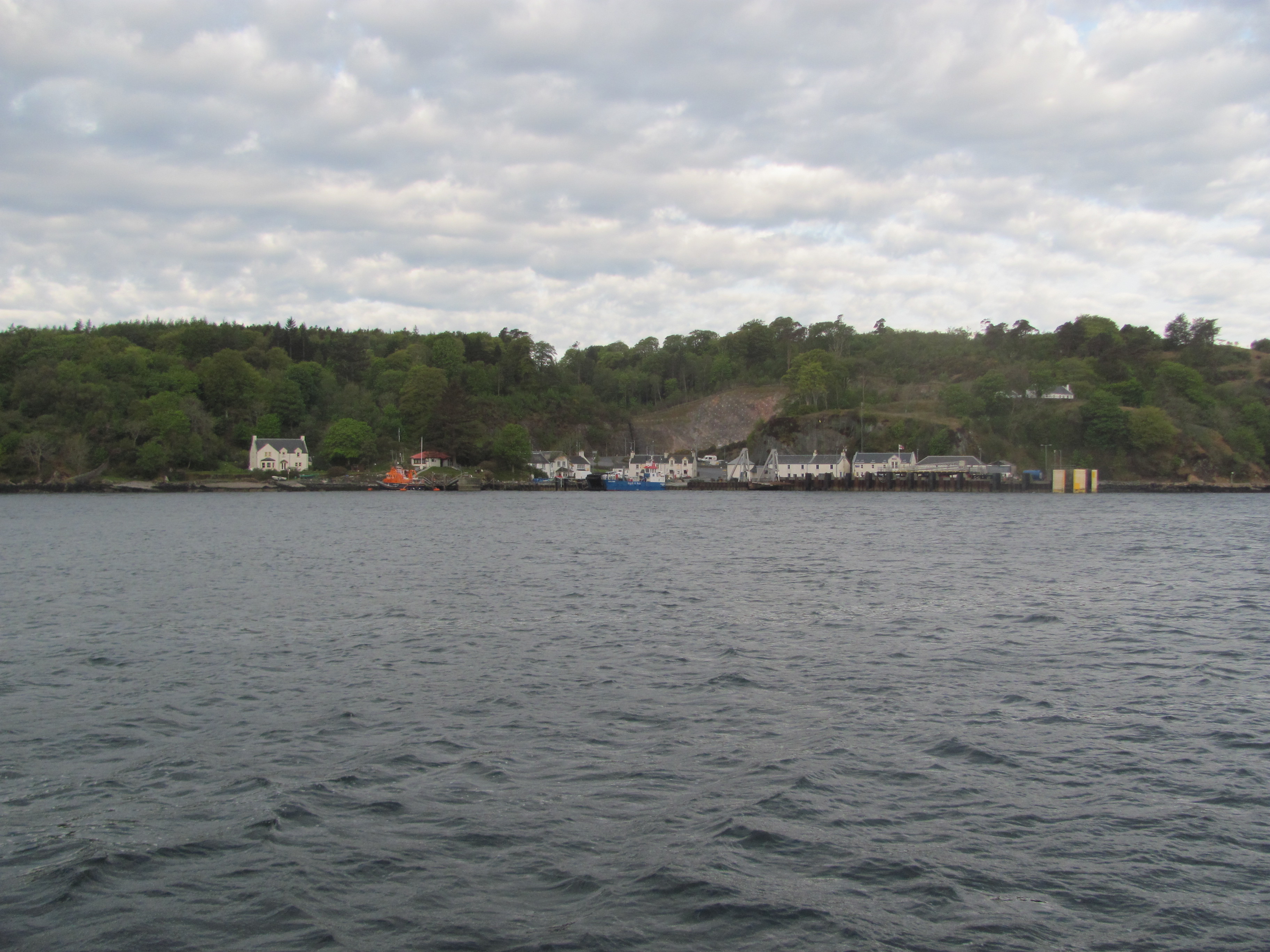
Even though it is fairly close to Mull, in several ways Gometra has to be one of the most remote Scottish Islands – there is one permanent inhabitant, four or five houses, including Gometra House, used by the owner of the island. There are no shops, no ferry, and the only access is by the single road running from the small cluster of houses on the south-western end of the island to a bridge over the narrow tidal gap that separates Gometra from the larger island of Ulva. Even from the bridge it is a two hour walk to Ulva Ferry to cross to Mull. And that’s about it, apart from lots of heather and beautiful beaches.

We decide it is too beautiful a day to do nothing, so we clamber into the dinghy and row ashore. As we do so, we are followed by five seals poking their heads out of the water, inquisitive about these intruders in their watery domain. The first two see us looking back at them and shyly submerge. The other three stay a respectful distance.

Oi! What are you doing here? This is where we live.

As we land, we are struck by the heaps of plastic waste on the shore – pieces of old fishing net, ropes, milk containers, soft-drink bottles, even a toilet seat. To be fair, much of it seems to have been washed up by the sea itself, almost as though it has vomited it out and is saying to us “Here, I don’t want this poison. Take it back and deal with it yourself!”. Some of it is in piles, which we decide, hopefully not naively, has already been collected from the foreshore and awaiting collection for safe disposal.

Plastic pollution on the beach.

But as we walk along the track, we also see much more – plastic fertiliser bags used to fill in potholes where vehicles have been stuck, old fish boxes discarded next to the road, a heating oil tank against a fence. I recall a recent National Geographic article I have read that globally 18 billion tonnes of plastic are dumped in the sea every year – this is only a tiny fraction of that amount, of course, but every little bit contributes.

Rubbish piled up awaiting collection.

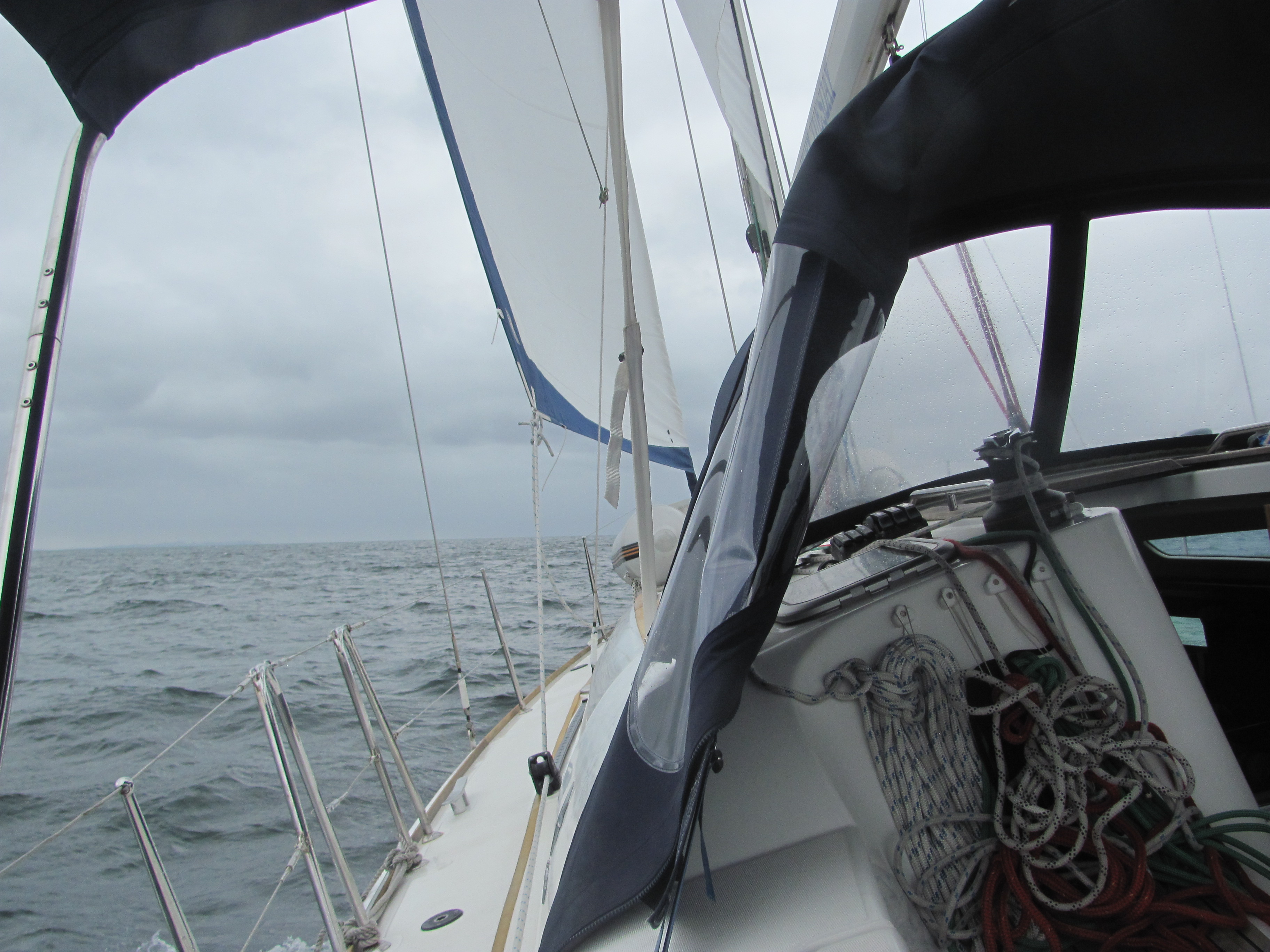
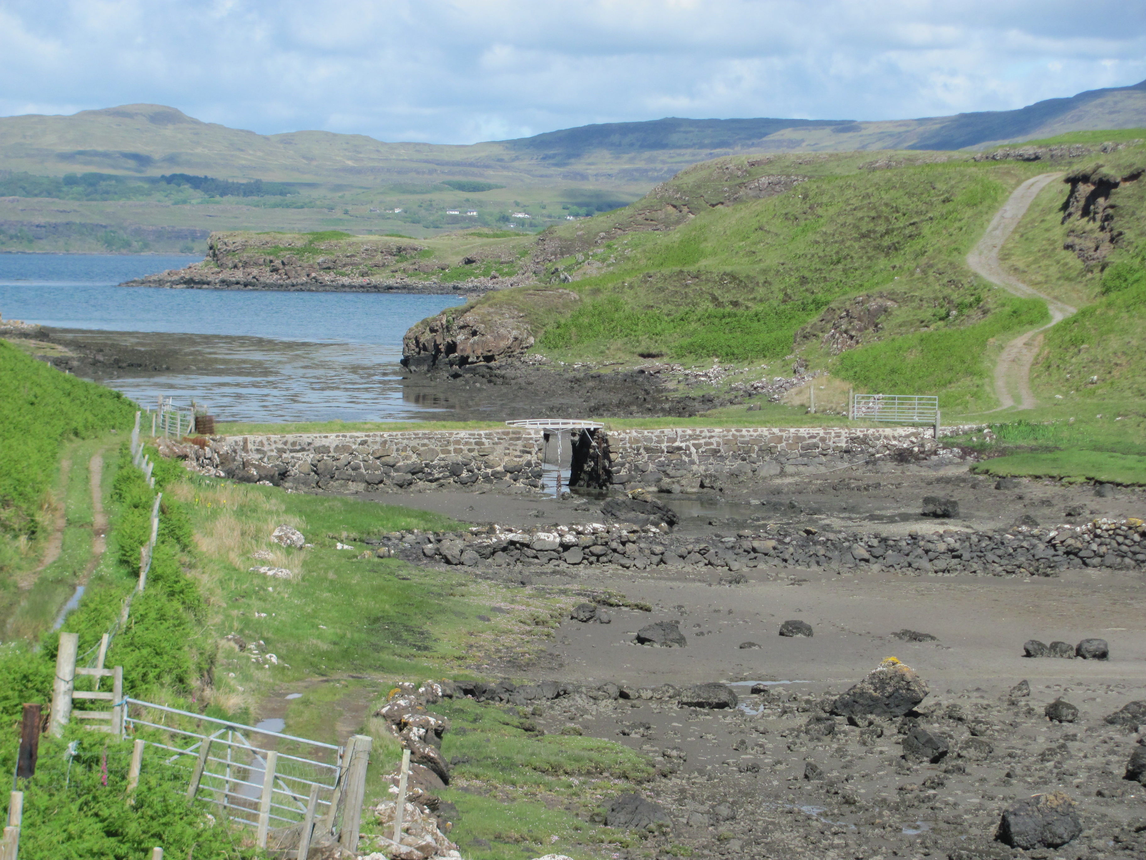
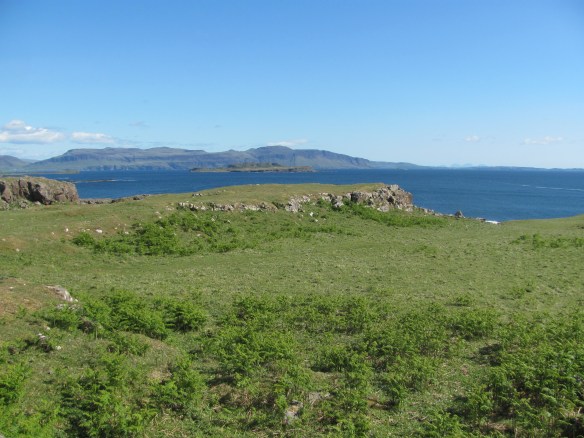
We continue along the track with the narrow gut that separates Gometra and Ulva on one side, and a hillside of rough heather on the other. The tide is ebbing and already we can see the mud on the bottom and the normally-submerged rocks beginning to appear. Eventually the small stone bridge comes into view.

The bridge between Gometra and Ulva.

Crossing the bridge, we walk up to a promontory on the Ulva side and look across Loch Tuadh. On the other side, we can make out the tiny white dots of houses on the hillside, one of which is our friend Mark, whom we will be meeting tomorrow.

Looking out over Loch Tuadh.

Retracing our footsteps, we pass two small buildings, one of which has two girls sunning themselves on the wooden seat outside. We guess that this is Jane Anne’s Bothy available for rent on AirBnB, but is very basic with no electricity, gas, bedding, cooking facilities or internet, has a shared outside toilet, and requiring an eight-mile walk in from Ulva Ferry, carrying all the supplies needed for one’s stay. Hot water and heating are from a coal stove with the coal being purchased in advance from the island’s single resident. Definitely one for the hardy, self-reliant and those fed up with modern society!

The second building is a small studio with a collection of craft work from the island’s only resident, Rhoda Munro. There is also a small pile of essential grocery items for the yachts-people that have run short, and sets of Gometra postage stamps (although these only get the letter as far as Ulva Ferry, beyond which a normal postage stamp is needed!). On one outside wall is a plaque in memory of Catherine MacQuarie McDonald, an inhabitant of Gometra, who facing abject poverty when her fisherman husband was drowned, took her ten children and emigrated to Australia. At the unveiling ceremony of the plaque in 2017, it seems that she now has more than 2000 descendants in Australia, including a MP!

Plaque to Catherine McDonald, a former inhabitant of Gometra.

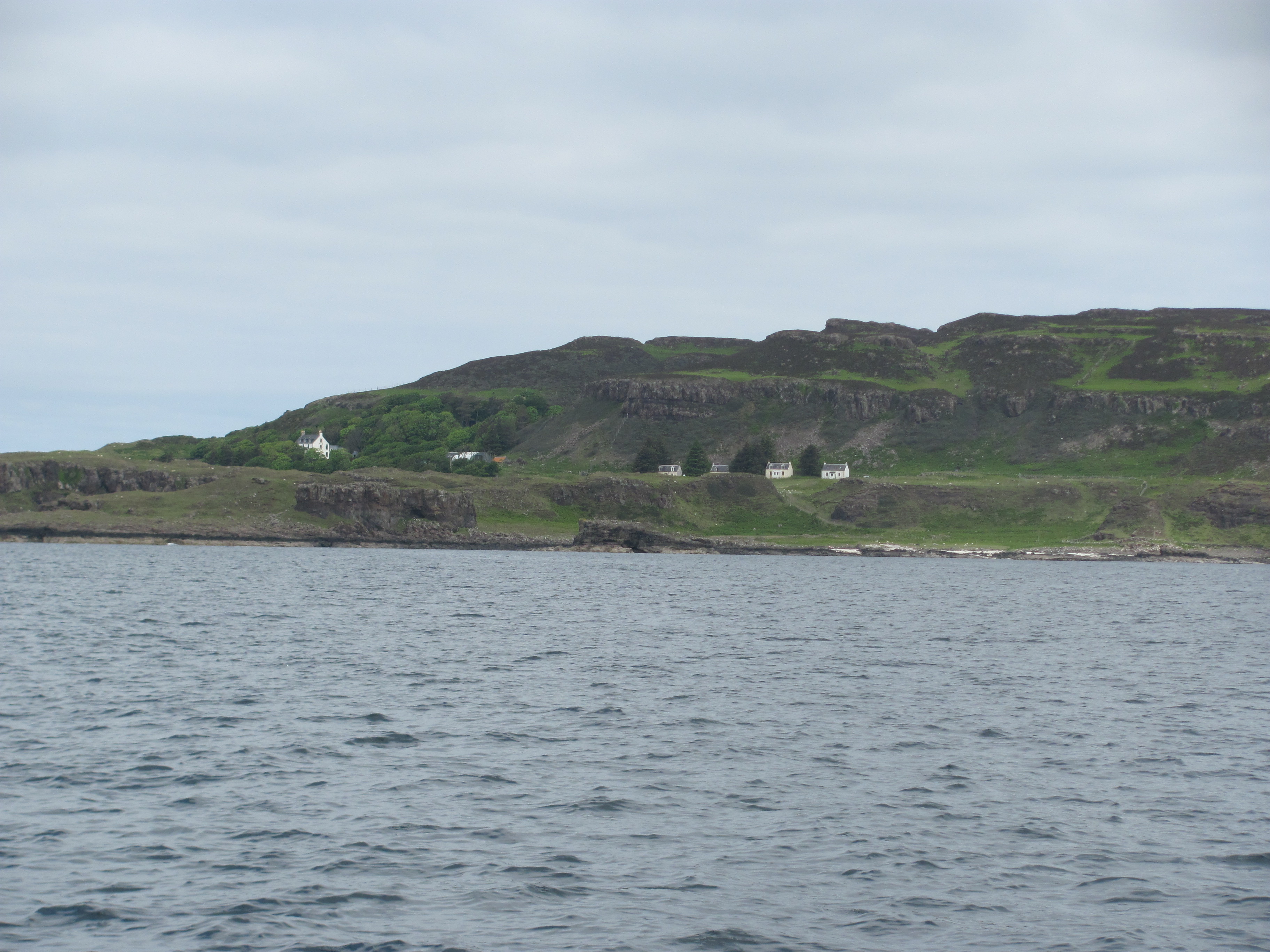
We continue along the rocky track, deeply rutted in places, passing close to the shoreline with the waves lapping below, through a cut in the rock, before reaching a gate beyond which there are a cluster of four houses in a row at the base of a steep cliff. The first one, the Teacher’s Bothy, is available for rent like the first one we saw. The other three are also obviously lived in – one has a Land Rover and a quad bike outside it, and we surmise that it is where Rhoda Munro, the island’s farmer, lives. In front of the houses is a fenced off area with an overrun garden and a dilapidated polytunnel frame partially covered with green netting. ††

The small settlement on Gometra.

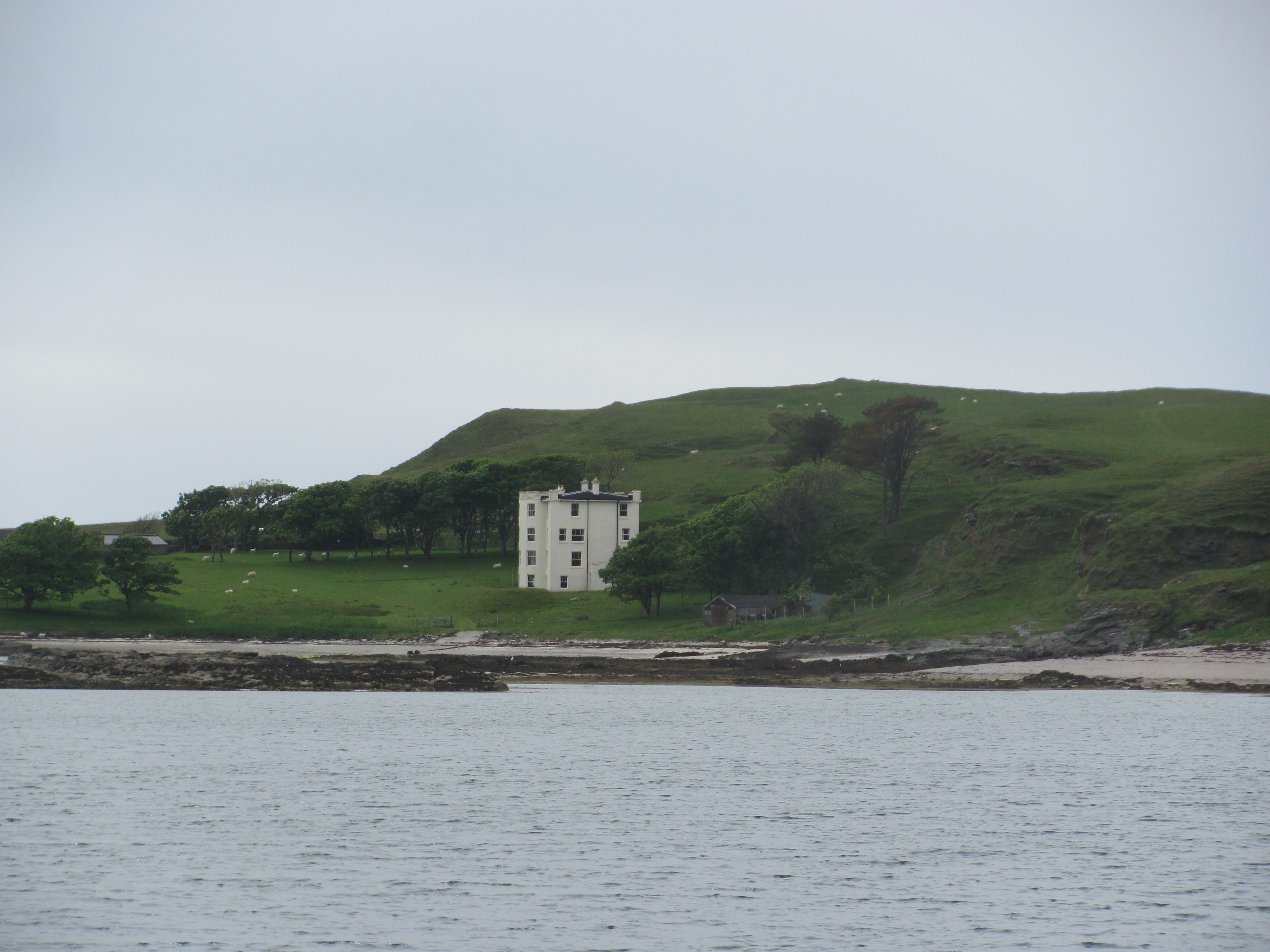
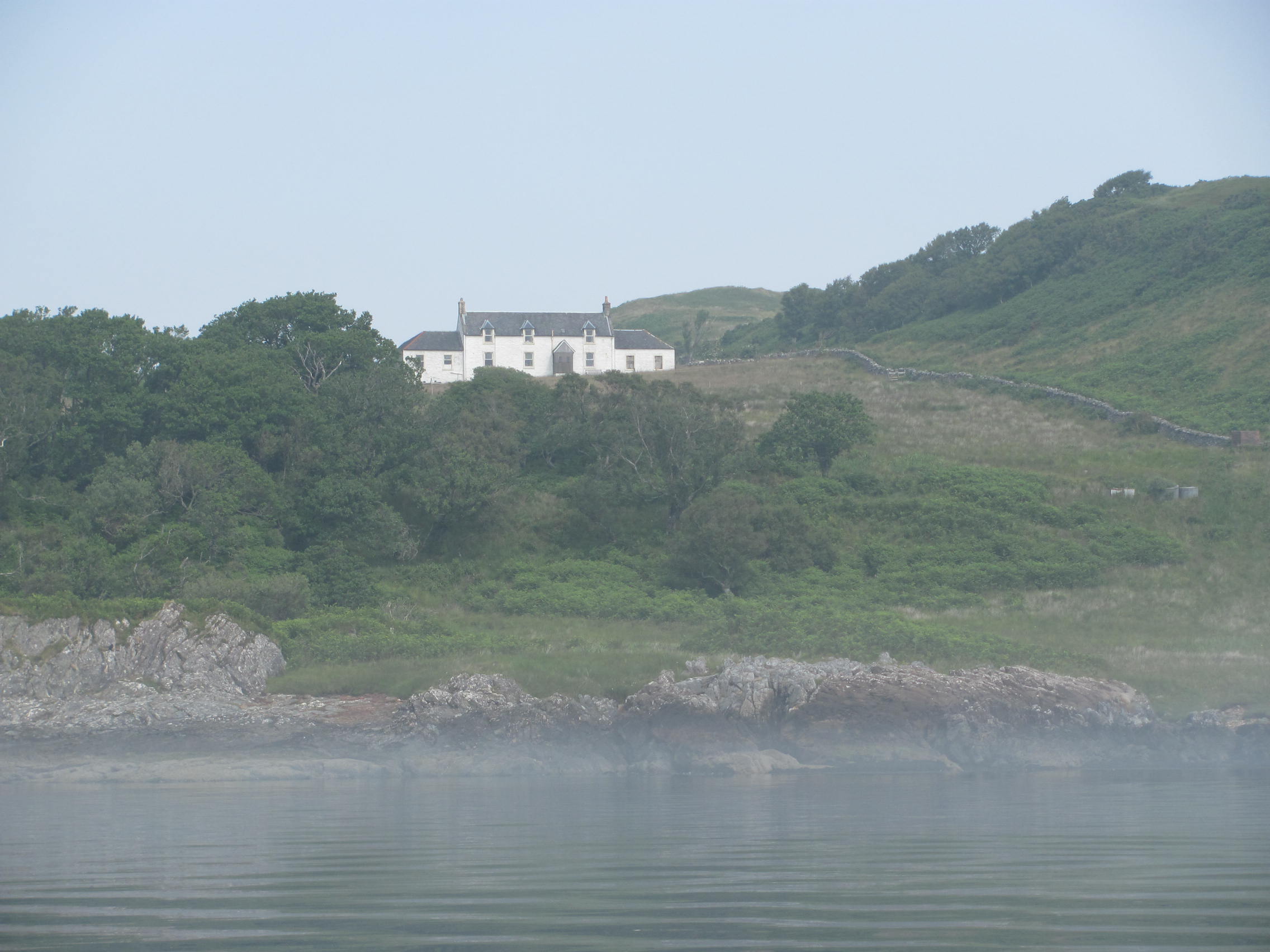
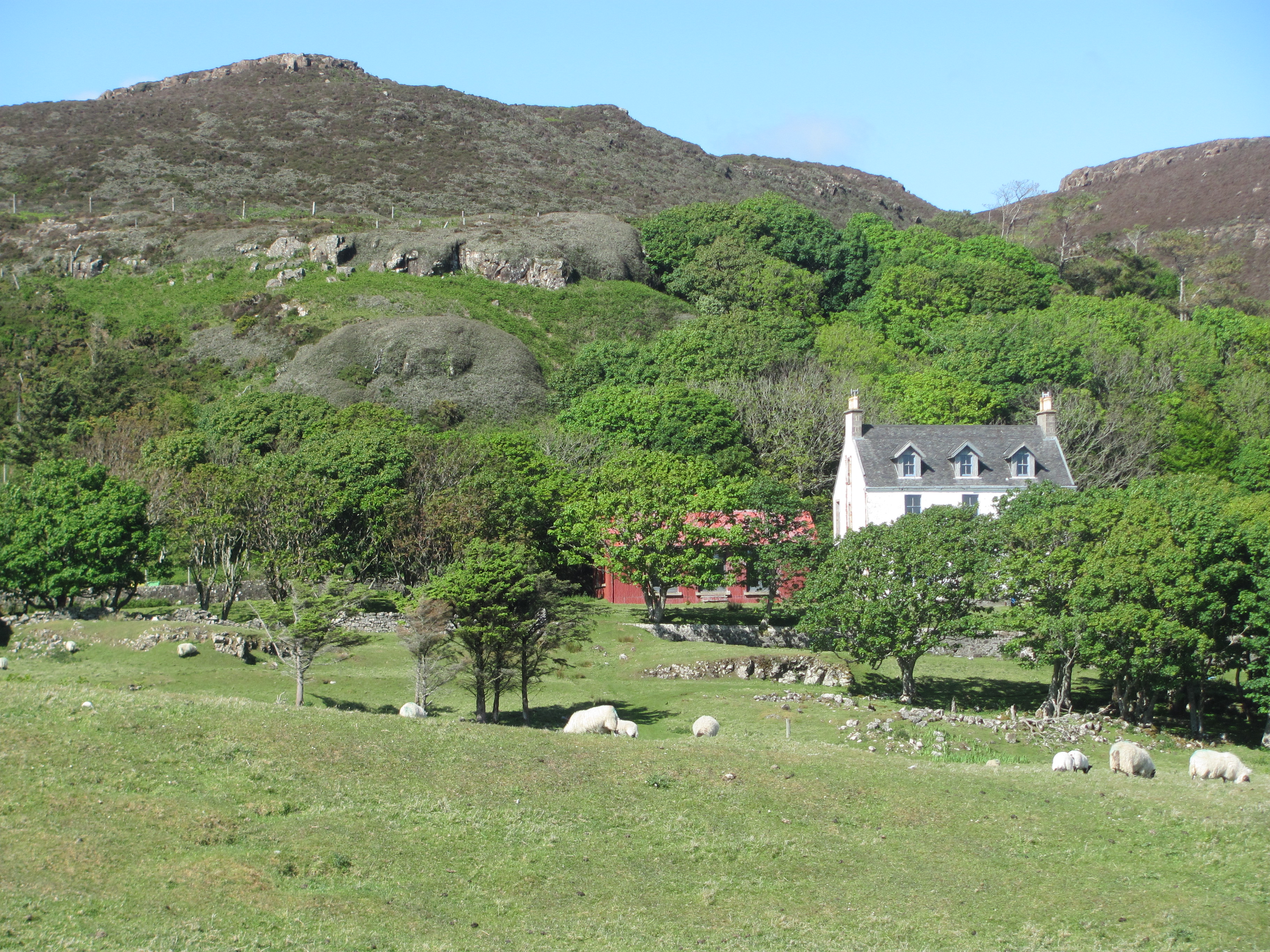
A little bit further on, reminding us of a mother hen in charge of her chicks, is the larger Gometra House, where the owner, Roc Sandford, lives. Sandford is an interesting character. He is a millionaire, having made his money in tourism, property and publishing, and is a self-avowed environmental campaigner, making a point of minimising his carbon footprint and living sustainably. Although he lives in London, to get from there to Gometra he travels by bike, train, ferry, bus and rowboat. Reading about him later, I find myself warming to him. He plans to gradually phase out the use of all fossil fuels and shift the focus of the island’s farm from methane-emitting livestock production to carbon and amenity farming, and probably because of this, publicly advocates a carbon tax to internalise the social costs of carbon dioxide emissions. Good for him.

Gometra House.

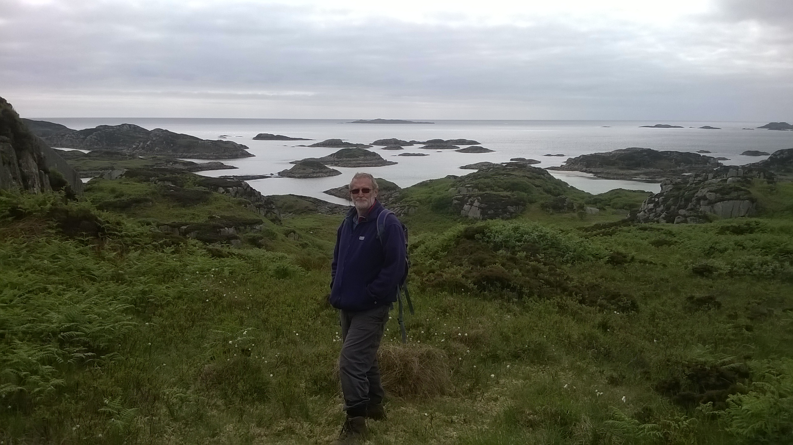
We walk to the top of the hill overlooking Loch na Keal and eat our sandwiches and munch our apples. The views on a brilliant day like this are stunning. We make out Iona in the distance, Staffa and Inch Kenneth, where we had sailed a few days previously, and then further westwards out to the Treshnish Isles, and Coll and Tiree, where we hope to be in a few days’ time. On the grass below us sheep graze nonchalantly, apparently oblivious to the view. Down to our left, there is a pretty little beach which apparently one of the previous owners used to have herself driven down to in her Rolls Royce (a distance of about 200 metres) and would swim naked!

View across to Staffa from Gometra.

“It’s beautiful”, sighs the First Mate, “but I am not sure I could live here. I need people, and there are not enough here.”

I muse to myself whether I could cope with island living, particularly on Gometra, which is remoter than many. For me, there is a definite attractiveness about the concept – the self-sufficiency, the escape from the rat-race, the closeness to nature, the time to read, think and write. But, it takes a special kind of person to thrive in such conditions – no mod cons (not even a working washing machine), no doctor or nurse, no school, no shop, limited phone coverage, limited social interactions, mail deliveries and collections once a week, and the nearest public transport nine miles away, meaning a three hour walk or two hour drive by Landrover. Alright if one is fit and healthy, but what if one took ill? There is no ambulance service, and evacuation is by lifeboat or helicopter. And the weather – could one tolerate the winter gales and biting winds coming in from the Atlantic? We were seeing on a perfect day. It is interesting that people who come with the intention to stay full time on the island last only about two years, while those who come and go last much longer.

I think to myself that I could maybe find ways around these challenges somehow, but decide that for me it would be a mixture of having something meaningful to do and social interaction that would decide whether I would survive or not in such a setting. Before I retired, I found that I could work on something for two or three days at home before needing to go into the office again to meet and talk with colleagues. Rhoda Munro is a farmer and has her farm to keep her busy and give her strong ties to the land, and family and friends who live on neighbouring islands. Those who leave after two years presumably come with some purpose such as writing a book or painting, and once that is finished, find it difficult to stay and make a life there. I guess we all have our own ways of trying to find some meaning to our lives, and island living is just one.

Would we like island life here? The settlement at Gometra from the sea.

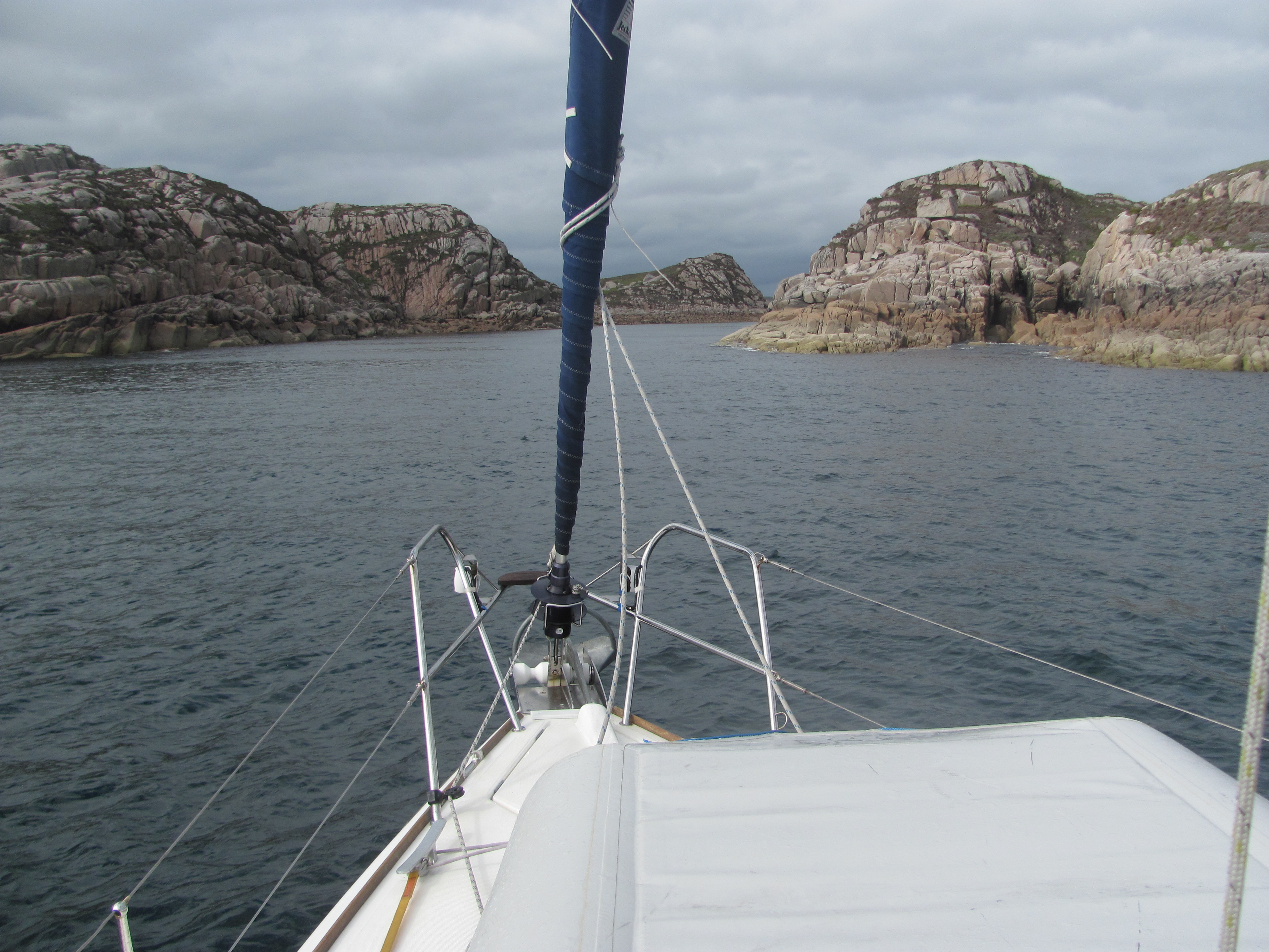
Below us, a solitary yacht makes its way around the tiny Maisgeir island at the south-west corner of Gometra, only its foresail out. It is where we plan to go in the morning on our way around into Loch Tuadh.

“Will we be going around that island, or through the gap?”, asks the First Mate, pointing to the narrow channel between Gometra and Masgeir.

The Atlantic swell surges through the gap and breaks on a couple of rocks in the middle, throwing up spumes of foam.

“Probably around the island”, I say.

View out across Loch na Keal from Gometra.

The First Mate chucks her apple core down the hillside. “Come on, let’s go.”

“You know that is biological pollution, don’t you?”, I say. “Some botanist might come here in 20 years’ time and think she has discovered that apple trees are native to Gometra, just like that botanist did on Rum.”

“Don’t worry. A sheep will come along shortly and eat it”, she says. “And anyway, why do you think the botanist will be female?”

“It’s a sign of the times”, I say.

The next morning, as I sip my first cup of tea for the day on deck, I see the two girls we had seen the day before in the bothy walking back along the track to Ulva Ferry, bulging rucksacks on their backs. They seem to be in a hurry. I wonder to myself if they have enjoyed their short interlude of off-grid island living.

Loch na Keal, Mull

The young monk looks up from his work in tilling the fields near the sea-shore. This job never gets easier, he thinks. Still, I am lucky to be here. He is on the holy island of Iona in the kingdom of Dalriada, but only joined the abbey just on a year ago after leaving his home in Ireland and putting his life in God’s hands. So far he had enjoyed it and had taken to his Latin lessons with enthusiasm.

His eyes narrow as he looks out to sea. On the horizon he thinks he can see a number of sails. Even though boats are a commonplace mode of transport around Iona, and indeed essential, there is something different about these – the brightly coloured square sails contrast with the drab brown sails of the everyday boats. That can only mean one thing – the men from the cold wastes of the North, the Vikings. They had last been here four years ago, and that hadn’t ended well for the monks. He hadn’t been here then, but the older monks still talked about it with fear in their eyes. He drops his hoe and with his heart in his mouth runs to the cathedral to warn the others. The bell begins to toll ominously.

Looking out for Vikings. View from the northern end of Iona.

The Viking commander signals to the other longships in his fleet. On the horizon, he can now see his target – the abbey on Iona. The plum is ripe for the picking, he thinks. All those valuable treasures and no one to defend them. He could never understand these wimpy Christian monks – what on earth would make a real man want to spend his life worshipping a God who only wanted to be loved? Surely a good bit of raping and pillaging was what the gods wanted? And it’s fun into the bargain. He is looking forward to the massacre later in the day – the nice thing about an island is there is nowhere to hide.

He orders his sails to be trimmed in response to a slight shift in wind direction, and feels a surge of pride as he glimpses the name of his longship on the crossarm – Rauðr Týsdagr – named after the day of worship of the red-haired god of combat, the great Tyr.

Rauðr Týsdagr?

We are just passing the green buoy marking rocks in the Sound of Iona. It takes me a few seconds to realise that I am not a Viking sea captain, but just plain old me. I have been trying to imagine what it might have been like on the day in AD 806 when the abbey was attacked by Viking raiders and 68 monks were killed in Martyrs’ Bay, just across from where we are now. Walter Mitty has nothing on me!

The abbey on Iona.

The Sound is shallow – just 40 cm deep in places – and we have to pick our way carefully through the narrow route that has been identified. Over to our port side is the impressive newly reconstructed Iona Cathedral on the same spot that St Columba built his abbey as the centre of Celtic Christianity in the early Middle Ages. From there the Celtic brand of Christianity spread through the west and north of Britain and Ireland, with different ways of calculating Easter and with different styles of monks’ haircuts from the English brand that was centred on Canterbury.

Picking our way gingerly through the Sound of Iona.

We decide to push on to Staffa, about seven miles north of Iona. As we approach it, I am reminded of the baleen in a whale’s mouth open to catch its breakfast. It seems that the Vikings saw it in another way – the name Staffa derives from the Old Norse word for staves, logs placed vertically to build their houses. We consider anchoring and rowing ashore to explore the island, but there is too much swell coming in from the Atlantic and breaking on the rocks, and we don’t want to leave Ruby Tuesday unattended, so we content ourselves with getting reasonably close to see inside Fingal’s Cave, and then motoring around the island. Fingal was a hunter-warrior in Irish and Scottish mythology, but the Staffa cave only gained his name from Sir Joseph Banks in the eighteenth century. The basalt columns were formed by volcanic activity around 60 million years ago – when lava cools slowly, it forms hexagonal columns. It is the same geological structure as the Giant’s Causeway that we had seen on our stop-over in Northern Ireland last year.

Fingal’s Cave, Staffa.

At lunchtime, the First Mate drops the anchor and we sit in the sunshine and eat our sandwiches prepared in the morning. We are just opposite McCulloch’s Tree, a fossilised conifer that was entombed in lava from the Mull volcano 60 million years ago as the Atlantic Ocean began to open. The tree itself has mostly disappeared; what is left is an imprint. Up against one side of the tree are the layers of lava that came to rest stacked up against the tree and cooled into a curved shape. It is possible to walk to it on land, but it requires a long walk from the nearest road along the top of the cliffs, descending some height down an iron ladder onto the beach, then clambering over slippery rocks and past two waterfalls, all timed to complete the beach vit at low tide. We can see the ladder and shudder – getting to the tree by sea is so much easier! We try to imagine what that day must have been like as the volcano erupts and the lava rolls down its flanks engulfing everything in its path.

McCulloch’s fossil tree.

Sandwiches and coffee finished, we weigh anchor and set off on a pleasant beam reach northwards towards the island of Inch Kenneth in the north-east corner of Loch na Keal, and anchor in the shallow anchorage to the east of the island. Inch Kenneth is perhaps best known for its association with the Mitford family during the Second World War. Several members of the family were ardent supporters of the Fascist movement in the UK, one daughter, Diana, being married to Sir Oswald Mosely, the leader of the Fascist Party. Another daughter, Unity, was personal friends with Hitler, and helped him draw up lists of British people who would either collaborate or be shot. When war was declared on Germany, she was so distraught that she shot herself in the head, but only succeeded in disfiguring and partially paralysing herself. She spent the rest of the war on Inch Kenneth planning her own funeral.

Inch Kenneth House.

We think about anchoring here overnight, but the small bay is rather exposed to the north, and a change in wind direction to the north is forecast overnight, so we decide to sail over to the south side of Ulva to a sheltered little anchorage called Craigaig. We navigate our way though the numerous small islands that protect it, and drop anchor at the top of the bay. Three other yachts are already there. We open a bottle of wine and sit in the cockpit marvelling at the play of light and shadow on the cliffs on the Ardmeanach peninsula in the distance, the seals basking on the rocks off to our left, a fat heron preening itself on the shore of the small island to our right, and the oyster-catchers flying overhead emitting their piercing shrieks.

The view from the back of Ruby Tuesday towards Ardmeanach peninsula.

We don’t realise it at the time, but there is a darker side to this beautiful place – it used to be a thriving village in the nineteenth century, but was a victim of the clearances to make way for sheep, and now nothing remains but a small bothy. There is also a poignant story of two sisters, one of whom ate a piece of cheese while the other, Charistiona, was out. Charistiona returned and discovered the cheese gone, and decided to extract a confession from her sister by dangling her over a cliff with a shawl. As you do. Unfortunately the shawl slipped and the poor girl was hanged by accident. Grief-stricken, Charistiona confessed all to the islanders, but they decided that she still needed to be punished and so wrapped her in a sack and left her on a rock that was covered at high tide. Needless to say, she drowned. The rock is still known as Charistiona’s Rock.

Looking back to Charistiona’s Rock .

The Scots seem to have been quite taken with this form of punishment, as there is a similar story from Duart Castle on the other side of Mull in which the badly behaved wife of a MacLean chief is punished in the same way.

Tinker’s Hole, Mull

I watch the two seagulls through the binoculars picking at the dead body of something on a rock on the shoreline. It could be a rabbit, but I can’t quite make it out. In the middle of the anchorage, a seal pops his head out of the water and looks at us quizzically. Out through the narrow entrance channel, I can see the seas breaking over the semi-submerged rocks in mid-channel.

We are at Tinker’s Hole, a small well-protected anchorage at the western tip of the Ross of Mull, just opposite Iona. At the height of the season, this place can be packed with boats, but today we are the only ones here. Surrounded by the pink rocks of Devonian granite on all sides, it has a rugged beauty of its own.

Anchored in Tinker’s Hole, Ross of Mull.

From Loch Spelve, we had had a few days at Dunstaffnage Marina collecting the new upholstery that the First Mate had chosen and ordered for the seats in the cabin to brighten it up. It hadn’t been quite ready before we had left Ardrossan, so the plan had been to sail to Oban, then for me to take the bus back to Ardrossan, collect the seats and their new covers, and also collect the car and drive back to Oban, put the seats back in the boat, then both of us would drive back home with the car, then get the bus back to Dunstaffnage. All highly choreographed, but it had worked.

The new seat covers.

We had then filled up Ruby Tuesday with fuel and water, and set off along the south coast of Mull, heading for Tinkler’s Hole where we knew there is good shelter. Gale-force winds had been forecast for the next day, so we needed to be somewhere safe by then.

The wind had been directly from the west, and we had had a good sail down the Sound of Mull on a close reach. Once we reached Frank Lockwood’s Island at the south-eastern tip of Mull, however, with the wind more-or-less directly on our nose, it was a different story. Unable to sail directly to where we wanted to go, we took a line out towards the northern tip of the Isle of Colonsay, retracing our track more-or-less of the previous week. Then began a series of long tacks of about two miles in length as we zig-zagged our way to our destination.

Sailing close-hauled along the south coast of Mull.

The closest that Ruby Tuesday can sail into the wind is 30°, but the speed drops at that angle and she performs better at around 40°. It was slow progress, but eventually we made it to the Bogha nan Ramfhear buoy marking the northern end of the treacherous Torrin Rocks, at which stage we had switched to motor the last little bit into Tinker’s Hole. At least now we would be sheltered from the gale.

The Bogha nan Ramfhear cardinal buoy marking the north end of the treacherous Torrin Rocks.
Entering Tinker’s Hole.

The seagulls finish their meal and flap off, leaving the meatless carcass to be washed off the rocks at the next high tide. The seal has gone too. Later in the morning the gale arrives. The seas outside the entrance become even rougher and smash on the mid-channel rocks in a maelstrom of foam. Inside the anchorage, however, we feel safe, and with the wind directly from the west the water remains mostly calm.

Sitting out the gale in Tinker’s Hole.

The next day, the gale has abated, and we think about exploring our locality. About a mile away to the north is a small circular white building which apparently used to be the signal station to communicate with two lighthouses out to sea, the Skerryvore and Dubh Artach. We decide to walk to it, so we unload the dinghy and row ashore. There is a path of sorts which we follow, but it soon peters out, or at least we lose it somehow. We trudge through the thick heather for a while until we come across a fence-line. There is still no distinct track, but we feel that the fence line must lead somewhere. Eventually we come to a boggy stream where the fence stops. We decide to follow the stream, but to our dismay, it leads us further away from the direction of the signal station. Yet there is still no sign of a path to the top of the hill, and we eventually find ourselves on the far side of the hill, where at least there is a track leading to a small settlement.

Getting lost – looking for a track, any track …

We walk up the track to the row of stone-built cottages at the base of the hill. In front of each is a long walled garden. Some of them have people working in them. We pass a young couple painting the gate at the entrance to one of them.

Living a sustainable lifestyle.

“Excuse us, but is this the way to the signal station?”, we say.

“Yes”, the young girl responds shyly. “You explain it to them”, she says to her companion.

“Yes, carry on here until you come to a gate. Just after that turn left, then just a but further on from there before you get to the road in front of the houses, you’ll find a path to your right up the hill. That will take you directly to the station”, he explains with a friendly grin.

“Is this a kind of community?”, says the First Mate.

“Yes”, says the young girl, again bashfully. “He’ll explain”.

“Yes, there are a group of us who live here”, he explains, again with a smile. “We try to be sustainable – getting away from the hustle of city life, living close to nature, growing our own food, that sort of thing. We all share the same values and have similar philosophies in life. We call ourselves the Erraid Community, but we are part of the Findhorn Foundation, if you have ever heard of that?”

In actual fact, we have. The Findhorn Foundation is in Findhorn in north-east Scotland, not far from where we live. We have even visited it once.

He tells us more about the community. There is a freshness and enthusiasm in the way that he talks, something that comes from being young, untainted by the scepticism that often comes later in life. A small part of me envies their messianic zeal, giving them some purpose to life. Is our sailing trip an attempt to recapture some of that lost innocence of youth, exploring places in the most sustainable way possible?

We wish them well, and continue up the track. There is a sign on a gate warning us to shut the gate after us or else we will be fined 40 shillings. I work out that is £2 in real money. I check my pockets and find I only have 73p. I make sure the gate is shut.

Don’t break the law!

Eventually, we reach the knoll on which the signal station is located. Its two windows remind me a little of the Tin Man in the Wizard of Oz. Inside is a box full of CDs and booklets on the Erraid community. They all cost more than 73p and the First Mate has also forgotten her purse. I feel guilty that we are not supporting the local economy very well.

The disused signal station on Erraid. The Tin Man?
View from one of the windows of the signal station.

Another couple are in the signal station too, having walked from the caravan park across the estuary at Fidden. Like us, they are recently retired, and are travelling around Scotland in their newly purchased motor-home. We compare notes on our terrestrial and aquatic means of transport and find there are many similarities. The conversation turns to Brexit.

“The worst decision this country has ever made”, says Mr Motorhome. “By the way, have you heard that Theresa May announced today that she is standing down?”

We had, but we agree that we can’t see how her successor, whoever it is, can solve the impasse. The sticking point is the Irish border issue, and the EU are unlikely to reopen negotiations on a completely new deal. How could the country come to this? We feel a bit depressed as we walk back to the boat, although part of this is because we get lost again.

Uh-oh, lost again! Has anyone seen a boat around here? At least the scenery is stunning.

That night I awake suddenly, and look at my watch. It is just after midnight. Something has woken me, but I don’t know what. I look at the map of our position on the tablet and am horrified to see that we have shifted quite a bit from our previous position. The wind has strengthened and has changed to the north, swinging us around on the anchor. Not only that, but the anchor itself seems to have shifted.

I find the torch and stumble out to the cockpit. It is difficult to see anything away from the boat, but we seem to be still some distance to the nearest rocks. I check the tablet again. At least we seem to have stabilised in the new position. I decide to stay awake and keep an eye on our situation, plotting a small waypoint every 15 minutes of our position. The wind howls through the rigging, and I pray silently that it isn’t strong enough to dislodge the anchor again. The waypoints all cluster around a point – at least the anchor seems to be holding in the same place.

The anchor seems to have dragged!

In the early morning the wind dies and I decide that there is no immediate risk, and drift off into a couple of hours of fitful sleep. In the morning I feel tired and grumpy, but console myself that it could have been worse.

Loch Spelve

Cuckoo! Cuckoo! The sound comes from somewhere in the small wood coming down to the water’s edge. The early morning sun’s rays are catching the trees and teasing out hidden shades of green and brown. Over on the left hand shore, a flock of geese angrily honk at each other for a moment before settling down self-consciously, almost as if they realise they are disturbing the beauty of the place.

Anchored at the top of Loch Spelve.

Another solitary goose begins to honk as it flies over the boat and glides in to land feet first near the shoreline, shakes its wins and begins to swim along it. I follow it with the binoculars and see that it is rejoining its mate in a nest on the shore with several small goslings. An oystercatcher speeds over the rocks, shrieking piercingly, while a pair of hooded crows pick aggressively at something on the foreshore. Out in the loch, two seals frolic noisily, their splashes causing ever-widening ripples on the surface. They seem to be having fun. A jelly-fish floats languidly past underneath the boat, its delicate body, almost transparent with its internal organs visible, pulsing like a heart. Overhead, I can see the contrails of an aircraft heading for America or somewhere.

Jelly-fish.

We are anchored in the top end of Loch Spelve on Mull. I am sitting on deck slowly sipping my coffee. It is utterly tranquil, the water as smooth as a mirror, hardly a ripple on its surface. I have an intensity of awareness of what is happening around me, making me feel that I am at one with nature. Even the contrails don’t seem to be out of place, although I know they are man-made. Nevertheless, the incongruity of the situation is not lost on me – I am only here because of a technological wonder – the boat, a man-made survival capsule that allows us to explore an environment that is not ours.

At one with nature?

The day before, we had set off from Crinan at around midday exiting the sea-lock out into the Sound of Jura, aiming for the far coast of the Isle of Jura. There was a fresh breeze blowing from the west, and Ruby Tuesday leapt forward on a close reach.

Preparing to leave the Crinan canal.

Near the northern tip of the island, we could see Barnhill, the farmhouse that Eric Blair, perhaps better known as George Orwell, had written his masterpiece, 1984.

My mind had gone back to our last visit. We had been in our previous smaller boat, and had anchored in Kinuachdrach Harbour just north of Barnhill. ‘Harbour’ was a slight exaggeration – there had been nothing else there apart from a derelict pier and a few scraggly looking Highland cattle. There had been a lot of kelp and the holding wasn’t good, and we had been worried about stray currents from the roaring Corryvrechan catching the boat and whisking her away. We had walked briskly up the farm track leading from the harbour and eventually arrived at the rear of the Barnhill house nestled in a shallow glen overlooking the Sound of Jura. It had been a kind of Mecca for me – I had read Animal Farm and 1984 at school and had been deeply impressed with them, and being here where the latter was actually written was magical. I had found the story rather disturbing – what on earth could it be like to live in a society where everything you did was monitored by the state? We had seen the tiny attic window where Blair had sat and typed his manuscript, interrupted every so often by the hacking cough caused by his tuberculosis. What was it about this remote yet beautiful place that had conjured up his vision of a dystopic world? I had concluded that it wasn’t necessarily the place that had done that – the vision was already in his head, and Jura had just provided a location free from distractions where he could put words to paper.

And yet, those words had been prophetic – already we were living in surveillance society monitored by CCTV, and where all our actions online are recorded on vast computer networks somewhere. And we are complicit in all this – in return for the convenience provided by the apps and algorithms we use, we don’t mind that the data collected on everything we do is used to further manipulate us on how to vote, what to buy, what to believe, and so on.

Barnhill House on Jura, where George Orwell wrote 1984.

Leaving Barnhill to recede into the distance, we had crossed the Ruadh Sgeir Ledges in the middle of the Sound with their strong overfalls and whirlpools. Even though Ruby Tuesday weighs nearly eight tonnes, we had been surprised by the ease with which the currents had nonchalantly pushed her around.

Turbulent whirlpools in the middle of the Sound of Jura.

We had followed the Jura shoreline down, passing Lussa Bay and Tarbert, with the awe-inspiring Paps of Jura looming in the background.

The Paps of Jura from the east.

Eventually we had arrived in the tiny Drum an Dunan bay, at the southern end of the much larger Lowlandman’s Bay, just north of Craighouse. Three other boats had been anchored at the top end of Lowlandman’s Bay, but we had been the only ones in our little spot. Perched on the promontory at the top end of the bay was the house and associated buildings that had been built for the keepers that maintained the Skervuile lighthouse further out in the Sound. The original plan had been to stop at Drum an Dunan for a cup of tea, but it was so peaceful and calm that we had decided to stay the night. We had sat on deck with the binoculars watching two families of geese – the parents and several young goslings – fossicking along the sandy beach for their evening meal, and the seals basking on the rocks on the eastern shore. Shags had flown over and landed noisily on the water between ourselves and the shore.

Up with the sun rise.

The next morning we had been up bright and early, and had left at 0530 to catch the southward flowing tidal current in the Sound of Jura to carry us to the south of the island, from where we would catch the current starting to change and flowing northwards at 0630 into the Sound of Islay. The wind had gone around to the south east, so we had had to motor a little at the start. As soon as we were around the south-east corner of Jura, however, we had hoisted the sails, cut the engine, and continued in peace and quiet along the southern coast of Jura.

Passing Port Askaig.

Our timing had been spot on, and at 0630 we were just passing Am Fraoch Eiliean (G: Island of Heather) at the entrance to the Sound. The wind was now almost directly behind us, so we had hauled in the main sail and coasted along with just the genoa. With the northward current now running quite strongly, we had scudded along at almost 10 knots. Port Askaig and the Caol Isla and Bunnahabhain distilleries had sped past us on the left, while to the right we could see the Paps of Jura again, this time from their other side. Within a short while, we had arrived at the northern end of the Sound of Islay, passing the Rubha a Mhail lighthouse to our port side. Off to our left, not far away, lay Colonsay.

The Paps from the west coast of Jura.

“What shall we do, then?”, I had called down into the cabin. “That’s Colonsay over there. Shall we give it a miss or swing past it?”

Emerging, the First Mate had looked surprised.

“Is it that close? That’s not very far! It looks pretty smooth between here and there. We might as well go and see what it is like now that we are here.” Gone was the nervousness of the night before after talking to the Salty Sea-Dog!

With the wind now from our port quarter and gusting to 22 knots, we had trimmed the genoa and sped towards the low-lying island ahead of us. While in the lee of Islay, the sea had been indeed quite smooth, but gradually it had picked up so that by the time we were approaching Colonsay, there was a short swell from the south-east. We had read that the Caolas Mohr anchorage on the smaller island of Oronsay at the south was better than Scalasaig, the main port of the island, but with the wind directly from the southeast it had been too exposed and rough to anchor, even for a quick cuppa! Reluctantly, we had circled around and left, heading northwards along the coast towards Scalasaig, keeping an eye out for a glimpse of the Augustinian Priory ruins on the way. Unfortunately, they were on the other side of the island and we couldn’t spot them.

Caolas Mohr anchorage on Oronsay.

We had carried on up the coast, passing Loch Staosnaig, which if anything had been even more affected by the swell. Eventually, we had reached Scalasaig, where the ferry came in, but this too had been quite rough. We had stopped for a minute or so and watched a moored yacht there wallowing from side to side, its mast describing huge arcs like an inverted pendulum, but had decided this wasn’t for us.

Scalasaig, Isle of Colonsay.

Looking at the chart, it had seemed that on the north-west coast of the island, there was an anchorage in Kiloran Bay sheltered from south-east swells, although susceptible to western swells from the Atlantic. There might be a slight chance we could find some protected water there. However, as we rounded the northern tip of Colonsay, it was apparent that the long Atlantic swells were still coming in, despite it now being two days since the westerly winds had ceased. Through the binoculars we had seen the white foam of the swells crashing onto the rocks and the beach at Kiloran. It had been the worst of all worlds – the Atlantic swells on the west of the island hadn’t had time to die down, and new swells had been whipped up by the wind from the south-east.

Turning around, we had set a course for the south-east corner of Mull with the sails trimmed for a easy broad reach, and had settled back to enjoy the sunshine.

Leaving behind the Isle of Colonsay.

Getting into Loch Spelve takes a bit of care – there is a shoal that comes out a long way from the southern shore into the entrance, with only a narrow channel close to the northern shore. Previously there used to be a series of white marks painted on rocks on the shore and a green perch marking an underwater obstruction, but the rocks are now largely overgrown with bracken and the perch has disappeared. We navigated carefully in with chart-plotter, keeping a close lookout from the bow for any unmarked rocks. In the end, we made it with no less than 8 m of water under the keel, and anchored in the north-west arm of the loch.

Just arrived in Loch Spelve.

Cuckoo! Cuckoo! Another cuckoo has joined the first, and they call to each other, sometimes in step, other times out of phase. Over on the brown kelp-covered rocks on the seashore, I hear the snort and expiration of air from something big, probably a seal, although I can’t see it. A whisper of a breeze springs up, causing a slight ripple on the previous mirror-like surface. I lie back and contemplate the shapes of the few puffy clouds hanging motionless in the sky. All is well with the world.

Calm and peaceful on Loch Spelve.

The Crinan Canal

“Och, I wouldn’t go out there if I was you. You are facing the Atlantic, it’s a long way out, and there are big Atlantic swells that will swamp your little boat. The wind has been blowing from the west for a week now, so the swells will have had plenty of time to build up. Far too dangerous!”

The Salty Sea-Dog sits back in his chair and surveys us as though we are silly school-children with a hare-brained scheme. A piece of pork pate has entrapped itself in his beard, and the right-hand side of his face is flecked with spots of white paint, all of which only seem to add to his authority on things maritime. His blue and white striped T-shirt helps a bit too.

We are sitting in the Seafood Bar of the Crinan Hotel tucking into our dinner after having just successfully transited the Crinan Canal. The Salty Sea-Dog and his partner are at the next table, and we have just made the possible mistake of telling them what our sailing plans are, namely to visit the Island of Colonsay. It was one of the islands we hadn’t visited previously, and probably undeservedly it had assumed an air of mystery in my mind.

The First Mate pricks up her ears. “Really?”

“Och, aye”, the Salty Seadog continues. “You need to go through the Corryvreckan, the third largest whirlpool in the world, and then cross a large expanse of huge swells which will pitch the boat up and down.” He is enjoying this. I wait for the inevitable “Thar be sea monsters too, oooh, aaarh”, but it doesn’t come.

The First Mate looks at me with a nervous look in her eyes. “I don’t think that I like the sound of that too much”, she says.

At least we are only in for a pitching and not a swamping now, I think. I almost mention that we have been through the Corryvreckan twice before, the first time in our tiny 17-footer, but it seems a bit like one-upmanship, so I keep quiet.

Ruby Tuesday tied up in the Crinan Basin, with the Crinan Hotel on the right.

We had left Ardrossan a few days earlier, headed across the Firth of Clyde and had anchored in Lamlash Bay for the night. The next morning, we had headed up the coast to Brodick for lunch, passing the Buddhist project on Holy Isle on the way. The project is the brain-child of a chap called Lama Yeshe, the Abbot of Samye Ling Monastery in Dumfriesshire, who bought the island with the idea of creating an ecologically sustainable community. Visitors can come to experience inner peace regardless of their religious background. From the small pier, a path lined with Tibetan stupas and flags leads up to a non-descript house surrounded by a stone wall. A solitary figure seemed to be meditating against the wall. We considered stopping to learn more, but unfortunately the water depth near the pier was too shallow for our draft, so we decided to push on for Brodick for lunch. Perhaps a place to visit another time.

The Buddhist Centre on Holy Isle, Lamlash Bay, Arran.

In Brodick, we had tied up to one of the visitor buoys and had rowed the dinghy ashore. The sun had come out and the wind had dropped, so we had a relaxing coffee, basking in the warmth.

Coffee at Brodick, Arran.

From Brodick, we had headed for East Loch Tarbert. The word ‘Tarbert’ comes from an old Norse word meaning ‘portage’, a place where boats or cargo could be hauled over the land from one part of the sea to another. Sure enough, East Loch Tarbert and West Loch Tarbert are separated by a narrow isthmus of land only 2 km wide, nearly cutting the Mull of Kintyre in two. The story goes that there was a Norse king called Magnus Barelegs who struck a deal with the King of Scotland at the time that he could have all the land on the west coast that he could take his boat round. Wanting the fertile land of the Kintyre peninsula, which apparently had the richest soil in the whole region, Magnus hatched a cunning plan to obtain possession of that too despite it not being an island. Getting his men to tow his longship over the land from West Loch Tarbert to East Loch Tarbert with him proudly standing in it and completing his ‘circumnavigation’ of Kintyre, he duly claimed his ‘island’ as his own, joking that it was “a bit of a drag” to get from West to East Loch Tarbert! Sense of humour, that lad!

Window cleaning in Tarbert.

After a couple of nights in Tarbert, we had then pushed on to the Crinan Canal. We had arrived at the entrance late in the evening after the office had closed and the staff had gone home, and had tied up in the sea-lock at the entrance. It had been almost low water and the dank walls of the lock prevented what little light there was from entering the boat, making it seem a long way to the top.

Tied up for the night in the Ardrishaig sea-lock at the start of the Crinan Canal.

The next morning, we were ready at 0830 for the staff, who had let us through the lock and into the Canal proper. We had been joined in the lock by another boat with four crew anxious to get through the Canal in a day to catch the tidal flow northwards on their way to the Outer Hebrides. Two other boats were already waiting in the Canal basin.

Unfortunately the Canal is losing money, and its management have been trying various schemes to try and cut costs. When we came through ten years previously, each lock was manned with a lock keeper who would operate the sluices and gates, grab the ropes and hook them around the bollards, and all the crew were required to do was to control the ropes, never needing to leave the boat. Since then the lock-keepers have been reduced in number, and assistance through the locks was outsourced to seasonal workers paid not very much. At first this was compulsory and not included in the fees, but there was such controversy about this, that now hiring a ‘pilot’ is arbitrary, but costs £60. The Scottish in us made us decide to do it ourselves, albeit finding a companion boat with an amiable crew to go with, which we were lucky enough to do.

After a couple of locks, we had fallen into an easy rhythm together – we would enter the lock first to be opposite the port-side ladder, the other boat would come in next to be opposite the ladder on the other side, one of us would climb the ladder, take the ropes and hook them over the bollards on each side, then walk ahead to the next lock, open the sluices, and eventually the gates. The remaining four would then control the ropes to keep the boats straight as the water rose or fell in the lock. No real need for a pilot!

On the way through the Crinan Canal.
Making sure the boats don’t touch!

As we were in no hurry, we had decided to stay overnight in Cairnbaan and visit the Neolithic rock art. After a good cup of tea to revive us, we had set off up a small path behind Cairnbaan hotel that led to the Neolithic rock carvings. They had not been too not difficult to find – a fence had been built around some outcrops of rock on which the ‘petroglyphs’ had been carved out. Although there are a number of variations on a theme, these carvings, dating from about 4000 BC, generally consist of a central shallow depression, the ‘cup’, surrounded by several concentric rings. Some of them have radial grooves going out from the centre. No-one really knows what they were for, but they probably had some kind of religious significance, as they are often near burial mounds, on standing stones, or else on outcrops that have great views out over the surrounding countryside. Some people think that they might have been boundary markers between different territories, while more fanciful ideas say that they may have been records of a chief’s sexual conquests, or they might have been used in sacrifices and the cup was to hold blood, although as many of them are on steeply sloping slabs this doesn’t seem likely.

Neolithic rock art at Cairnbaan.

These ones certainly have a great view over the valley of Kilmartin, and we had sat for a time taking it in, listening to the wind in the pine trees behind us, and trying to imagine what those long-forgotten carvers of the enigmatic symbols were trying to depict.

I recalled a book I had read over the winter, ‘Inside the Neolithic Mind’, by David Lewis-Williams, in which he describes the symbols found in many Neolithic tombs in Europe. He hypothesises that spirals and concentric circles are hard-wired into our neurological system to represent tunnels or passages into the underworld and are activated by altered mind-states such as might happen when in a trance or under the influence of hallucinogenic substances. I wonder if these ancient carvers could have been high on the magic mushrooms or had a barley beer too many and carved out what they had imagined they had seen on regaining consciousness? We’ll probably never know, but it’s as good as any of the other fanciful theories.

View out over the Crinan Canal from the Cairnbaan neolithic rock art site.

The next morning we had continued on through the remaining seven locks, by mid-afternoon reaching the Crinan Basin where we had been given a berth near the coffee shop.

The last lock into the Crinan Basin.

It had been warm and sunny, so we had relaxed and celebrated our successful transit of the Canal with a cup of coffee and cream scone each as we watched the other boats entering the sea lock and into the sea. That would be us tomorrow hopefully.

Coffee and scones at the Crinan Basin.

Back in the Seafood Bar of the Crinan Hotel, the Salty Sea-Dog and his partner are telling us about his hobby of restoring old boats. They are living in his current project just outside in the basin – an beautiful old wooden ketch built back in the 1950s which we had passed on the way into the locks. He had bought it on an impulse and had spend the last four years and a lot of money restoring her to her former glory. Today he had been painting, some of which had ended up on his face. So far he had not been sailing in her, but he did have another wooden boat which he kept in Las Palmas and did sail.

“He loves his boats, he does”, says his partner, as she alliteratively picks the piece of pork pate from his beard.

They finish their coffees, pay their bill, bid their farewells to us and leave.

“We are definitely not going to Colonsay tomorrow”, says the First Mate after they have gone.

I eat my after-dinner mint and change the subject.

The Odyssey continues

Sir Fergus Barclay (Image from http://alerock.wikidot.com)

The horseman canters up the slope, the horse’s bridle glowing golden, and urging his steed onwards, leaps over the moat in a single bound and disappears behind the small chapel at the base of the castle tower. It is Sir Fergus Barclay, the Sherriff of Ayr, and he has ridden home all the way from there, some 24 miles, after presiding over a particularly tedious case of a land ownership dispute. At least the ride had been exhilarating – it was not for nothing he was known as the best horseman in the Kingdom. And so he should be, as he had had to pay a great price for his skill – his own soul given to the Devil in return for a magic bridle. At the time, when he was young with all of life stretching out in front of him, it had seemed like a good deal, but now that he was in his twilight years, he was starting to wonder. It was all very well the commoners calling him the Devil of Ardrossan behind his back, but Hell didn’t feel like a very inviting place to spend quite a long time. What he needed was a cunning plan to trick the Evil One. Where was that Baldrick when you needed him?

“Are you dreaming again?”, says the First Mate.

We are standing next to the ruined castle in Ardrossan, once the family seat of the Barclay family, of whom Sir Fergus was one of the most colourful. One story has it that he successfully tricked the Devil into giving his soul back again, but unfortunately he didn’t have the last laugh. While he was away on a distant journey, his only son found the magic bridle, put it on a horse, but was killed when he was unable to control it. Blaming himself, Sir Fergus retired to a life of solitude on the Isle of Arran opposite, but drowned while out walking on the beach one day. His body eventually washed up on the shore hear Arran and was buried in his old home, Ardrossan Castle. Lesson: Don’t mess with the Devil.

All that is left of Ardrossan Castle.

The castle is now in ruins, just a single tower and part of the chapel remaining. It is a beautiful sunny day but with an icy wind from the north. Looking over to the west, we have a clear view of the Isle of Arran, the shape of the Sleeping Warrior silhouetted against the sky. To the north and south, we can see the lower lying hills of the Kintyre Peninsula, and further still to the north, the entrance to Loch Fyne and the start of the Crinan Canal, where we would be heading in a day or two. We could understand why the Barclays had chosen this place to build their home.

View across to Arran from Ardrossan.

The winter had passed quickly. Back in October, we had finished the many essential maintenance jobs of packing away Ruby Tuesday’s sails, changing her oil and fuel filters, replacing her engine oil and coolant, flushing her exhaust system with antifreeze, servicing the winches, and then, leaving her on the hard standing at Clyde Marina, had flown off the Australia and New Zealand to visit friends and family. An added bonus for us was the second beautiful summer in a row, following the one we had had in the UK in 2018.

On arriving back, we had spent some time preparing Ruby Tuesday for the coming season – a new cockpit enclosure had been made to provide shelter from the winds and rain when we weather-bound in some port, the anchor rope was replaced with a chain to cope with the less forgiving conditions in Scotland, and her whole bottom had been cleaned and anti-fouled to reduce marine growth. It had been a labour of love, but she was now looking in good shape and raring to go.

Ruby Tuesday’s new cockpit enclosure.
Anti-fouling Ruby Tuesday’s bottom.

Eventually the crane had come and had effortlessly picked her up, trundled her over to the marina, and lowered her gently into the water. She had seemed to settle in with a sigh of relief, as if she was back home again where she belonged after enough of the terrestrial life she had had forced unceremoniously on her.

Ruby Tuesday about to be lowered into the water again.

As the last rays of the sun disappear behind the mountains of Arran, we walk down the path from Ardrossan Castle and finish the shopping for provisions for the next leg of our odyssey. I amuse myself by wondering where Sir Fergus Barclay would have done his shopping in the days before Asda.