Lochboisdale, South Uist

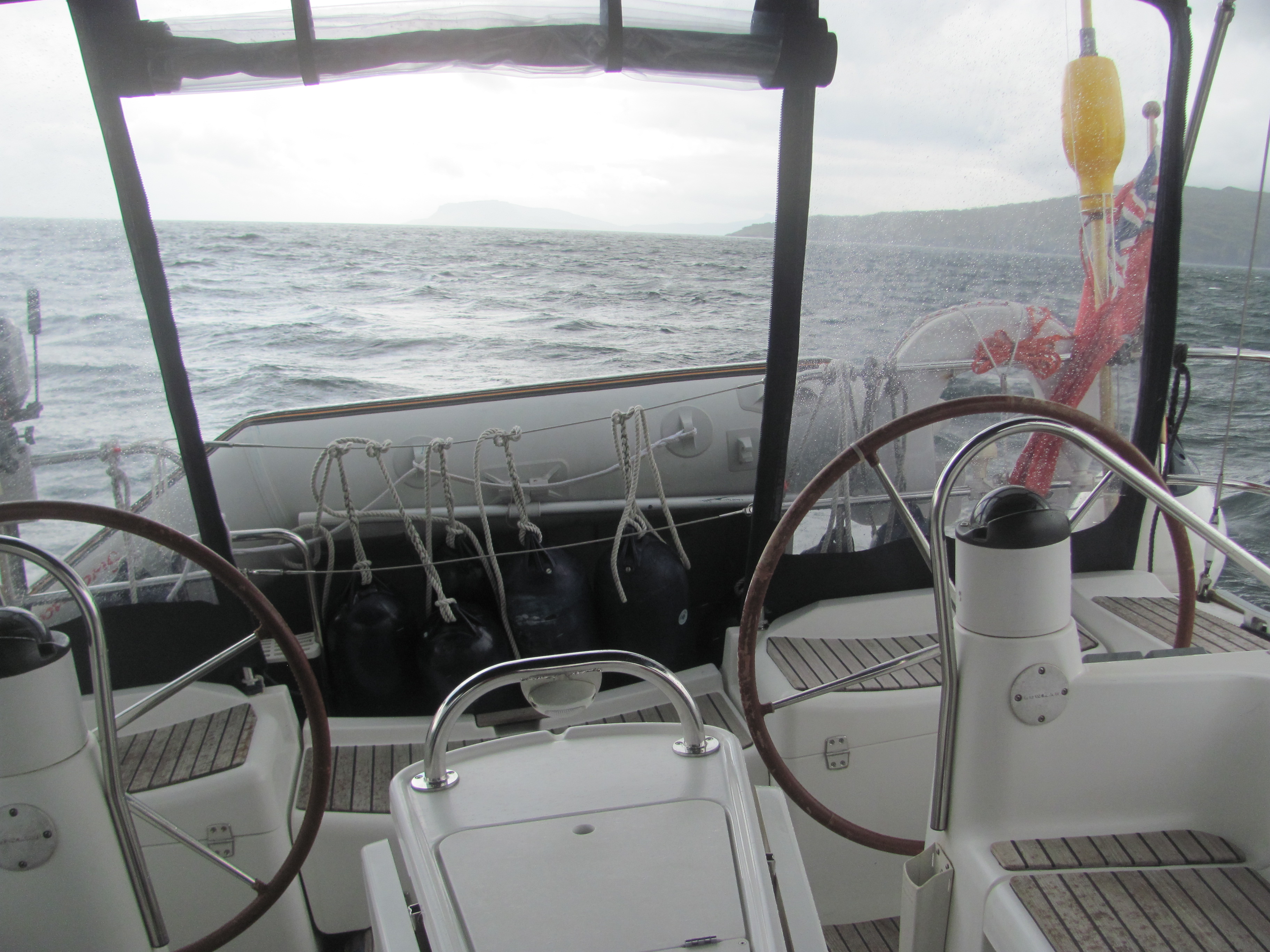
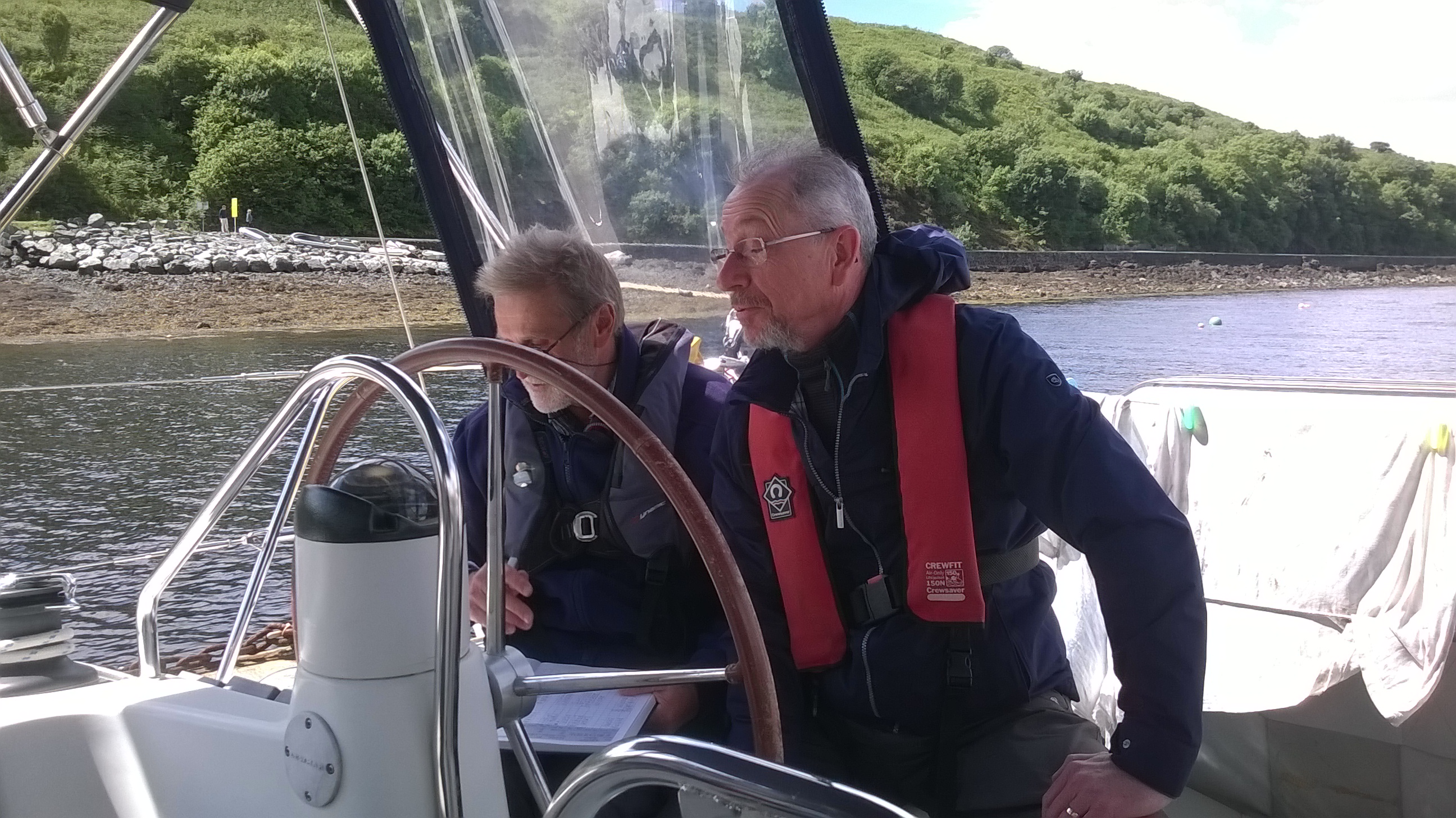
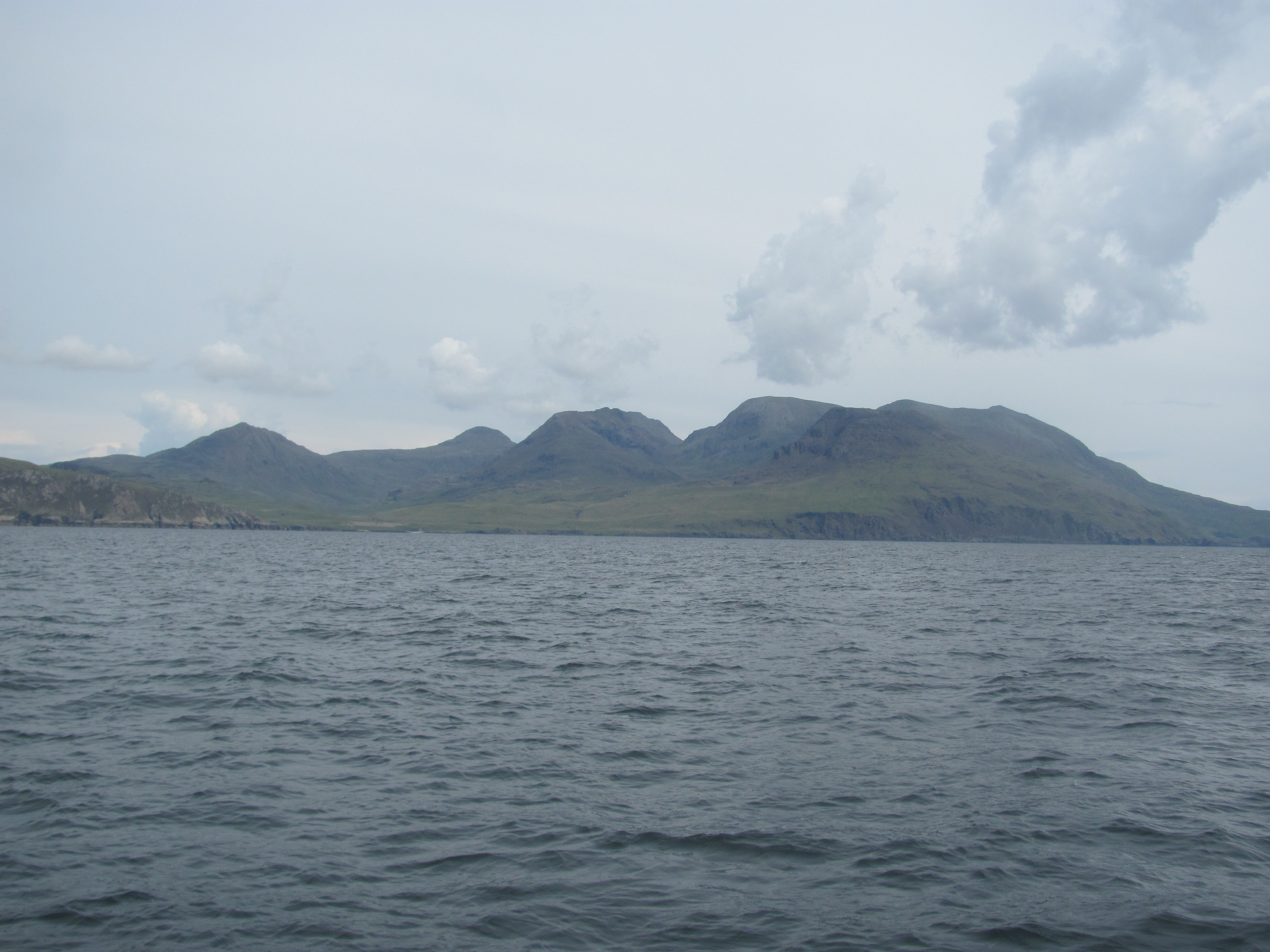
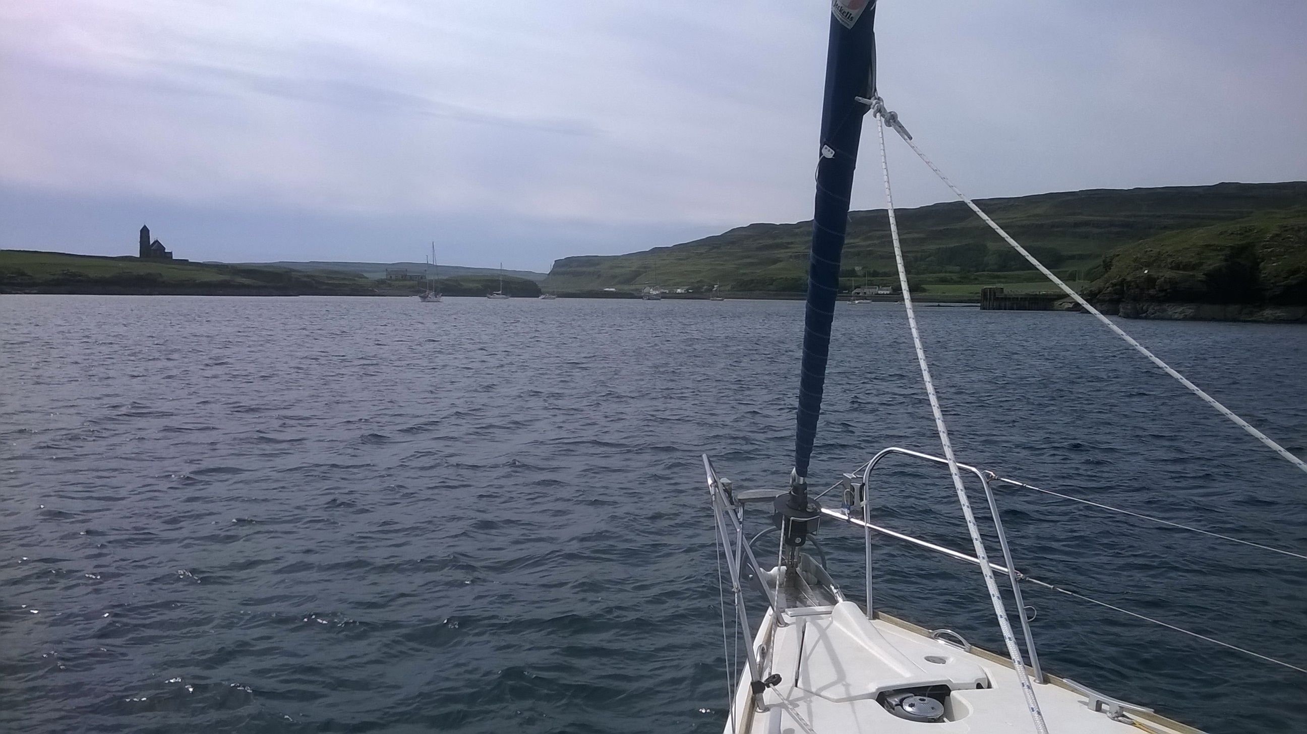
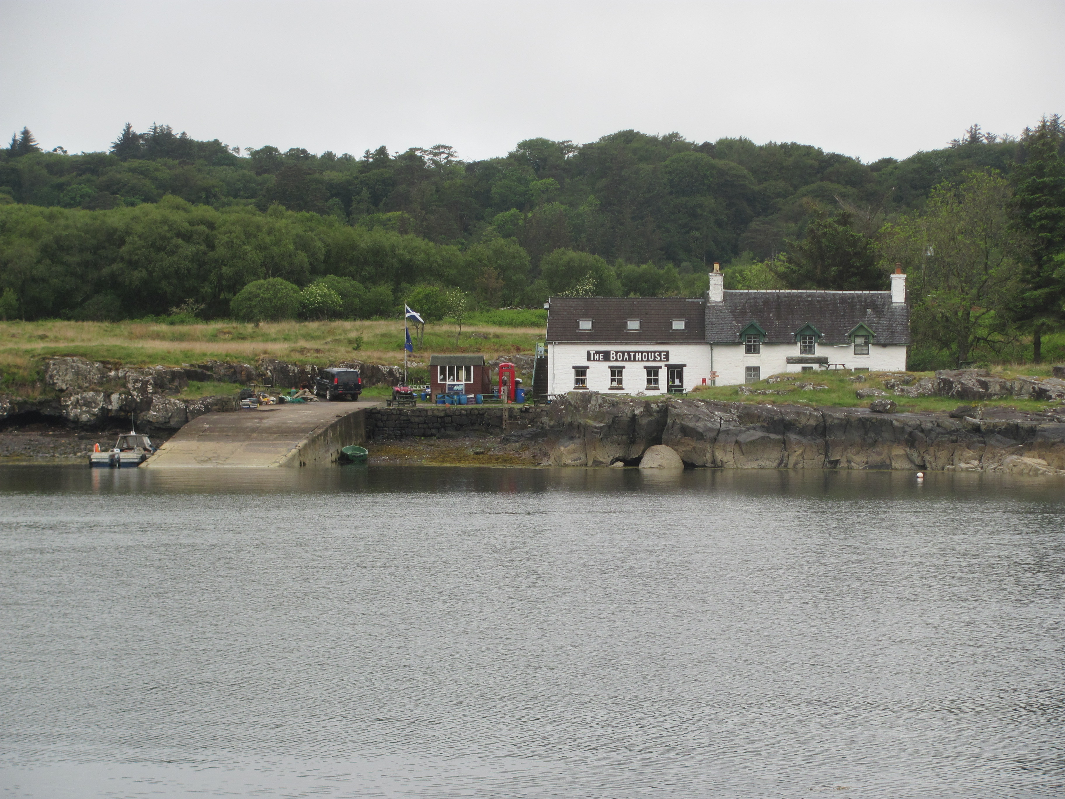
There is a strong south-westerly wind blowing as we try and edge our way into Lochboisdale marina in the late afternoon. We have just arrived from Barra and are looking forward to a relaxing cup of tea and afternoon snack. Fortunately there are a few other boats there already, and the owners kindly help us to tie up. Even so, the wind blows us sideways and we end up on the opposite side of the finger pontoon from where we intended. Luckily there is no other boat there, and some strategic manoeuvring with the lines gets us where we want to be.

Lochboisdale marina.

In the morning, we decide to take the community bus down to Eriskay to make up for bypassing it in the boat. We need to ring the bus company and request that they come to the marina, which they are happy to do. The other passengers turn out to be an eclectic mix of locals going shopping or visiting relatives in the next village, tourists from the ferry, and backpackers with bulging rucksacks. We seem to be the only sailors. We all manage to cram in somehow, even though the First Mate’s elbow keeps digging me in the ribs at every bump we go over. I make a note to get her some elbow pads for her next birthday.

Clambering on to the local bus.

We pass through several small crofting villages. I am not quite sure if village is quite the right description – individual crofts seem to be dotted more or less at random over the landscape reminiscent of Scandinavia, and names given to places where there seem to be a slightly higher concentration of houses. Baile is the Gaelic translation, so perhaps that is a better word to use.

The Baile, Eriskay.

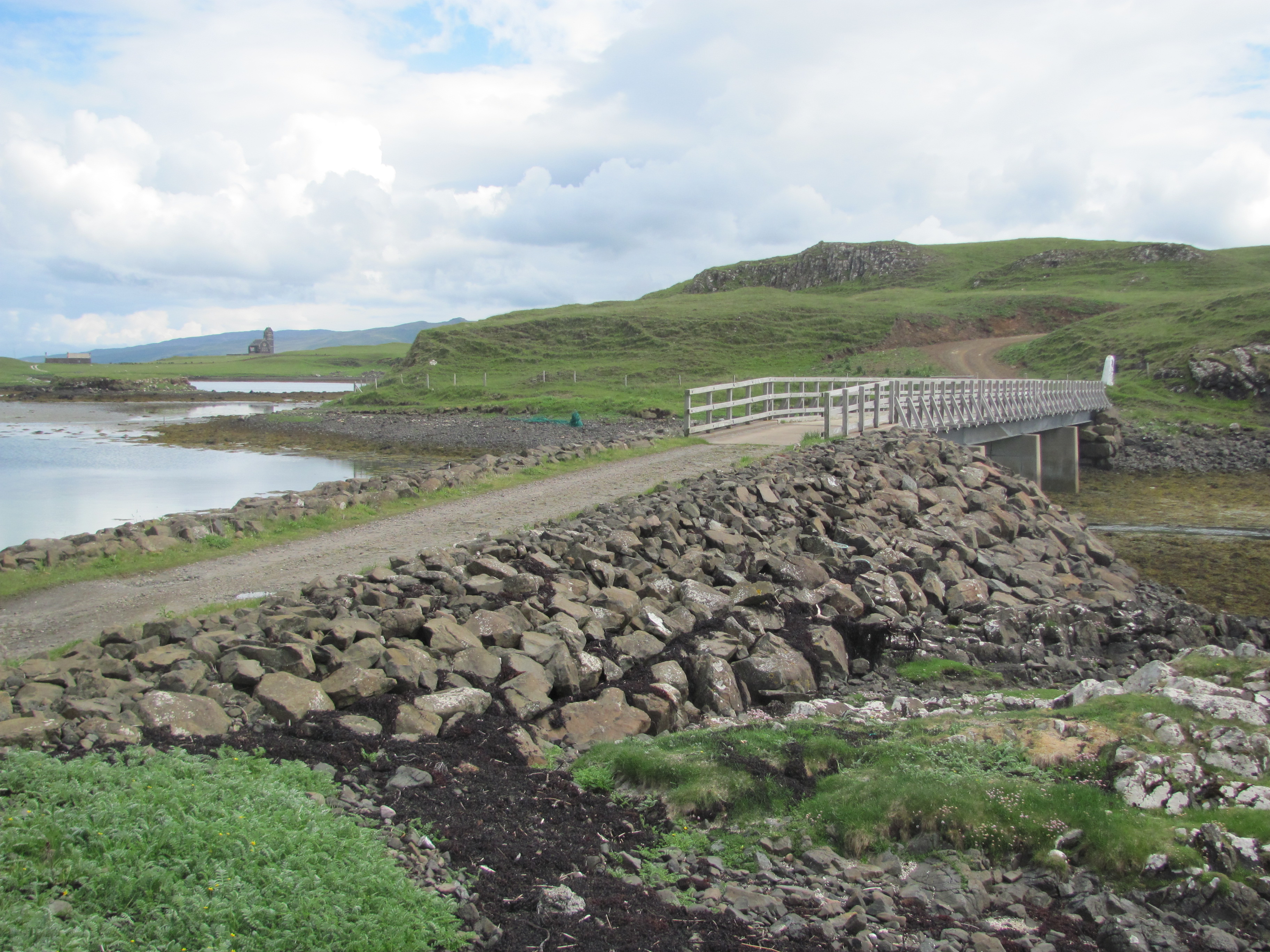
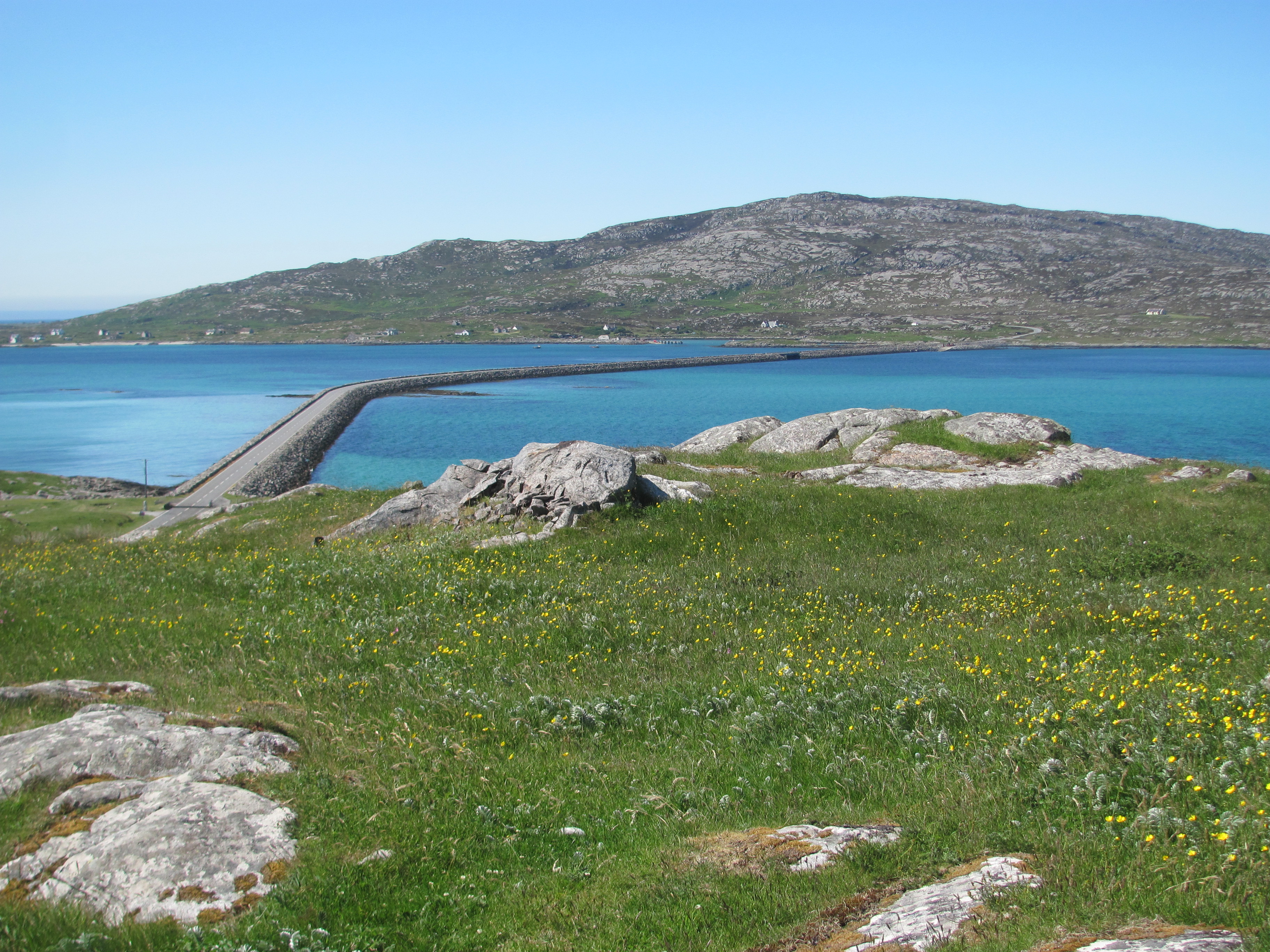
In a little while, we cross the causeway linking South Uist to Eriskay. This was built in 2000, and is part of a scheme to link all of the Outer Hebrides with an integrated transport system of roads and ferries. It is now possible to drive all the way from South Uist, through Benbecula and North Uist, to Bernaray in the Sound Of Harris. Ferries complete the rest. It has all helped to rejuvenate the economy of the islands.

The causeway between South Uist and Eriskay.

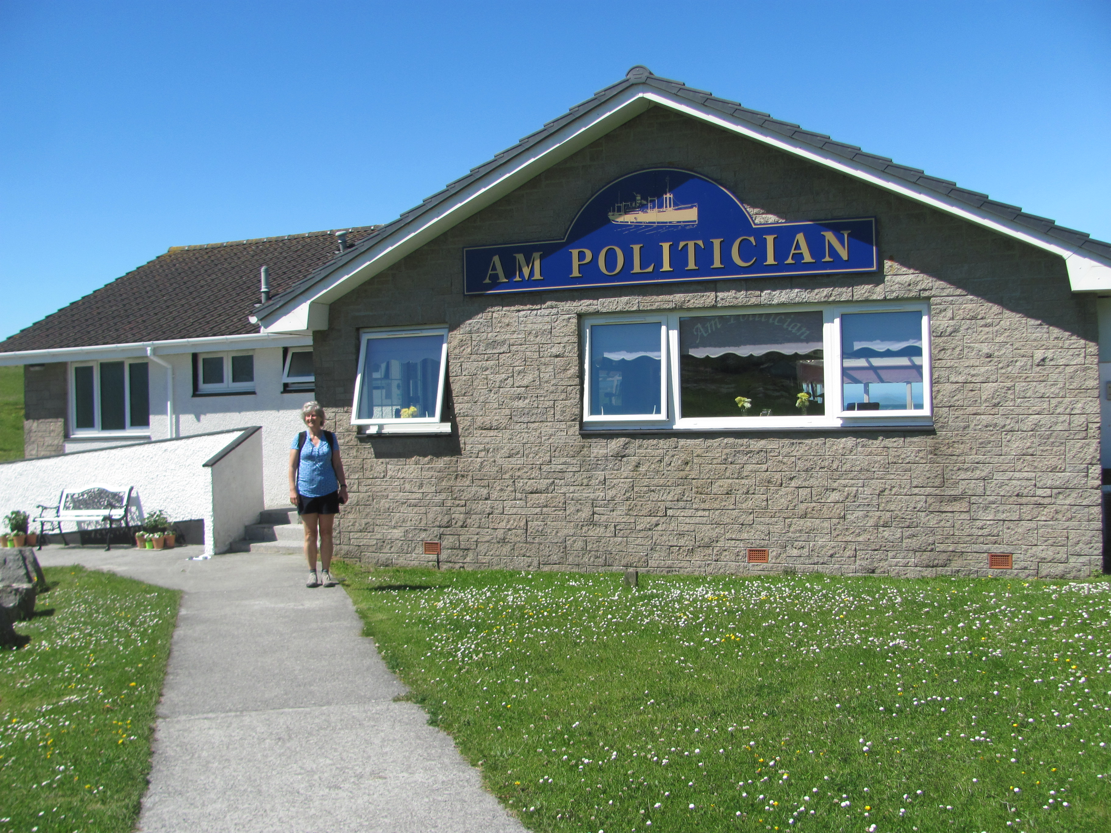
The bus drops us off just opposite the community centre in Eriskay. The next bus comes in two hours’ time and the one after that in four hours, so we have the choice of how long to stay. We are both feeling peckish, so we start off by walking down to the Am Politician pub near the beach for something to eat. The pub is named after the ship that sank in the Sound of Eriskay during WW2 with 336,000 bottles of whisky on board. Needless to say, this didn’t displease the islanders one little bit, and for the following few weeks they did all they could to retrieve as many of the bottles as they could. The problem was that no duty had been paid on them, and consequently the Customs and Excise weren’t too happy. They succeeded in catching some of the men red-handed and eventually tried them and gave them jail sentences, but they soon realised the futility of this, particularly as some of the local police were also involved in the ‘rescue’ and were reluctant to do anything about their fellow-islanders. Eventually, the customs people had the remains of the ship blown up so that no more bottles could be retrieved. The whole story is the basis of a book by Compton MacKenzie and an Ealing comedy film, both called Whisky Galore.

The Am Politician pub on Eriskay.

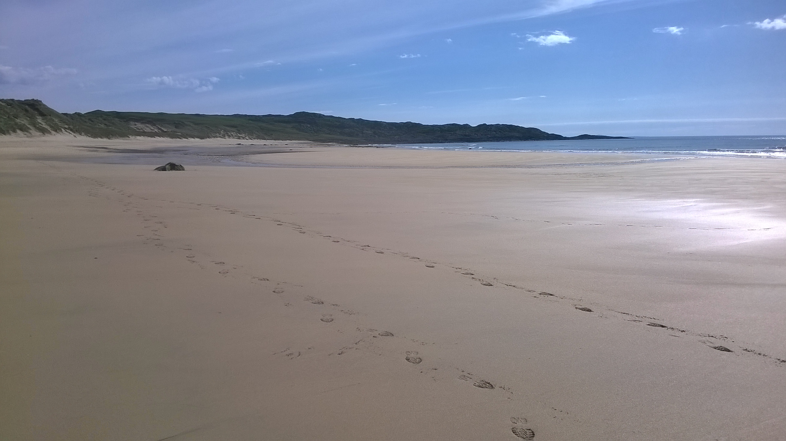
We sit outside and eat our soup and bread. A cool breeze begins to blow off the sea, but we decide to stay and enjoy the view. Just in front of us is a white sandy beach, which is where Bonnie Prince Charlie was supposed to have landed at the start of his ill-fated attempt to become the King of Scotland. We joke that he probably chose that beach as being the one that is most like the beaches in France when he arrived from, and would make him feel most at home.

Bonnie Prince Charlie’s beach.

We walk through the machair at the end of the beach and up onto the road over to the other side of the island. Machair is a natural grassland that is unique to the west coast of Scotland and parts of Northern Ireland, and is high in calcium from seashells that have been brought ashore by waves and then broken up.

Machair pasture.

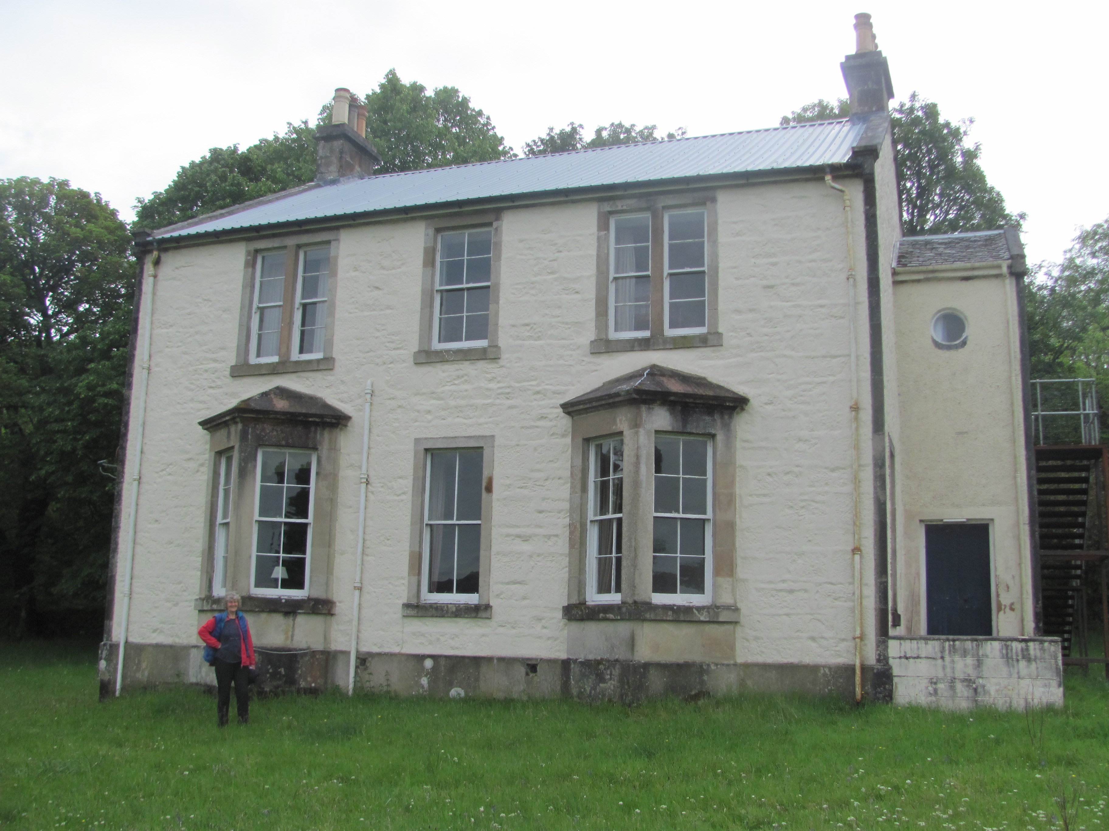
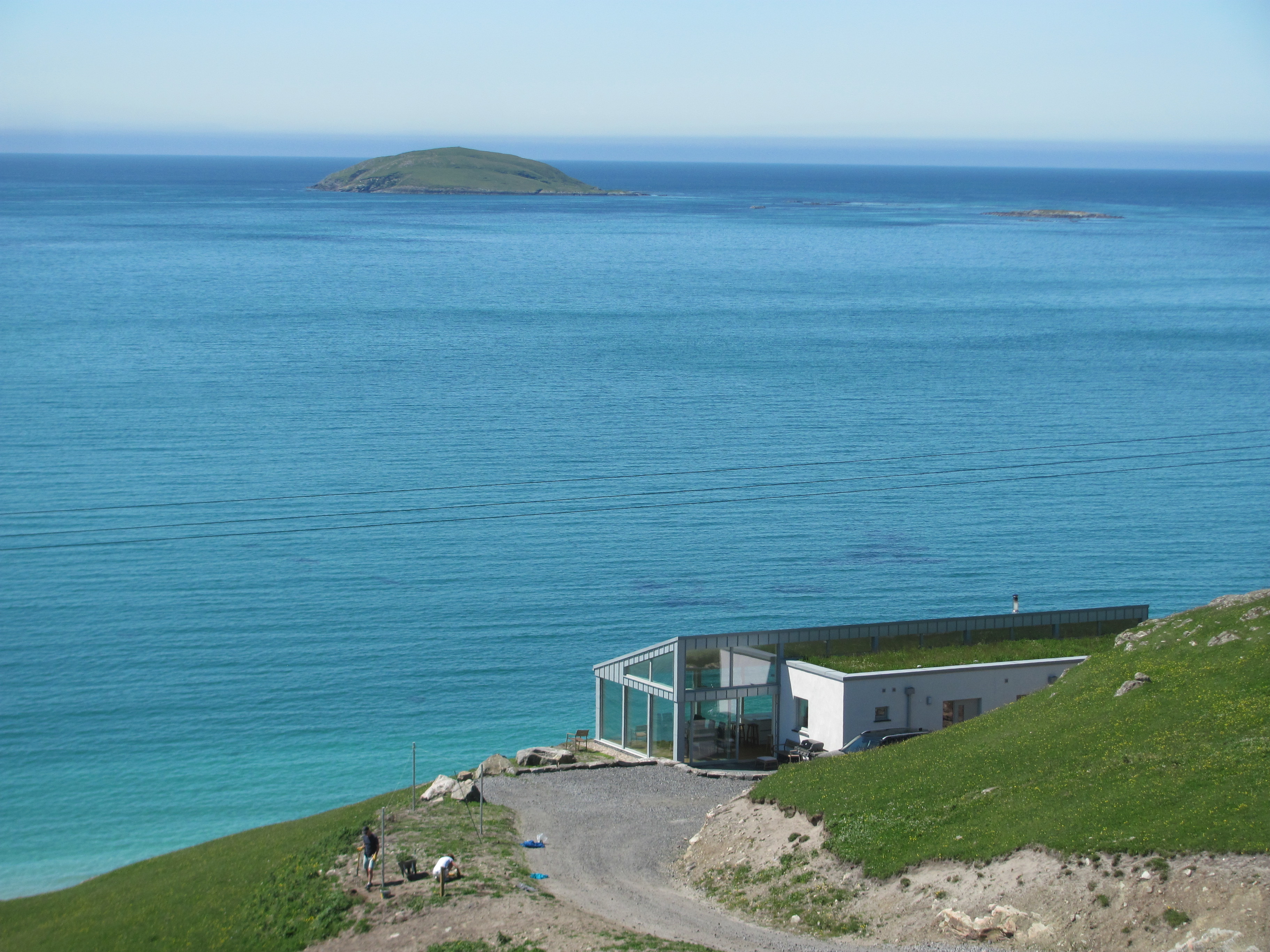
On the way we pass a house with a magnificent view out over the Atlantic. It looks idyllic, but we wonder what it is like in the winter or during an Atlantic storm – it must cost a lot to heat, with all that glass. It doesn’t have a turret, so the First Mate is not so keen on it.

Stunning view out over the Sound of Barra.

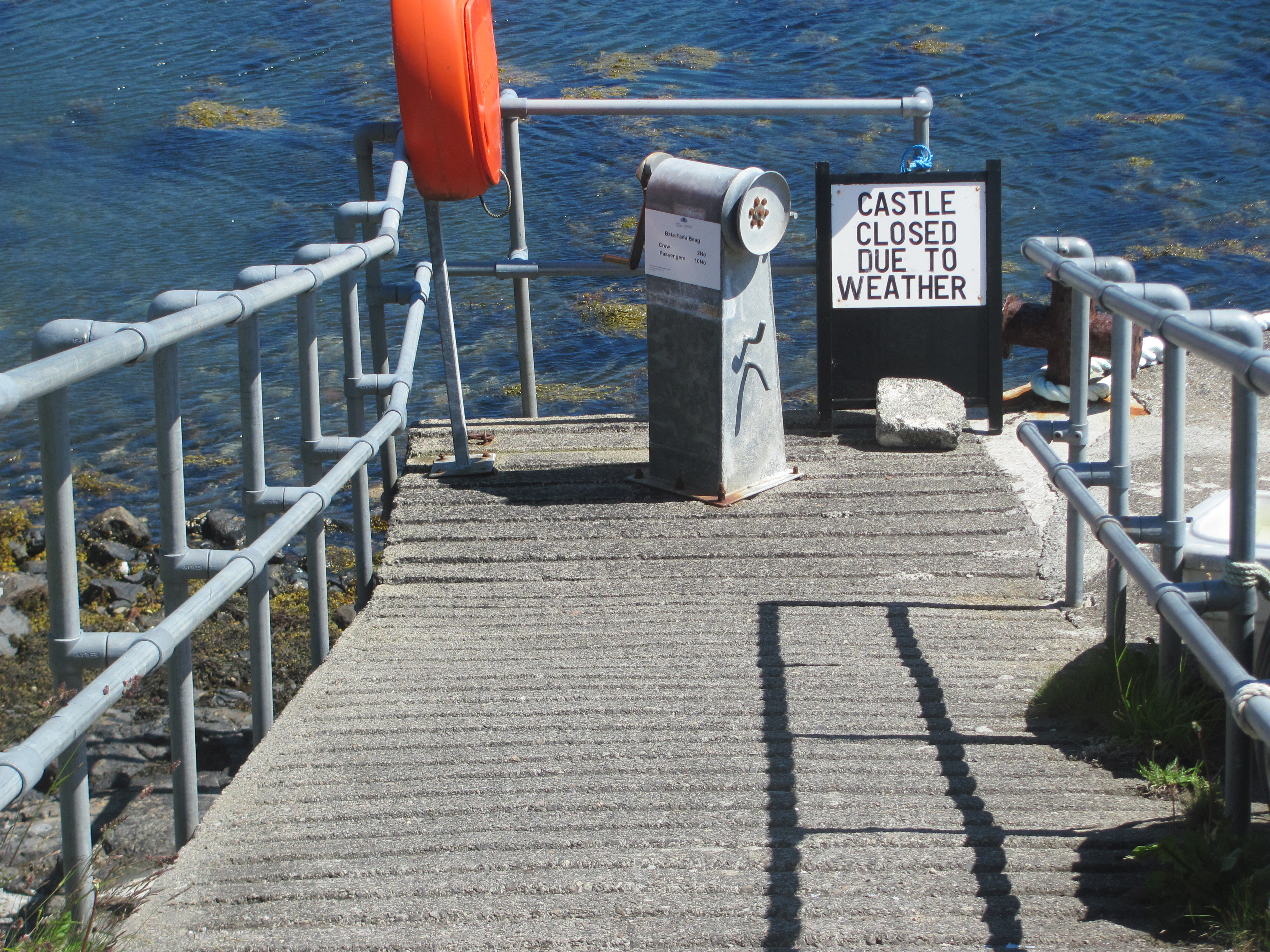
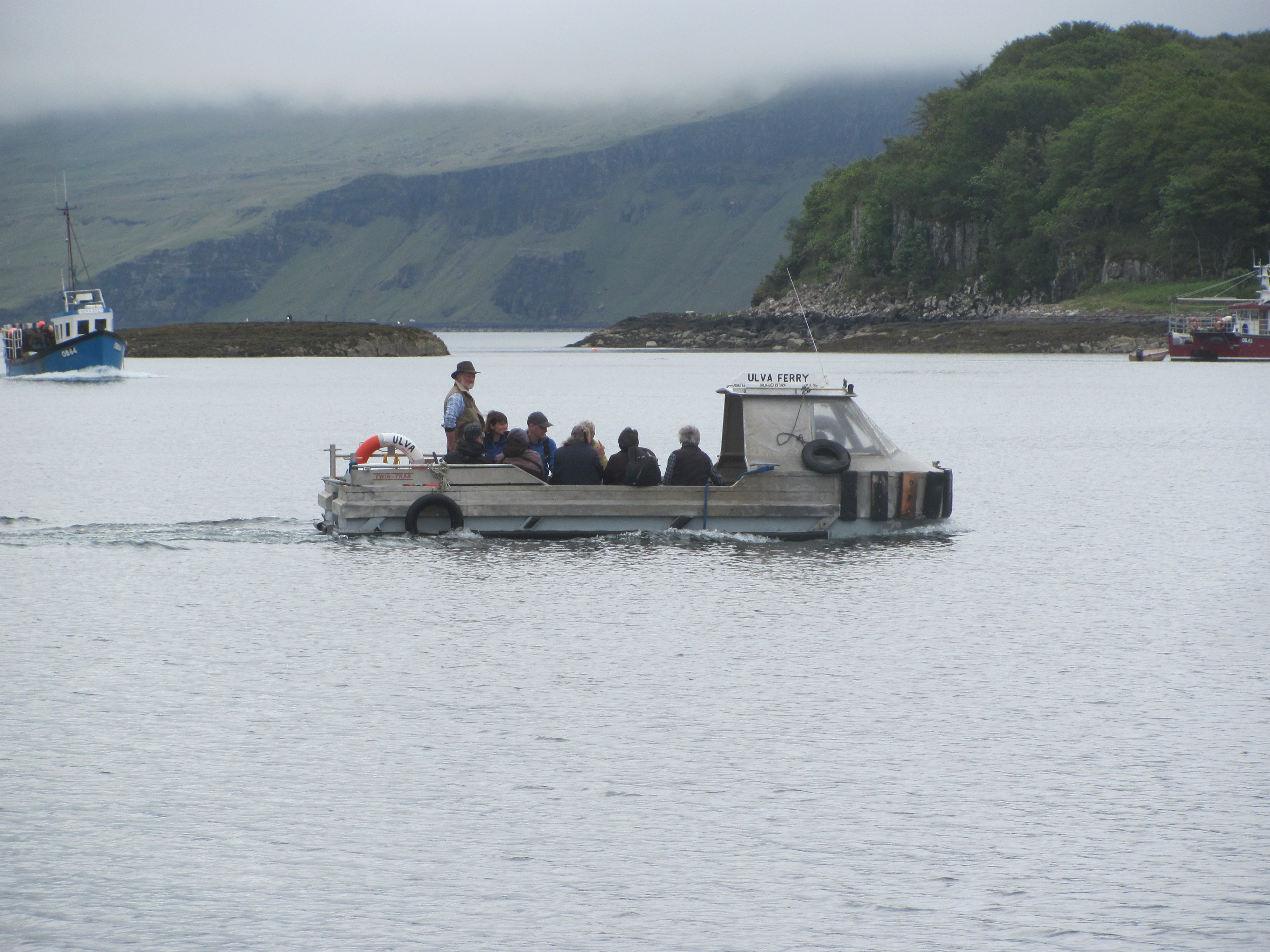
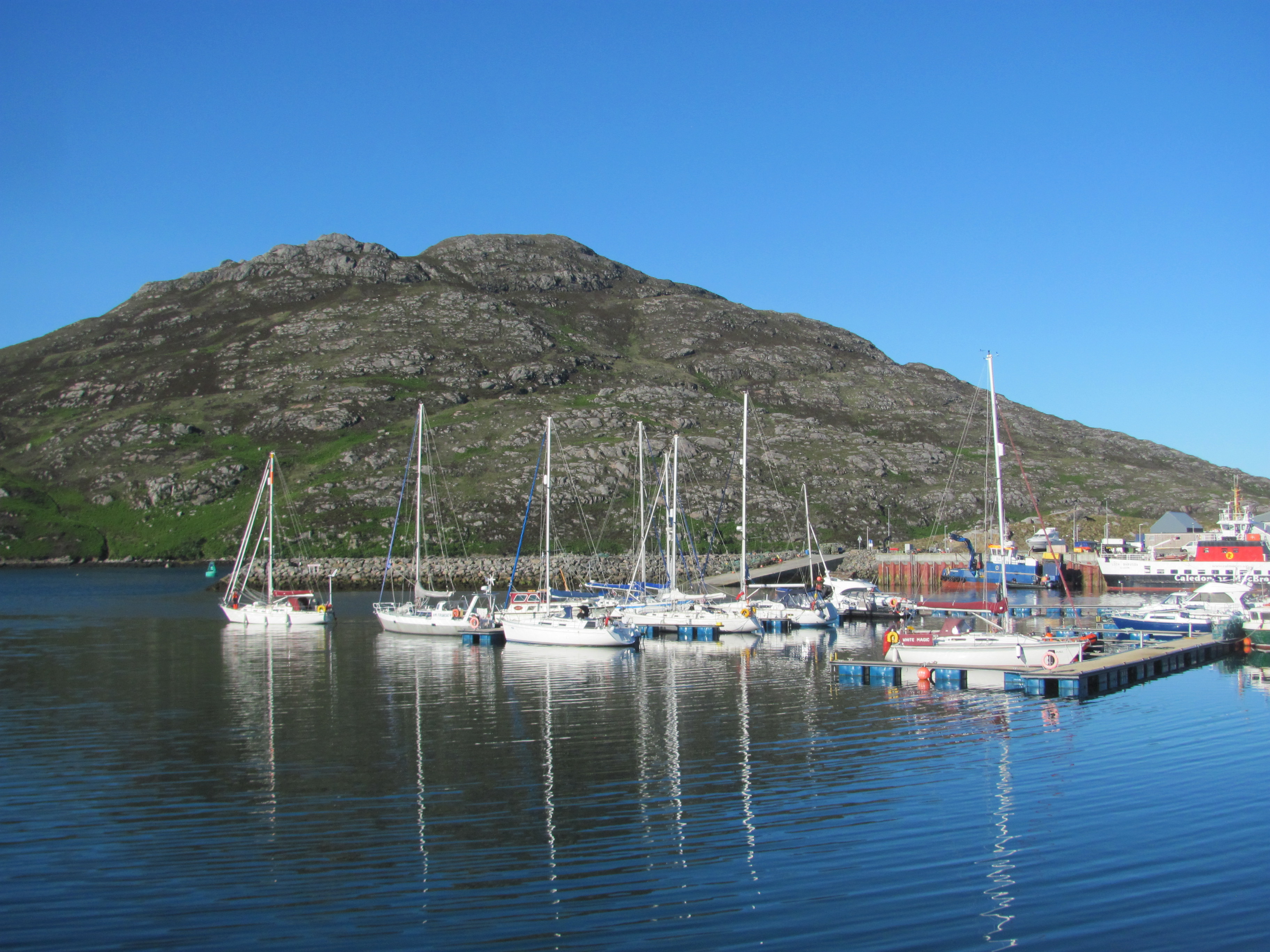
Below us we see the little harbour, consisting of just a pier and a stone breakwater, where the ferry from Barra comes into. In the distance, we can see the wake of a powerboat in the Sound of Barra, which we surmise might be the ferry on its way. A few cars are starting to pass us on the road on their way down to the harbour.

Harbour for the Barra-Eriskay ferry.

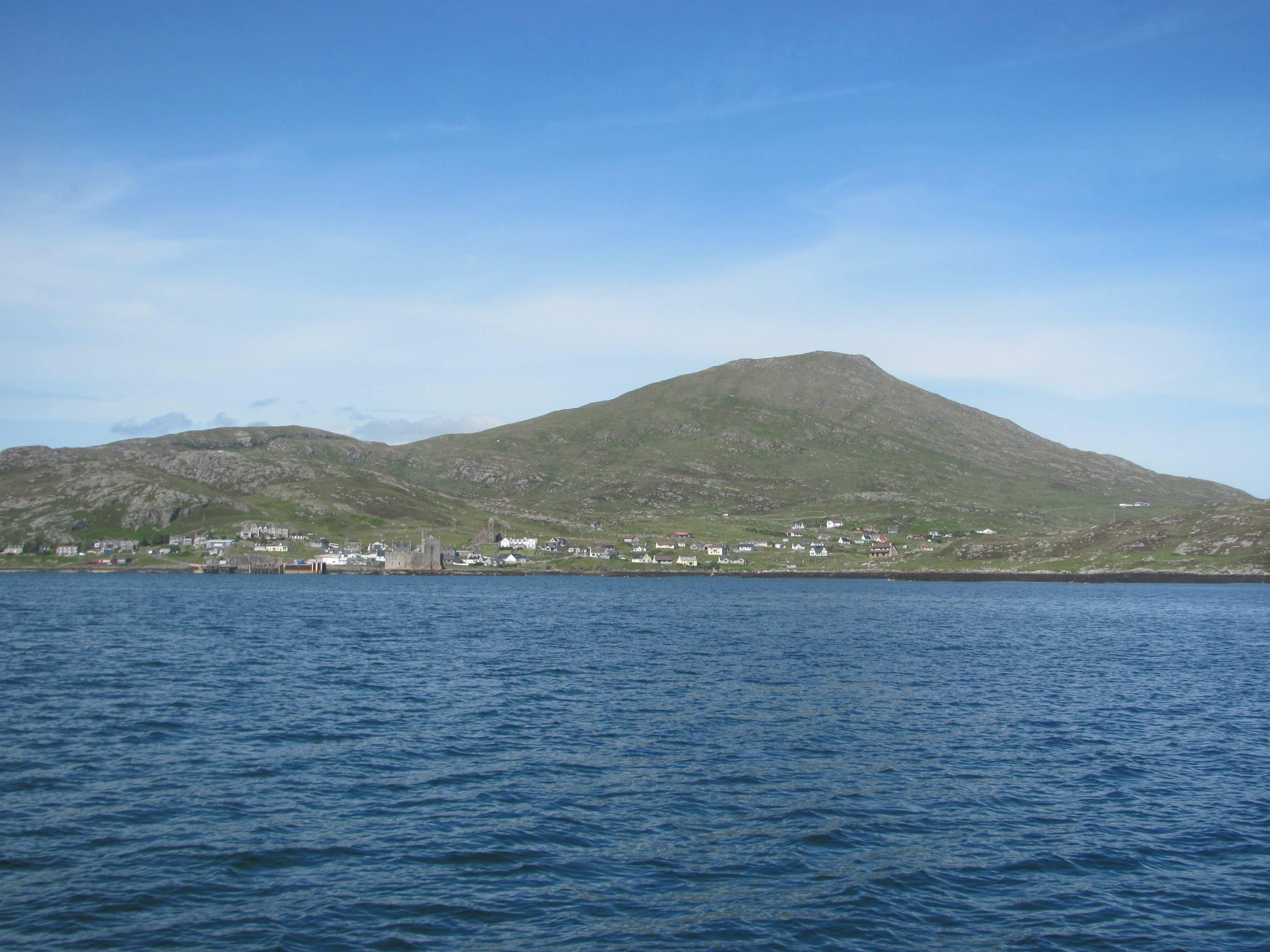
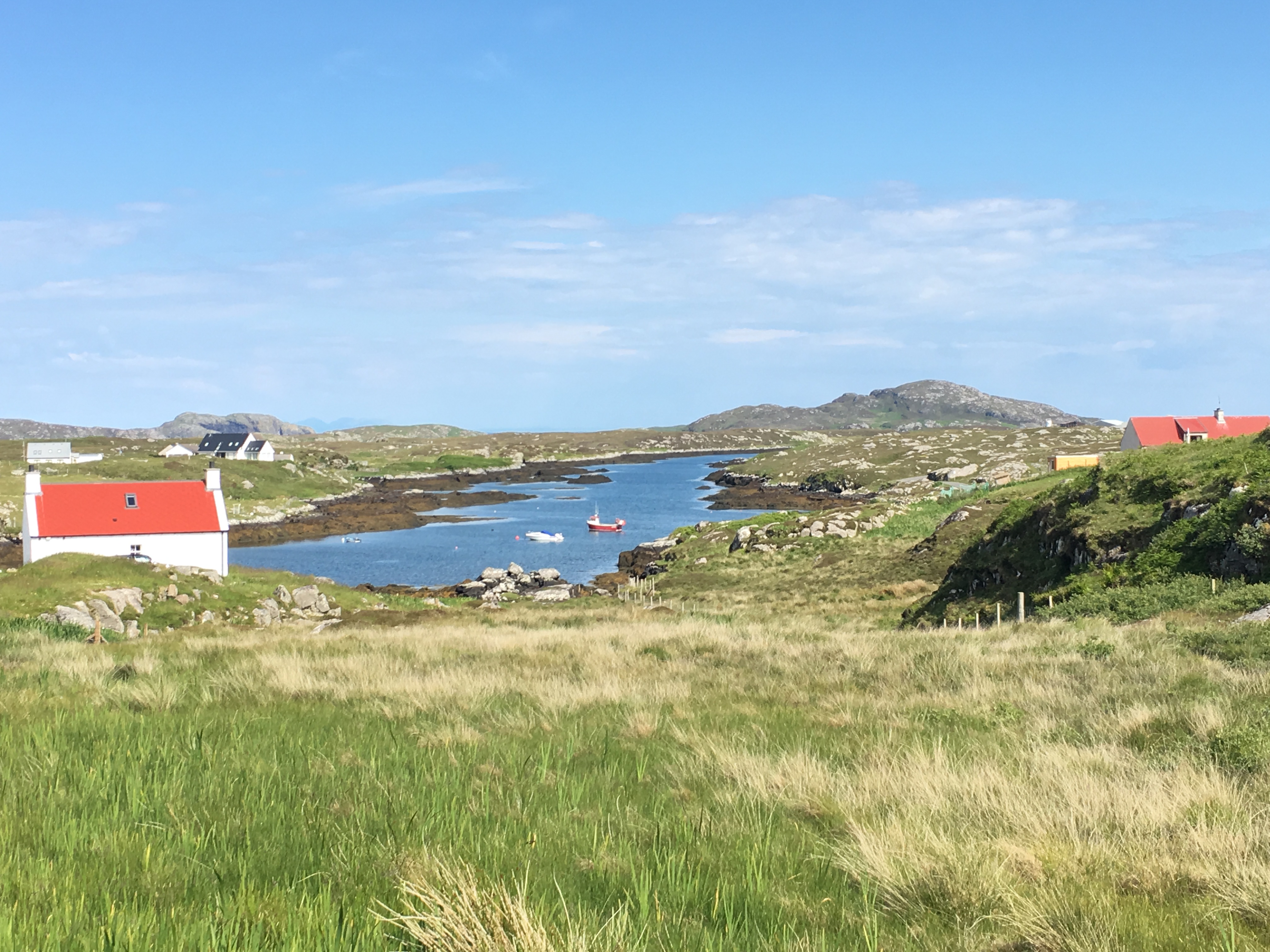
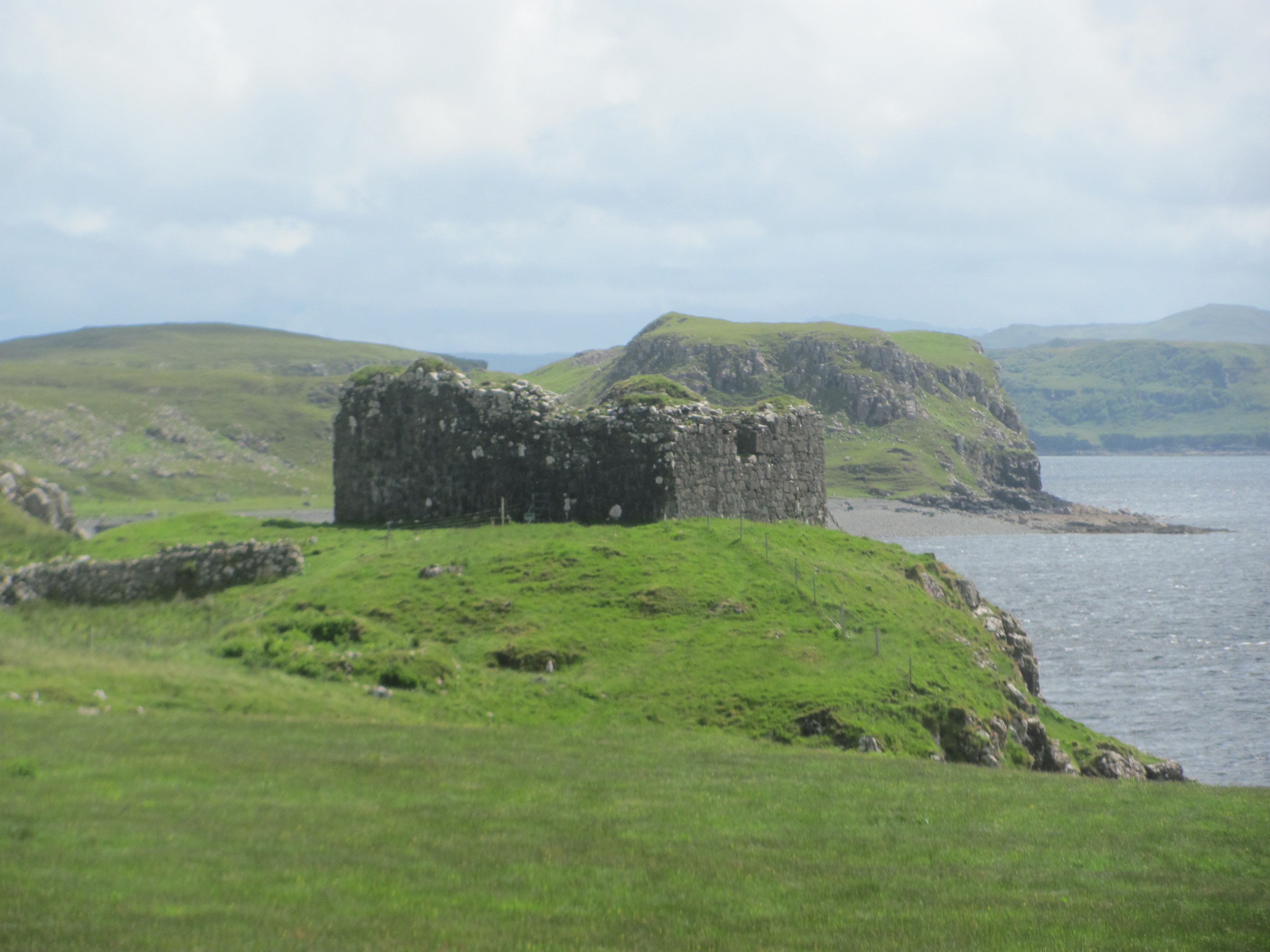
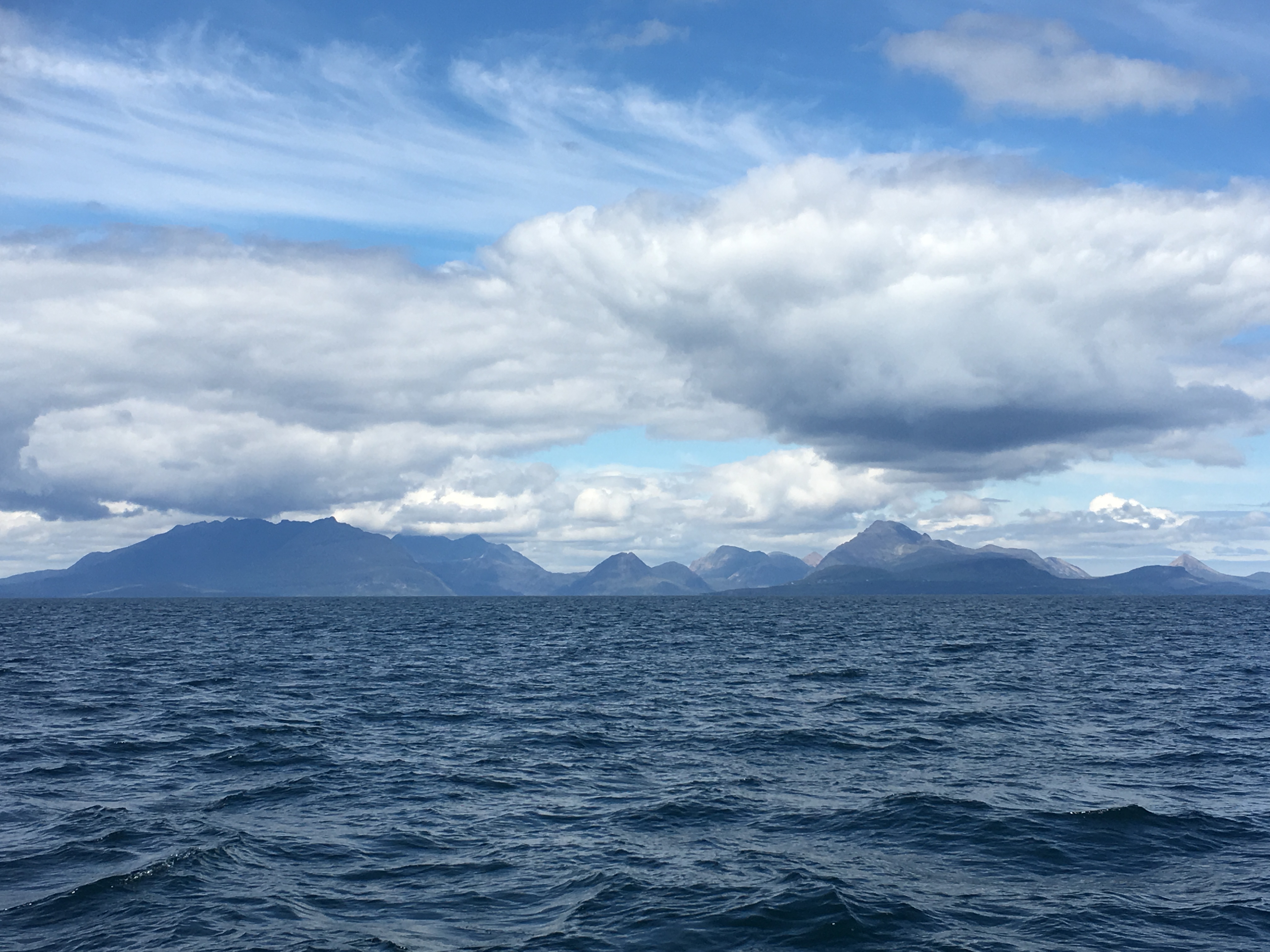
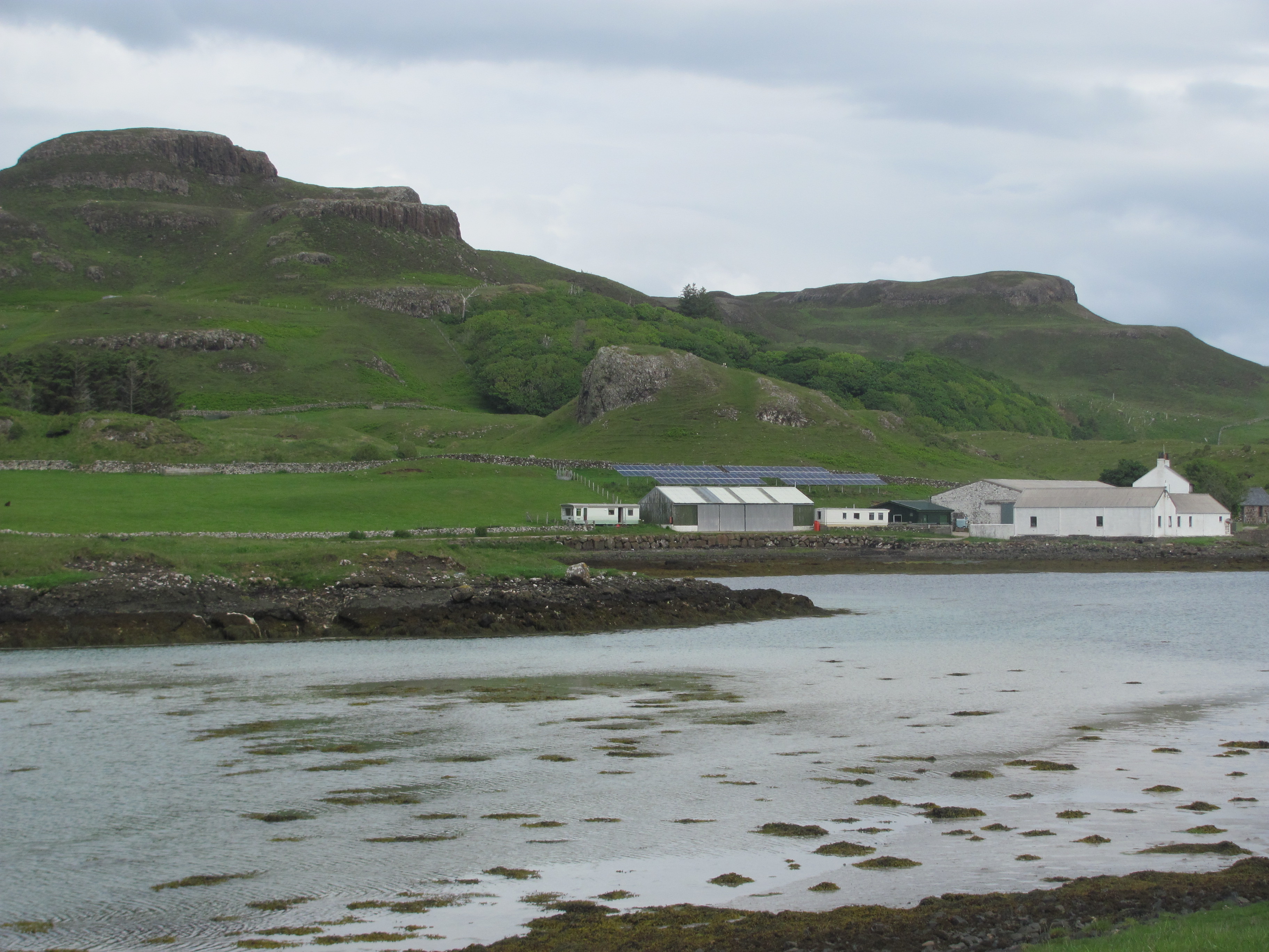
Eventually, we come to the little anchorage on the other side of the island that we had seen on the way up from Barra, called Acairseid Mohr. There are a couple of fishing boats tied up to the pontoons. In the middle of the harbour are two visitors’ moorings which we could have tied up to if we had come in. A few isolated houses dot the hillside around it. In the brilliant sunshine, it is an idyllic little spot, and we wish that we had taken the opportunity to have stayed there a night. But at least we are seeing it now.

Acairseid Mohr, Eriskay.

We make our way back to the baille and sit in the sun outside the Eriskay shop and have an ice-cream while we wait for the bus back to Lochboisdale. A girl with an eastern European accent comes out of the shop with a cup of tea and sits in the shade. An old man with a white beard, belt and braces sits next to her. They laugh and talk. She is travelling around the Outer Hebrides by herself and had slept in her tent on the beach last night. She wants to see some sea-eagles. The old man shows her on a map where the best place to see them is, quite a long walk from here. She finishes her tea and sets off in that direction, rucksack on her back.

“Brave girl, travelling alone, and telling everyone where she is going”, says the First Mate.

The Eriskay shop.

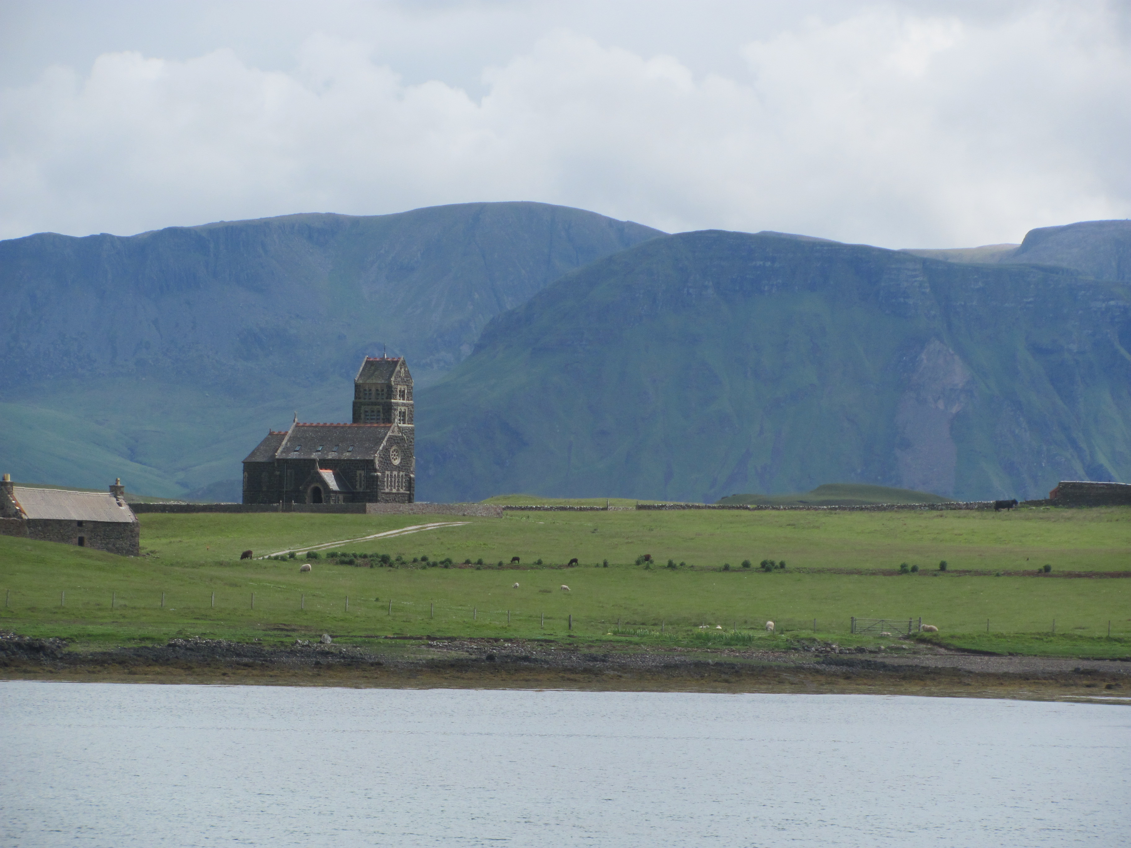
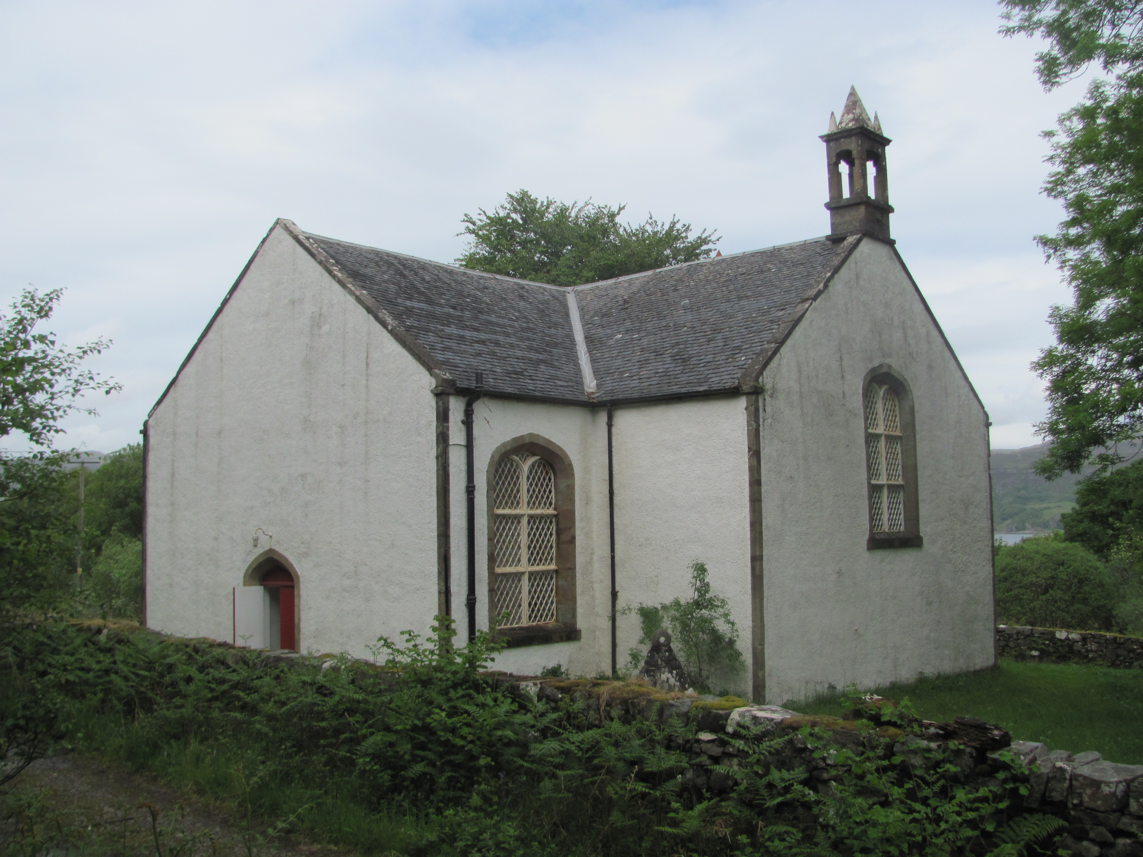
The next day we decide to take the bus up to the Kildonan Heritage Centre, north of Lochboisdale on the road to Benbecula.

Kildonan Heritage Centre.

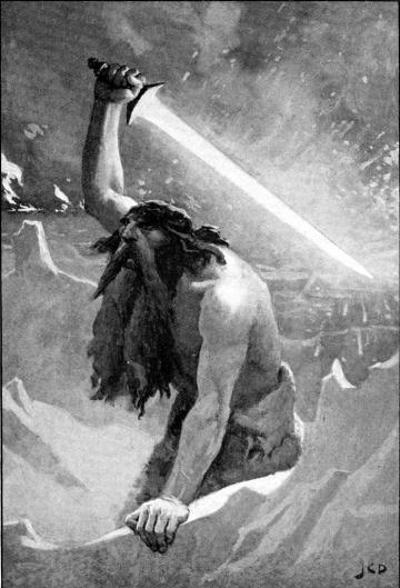
The man blinks back tears from his eyes as he watches the woman’s body being lowered into the recently dug pit. They had had only a short time together and now she had gone. He thinks back to the time they had met on one of his father’s trading journeys to the Kingdom of Fortriu, bringing fish from the coast in exchange for farm produce from the plains of the east. There had been laughter in her eyes then as he had given her fish to try, and she had spat it out, hating the strange taste. They had married and she had returned with him to Dal Riata. She had settled in, learning the language of his people, bearing his children, keeping house for him, grinding the grain for bread, and using her skills with the animals, but she had never felt completely at home.

The past winter had been cold, colder than anyone in the village could remember, even the old ones. At first the woman had been the stronger one – finding what little wood remained for the warmth-giving fire, then transporting peat from the men had cut it and left it to dry. Then she had started coughing, a deep hacking cough that had kept him and the children awake during the night. He had burnt more peat in the hearth to try and warm the house for her, but the smoke had seemed to make things worse. Then she had stopped eating, just lying there on their bed, her brown eyes looking at him with sadness. Then, in the night, she had called him and had asked him to take care of the children as she was going on a long journey. She didn’t know when she would see them again. In the morning she had gone.

He steps forward and puts the white pebble in her cold hands. She had always liked that pebble, the one that she had brought with her from Fortriu and kept ever since, saying that it reminded her of home. He watched as the other men place the stone slab over her tomb and cover it with cobbles from further down the beach. As they do so, a white-tailed eagle appears, swooping low over the small group of mourners before turning out to sea. It has come to take her soul away, he thinks. At least, if the Irish missionaries were right, she had gone to heaven where she would be looked after. And he would see her again when it was his turn.

Burial of Kilphedder Kate, c. 700 A.D.

“Shall we go and have lunch now?”

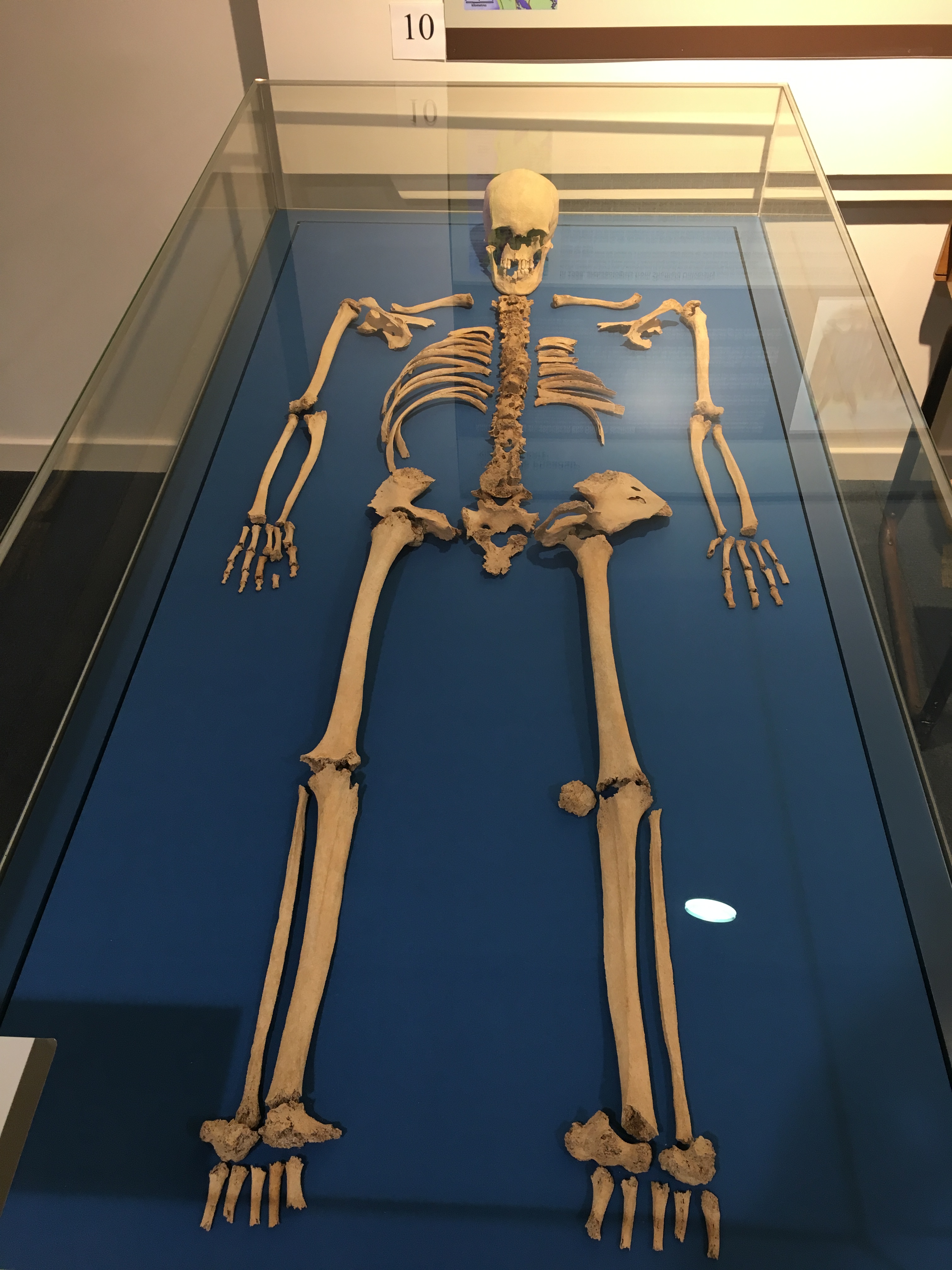
The dulcet tones of the First Mate bring me abruptly back to the present. I am looking at the remains of a woman whose grave had been recently discovered near Kilphedder, a few miles away from the Heritage Centre, and trying to imagine the circumstances of her death. The archaeologists have worked out that she had died in about 700 AD and was buried in a square grave, unusual in that area, that she wasn’t from the area, that she had arthritis, that her teeth were worn, and that she didn’t eat seafood. What kind of woman she had been, I wonder? How did she see the world? Did she have a family? What had been her loves and hates? We’ll probably never know, but it doesn’t do any harm to imagine. After all, she had been a living person once. I wonder if my bones will be on display in 1300 years’ time. Would people then be asking the same questions about me?

Remains of Kilphedder Kate.

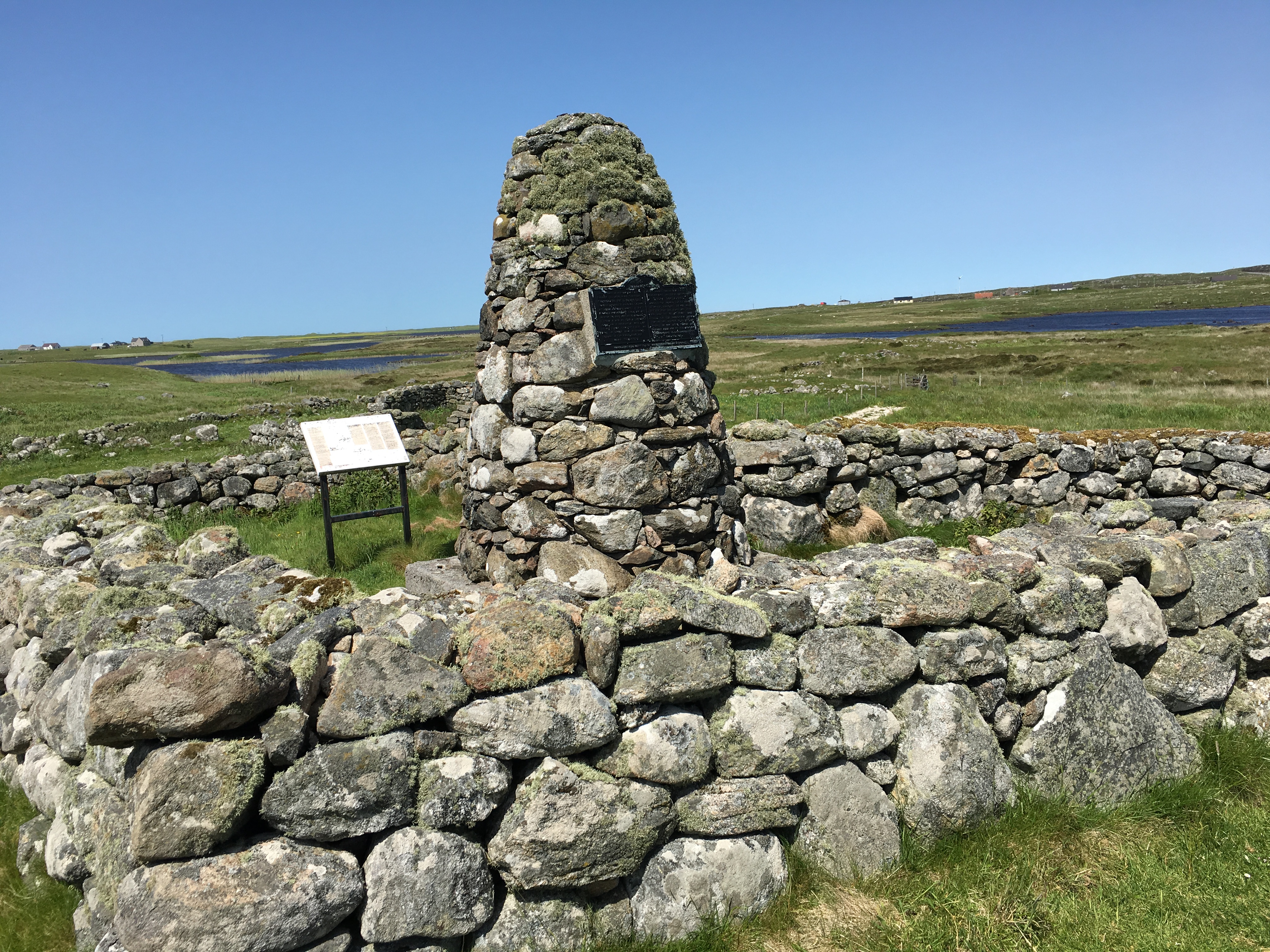
Just across from the Heritage Centre is the site where Flora MacDonald, the woman who helped Bonnie Prince Charlie, was supposed to have been born. I decide to walk over to the monument there. A farm track leads from the main road down past some farm buildings to a small knoll where the remains of a stone house lie, in the middle of which is the cairn announcing that the famous lady was born nearby.

The site of Flora MacDonald’s birthplace.

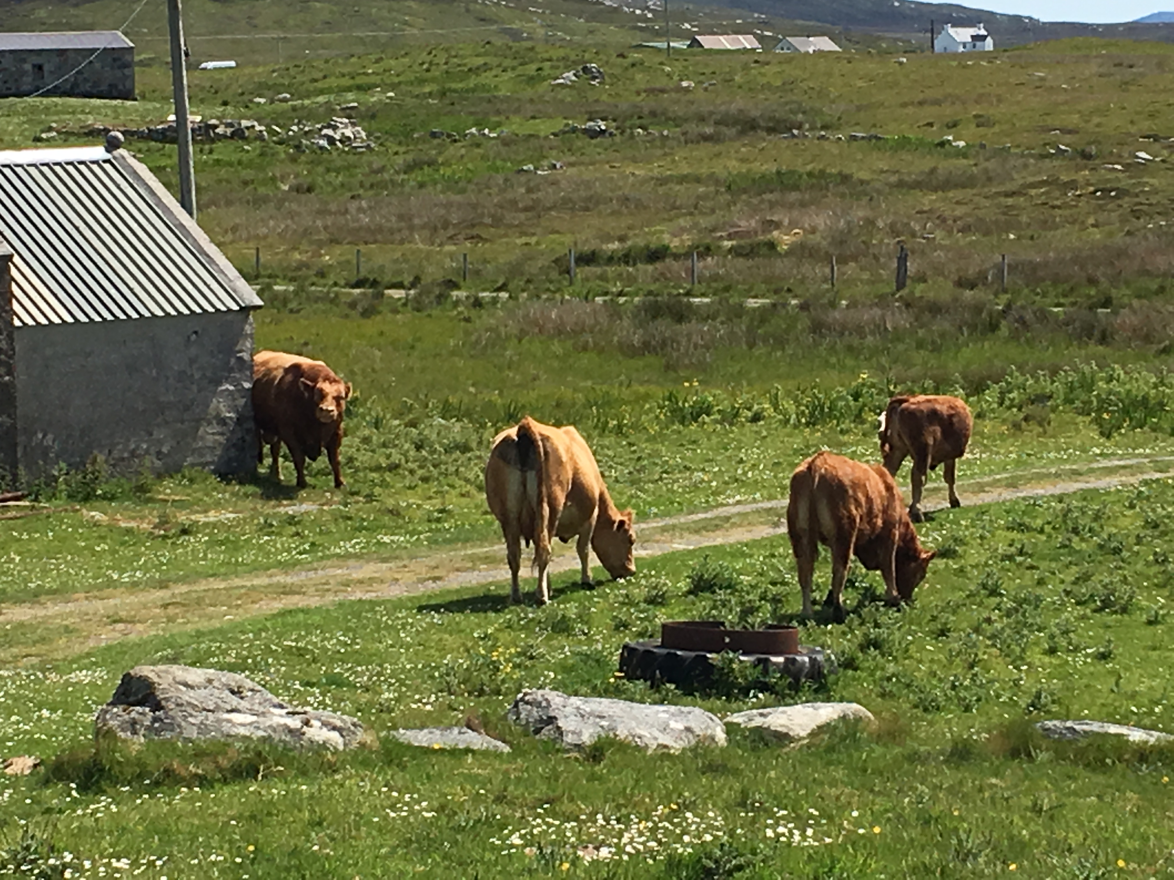
I am so engrossed in reading the plaque, that I don’t notice that a bull and his harem have appeared from somewhere and cut off my escape route. The bull looks a mean one, judging from the narrowing of his eyes when he spots me coming down from the monument. I rack my brains trying to remember whether you should not make eye contact with bulls or whether you should try and stare them down, so rather than risk making the wrong choice, I scuttle back to the monument and shut the gate behind me. The bull paws the ground and some of the cows come up to investigate. I soon realise that I can’t stay here forever, and decide to try and make a run to a stone fence several metres away, and make my way along it on the other side. By this time, however, the cows are all around the monument and looking at me suspiciously, but I make it through them and clamber over the fence. The bull snorts. I crouch down and crawl my way along the fence, hoping I am out of sight, until I reach the farm track further up. I look back at the bull and punch the air in triumph. He is grazing and not even looking at me.

Bull and cows.

“You took a while”, says the First Mate back at the Heritage Centre.

“I nearly got gored by a bull”, I explain. “I was lucky to escape with my life.”

“Did you? Do you want to finish off this pot of tea? I don’t want any more”, she says. Somehow I feel that she is not taking her near-widowhood seriously enough.

Barra

We leave Carbost at around 0530, heading for Barra in the Outer Hebrides. There is a strong wind from the south-east which is in our favour, and we speed along at 7 knots. Gradually Skye fades into the haze and the faint shapes of the Outer Hebrides begin to appear on the horizon. There is a long swell coming in from the Atlantic and Ruby Tuesday rears and plunges her bow into each successive wave, loving every moment of it.

Leaving Skye behind …
… and approaching the Outer Hebrides, the land that time forgot.

As we approach, I dip into my “Land of Mountain and Flood” to remind me of the geological events that led to the formation of the Outer Hebrides. The rocks here, gneisses, are amongst the oldest rocks on earth, having formed three billion years ago – in terms of a human lifetime, it is almost impossible to comprehend how old that is. The mountains we had seen on Skye at 60 million years old are mere infants in comparison. Even more mind boggling is that these rocks were formed nowhere near here  – originally they were part of the Laurentia supercontinent, most of which is North America now, and they are more similar to rocks in Canada and Greenland than they are to other rocks in the rest of Britain. There would have been no life on land at this time – presumably the landscape would have looked like a desert today – the only life at all being a few single-celled organisms in the seas.

Geological map of the Outer Hebrides.

It seems that these rocks originated from molten rock in the earth’s mantle reaching the surface through volcanoes which were then eroded down to produce sediments that accumulated at the bottom of early oceans. These were subsequently buried deep in the earth’s crust and transformed over the next 1000 million years by the great temperatures and pressures into the light and dark banded gneiss that we see today. Some of these may have been up to 30 km deep, but were gradually lifted up to the surface again by tectonic movements. Then around 1700 million years ago two ancient continents collided, forcing up the crust which was gradually metamorphosed and folded to form the basis of the mountains of the Outer Hebrides. These were again gradually worn down by erosion over the next 500 million years or so. Then at around 1100 million years ago, a major fracture developed called the Outer Hebrides Fault, and the two sides ground against each other to crush and deform the surrounding rocks, which today starts in Lewis and runs all the way south through the Uists to Barra, sometimes on the land, sometimes offshore.

A nice piece of gneiss metamorphised by tremendous temperature and pressure.

More recently, the Outer Hebrides were covered on and off by vast ice sheets that scoured the surface into what we see today. As the ice melted, grassland vegetation became established, and as soil began to form and the climate warmed still further, this was replaced by forests of oak, hazel and birch about 8000 years ago. Then as the climate cooled again, and possibly aided by stone-age farmers, the trees disappeared and were replaced by the acid peatlands common throughout the islands.

Treeless Hebridean landscape.

My thoughts are interrupted by a dolphin jumping out of the water just next to us. Then another, and another, then several more. A whole pod has joined us and seem determined to show off their skills. The sea around us seems alive as they twist and turn on both sides and underneath the boat, spurred on by the knowledge that they have an appreciative audience. They accompany us for perhaps about five miles before disappearing quietly back into their own world. Even though we have seen dolphins often before, there is always something awe-inspiring about seeing them so close and imagining there is an affinity between us and them. It is tempting to think they are also curious about us, other sentient creatures aware of their own existence.

Dolphins on the port quarter!

The wind veers around to the south and south-west, so we adjust the sails so that we are sailing close-hauled almost directly into it. Unfortunately, this means that we can no longer aim directly for Barra and we have to take a couple of long tacks to get closer to our destination. In the mid-afternoon, however, with just a few more miles to go, the wind drops completely, the sails flap uselessly, and we have to motor the last few miles into Castlebay.

Arriving in Castlebay, Barra.

In the morning, I sit in the cockpit and drink my early morning cup of tea. Strong winds from the north have been blowing all night and are predicted to carry on for most of the day. Despite being sheltered by Sheabhal mountain rising up behind Castlebay, and the short reach between us and the shore, waves are being whipped up and slap noisily against the side of Ruby Tuesday. Overhead a seagull battles against the wind, but despite all its efforts it remains in the same place, and eventually peels off to take shelter somewhere else. A tall ship has tied up next to us – it wasn’t there when we went to sleep last night, so they must have arrived very late.

A new neighbour.

Suddenly a small fishing boat with two men in it appears and ties up to the pontoon. Some of the other sailors gather around it. Intrigued, the First Mate ambles over to investigate, and discovers that they are selling fresh scallops collected this morning. She buys a dozen for lunch and brings them back in a bucket of sea water to keep them until their execution. I feel a bit sorry for them until one spits water at us.

Lunch!
Herring girls.

In the afternoon, we visit the Heritage Centre. When we arrive, we are the only ones there, and the young man behind the desk tells us that after we have looked around we can have a coffee and a biscuit included in the price. A lot of effort has gone into collecting and showing the history of island life. We learn that the past economy of the island was dependent on fishing, with large numbers of boats operating out of Castlebay and bringing their catch into the processing sites just near where the marina is now. The remains of some of the old quays are still there. We tried to imagine the hustle and bustle as the catches were unloaded, the women would begin the gutting, cleaning and slicing the fish, packing them into boxes to export to the mainland. The season for all this was in June and July, then they would move northwards to Orkney to work, then Wick, and, surprisingly, down to Great Yarmouth in England, before returning back to Barra for the winter.

In the evening, we go to the Castlebay Bar for a drink and find that there is a local ceilidh band on. It is too loud to talk, so we sit and listen. Some of the young folk dance in the area in front of the band. We realise just how old we are getting when we prefer to sit it out.

Live music in Castlebay Bar.

The next day we get out the folding bikes and cycle around the island. We decide to go anti-clockwise which we find requires a steep climb out of Castlebay before anything else. Halfway up, we wonder if it is a mistake, but conclude that it is probably best to get the steep bit out of the way while we are still fresh, rather than at the end.

Struggling to the top.

Eventually, and a little out of breath, it has to be said, we reach the top of the saddle between Sheabal and Beinn nan Caman and are rewarded by a magnificent view over the Sea of the Hebrides across to Skye in the north and Rum and Canna to the east. The ride down to the little village of Breibhig makes up for it, but we lose all the height we have painfully gained.

View out across the Sea of Hebrides. Skye in the background.

Despite following the shoreline, this becomes the pattern – a series of ups and downs, past beautiful little bays and inlets and loose clusters of crofts. The thought is not lost on us that we are passing over some of the oldest rocks on earth.

Beautiful bays and really old rocks.

Eventually, we come to North Bay, a small village where most of the fishing on Barra is now based. There are a number of boats in the harbour and a fish processing plant on the little knoll overlooking the harbour.

North Bay harbour.

Here the road bends round to the west. Just a little bit further on, we reach a junction leading down to the famous Barra airport where the planes land on a sandy beach at low tide. Just as we are contemplating whether to go and see it, we see an aeroplane climbing steeply into the air from behind a small hill and we realise that we have just missed its take-off. If we had only left half-an-hour earlier, we might have seen it.

Traigh Mohr, otherwise known as Barra Airport.

As we continue, the landscape gradually changes from rocky little bays and numerous inlets on the east coast to more expansive sloping machair pasture and sweeping sandy beaches. It is no coincidence that all the cemeteries are on this side of the island – it is much easier to dig six feet into sand rather than into rock!

Beach on west coast of Barra.

Eventually, we come to the Barra Beach Hotel and decide to stop and have a drink. The hotel is really designed for residents only rather than casual walk-ins, but they feel sorry for the two sweaty cyclists before them and tell us that the bar is opening in 30 minutes. But we have to open an account and put the drinks on it, and pay at the reception when we leave. It all seems a bit of a palaver, but we decide that we need the drinks and want to enjoy the view out over the Atlantic Ocean, so we wait. It is worth it.

Since we arrived in Castlebay, we have been fascinated by Kisimul Castle in the middle of the bay. The castle was the family seat of the MacNeil clan, but they had had to sell it and the island of Barra in 1838 to pay their debts. The castle fell into disrepair with much of its stone being taken for ballast for fishing boats. Just a hundred years later, in 1937, it was bought back by the clan chief, Robert MacNeil, an American architect, who spent the rest of his life renovating it. Then in 2000, his son leased it to Historic Scotland for a £1 a year and a bottle of whisky, who have carried on the refurbishment work.

Kisimul Castle, Barra.

The first time we try to visit it, it is closed because of the weather, which we find is due to the conditions being too rough for the little boat that takes visitors across.

Sorry, castle closed today!

The next day is calmer, and the small boat is running, so we join the queue of a half-a-dozen other people waiting at the small pier opposite the post-office. The small boat makes the run across every half an hour, the cost of which is included in the entry fee.

Boat to Kisimul Castle.

Inside is quite a surprise – somehow crammed into the restricted space within the walls there is a small courtyard in the centre, a great hall, a living hall with a large fireplace, bedroom, a tower, and a small chapel. There is even a fresh water well, a pretty useful feature for those inside to be able to withstand a lengthy siege.

Inside Kisimul Castle.
The Great Hall, Kisimul Castle.

We climb the tower and walk around the battlements and look over to the Castlebay village on Barra proper. I try and imagine what is must have been like to be standing up here for real and repelling the enemy.

View of Castlebay village from the battlements of Kisimul Castle.

Rum and Skye

“It’s a pity that the castle isn’t open. I wouldn’t have minded seeing inside it”, says the First Mate.

“It’s those turrets again”, I joke. “You just want to see what it is like living in a house with turrets.”

“Nah, not really”, she responds. “Too much cleaning. How do you suppose they kept a place that size clean and tidy?”

We are sitting outside the community café in the sun on the island of Rum, after an exhilarating sail over from Mallaig. It is Sunday, and nothing is open on the island, although we have been told that the small shop at the side of the community hall will open at 1700 for a while. Inside the community hall, a group of people are playing a board game. They are concentrating so hard they hardly notice we are there.

Sitting ouside the community cafe, Kinloch, Rum.

“There were 40 staff employed in the castle at one stage”, I say, remembering something I had read somewhere. “And 14 of them were gardeners. All right if you can afford it, I suppose.”

Kinloch Castle, Rum.

The castle in question is Kinloch Castle. It was built by one of the previous owners of Rum, George Bullough, who had also built the mausoleum on the west coast of the island we had seen on the way to Canna the previous week. With money no object, he had imported red sandstone from Annan, soil for the gardens from Ayrshire, and had employed 300 masons and craftsmen from Lancashire, all of whom were even given extra wages to wear kilts. The castle had every modern convenience of the time – electricity generated by a hydro scheme, central heating, and even an orchestrion, a musical instrument that could replicate an orchestra! There was also a golf course, bowling green, squash court and heated greenhouses. In today’s money, it took around £15 million to build. All of this was for a residence that was only used for three months during the summer, with the Bulloughs spending the rest of the year at their other properties in Perthshire, London, and on the Continent. The local people were treated like peasants – apparently they were required to get off the road and hide when anyone from the castle went past. Visitors to the island were also discouraged – so much so, it became known as the ‘Forbidden Isle’.

Rum, the ‘Forbidden Isle’.

On the way back to the pier, we meet the couple who are from the one other boat anchored in the Loch. He tells us that his name is David Rainsbury (‘Like Sainsbury’s, but with an ‘R’ rather than an ‘S’, he says), and that he writes articles and provides photographs for the Practical Boat Owner magazine. Things are not as good as they used to be when they would pay his flights and accommodation to go our to exotic places to test a brand new boat for a week. Now he is expected to pay for his own flights, as the perk is having free accommodation on the boat for a week. It would be even worse with Brexit, he thinks, as he won’t be able to work in an EU country any more. We have a good chat and set the world to rights. They are heading south, back to the Liverpool, where they keep their boat.

We leave Loch Scrisort the next morning and motor until we catch the wind from the south west. It is gusting at 30 knots, so we reef the sails heavily. Even so, with only a tiny amount of sail out, we whizz along at nearly 7 knots.

Leaving Loch Scrisort, Rum.

Soon we are passing Kilmory Bay on our port side. It reminds me of the book I read earlier in the year, A Rum Affair by Karl Sabbagh, on the great botanical hoax carried out on Rum by a John Heslop-Harrison. Despite being already a well-recognised professor of botany, it turned out that he secretly took seedings of rare plants to the island, planted them near Kilmory Bay, and then later, organised expeditions there to ‘discover’ them. Some of his colleagues became highly suspicious at the plants turning up where they shouldn’t, and one of them even visited Rum clandestinely and found evidence that the plants in question had been hand planted with a trowel and even that clumps of them contained weeds from Heslop-Harrison’s own back garden!

One might well ask why he had perpetrated the hoax, but it seems that he had wanted to gain ‘an immortal place in the annals of British botany’ by proving a theory he had had that ice had not covered the Scottish islands during the Ice Ages. But that doesn’t really explain why an eminent academic would want to risk his reputation and legacy to try and prove such an outlandish idea when there is so much evidence to the contrary. Surely he must have known that he would be found out eventually? A rum affair indeed.

It starts to rain heavily. Even though we have the bimini up for shelter, the rain comes in from the side and very quickly the cockpit is soaking wet. The First Mate takes shelter inside, promising to make a hot cup of soup for me if I stay out. Someone has to be on watch, so I grin and bear it, looking forward to my hot soup.

Making our way through heavy rain, somewhere betwen Rum and Skye.

An hour later, I am still waiting. “Sorry”, calls the First Mate. “I forgot.” In the old days, crew were keelhauled for less, I remind myself through chattering teeth.

We arrive at Carbost in Loch Harport in the late afternoon. There is a place left at the pontoon, so we tie up. There is a piper there in full kit playing a stirring tune on his bagpipes. At first we think that they must have heard that we were coming and that it is a welcome for us, but we realise that it is a farewell to another boat which is just leaving.

A piper piping us in?

“They were in the pub last night when we were playing music, and I promised them I would pipe them off if they bought me a beer”, the piper explains. “By the way, we are playing again tomorrow tonight, so why don’t you come?”

The next morning, Barbara and Roy come down to the boat for lunch. They are old friends from Bedford days and are holidaying on Skye at the same time as we are passing, so we have made plans to meet up. Their children grew up with ours, so we spend time catching up with what each one is doing now they are independent.

Catching up on all the news.

Their daughter, Nina, is planning to row the Atlantic next year as part of the Talisker Challenge and to raise money for charity. It seems very apt given that we are moored just right next to the Talisker Distillery itself.

Talisker distillery.

“Do you think she will really do it?” we ask Roy.

“I think she will”, he says. “She is a pretty determined lass when she decides to do something.”

We are impressed. “Perhaps we could sail alongside her in Ruby Tuesday?”, I tease the First Mate. She looks at me disdainfully.

That night we stay with Barbara and Roy in their holiday cottage. In the afternoon, we decide to walk to the ruins of Caisteal Uisdean (G: Hugh’s Castle). This castle was built by Hugh MacDonald, who, by all accounts, was a bit of a lad. Believing that his father had been killed by his Uncle Donald, the chief of the MacDonald clan, he embarked on a quest for revenge, first of all by stealing cattle, stirring up battles between different branches of the clan, and eventually piracy against Donald’s ships. None of that seemed to work too well, and so, at his wits end, he hit on a cunning plan to invite Donald to his castle for a housewarming party, during which he would have him murdered. What could go wrong?

The guests arriving at Hugh’s castle.

Even though Hugh probably had other qualities, the ability to plan doesn’t seem to have been one of them, as unfortunately he got his invitations mixed up. The instructions to the murderer got sent to Donald, whose invitation in turn went to the murderer. Not overly impressed, Donald had him captured, imprisoned him in the dungeon of Duntulm Castle further up the coast, and fed him only on salty beef and fish with no water until he died of thirst and joined all the other ghosts in the castle. Not a pleasant way to go!

Hugh’s Castle, Skye.

On the walk back, we pass a number of polytunnels on the shoreline. Someone jokes that they are probably for growing cannabis, but they turn out to be for making salt from sea water. Apparently Skye salt is for sale throughout the island. The First Mate promises to buy some the next time she is shopping.

Salt factory, Skye.

We have dinner that evening in the Sligachan pub. Mainly a watering hole for walkers and climbers, there is a relaxed ambience there, and the food is good. A story we had heard the last time we were here comes back to me of a Gurkha soldier who had once run from the hotel to the top of nearby Glamaig, 775 m in height, and back again in 75 minutes, unheard of in those days, so much so that the MacLeod chief had refused to believe that it was possible, and challenged him to do it again to prove it. The poor Gurkha set off again, and this time managed to do it in just 55 minutes!

Dinner in the Sligachan pub.

The next day, Roy and Barbara are keen to do some sailing, so we decide to take a spin out to McLeod’s Maidens, three sea-stacks that are supposed to represent the wife and daughters of one of the McLeod chieftains who were drowned near here.

Learning the ropes.

I think to myself that the largest stack has a passing resemblance to Queen Victoria, but perhaps most women’s dresses looked like that in those days.

The McLeod’s Maidens from the sea.

We come back along the cliffs on the east side of Loch Bracadale hoping that we might see some sea eagles, but we don’t see any. They must have seen us coming.

No sea-eagles today.

In the evening, we have a drink in the pub in Carbost, the Old Inn. It is packed out, with standing room only, as there is live music on tonight. The musicians are all local, the piper on the pontoon amongst them. The atmosphere is great and the music inspiring. There is something satisfying about seeing Gaelic music and traditions being kept alive.

Music at the Old Inn, Carbost, Skye.

Mallaig

The forecast is for strong north-easterly winds the day after tomorrow and lasting for a few days. We discuss with one of the neighbouring boats about what to do. They are making a run for Loch Harport on Skye to shelter there. We hum-and-hah about staying in Canna, as the harbour is relatively well protected from all wind directions except the east. The only problem is that there is not an awful lot to do in Canna if the weather is bad and if you have already done the sights. In the end we decide to run for Mallaig, which gives reasonable shelter, and wait it out there. There are at least pubs and shops to indulge ourselves in.

Strong north-east winds forecast right over the west coast of Scotland.

The next morning, as we leave Canna, a solitary sheep watches us from a promontory at the harbour entrance.

“Wool ye nae come back again”, I think she says. “This island belongs to us.”

“Mint sauce”, I respond. She disappears. She knew what I meant.

Wool ye nae come back again?

There isn’t much wind and we drift in the current at about 1 knot. We are in no hurry as long as we reach Mallaig that evening, so there seems little point in motoring. It is warm and sunny, so we read our books and listen to a CD by Fiona MacKenzie that the First Mate had bought in the Canna shop. It fits with the location and mood we are in.

Relaxing …

Deep in the dark underground caverns of Muspell, the fire-world, Surtr the fire-god and his fire-dwarfs continue their work, toiling ceaselessly to smelt metal out of the molten rock. The fires they tend have made their faces black and their skin dry and leathery, moistened only by the rivulets of sweat that run down their bodies. Surtr is fated to do battle with the Æsir at Ragnorök, the final battle of the gods, and kill the god Freyr before summoning the flames that will consume the world. He will also die. But first he must create a sword with the power to overcome Freyr. A sword the like of which the world has never seen before and will never see again.

Surtr the fire-god.

A dwarf pours the molten metal from the crucible into the mould. Surtr waits for it to cool, then begins to beat it into shape on the anvil. As he does so, sparks fly up and spurt from the gap at the top of the cavern. The dwarves hiss and shriek in a frenzied accompaniment as they fashion their own blades, their smaller sparks finding their escape through cracks in the roof of the cavern. Surtr beats the blade faster and faster, his Jötunn magic giving it the power he needs to overcome Freyr. The sparks fly hotter and higher, pouring out on the surface of the earth and coalescing into a molten stream flowing down the sides of the mountainside. Surtr is pleased – he knows that the blade now has the power to defeat the Æsir. He lays it down to cool – he is tired; it is now time to rest and gain strength for the last great battle.

The fires die down and the forge falls silent as Surtr and his dwarves slumber until the dawn of the Day of Ragnorök.

We are passing the Isle of Skye off to our left, the craggy peaks of the Cuillin forming the rim of the now extinct volcano. I have been recalling the Norse myths and legends I loved reading as a child.

Looking across to Loch Scavaig and the remnants of the Skye volcano.

The modern explanation, of course, is that the Skye volcano was formed as the Atlantic Ocean started to split about 60 million years ago, creating a rift through which molten lava spewed out to form a string of volcanoes – Skye, Rùm, Ardnamurchan, Mull and Ailsa Craig. Since then they have been pushed eastwards as the Atlantic Rift widened and are now dormant. The original volcano was more than 3000 m high, but the cones and craters have long since been eroded away, and what we can see now was the floor of the magma chamber of the volcano. While the lava was still molten in the chamber, the heavier minerals settled towards the bottom and cooled slowly to become gabbro, which became the sharp jagged rocks of the Black Cuillin. Further to the east, later volcanic activity melted the crust to form granite, which forms the Red Cuillin and because they are more easily erodible, are more rounded in shape.

The jagged peaks of the Skye Black Cuillin …
… and the smoother, rounder peaks of the Red Cuillin.

“PAN-PAN, PAN-PAN, PAN-PAN”, says the VHF radio suddenly. We sit up – it seems like someone might be in trouble.

“Stornoway Coastguard. Station calling pan-pan, go ahead”, says the VHF again.

“Stornoway Coastguard, this is yacht Nidea, Nidea, Nidea. We have a net wrapped around our propeller and can’t start the engine”, continues the VHF. (Nidea is not the boat’s real name.)

The clarity of the call suggests that Nidea is not far from us. We scan the sea around us, but can’t see anything. There is a boat off our port quarter about three miles away, but we can see from the AIS that it is not Nidea.

There is a lengthy interchange between Nidea and Stornoway Coastguard. It transpires that it is south of Loch Scrisort on Rum and is going to try and make it to Mallaig under sail. Not an easy ask with the lack of wind. The lifeboat at Mallaig will come and tow them into harbour when they are close. We again scan the sea with our binoculars. We can pick up Loch Scrisort itself about six miles away, but the only boat we can see is north of the loch and heading into it. Nothing matching Nidea’s description.

The VHF goes silent, although from time to time there is a call from Stornoway Coastguard to enquire on Nidea’s progress. They seem to be moving at least.

Just off the Point of Sleat, we see a boat about a mile off our starboard beam with her spinnaker out. She is not showing up on the AIS, and it takes us a few moments to realise that she is Nidea. They seem to be making good progress, but lower their sails when they are about a mile away from Mallaig harbour.

We reach the green buoy just at the entrance to Mallaig harbour, but are told to wait until the ferry leaves in about five minutes. As we do so, we see the lifeboat leaving to go out to Nidea. Just as we are tying up, we see both boats come into the harbour – within a few minutes, the lifeboat has expertly placed Nidea alongside the end of the pontoon we are on, untied her, and is back in her normal berth.

The lifeboat rescues the powerless Nidea.

The skipper contacts the local diver, and before long he is underneath the water looking at what has happened.

The diver goes down …

A little bit later he surfaces with a large piece of fishing net that he has cut away from the propeller.

… and brings back a large chunk of fishing net.

Talking to the skipper later, it seems that he had motored through a patch of floating seaweed without realising that underneath lurked the fishing net waiting to entrap his propeller. We shudder, as it is something that could happen to anyone – the seaweed floats everywhere, and we ourselves had motored through it from time to time, the propeller normally shredding it to pieces. Something to be wary of in the future in addition to the ubiquitous lobster pot buoys!

We stay in Mallaig for a few days waiting for the winds to die down. The high is centred over Iceland and seems to be just sitting there. Although the harbour is sheltered, there is a swell coming from the north and the boats rock up and down violently. Fortunately we are facing the wind, which helps to deflect some of it.

Making sure that Ruby Tuesday is tied up securely.

We get to know Sebastian. Sebastian is a seal that has discovered he can make a living from hanging around the harbour and feeding off bits of fish that are thrown off the fishing boats. We don’t know that his name is Sebastian, but it seemed to fit him pretty well. We even see him devouring an octopus one day.

Sebastian the seal.

Canna

We leave Arinagour around 0900, heading for Canna. The doctors have already left. The wind is from the north-north-west, just enough angle for our voyage north. We motor out past McQuarrie’s Rock, just visible above the surface, until we reach the headland of Meall Eartharna where we slow to put the sails up. Before long we are sailing at nearly 7 knots on a close reach towards the rocky north end of Coll. We pass the light at Sùil Ghorm marking the treacherous Cairns of Coll, then adjust our course directly north towards Rum and Canna. The sun appears and we settle down and relax.

Canna and Rum on the horizon.

I continue reading my book, Straw Dogs, by the philosopher John Gray. It is a bleak, even nihilist, view of human nature and the world, but thought provoking. His central tenet is that the idea of progress is a myth, rooted in Christianity and its successor, humanism. Both make the mistake of assuming that humans are different and above other animal species, and that our destiny is to rise beyond our biological limits and conquer and rule the Earth. In reality, he argues, we are just another animal, and a not particularly special one at that, apart from a well-developed ability to construct stories to delude ourselves. Nothing new in being another animal of course, we have been aware of that since Darwin and with the findings of modern science, as have the eastern religions for much longer than that. And for sure, we do like narratives that appear to provide a place in the universe for ourselves.

But I find it difficult to accept that progress is just a story we are deluding ourselves with. Evolution shows that there has been a steady increase in complexity from the start of life right up to the present. And the increasing sophistication of human technology and achievement in the arts – surely all of these are progress? Unless we redefine its meaning. Until recently, there even seemed to be a progression in politics. Feudalism, nationalism, fascism, communism, liberal democracy – Francis Fukuyama’s ‘End of History’ seemed to sum up the prevailing view that we had finally cracked it – a system that worked for everyone. We can all choose what we want to do, whom we marry, what we buy, whom we vote into power. We all have fantastic standards of living and we are all happy. Or are we? At the moment, there seems to be a swing back to the right-wing nationalism seen at the start of the 20th century – is this just a blip due to the inequalities of liberal democracy, or is it a reversion to an old world order? Perhaps Gray has a point.

We are roused suddenly from our thoughts by the sound of something large expiring air. We look in its direction and see a hefty body and fin just disappearing into the depths again. We don’t get a clear view of it, but surmise that it might have been a basking shark or minke whale. We slow down and keep an eye on where it was, but there is no further sign of it. Fleeting as it was, we still feel a sense of awe at being so close to a large creature of the depths. Hopefully there will be more. I wonder briefly if it, whatever it was, also has some kind of world view. Does it also have an ability for convincing itself of a plausible story to explain itself and its environment? Or does it just live from day to day?

But Gray’s argument is that while there may be technological advancement, human nature has not and will not change – there will be always wars, for example, albeit for different reasons, with scarce resources being more prominent in the near future. But why should human nature be immune from evolving if our bodies and brains do? And what is human nature anyway? Is it a real entity, or is it just a coverall term for a set of characteristics associated with humans?

Passing the island of Eigg on our starboard.

We are approaching the coast of Rum, the foreboding peaks of Hallival, Askival and Ainshval rising into the clouds. In the distance on the coastline we can see the mausoleum at Harris. This was built by one of the owners of Rum, George Bullough, to bury his father in when he died. The story goes that a guest pointed out that the tiles used to build it made it look like a public lavatory, so George destroyed that one and constructed a new one nearby!

The mountains of Rum. The site of the mausoleum is just to the right of the sea cliffs on the left.

We arrive in Canna harbour, following a ketch which has appeared from somewhere. There are only two visitor buoys left; all the others have boats attached to them. The ketch aims for the furthest in of these, meaning that she will be more sheltered and have less distance to row to shore. We don’t have any choice but to go for the last one in the line, which is quite far away from the slipway and is more exposed to the swell from the east. At least the buoy has a rope attached to it, which the First Mate snares with the boathook and loops through the bow-roller and onto one of the forward cleats. We are secure at least.

Entering Canna harbour.

We notice that the other boat is still trying to tie up to the buoy. It has no rope and they have to use one of their own and try and thread it through the eye on top of the buoy. With the wind coming in strong gusts and their boat pitching up and down, it isn’t an easy job, and they keep missing the eye. We try and repress feelings of schadenfreude; we are only human after all. Eventually an inflatable dinghy from a neighbouring boat appears and the owner grabs their line and threads it through the eye and returns it. They are finally safe.

We unload the dinghy and the First Mate rows us ashore. We decide this is part of her Competent Crew training, and she gets a star for getting us to the slipway in a straight line without getting wet. In fact, I give her two stars for managing to do it while another larger cruise boat is anchoring in the harbour not far from us. We carry the dinghy to the top of the slipway where it should be safe from the rising tide. We don’t want a repeat of our experience on Lundy Island last year!

Inside Rhu church.

Just along from the pier, we pass the Rhu church that was built as a memorial for a previous owner of Canna, Robert Thom, by his son. Apparently it was modelled on the early Celtic churches in Ireland. Across the harbour we see another church, this one a Catholic church dedicated to St Edward the Confessor in 1886. Later we see a third chapel, the St Columba Chapel. With three places of worship on an island having only 18 inhabitants, the population seems to be spiritually well-provided for, at least.

St Edward’s Church, Sanday. The mountains of Rum behind.
St Columba’s Chapel.

We arrive at Canna Shop tacked on the end of Canna Café, and are surprised to find it reasonably stocked with the essentials of life. We are even more surprised to find that it is open 24 hours and operates only on a honesty box system. If you take any items, you just leave the required  money in an empty ice-cream tub, in itself a possible temptation judging by the amount of money in it already that morning. You can also pay by PayPal to an e mail address if you have no cash. Payment for mooring dues is in the same way. Talking to one of the islanders later, we learn that the system works well, and they have had only one occasion four years ago when goods were taken without payment. It restores our faith in human nature to some extent.

The Canna shop.

We have lunch at the Canna Café in the sunshine, then walk along the rough track that is the only road on Canna. Not far from the café, we come across Canna House, which was where the previous owner of the island, John Lorne Campbell and his wife Margaret Fay Shaw used to live. I had read the book of their story, The Man who Gave his Island Away, a few years ago. They had bought the island in 1938 and made their life there. Both had a passion for Gaelic culture which they saw as declining, so as a way of preserving it, they had collected together a huge number of songs and recordings and other material which they had kept in a library in the house. Poets, scholars, musicians and artists came from all over the world to visit Canna House to gain inspiration from the collection. In 1981, they donated the island, including Canna House, the library and archives to the National Trust of Scotland for maintaining in perpetuity.

The Escallonia tunnel, Canna House.

We push open the rusty iron gate and walk up to the house through the overgrown Escallonia tunnel. The house itself is locked as it is in the process of being refurbished by the National Trust, but we peer in through the windows and see dusty piles of old office equipment and books. The gardens around the house are well-maintained and it is clear that someone has spent a lot of time keeping them in good shape.

Canna House.

We walk further along the track as far as the bridge that connects Canna to the island of Sanday. Apparently this used to be a much more flimsy structure, and from time to time would be destroyed by heavy seas surging through the narrow gap between the two islands during a storm. Nowadays it is a much more sturdy structure.

Bridge linking Canna with the island of Sanday.

We return to the Canna Café and sit in the sunshine and order a tea and coffee. My toe is hurting from the walk and I take my boots off to get some fresh air on them. The bandaged toe gets some sympathetic glances from passers-by which makes it feel a little better.

Outside Canna cafe.

“That looks nasty”, says one lady.

“Oh, it’s nothing really”, I say, through clenched teeth, but secretly feeling pleased that my suffering hasn’t gone unnoticed. I haven’t had man flu for a while.

She sits down to talk. She is on the small cruise ship we had seen anchoring in the harbour earlier and is waiting for her fellow shipmates to return from a walk. They had started their ‘Small Islands of Scotland’ cruise in Oban two days ago, and had overnighted in Tobermory before arriving in Canna this morning. It was great so far – the boat was run by a husband and wife couple who had cruised the Scottish Islands all their lives and knew all the best places to go. The food was fantastic – it was a NZ chef on board.

The First Mate is talking to two woman who turn out to be mother and daughter. The daughter, Fiona, runs the guesthouse up the hill. On one of our previous voyages to the Small Isles, we had met her predecessor on the Isle of Eigg, who had had to leave Canna because of difficulties caused by an intransigent NTS officer in charge of the island who wouldn’t let her and her husband build a house on the island for their retirement.

Fiona and her mother.

Fiona tells us that things have improved since then, but that the NTS is still not the best of landlords. Her guesthouse is owned by the Trust (as are most properties on Canna) but they took forever to respond to her requests to have the windows replaced because some were broken and leaking rainwater into the house. When they did eventually have them replaced, they were only single-glazed rather than double-glazed and lost a lot of heat from the rooms.

“Are there many children on the island?”, asks the First Mate.

“No, none at the moment”, says Fiona. “There were two up until last year, but then the eldest had to go off to boarding school in Oban, which the family found too difficult, so they left the island. Since then the teacher has left and the school has had to be mothballed. They have to keep the school available for future children even if it is not being used at the moment. One of the islanders is paid to keep it in good condition.”

“Are new people coming to the island?”, asks the First Mate.

“We would like more people to come”, says Fiona, “but the problem is that there are no houses for them, as the National Trust won’t permit the building of any new ones. Having said that though, the farm manager is retiring soon, and they will need to find a replacement somehow. So if you want to apply …”

The farm on Canna.

“What about the wind turbines over there?”, I ask, pointing to the rows of turbines across the harbour on the island of Sanday. “Do they belong to the community, or to the National Trust?”

“They belong to the community”, says Fiona’s mum. “The National Trust see their role as just preserving the island as it was with John Lorne Campbell, and the community have to make their own efforts to be sustainable if they want to stay here. We managed to get some money from the Lottery and we put up quite a bit of money ourselves. That paid for the turbines and having them installed, but the problem is in maintaining them. We do it ourselves, but no-one on the island really is an expert in them, so we just make it up as we go along – common sense can go a long way. Luckily, they are quite simple inside, and most problems can be solved with spanners and screwdrivers. So far so good, at least!”

The wind turbines on Sanday, dwarfed by the mountains of Rum behind.

Eventually Fiona and her mum say they have to get back to the guesthouse to prepare for the evening meal. It has been a fascinating conversation and given us a good insight into island life. On a day like today in brilliant sunshine, it all seems so idyllic, but we realise there are many difficulties under the surface that have to be overcome by the resourcefulness of the islanders, particularly where there are absentee landlords.

We climb back into the dinghy and row back to Ruby Tuesday. That evening, we sit sipping our wines watching the moon rise over St Edward’s Church. There is hardly a ripple on the water. Peace descends.

The moon rises over St Edward’s Church, Sanday.

The Island of Coll

We float on a languid sea under a hot sun. The sails hang limply – the wind is a mere puff, three knots, and we are only just managing one knot in speed. Probably most of that is due to the current. Ahead of us is Coll, our destination, low and long on the horizon. To the north are the unmistakable silhouettes of Eigg and Rum, and beyond that the mountains of Skye, dark blue in the haze. Behind us lies the Dutchman’s Cap, one of the islands of the Treshnish Isles, and Mull, its Loch Tuadh framing the view through to Ben More rearing its head into the clouds. Guillemots and puffins bob up and down on the slight swell coming from the south-west, flapping noisily off as we approach, then finding somewhere else to settle further away from us. We pass a flock of cormorants nervously looking this way and that, eventually diving to escape this intruder into their domain. We lie lethargically enjoying the warmth, each in our own thoughts.

Somewhere between Mull and Coll. Dutchman’s Cap in the background.

The news on the radio is full of Donald Trump’s state visit to the UK. My mind goes back to a day in 2016; three other colleagues and myself are having lunch. Someone jokingly asks what we should do if both Brexit and Trump are voted for. We all laugh at the impossible, the world order is too resilient for that. People aren’t going to vote for leaving an organisation that has been beneficial to the UK and Europe, are they? The ties are too strong surely – we all go to Europe on our holidays and travel freely without visas, some of us have married Europeans, there has been peace for forty years. Sure, some of the regulations are a bit of a pain sometimes, but hey, every country has its rules and regulations, and surely the benefits of being in the EU outweigh these little annoyances? And Trump, well, what is there to say? Building a wall between the USA and Mexico! Surely we had learnt our lessons on the futility of building walls in keeping people out or in – Hadrian’s Wall, the Great Wall of China, the Berlin Wall, the Maginot Line? People are not going to vote for that, are they?

And here we are, three years later, almost to the day. The world order has been well and truly shaken. Britain is a divided nation, the complexities of leaving the EU are now apparent, a Prime Minister has resigned and a search for a new leader has begun, a leader who the country will have little say in choosing. False news perpetuates itself, people don’t know what to believe; many don’t seem to care anyway, as long as it fits their view of the way the world should be.

What has changed? The world looks the same as it ever has – the mountains, the sea, the islands, the wildlife. The towns, the villages and the harbours don’t seem any different from what they did three years ago. All that has changed are the stories we tell ourselves – the EU is evil rather than beneficial, immigrants are bad for a nation rather than good, inequalities are all due to Brussels and not Westminster, we have lost our sovereignty and need to regain our former glory. Or is it as Harari says, that we have lost the old stories that gave life meaning, having surrendered ourselves to consumerism and the easy life, and we are now desperately floundering around looking for new narratives? But will Brexit and Trump give us those new stories? So far they are saying what we shouldn’t do rather than what we should do. Where is the vision?

A breeze springs up – it has gone around to the north now, just as the weather forecast said it would. We adjust the sails so that they fill and Ruby Tuesday surges forward on a close reach towards Coll. It always surprises me how quickly the wind can change – one minute it is dead calm, next minute there is a strong breeze. A bit like world events, I suppose.

Approaching the island of Coll.

We arrive in Loch Eatharna, tie up to one of the visitors’ buoys, and take the dinghy to explore Arinagour, the capital of Coll. It is tiny, but seems to have all the essentials at least – a café, a deli, petrol station, fire station, post office, bike hire, community centre and hotel.

The Main Street in Arinagour, Coll.
Extended holiday? Notice in a shop in Arinagour, Coll.
Denizens of Arinagour in the Main Street.

In the evening, we eat in the Coll Hotel. The First Mate has venison and I have scallops. The barman and waitress turn out to be a couple from New Zealand working on Coll over the summer on their Overseas Experience. I remember back to the time when I did the same thing – how long ago it seems now and how much water has flowed under the bridge since then. I realise that it hasn’t finished – I am still on it at the moment. Am I a nomad?

View from Coll Hotel out over Loch Eatharna.

The next day we decide to explore the island by bike. We extricate the two bikes from the rest of the gear that has accumulated in the spare cabin of Ruby Tuesday that we use for storage, and somehow manage to load them one at a time into the dinghy. There isn’t enough room for two bikes, two people and two rucksacks so we make two trips. At the pier, we manage to manhandle them up the slippery steps and assemble them at the top. It is the first time they have been out this year and we hope that nothing has fallen off or gone wrong with them since last year in Campbeltown. Everything seems fine. Even the tyres are still pumped up.

Getting the bikes ashore.

My foot is still bothering me and seems to have some infection on the inside of one toe. The First Mate has convinced me that I need to see a doctor, so I ask Mr Google if he knows if there is one on Coll. Sure enough, he comes back immediately with the details of the island’s only doctor in Arinagour. I ring the number and ask the receptionist if it might be possible for the doctor to have a look at a poorly foot. It isn’t the receptionist though, it is the doctor herself. She can see me when the surgery opens in the afternoon. Considering I was thinking that we may have to go back to the mainland to find one, that doesn’t seem long.

Arriving at the doctor’s in Arinagour, Coll.

At 1630, we are waiting in the waiting room. The doctor is a little late. The First Mate finds an article in a National Geographic magazine about a Greek ship that had sunk in the Mediterranean with all its cargo on board. I wonder to myself if it is the right thing to read while sailing. Another patient comes into the room, and the First Mate starts talking to him, so I gently close the National Geographic and put it back on the pile.

The doctor arrives and apologises – she had another call to make and it took longer than she thought. We go into her room and she looks at my toe. I think I hear a sharp intake of breath like when the man in the garage is estimating the cost of repairs to the car, but I might have imagined it. She puts me on a course of antibiotics and says that if it doesn’t get better in a week I should come back. Explaining that we are travelling by boat and are heading for Coll, I ask her where the next doctor would be. She thinks there is a visiting doctor on Eigg, but is not sure. Otherwise Mallaig. It brings it home to us how many things we take for granted on the mainland that the islanders don’t have.

A patched up toe.

Leaving the medical centre, we set off on the small road heading for the west coast of Coll. The scenery reminds us of Harris in the Outer Hebrides, with myriads of small rock outcrops protruding through the thin soil. In the valleys between, more fertile areas support lush grassland with sheep contentedly grazing.

Somewhere in the wilds of Col.

We stop at the top of a knoll and survey the vista in front of us. A corncrake calls from some long grass in the nearby field, although we can’t see it. Below us are whitewashed buildings which we identify on the map as the Ballyhaugh Hebridean Centre. At first, we think this may be some kind of heritage centre, but on entering it, we see that it is much more like a hostel.

Ballyhaugh Hebridean Centre, Coll.

It seems deserted, but suddenly a woman appears.

“Is this a kind of museum open to the public?”, I ask.

“No, sorry, this is private,” she says. “It is run by the Project Trust, and arranges gap years for school leavers to go abroad and work in developing countries to give them experience before they settle down to their careers here. They go all over – Asia, Africa and South America.”

The First Mate suddenly blurts out “Do you come from Inverbervie by any chance?”. Inverbervie is a small village not far from where we live. I wonder why on earth she asks the woman that.

The woman is equally nonplussed. “Yes, but how on earth do you know that?”, she says.

“You look so much like one of my former work colleagues, and I remember now her saying that she had a sister who lives on Coll. Are you Shona’s sister?”, continues the First Mate.

“Well, well, well”, says the woman. “Yes, I am.”

It’s a small world. The First Mate explains about her work and they start to have a good old natter. The woman has worked on Coll for the Project Trust for fourteen years and loves island life. She met her partner here and her children from a previous marriage came here with her of their own choice.

From the Hebridean Centre, a rough track leads over the sand dunes to the beautiful sandy beach at Hogh Bay. Having seen very few people on the way down, we are not really surprised to find that we have it to ourselves. We sit on a chair-shaped rock and eat our apples and drink our coffee, drawing pictures in the sand with our toes like we did when we were children, and absorbing the beauty of our surroundings. The sky is an azure blue, the sun is beating down, and the sand is yellow and warm.

Beach at Hogh Bay, Coll.

Two oyster-catchers fly overhead, wheeling and diving as in a dogfight. We follow them over the dunes at the back of the beach, and notice discordant dark clouds gathering behind them. It is time to push on.

Patterns on the beach at Hogh Bay, Coll.

On the south-east corner of the island we find Breachacha castle. Actually, there are two castles, Old Breachacha Castle and New Breachacha Castle. The old one goes back to the 1500s, whereas the new one was built in 1750.

The Old Castle Breachacha.

The latter’s claim to fame was that it was visited by Johnson and Boswell in their trip around the Hebrides, although Johnson wasn’t particularly impressed by it. “I liked it at first”, he said, “but eventually I came to see it as a mere tradesman’s box.”

The First Mate, however, doesn’t agree. “I’ve always wanted to live in a house with a turret”, she says. “Ever since I was a little girl. And I read somewhere that it is for sale. At least it was last year. I wonder if it still is?”

There don’t seem to be any For Sale signs around, so we guess that it has been sold. Besides, it looks like it needs a lot of work. I wonder what the new owner has bought it for. It isn’t the sort of place that I would want to live – great views out over the sea, but otherwise somewhat bleak – no trees, nothing except featureless moorland all around.

The New Castle Breachacha.

That evening, we eat again at the Coll Hotel. As we order, we chat to two other sailors at the bar, and we decide to have dinner together. They turn out to be two doctors, Richard and Paul, who are on their way out to Barra in the Outer Hebrides and are planning to leave at 0500 in the morning. I briefly wonder if doctors are like buses – I have not seen one for a long time, and here on Coll I see three in a day. The conversation, however, is light-hearted.

“Did you know that research has shown that men live longer if they are married while woman die sooner if they are married?”, says Paul. We puzzle over that one for a while.

“I wonder what happens if men have two wives, or even three?”, I muse. “Do they live even longer?”

“I hadn’t thought of that”, says Richard. “Perhaps I’ll try it.”

“And be responsible for the early deaths of three woman rather than just one?”, says the First Mate. “I thought you were a doctor?”

My life extender.

While we are wining and dining, the wind goes around to the south-east, blowing right into the anchorage and whipping up a vicious chop. It is quite difficult to climb into the dinghy as it keeps on being dashed up against the pier wall. The doctors decide to lift theirs onto the pier and over the other side, but we persevere and in between waves eventually manage to clamber in. The ride back to the boat is bouncy and seems a long way. The wind continues all night, and we don’t sleep well. In the morning it is calm again.

The morning after the night before. Calm again.

The Island of Ulva

“I think we should go for it”, I say.

“Are you sure?”, says the First Mate nervously.

“No not really”, I say, pretending to be more confident than I feel. “But if we take it very slowly, and you stand at the bow and shout out if you see any rocks, then we should be OK. It’s an hour before high tide and that should add another two or three metres to the depths on the chart. We should just scrape through.”

We are at the eastern end of Loch Tuath and have anchored temporarily to have a cup of tea and debate whether we try and enter Ulva Sound, the short stretch of water between Mull and the island of Ulva. It is marked by a number of tiny islands, skerries and drying mudflats, with only a narrow channel of slightly deeper water which itself is only 0.9 m in depth in places. With a draft of 2 metres, this is not an activity compatible with a stress-free retirement, but the prize is a small pontoon at Ulva Ferry with drinking water, fuel and power where we can stay in relative comfort for a couple of days, rather than anchoring in the loch. Such luxuries are precious.

The narrow channel through Ulva Sound, littered with dangerous rocks and skerries.

“Well, OK”, says the First Mate. “But remember, we are not locals and don’t know these waters as they do.”

I put the engine into gear at idling speed, and we inch forward. The first part is OK, with 4 m under the keel, but gradually it decreases. We wend our way between the small islands, hoping that we are not too close and that there are no wayward rocks waiting for the keel to smash into. We are using the Antares charts produced by Bob Bradfield, who has charted all the major harbours and anchorages on the west coast of Scotland with high resolution as a retirement project, more-or-less as a labour of love.

The stick marking the position of Potato Rock.

The channel narrows to a few metres, just wider than the boat. This is the moment of truth, where we either make it or not. To the left is a shallow shoal, while to the right a stick pokes out of the water marking the so-called Potato Rock, a pinnacle rising straight from the bottom to just below the surface. I select a line a metre or so to the left of the stick and hope that that is enough. We inch forward. The depth sounder shows 1.9 m below the keel. So far so good. The First Mate on the bow shouts out something, but I can’t make out what she is saying. I watch the Potato Rock stick glide past with no more than a metre to spare, and we are through. We both breathe out.

Our route through Ulva Sound.

At the pontoons we are met by the pontoon manager, Mark.

“You did pretty well through there”, he says as he helps us tie up. “A lot of people get grounded by going too close to the shoal. There is only a narrow channel about two metres wide past Potato Rock and you have to get it just right. Even the local fishermen mess up from time to time. You found it exactly.”

The bottom of our keel is about a metre in width, so there wasn’t much to spare. I pretend that it is something I have been doing all my life, and that it was nothing really. But I know that it is Bob Bradfield and his Antares charts that really take the credit.

Tied up safely at Ulva Ferry. Not a lot here!

That evening, our friend Mark comes down to the pontoon and picks us up to go back to have dinner at his place on Mull. Although they live in London, he and his wife Jane and daughter Sarah are having a week’s holiday in their cottage, which by a stroke of luck coincides with when we are in the area. Mark is an old friend from university days, when we used to go diving together in many of the sites in Loch Tuath and beyond. He works now for an organisation involved in sustainable development in developing countries. We spend an enjoyable evening catching up and recounting old adventures, including a few I have completely forgotten about. We also take the opportunity do do our washing!

Drying the washing in the boat.

The next day, we decide to go over to Ulva Island and explore. The island apparently derives its name from the Old Norse for Wolf Island, was recently the subject of a community buyout by the North West Mull Community Woodland Company (NWMCWC) from the previous owner, Jamie Howard. We are amused that acronyms are supposed to make it easier to remember names, but in this case, an acronym for the acronym is needed. NWNCWC want to attract new residents to increase the population and rejuvenate the economy.

Across the water: the Boathouse Restaurant on Ulva. Great seafood, but closed on Saturdays.

It is Saturday and the ferry is not running, so we unload the dinghy and row across. As we tie up on the slipway, we discover that the Boathouse restaurant, at which we planned to have lunch, is also not open on a Saturday. We are puzzled by this as we would have thought that Saturday is a good day to be open to take advantage of people visiting the island over the weekend, but we find out later that Saturday is the change-over day for most accommodation and people are either leaving or arriving.

The Ulva Ferry.

To the right of the Boathouse is Sheila’s Cottage, a small thatched cottage which is in the process of being restored and is being used as a museum of the history of the island. Sheila was born and bred on Ulva, and worked as the dairymaid for Ulva House for most of her life. In her old age she moved to live with relatives on Mull, still within sight of her old home over the water.

Sheila MacFadyen in her cottage.

A little further on, we take a branch track off to the left, which leads us to Ulva House itself. Obviously not the original one, but one that was rebuilt in the early 1950s after the fire. It was sold along with the rest of the island in the community buyout, and is now being rented out by the community as holiday lets. No-one is around, but the garden in front of the House is in the process of being tidied up. It must have been quite a garden in its day.

Ulva House.
The garden at Ulva House.

“Oooh, come and have a look at this”, calls the First Mate.

It turns out to be a Slender Scotch Burnet moth, vey rare, and found now only on Ulva, Gometra and a few places on Mull.

The very rare Slender Scotch Burnet moth. We think the other one was just sleeping.

We continue along the track, which takes us in a loop around the House past some farm buildings, another smaller house where we found out later is where the community bus driver lives. Eventually we come to the church. The door is unlocked, so we push it open and enter. There are chairs laid out as if for a service, and on the side there is a vase of faded flowers. Although dusty and looking a bit worse for wear, it does look as if it has been used in the not too distant past. We learn later that it is used both as a community centre and for worship.

The church on Ulva.

A little bit further on, we come to Ardalum House, again with no sign of life, but looking as if there were people in it not too long ago. Peering through the windows, we can see furniture in the lounge and bedrooms, and washed dishes are still drying in the rack on the draining board near the sink. We hear later that someone had tried to establish the house as a hostel for backpackers to stay in while visiting the island, but had done it without the permission of the island’s owner at the time, and had had to discontinue that idea.

Ardalum House, Ulva.

As we walk back towards the ferry, we realise that we have not seen a single person the whole time we have been on the island. Admittedly, it is a Saturday with no visitors there, but that just serves to intensify the melancholy we feel. It has been like exploring an island of ghosts – so many people have lived their lives there in the past, with the population reaching a peak of 600 in the mid-1800s, but now only a handful are left. Hopefully, the recent community buyout may help to restore its former vitality.

That evening, a toe on my left foot hurts. I dismiss it a friction sore from the walk. At least the sunset makes it feel better.

Sunset over Ulva Ferry.

In the morning the First Mate decides to go shopping in Tobermory on the other side of the island. I decide not to go as my toe is still hurting. She takes the community electric car to the village of Salen, then catches the bus up to Tobermory. The car is available by arrangement for £12 return and is driven by members of the community. The driver today tells her that he and is his wife are artists and originally lived in Norfolk, but got fed up when all the houses around them were sold for holiday lets, and decided to move to Mull. They love it here. Who can blame them?

The Ulva Ferry Community electric car.