Gigha

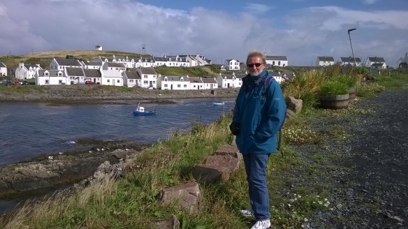
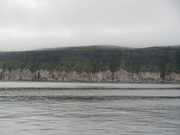
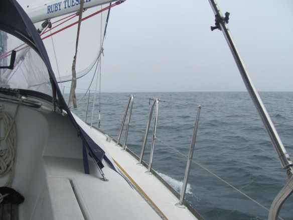
While in Campbeltown, we decide to go to Gigha for a day. We take our folding bikes and catch the bus to Tayinloan, about 12 miles away. We arrive at 0900 and discover that we have one minute to get to the ferry about half a mile away. Hoping that it might be a little bit late, we assemble the bikes and pedal madly down the small road leading down to the ferry slip. The ferry is still there and nothing much seems to be happening, so perhaps we are in luck. We round the corner, and sprint the last 100 metres or so, but just as we arrive at the carpark, the ferry leaves. I am sure they saw us. One might have thought that in this age of joined-up thinking that they could have matched the bus and ferry times a little bit better.

Just missed the ferry.

We have an hour to wait. Oh well, a nice coffee at the little café will do the trick. We push the bikes over, licking our lips in anticipation.

The café is closed and opens at 1000 just when the next ferry goes. It’s not our day. There is nothing to do but stand in the cold wind trying to amuse ourselves. I read the timetable three times, but it doesn’t change. Eventually the ferry returns, we board, and cross to Gigha.

Last one off is a rotten egg!

Near the ferry slip is the Boathouse restaurant, which is open at least, so we stop and have a coffee and check the bikes while we are at it. The seat clamp on mine is not holding, letting the seat slide down, so I adjust it as tightly as I can.

Essential bike repair.

We set off heading for the south of the island. The seat on my bicycle lasts about five minutes before it is down again. We stop, and I try and tighten up the tensioning bolt, but it is just not holding. An elderly gentleman in his front garden sees our predicament and comes over to see what the problem is. I explain.

“Och, what you need is a bit of tape just to make it a bit tighter”, he says, disappearing into his house and returning with some red electrical insulating tape. “Let me put this on for you”.

It’s worth a try, so I let him. It seems to do the trick. The First Mate asks him how long he has lived on the island.

“Och, I have been here for nearly 50 years”, he answers, “I came over to work as a plumber for Sir James Horlick in 1970, and never left. But I am still considered an outsider, you know. You have to be born here to be a true islander.”

“Wow”, says the First Mate, clearly impressed. “What was it like living here when Horlick owned it?”

“Ah, he was very strict, and it was tough for the people who were living here – they weren’t even allowed to be buried on the island”, he responds. There is a twinkle in his eye, but I can’t work out why.

“Oooh, that’s terrible”, says the First Mate, trying to imagine coffins being loaded onto the ferry. “Why on earth not?”

“Because they were still living”, he answers, slapping his knees and guffawing with laughter. “You wouldn’t want to bury living people, would you?”

We laugh with him – as jokes go, it’s not bad. The old ones are the best ones. Joke-tellers, that is.

We continue on our way, heading for South Pier at the tip of the island. Five minutes later, and the seat is down again. The tape has made no difference at all. I decide to put up with it.

Exploring Gigha by bike.

Off to our right, we pass the Gigha windfarm. The turbines are known as the Dancing Ladies and apparently are called Faith, Hope and Charity, although as there are four of them, someone seems to have slipped up on the maths. They were commissioned in 2005, and produce enough electricity to supply the houses on the island as well as exporting any excess to the national grid and earning income. Apparently they paid for themselves within five years.

The Dancing Ladies: Faith, Hope, Charity and …. erm …

We continue to South Pier, where a team is carrying out the annual check on the pier itself. A woman from the local council is in charge of four divers who are preparing their gear to go underwater and examine the piles. She tells us that she is of Portuguese origin from Mozambique. We wonder why she has ended up in such a place so far away from home.

“Marriage”, she says. “When we left Mozambique, my husband got a job for the local council in Belfast in Northern Ireland. This was the closest job I could get.” We stare across the North Channel through the haze to Northern Ireland and think to ourselves that they are both in Dalriada at least.

Annual check up of South Pier.

We return along the same way that we came and take and entrance to our left to enter Achamore House and gardens. A winding driveway eventually ends at the House. We meet an elderly couple walking out who tell us that the current owners are moving away and the house itself is a bit of a mess with everything in boxes ready to go. It is, however, possible to visit the gardens, including the walled garden behind the house.

Achamore House.

The gardens are now owned and maintained by the National Trust as part of a community buyout of the island. We push the bikes up the track at the side of the house and explore the walled garden behind. Two peacocks eye us suspiciously and continue preening themselves.

Achamore Gardens.

Achamore Gardens.

We climb the short path behind the gardens and find the spectacular viewpoint out over the western side of the island and over to Islay.

Western coast of Gigha.

Further on, we pass the ruins of Kilchattan church established by St Catan, an Irish missionary who came to Argyll to preach Christianity in the 6th century. As we wandered between the stones in the graveyard and inside the church itself overlooking the Sound of Gigha, I wonder what motivated these missionaries to give up what they had at home and come to a strange land and strange people, all in the name of a set of beliefs. What gave them such strong conviction that these beliefs were right and needed spreading? It must be nice to be so certain about something.

Kilchattan church and graveyard.

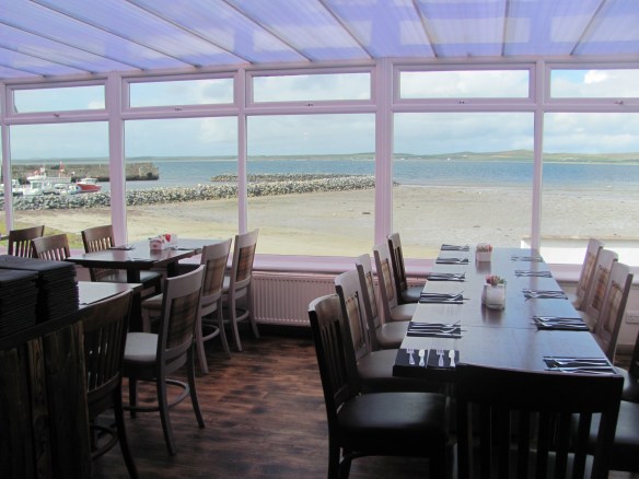
We make our way back to the Boathouse for our lunch. It is packed out, so we are glad that we made a reservation earlier.

Lunch at the Boathouse, Gigha.

We are given a table underneath an antique diving helmet. I feel that it is watching our every move, and try and sit still and talk without my lips moving. It may be my imagination, but the helmet seems to move closer as if to hear better.

Antique diving helmet.

We decide to splash out and order grilled Gigha halibut with avocado, apple, radish, chilli and orange crispy pancetta, and walnut arancini. We feel slightly guilty for eating so much at lunchtime, but it is excellent and we convince ourselves that we deserve it after all the cycling we have done. The helmet rocks in agreement. I feel like telling it to mind its own business.

Working out what to have for lunch.

To work it off, we continue our ride to the north of the island as far at the Carragh an Tairbeirt, or the Stone of Tarbert, shaped like a hand emerging from the earth. Other names include the Druid’s Stone and the Giant’s Tooth. Nobody knows quite what it was built for, but one theory is that it may have been some kind of lunar observatory. We look at it and wonder what secrets it holds.

Carragh an Tairbeirt.

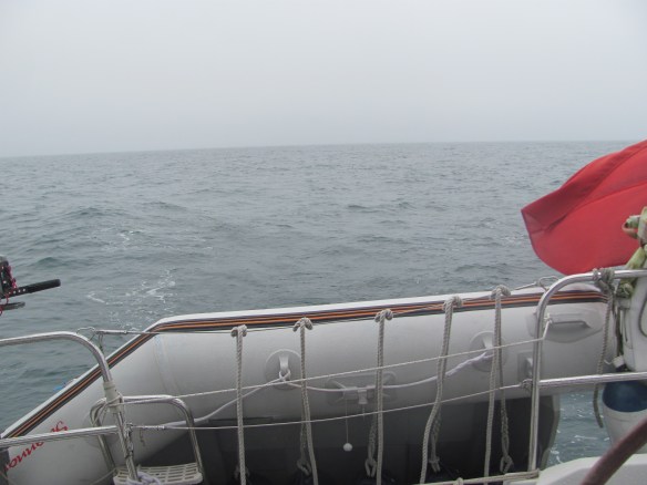
We suddenly realise that the ferry is due to leave soon, which we must get if we are to catch the last bus back to Campbeltown, so we pedal furiously back to the slipway, arriving just as the ferry pulls in.

The ferry arrives.

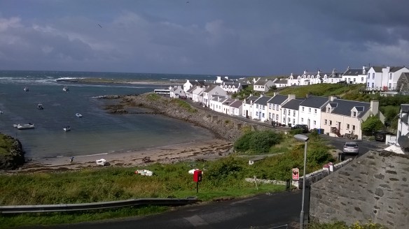
A fascinating island, and we resolve to go back some day.

Campbeltown

We had hoped to explore a few more of the Scottish islands further north, but the weather over the last few days had confined us to shelter in Port Ellen, with more of the same forecast to come in the next week. Today is a favourable window, but as we need to return home for various appointments in a couple of weeks, we have decided to head south again around the Mull of Kintyre for Campbeltown and from there to Ardrossan where we will keep Ruby Tuesday over the winter..

Preparing to leave Port Ellen.

The east-flowing stream around the Mull of Kintyre starts six hours before highwater at Dover, which is at 1200 and continues for six hours until 1800, so we plan on arriving at the Mull lighthouse about mid-way between these two times. We calculate that it will take about 4½ hours to get there from Port Ellen and decide to leave at 0900. Several others have the same idea and for a while we form a neat orderly line as one by one we cast off and motor out past the distillery. Before long, however, we are heading in different directions, some towards the Mull of Kintyre, others toward Bangor in Northern Ireland. The wind is from the north-west, directly behind us, so we goosewing with the genoa poled out.

Passing Port Ellen distillery.

My mind drifts back to my first year at university. The book ‘Limits to Growth’ by Donella Meadows and her colleagues had just been published and it was required reading for an assignment. In it, the authors describe how a relatively simple computer simulation was developed to capture the dynamics of the world system, and then how it was used to investigate various scenarios of consumption and resource use. They concluded at the time than most scenarios, especially the ‘business as usual’ one, would result in economic collapse. Only a few scenarios would allow civilisation to develop sustainably, but this would have to be done at much lower consumption. Even then, if this didn’t happen by the mid-1980s, then it would be too late to avoid a collapse.

Scary stuff, and at the time it caused a lot of controversy. Economists attacked it because it didn’t explicitly include financial flows. Others thought that human ingenuity would always find an answer to our problems and that there was no need to worry, despite improved technology being one of the scenarios they examined. As time went on and civilisation seemed in no danger of collapse, growing stronger if anything, most people consigned it to the dustbin of history.

Until recently, that is. It is now 40 years since the original work, so an Australian scientist thought that it would be a good idea to compare the original predictions with what had happened over those 40 years. What he found was that the business as usual scenario was dead on track with the observed data for many of the variables. Not only were the predictions pretty spot on, the collapse hadn’t occurred yet because it hadn’t been predicted to until the early 21st century. So at the moment they can’t be proved wrong.

The wind goes around to the west slightly, and we have to trim the sails. Goosewinging is no good any more, so we remove the preventer from the mainsail and bring the genoa over to the other side. We are now on a starboard broad reach and continue on our way. For a while we are joined by a small sparrow wanting a rest on the guard rail before fluttering off again. We are amazed at how far out it has flown and hope it makes it home again.

I think of the current trends in world affairs. Liberal democracy and the world order that brought about the tremendous rise in living standards for many and lulled us all into a false sense of security that it would continue forever, is on the run from the rise of nationalism, right-wing politics, and authoritarianism. In the rush towards prosperity, what everyone forgot to keep a check on was the huge inequalities that had built up within and between countries. Now these are kicking back.

After three hours, the wind drops off. I feel a bit worried that we won’t make it to the Mull before the current starts flowing west again preventing us from getting around, but luckily there is enough south-eastwards tidal flow in the North Channel to keep us moving on. We arrive at the lighthouse at 1400, slightly later than planned but still in good time. The water is a bit rough but nothing that Ruby Tuesday can’t handle, and before long we are past the Mull and approaching Sanda Sound.

Passing the Mull of Kintyre light-house.

The wind picks up again and is now on our port beam, and we speed along at a cracking pace up the eastern coast of Kintyre and into the Firth of Clyde where we trim the sails to a close reach. Straight ahead we can see the majestic mountains of Arran, while off to our starboard is the small island of Sanda.

Entering Sanda Sound, with Sanda Island on the right.

We are amused to read that Sanda has had phenomenal growth rate of 300% in its population in recent years, rising from one person to three persons from 2001 to 2008!

Small numbers I know, but I try to imagine what the world would be like with a similar population growth rate. I can’t really. What will the future be like for our offspring, I wonder? Not only have our generation failed to move to a more sustainable lifestyle despite knowing we have to, but we seem to also be descending into the politics of the past, away from cooperation to solve our joint problems towards nationalism. Add to this the ‘hacking’ of the human will by subversion of the truth towards specific ends that Harari talks about. Escaping it all and sailing off into the sunset suddenly has some appeal. Or is all this just doom-mongering, with nothing to worry about that the human spirit won’t be able to overcome? Time will tell.

We are now approaching Island Davaar and behind that, Campbeltown. We find the transit line at 240°, furl the sails, and motor slowly into the harbour. A man gesticulates wildly for us to tie up to the outermost hammerhead pontoon. It turns out he is the marina manager. He helps us tie up next to a motor boat which we know well by now – it is none other than Richard and Maryanne. They invite us over for a drink.

Entering Campbeltown harbour.

That evening, we dine at the Taj Mahal Indian restaurant just up from the marina. Surrounding us are hughly-inflated photographs of the Himalayas and various other scenes in India, reminding me of the time I spent working there in my youth. The waiter comes over and promises us that we would have a meal to remember. Two hours later, we look at each other over the nearly-finished bowls of curry sauce, unfinished naan breads, and the empty glasses of beer. Enough is enough! “I told you that you would remember that, didn’t I”, said the waiter as if he has just proved a scientific theorem. I hope it will be for the right reasons.

The Taj Mahal restaurant, Campbeltown.

Feeling very bloated, we decide to explore around the harbour to walk some of it off. Who should we come across but our old friend Thalassa, the tall ship we had first seen in Ballycastle, then off the coast of Rathlin, then in Port Ellen, and now in Campbeltown. We learn that it is a Dutch ship, available for charter, and that a bunch of friends are on it now travelling around the Scottish islands before making their way over to Bremerhaven.

The Thalassa tall ship.

The next day, we get the bikes out and go for a ride out along the coast to the south of Campbeltown to the point opposite Island Davaar. I am having trouble with the clamp on mine that keeps the seat post up, and every five minutes it disappears back down into the tube to its lowest level so that I end up with my knees brushing my ears. I take a pair of pliers so that I can adjust the tension of the bolt, but it doesn’t seem to make much difference. Something clearly has gone wrong. At least we have the wind to our backs. Ever the optimist, that’s me.

We arrive at the Dorlinn, the causeway between the mainland and Island Davaar. It is still above water, but the tide is rising and it is too risky to try and walk across it to the island. We have no real desire to be marooned on the island until the next tide, and decide to leave it for another time. It’s a pity as apparently there is a cave with a painting of the crucifixion there we would have liked to see. The story goes that it was painted back in the 1880s by a local artist, but the good people of the town thought it was a sign from God. They were not well pleased when they found out it was one of them that had done it.

Island Davaar, Campbeltown.

On the way back, we stop off to visit the Linda McCartney memorial garden in a little area behind the museum. It seems that she was very well liked by the local people in Kintyre after her and Paul McCartney moved there and formed the band Wings, so after she died in 1998 of breast cancer a trust was set up to create the garden. A bronze statue of her was donated by Paul McCartney.

Linda McCartney Memorial garden, Campbeltown.

In the evening, another large boat comes and moors behind us. I give them a hand in tying up. It turns out to be a training ship with a load of youngsters from a school near Glasgow on it. They are with one of their teachers and have chosen sailing as their summer activity. They are fascinated by our ‘small’ boat and want to have a look inside. We invite them in and are amused by their comments that it is ‘cosy’. Their boat is probably twice as long, so it is all relative, I guess.

A visit from our neighbours.

Islay

We leave Rathlin harbour at around 1200 the next day. It is grey and misty, but visibility is reasonable and we can see some distance around us. The game plan is to take as much advantage of the tidal currents around the island as possible. We plan to go around Bull Point at the western end of the island where there is slack water at 1300, before which time there is a small west-flowing eddy current in Church Bay that should take us from the harbour along the southern coast. Just after slack water at Bull Point, the main Northern Channel flood tide then begins to flow north-westwards again back into the Atlantic, which should help us on our way to our next destination, Port Ellen on the Isle of Islay.

Leaving Rathlin.

That’s the theory at least, and this time it seems to work. The eddy current takes us along the cliffs that we had walked the day before, the dark basalt overlaying the white lay of chalk underneath. Charles Kingsley apparently described Rathlin Island as a drowning magpie because of this layering, but it reminds me more of a layered chocolate cake with a tasty cream layer in the middle.

Basalt lava overlying chalk, Rathlin Island.

We reach Bull Point just as the slack water period starts, perhaps slightly earlier if anything, as it is still very rough there. Ruby Tuesday pitches up and down violently for ten minutes or so before she reaches calmer water. Above on the cliffs through the mist, we can see the ‘upside-down’ lighthouse that we had been in the day before. Ahead of us, we see a small catamaran struggling in the opposite direction trying to furl its sails to come around the point.

A strong wind is coming from the west, and we set a course northwards through the mist. Gradually Rathlin disappears and we are alone again on the sea. As we are crossing a shipping lane, we keep an eye on the radar and AIS to make sure there aren’t any large ships about to run us down. The First Mate goes inside to keep warm.

Course set for Islay.

I muse on the book I am reading – Homo Deus by Yuval Harari – in which he talks about the trade-off modern man has made between meaning and power. Before modern times, life’s meaning was clear to most people and was determined by how it fitted into the cosmic plan devised by omnipotent gods. These gods provided the script and humans acted it out. Human power was limited, however – if a person fell ill, it was because those omnipotent gods willed it. Now if we get ill, we know that it is a bacterial infection we were unlucky to contract, but we have the power to do something about it. Science and our economic systems have made us almost omnipotent ourselves; but to gain this power we have had to abandon any idea that there is an overall cosmic plan that we fit into – the universe is blind and purposeless, and has no meaning. Things just happen.

I think back to my previous musings on our way to Fishguard – it makes me wonder if it is a pointless quest we are on to try and find something beyond ourselves. Perhaps there is nothing. But Harari offers a way out – the old ways that provided certainty from external gods have been replaced by the new religion of humanism. In humanism, it is our own thoughts and desires that are paramount – we choose what morals we live by, who we marry and stay married to, what we buy, what is art, what we worship, who we vote to govern us. Knowledge comes from our experiences, which in turn are made up of our sensations, emotions and thoughts, and how we analyse these experiences and let them influence what we do. It is now human experience that gives meaning to the cosmos rather than the other way round. All we have to do is follow the yellow brick road and open ourselves to whatever experiences come our way. Meaningfulness is just a human construct.

The AIS suddenly shows a boat approaching off our starboard bow. I peer through the mist, but can’t see anything. No matter, it will be out there somewhere. I pull up its details and see that it is the Kintyre Express, the fast ferry service that runs between Islay, Ballycastle and Campbeltown. We are not on a collision course, so I relax again.

They are interesting ideas, and to some extent chime with my own. But there is something I feel uneasy about, not least the raising on a pedestal of humans providing meaning to the cosmos. Are we really that important? One species on one small planet in one solar system in one galaxy in one cluster – giving meaning to the entire universe? Can it be? What if there is life elsewhere – would that not also give meaning, and what if it were different? And if multiple meanings are permitted, isn’t the very concept of ‘meaning’ meaningless?

And yet, there are parallels in modern physics with the ‘observer problem’. Quantum theory tells us that things are in a superposition of multiple states until they are observed. But what counts as an observer – a human, or another conscious entity? If so, did the universe not really exist until humans came along to observe it? Does it only exist in our heads? Is there no ultimate reality?

My brain is starting to hurt, but we are arriving at the entrance to Port Ellen and I have other things to think about. We furl the sails and motor into the harbour. Through the mist we can see the low-lying buildings and tall chimneys of the Port Ellen distillery, looking for all the world like some kind of battleship. Ahead is the small pontoon where we find a berth and moor up. Richard and Maryanne, our neighbours from Ballycastle, are already there. Behind us is a large cargo ship loading logs. Later in the evening it moves forward to load logs into its stern, and our way out is blocked.

Cargo ship blocking our exit.

The gale arrives in the early morning. I am awoken by the howling of the wind and the loud slapping of waves against Ruby Tuesday’s stern. I lie there for some time, hoping to get back to sleep, but it is impossible, so I make myself a cup of tea. While the kettle boils, I look out of the companion-way and in the half-light see the angry waves driven by the wind from the west blowing right into the harbour. We couldn’t have chosen a worse berth, and I make a mental note to see if we can find another one on the other side of the pontoon in the morning so that at least we are facing into the wind.

Sitting out the gale.

The morning arrives and I feel grumpy. The cargo ship loading logs leaves and there is now space for us to move out, but its departure has made us even more exposed to the strong winds and waves from the west. Luckily several of our neighbours are on hand to help us, so we reverse out of our berth and motor around to the other side of the pontoon. It’s not as easy as it sounds as the wind is still very strong, and it takes a major effort to avoid being blown onto the edge of the pontoon and into the other boats. Eventually however, helping hands guide us in and we are tucked up safely and soundly in our new position. The slapping almost stops, and some of my grumpiness disappears.

Now pointing into the wind.

The next day, we decide to take the bus to Bowmore, then to Portnahaven. We find the bus stop and wait. The bus is already ten minutes late. The First Mate asks a fellow-queuer if this is normal.

“It depends on the driver”, she says. “All the others are fine, but there is one who is a bit of a law unto himself. He seems to have his own timetable, and nothing will shift him from it. He wouldn’t even drop me off near a friend’s house once and I had to walk all the way back from the bus-stop, me with my bad leg. He’s a right one, that one.”

Ten minutes later the bus arrives and we climb in.

“Is this the driver you were talking about?”, the First Mate asks the woman as we sit down.

She suddenly looks embarrassed. “No, no, not this one”, she whispers, worried that he might overhear. The First Mate suspects it is.

We change buses in Bowmore. This one has a different driver and leaves exactly on time. We travel around the broad expanse of Loch Indaal, past Bruichladdich with its distillery, then past Port Charlotte with its Museum of Islay Life. Across on the other side of the Loch we can see the broad expanse of the Big Strand, its seven miles of sands glistening in the sunlight. The driver waves at everyone he passes, sticking his arm straight out like a salute, then rotating his hand back and forwards like the agitator in an old-fashioned washing machine.

Before long, we are the only passengers on the bus. We arrive at Portnahaven at the end of the road on the south-western tip of Islay. I had thought that its name might have derived somehow from ‘haven’, meaning harbour, but apparently it comes from the Gaelic Port na h-Abhainne, meaning ‘port of the river’.

Portnahaven, Islay.

The bus driver tells us that he is returning to Bowmore in an hour, so we can go back with him then, or catch the bus after that which will be three hours later. In the meantime, he says we can have a coffee at the art studio or the pub in the village.

“Great”, says the First Mate. “I could do with a coffee”, heading for the studio. The studio is closed for the season. We find this odd as it is surely near the peak of the season, when there is likely to be the most customers.

“Never mind”, I say. “I am sure that the coffee in the pub will be as good.”

The pub is closed too. At least it opens at noon, but unfortunately that is also the time that the bus leaves.

Looking for a coffee in Portnahaven.

We explore the village. There is a picturesque little harbour with fishing boats bobbing up and down, and about three or four seals looking inquisitively at us. The harbour is protected from the outside sea by two islands with a narrow gap between them. On one of the islands stands a lighthouse. Today it is rough, with waves breaking over the bar between the two islands and bringing surges into the harbour. Whitewashed houses surround the harbour on both sides, with more spilling down from the slopes behind. A solitary post-box provides a splash of red. One or two people can be seen, but there is an overwhelming feeling of isolation, as though this is the end of the world. Just the deep blue ocean from here on.

Portnahaven harbour.

We come across a small shop advertising ice-creams for sale. We enter, and immediately the conversation stops and six heads turn to focus on us. So this is why the streets are deserted.

“Is this the queue for ice-creams?”, says the First Mate.

“Papers”, says one of the heads tersely. It seems the arrival of the newspapers is quite a social occasion in Portnahaven.

There is only one type of ice-cream and only two of those left, so we take them and eat them on the small bench outside the shop overlooking the harbour. The seals seem to look at us longingly. Perhaps they like ice-creams.

Back in Bowmore, we have lunch and the long-awaited coffee in the Lochside Hotel overlooking the small harbour and Loch Indaal. A kite-surfer is just leaving from the harbour heading for Port Charlotte on the other side of the Loch and we watch him or her until they become too small to see. What some people will do to save on a bus ticket!

Lunch at the Lochside hotel, Bowmore.

Replenished, we amble over to the other side of the road to the Bowmore Distillery and sample a dram, savouring the taste of the peat smoke as it slips down. Aaaaah, perfection! If you want distilleries, then Islay is certainly the place to come, but the Bowmore one is the oldest of them all, and the whisky that is produced there one of the most drinkable.

Bowmore distillery.

Then just to salve our consciences, we move from matters of the spirit of one kind to matters of the spirit of another kind and visit Bowmore’s unique Round Church. Sitting in a dominant position at the top of the main street, it seems to serve as a stern reminder to the town’s citizens not to indulge in the pleasures of the flesh, at least not too much! It was supposedly built in a circular shape so that there are no corners in which the Devil could hide.

The Round Church, Bowmore.

Rathlin Island

I look down at the swirling water below me where the Atlantic Ocean and Irish Sea meet, the waves smashing themselves onto the dark rocks and hurling white spray into the air. Thousands of seabirds fly in all directions. Even though it is just too late in the season for the puffins and razorbills – the last puffin was seen only four days earlier, apparently – the numbers of kittiwakes and fulmars make up for them. A flock of gannets gracefully skim the waves, their black wingtips barely touching the water and their yellow heads adding a splash of colour to an otherwise grey sea.

Near West Lighthouse and RSPB Seabird Centre, Rathlin Island.

We are at the RSPB Seabird Centre at the western end of Rathlin Island. The evening before we had left Ballycastle with the aim of crossing the Slough-na-More, the treacherous stretch of water between Rathlin and the mainland, at slack water. What we had not counted on, however, was that even though the main channel was slack, there was a nasty little back-eddy still circulating. Just over halfway across, we suddenly found ourselves being carried back into the mainstream again. We increased the engine revs to the maximum and managed to make one knot headway against it. It seemed like an age and at one point we despaired of making it, but eventually we reached the calmer waters of Church Bay and from there through the breakwater into the small harbour. It had been a close run thing. If we had got swept back into the main channel again, by that time the tide would have turned against us and we would have been swept south-eastwards back into the Irish Sea.

Currents in Rathlin Sound at slack water.

Rathlin village and harbour.

Rathlin Island is shaped a bit like a back-to-front letter L with the harbour and the village at the crook. Reflecting the dangerous waters around the island, there are lighthouses at each of the points – western, eastern and southern. The western lighthouse is integrated with a RSPB Seabird Centre that provides a stunning platform to see puffins, razorbills, guillemots, kittiwakes and other seabirds, which we were keen to see the following morning. A Puffin Bus takes visitors from the harbour to the Centre, but we had decided to walk the four miles to experience the island to the full. On the way, we had passed a poignant memorial to 500 inhabitants of the island who had emigrated to England and America during the Great Famine, and wondered if such a thing could ever happen again. Civilisation is fragile so perhaps it could.

Memorial to those who left the island due to the Irish famine.

One of the RSPB wardens comes over and talks to me. He was born and bred on the island – his father was one of the last lighthouse keepers before it was automated. He shows me the huge ruby-coloured light that flashes every five seconds to warn sailors of the dangers.

The light inside West Lighthouse, Rathlin.

The lighthouse is unusual in that it is ‘upside-down’ – the light is at the bottom of the tower so that it is below the cloud layer and visible out to sea. I think of the Old Lighthouse on Lundy Island that was never used because it was too high. They must have learnt their lesson for this one.

The ‘up-side down’ lighthouse.

Keeper’s living quarters in West Lighthouse, Rathlin.

I retrace my footsteps back up the narrow stairs of the tower where each floor has a recreation of the keepers quarters, until I reach the new RSPB building at the top. The First Mate is waiting for me there.

“Quick, the bus is just about to go and we could get a lift back if they have space”, she says.

The Puffin Bus gives priority to returning passengers who are doing the round trip by bus and will only take others if there is room. We rush over and breathlessly ask the driver if there is any chance of a lift back. Fortunately there are two spaces left, and he says that we can have them, nodding at the front seat just opposite him. We gratefully clamber on board, he puts it in gear, and we are off.

“Bla … barooom … skrrrrr … prehistoric … errrrrrm”, he says to us about halfway along the route back to the harbour. The noise of the engine, the frequent gear shifts, and his voice merge together, making it difficult to understand what he is saying. The fact that we are sitting behind him doesn’t help either.

“Pardon?”, I say.

“Skkkrrrrr … errrmmm … axehead … barroooommm”, he continues, passing the First Mate a lump of stone from the dashboard.

“It’s a prehistoric axe-head”, she says, “and he is giving it to us to have a look at it.”

“I didn’t know you spoke Irish”, I say.

“I don’t”, she says condescendingly. “He is speaking English.”

“Oh”, I say. I take the stone and examine it. One of the edges seems to have been sharpened. I think of the people who made it perhaps 5000 years ago, and wonder what they thought about.

“Errrr … rrrrmmmm … flint mine … skrrrrr”, says the driver, pointing out to the left and steering with his knee. The Puffin bus starts to veer to the other side of the road. The knee skilfully corrects it. Luckily nothing is coming.

“There is a quarry out that way where prehistoric people used to mine flint for axe-heads”, translates the First Mate. I make a mental note to improve my Rathlinese and not to engage Puffin bus drivers in conversation. At least, not when they are driving.

We reach the harbour in one piece and disembark. There is still time, so we decide to walk down to the southern lighthouse at Rue Point. On the way, we pass Richard and Maryanne, our marina neighbours in Ballycastle, who had also come over the day before, earlier than we had. At the point, the light is beautiful and we sit next to the ruins of a cottage and look out across Rathlin Sound to Fair Head on the other side. A tall ship with square-rigged sails passes gracefully by, heading north-eastwards. Below us, in a small bay, seals sunbathe on the rocks, looking like bananas with their heads and tails curved, while goosander ducks cluck fussily and dive for their dinner. It could be the land that time forgot.

Looking across to Fair Head on the mainland from Rue Point, Rathlin.

Tall ship heading for Scotland.

Seals practising synchronised sleeping on the rocks at Rue Point, Rathlin..

After some time, we decide to take the coastal path back to see the stunning cliff views. Eventually it peters out.

“We must have missed the turning somewhere”, says the First Mate. “Look here, this looks like a path. This’ll be it.”

We take a sheep track along the side of a hill and down into a valley. Before long, it too peters out into a swamp. It looks impassable without getting wet, but we follow an old fence line through brambles and manage to reach some higher ground where there is a farm track.

An aggressive-looking goat bars the way. It reminds me of a story I used to read when I was a child about some trolls trying to cross a bridge blocked by a fierce Billy Goat Gruff. Or was it the other way round? In any case, I manage to convince the goat that the beautiful maiden behind me will be much tastier than me. He lets me pass. The First Mate approaches, following my tracks. The goat nonchalantly looks the other way, and starts grazing.

“How did you do that?”, I ask.

“Do what?”, says the First Mate.

“Stop him from accosting you”, I say. “According to the story, you are then supposed to butt him with your head and he will run off.”

She looks at me pityingly.

Billy Goat Gruff?

We reach the village, and decide to eat in McCuaig’s Bar. It is a bit chilly to sit outside, so we find a table inside. The décor is dated, but tolerable. Unfortunately, it is the one night of the week when there is no live music. The First Mate orders Cullen skink and squid, and I have the lasagne and chips. Good basic pub food, no frills, but plenty of it. Too much, in fact. We waddle back to the boat, hoping that the ducks in the harbour don’t think we are one of them.

McCuaig’s Bar, Rathlin.

Ballycastle and the Causeway Coast

We leave Bangor marina and continue our voyage north, stopping for a night at Glenarm where we catch up with our washing. The marina staff are friendly, but there is not much to see and do there apart from a castle which is only open to the public at certain times of the year. Unfortunately, they don’t coincide with our visit, so we content ourselves with looking at a fisherman’s cottage instead.

Fisherman’s cottage, Glenarm.

We press on. We are now in sight of Scotland – the Mull of Kintyre is clearly visible on the horizon, only 15 miles away. We are now entering the ancient sea-kingdom of Dalriada, which spanned what is today Antrim in Northern Ireland and Argyll in Scotland. Its Gaelic-speaking people were called Scots by the Romans and eventually gave their name to Scotland.

The Scottish coast appears in the distance!

The wind is from the north west and freshening. The sea captain orders his long-ship crew to break out the sail so that they can save their energy from rowing. They will need it later when they reach the Slough-na-More between the mainland and Reachlainn. According to his reckoning, the current will be with them and take them in to Baile an Chaistil, but it will still be rough and they will need to keep the ship on a straight course. Even though he has done the trip many times, he still feels some trepidation – one might get to know the sea, but it is never one’s friend.

He thinks of his next assignment. He has been called from his farm in Aontroim by the king of Dal Riada, Áedán mac Gabráin, to use his ship to take soldiers from Baile an Chaistil across the treacherous Sruth na Maoile to the great river Abhainn Chluaidh. Off to his starboard, he sees other long-ships coming from different directions but converging on Slough-na-More, all having received similar orders. It seems that the Anglo-Saxon king Æthelfrith from Northumbria is getting a bit too big for his boots and has invaded their allies, the Britons, on the mainland. Those Anglo-Saxons need taking down a peg or two, and our King Áedán is the one that can do it, he thinks. That will teach the pesky Anglo-Saxons to invade our Celtic brothers. Never mind that we have just finished having a bit of a scrap with the Britons ourselves, we Celts have to stick together. After all, Toutatis will make sure that we win.

Even though he has signed up to this new-fangled religion of peace and love introduced by that strange chap Colmcille, the sea captain still prefers to put his trust in the old gods when it comes to matters of war. He is glad that he managed to get the livestock out to their summer pasture and the barley and oats planted before the call came – at least there should be something to harvest when he comes home. If he comes home.

“Time for a cup of tea?”, the First Mate says, bringing me back to the present with a jolt. I had been imagining what it might have been like to be a sea captain in the Dalriadan sea-kingdom in the seventh century heading across the North Channel to the Clyde for the Battle of Degsastan between the Gaels and English in 603. Unfortunately, the Gaels get thrashed, marking the beginning of the decline of Dalriada.

Rounding Torr Head.

The sea becomes more turbulent and we need to alter course to head directly into the wind. We are entering Slough-na-More, the hazardous stretch of water between Rathlin Island and the Antrim coast, where the tidal flow is forced through a narrow channel to produce strong currents, backflows and overfalls. Even though the current is in our favour, tacking in such conditions is difficult, so we furl the sails and motor instead. Ruby Tuesday takes each wave as it comes, riding over it then plunging into the trough behind. We try and keep her on a slight angle to the wave direction to avoid her slamming.

Ploughing through the turbulent water of Rathlin Sound.

Up ahead we can see the imposing bulk of Fair Head, the north-eastern point of mainland Ireland. The origin of the name Fair Head comes from a rather poignant little tale. It seems that a beautiful girl once lived on a castle at Rathlin Island. Her beauty was known far and wide, and prospective suitors came from all over to woo her, but she rejected them all except two. Neither of the two would withdraw, so it was decided to settle the issue by a fight between them. They fought long and hard, but eventually one of them won. As the loser lay dying and not being able to bear thinking about the girl being with his opponent, he spoke to his manservant, telling him to ask her to dance with him at the marriage celebration. He was then to dance her over the edge of the cliff. This all happened, and the girl’s body was found later washed up amongst the rocks at the base of Fair Head, giving it its name. Such is love.

The imposing cliffs of Fair Head.

We eventually reach Ballycastle marina and tie up. The small town lies adjacent to the marina, so we relax by having an ice-cream in the sun before exploring.

The beach at Ballycastle.

We see the Marconi memorial commemorating the first commercial radio transmission in the world, from Rathlin Island across to Ballycastle. Apparently this was for the coastguard to report the passage of ships along the north coast of Ireland to Lloyds in London.

The Marconi memorial in Ballycastle.

The next morning we take a local bus to explore the so-called Causeway Coast. Some miles west of Ballycastle, we get off and walk down the small road signposted to the Carrick-a-Rede Rope Bridge, the first ‘must see’ we have been told about. We pause to take in the view – picturesque fields sweep down to the steep cliffs rising out of the sea, with a small whitewashed church on the edge between land and water. It is picture postcard Ireland.

The Causeway Coast, Country Antrim.

A little bit further on, we come to the rope bridge itself spanning a precipitous gap between the mainland and the small rocky island of Carrick-a-Rede. There is a queue of people waiting to cross it a few at a time, but we follow the track to its end and look back. Old fogeys that we are, we have done enough such thrills in our lifetimes not to feel the urge to try this one. It is no more than a tourist attraction nowadays, but apparently fishermen used to fish for salmon from the island and constructed bridges across the narrow gap to bring their catch back to land.

The rope bridge at Carrick-a-Rede.

Back on the road, we catch the next bus which takes us to the stop for the Giants’ Causeway, and we walk the kilometre or so down to the coast. The stones are part of the same geological structure as the structures at Staffa, and were formed by volcanic activity around 60 million years ago. When lava cools slowly, it forms hexagonal columns. Legend has it that the Causeway was built when a giant from Ireland was challenged to a duel by a giant from Scotland, and the latter needed a way of getting across to the bout. We were amused to hear that DUP ministers had insisted on a Young Earth Creation explanation in the Visitors’ Centre of the formation of the stones 6000 years ago. What’s a factor of 10,000 amongst friends?

The Giant’s Causeway, County Antrim.

Columns at the Giant’s Causeway.

We sit and have a coffee at a street cafe in the next town, Coleraine. A man approaches and asks if he can share our table as there are no others spare. We are fine with this and he sits down. After some small talk, I decide to ask him about Brexit.

“Brexit?”, he says, as if confused. “Oh, you mean Leave. Well, everyone around here would have voted for Leave. If you want to talk to any Stayers, you’ll have to go to Belfast. That’s where they all are”, he continues defensively, as if they are a race apart.

I want to ask him why people voted for Leave in Coleraine, but unfortunately he is joined by his wife at that stage, and the chance is lost.

We arrive back at the boat and meet our new neighbours, Richard and Maryanne. They have a motorboat and are heading in much the same direction as us.

Bangor and Belfast

We leave Strangford the next morning at about an hour before high water. This means that we will be battling against the inward-flowing current for about an hour before it turns, but it does mean that we catch the northward flowing tidal current all the way to Bangor, our next port of call. Leaving it later would also mean that there is the likelihood of dangerous overfalls where the outgoing current from the Lough meets the north-flowing current of the Irish Sea. It is drizzling heavily and grey and overcast and we feel a bit miserable. The First Mate makes us cups of tea and I try and steer a course as close as I dare to the shore of the Narrows where the opposing current is slightly less strong, taking care not to get too close where it is shallow. We pass the wonderfully named Pladdy Lug beacon and eventually reach the open water of the Irish Sea beyond any turbulence from Strangford Lough.

Strangford Lough to Bangor.

The wind picks up from the south, filling the sails, and we make good speed along the coast on a broad reach. The rain obscures everything, but after a time it stops and the sun tries to peek though. We can now see two other boats following us on the same route, probably coming from Ardglass or even further south. Through the haze over to our starboard, we can see the Belfast to Liverpool ferry, and to our port side the villages of Portavogie, Ballywater, Millisle, and Donaghadee on the coastline, the green fields between each one contrasting harmoniously with the white painted houses. We muse on what each place is like to live in and what sort of people live there.

We pass through Donaghadee Sound, keeping the two red marker buoys to our port to avoid Governor Rocks and Foreland Spit and the green one to our starboard to avoid Deputy Reefs, and enter Belfast Lough. Here the wind strengthens and we enjoy a fast beam reach down the Lough until we reach Bangor Marina.

Approaching Bangor.

Bangor exudes a strange mixture of prosperity and dilapidation. Along the seafront, there are well-to-do Victorian townhouses reflecting its popularity as a seaside resort in Victorian times. More recently, with the decline of sea-side resorts due to cheap foreign holidays, it has shifted to being a commuter town for Belfast. Much of the city centre is modern, partly because some of it was blown up by bombs during the Troubles, but there are also areas that look run down and boarded up. The harbour area is in the process of being redeveloped, so hopefully something will be done about them. Shops are shuttered up after closing, creating a cold and abandoned atmosphere in the evenings.

Bridge Street in Bangor.

The Old Customs House, Bangor.

Shuttered shops in the evening.

The next day we decide to catch the train from Bangor into Belfast, arriving at the Great Victoria Street station.

“Oooh”, says the First Mate as we emerge. “The Europa Hotel. The guidebook says that it is the most bombed hotel in the world. Let’s go and have a look.” We stand in the lobby and admire the marble walls and ceilings. I look around nervously for any unattended bags lying in corners, but nothing seems suspicious and I relax slowly. Apparently Bill and Hillary Clinton stayed here in 1995, but otherwise it looks like any other hotel.

Europa Hotel, Belfast.

After a brief lunch, we find a hop-on-hop-off city sightseeing tour bus and climb aboard. First up is the Titanic Centre in the city’s Titanic Quarter, the site of the Harland & Wolff works, where the original Titanic was built. The building is supposed to represent the bows of the Titanic, but apparently it is better known locally as the Iceberg. We think it might be worth a visit later, but we decide to stay on the bus tour for the time being.

The Titanic Building, Belfast.

Next we pass by Stormont, the site of the Northern Ireland power-sharing government. Except it isn’t, as there hasn’t been any government for the last 18 months since it collapsed following the ‘Cash for Ash’ scandal. Everything seems to have carried on as normal since then, which perhaps says something about governments in general. The tour guide does note ruefully, however, that all the MPS are still being paid regardless!

Stormont.

The last part of the tour takes us through the Falls Road and Shankill Road area. Although only a few streets apart, the first is staunchly Republican and Catholic, while the second is resolutely Unionist and Protestant. Between the two is a giant so-called ‘peace-wall’ to keep them apart. The tour guide is at pains to remind us that the conflict during the Troubles was not motivated by sectarian differences, but was political, with the Republicans wanting a united Ireland and the Unionists waning to stay part of the UK. Superficially, there doesn’t seem to be a lot of difference between the two communities – both have numerous murals painted on houses remembering their own that died during the conflict – the same pictures of militaristic hard men and fighting talk on each, just different names and faces. Even though the streets look peaceful as we look out from the safety of our bus, tensions still simmer below the surface – even as recently as 2012, the majority of residents on both sides thought that the walls were still necessary to prevent violence, so they have stayed for the time being.

Republican poster.

Unionist pub.

Passing the ‘Peace Wall’.

We return to the apparent normalcy of the city centre and have a coffee, reflecting on what we have just seen. It is difficult to imagine such hatred between two communities to the extent of 20 years after the peace agreement, there still seems to be little desire to put the past behind them and move on. We look out of the café at the people passing by – they all look the same and we can’t tell which might be republican and which might be unionist, nor who is Catholic or Protestant. Some must be from Falls Road and others from Shankill Road, but how would you know?

Who is who?

And yet, looking back at the history of the conflict, we have a glimpse of the events that have contributed to this mind-set – a deliberate British Government plan of colonisation by English and Scottish planters in the 1600s using land confiscated from Irish nobility, local Irish being displaced from their homes and not being able to work on the new estates, rebellion, torture, massacres and atrocities on both sides. It takes a bit to forgive and forget 400 years of that kind of history.

Music to lighten the heart.

We are on the train back to Bangor.

“I’m absolutely shocked”, says the First Mate.

“At what?”, I say, trying hard to think of any misdemeanour over the last 24 hours that I might have committed. Only eating the last slice of cheese comes to mind.

“At the way the two communities are still divided, even after twenty years”, she continues. “Imagine having to keep a wall between them in this day and age.”

The woman sitting opposite us leans over. “Ah, don’t be too hard on them”, she says. “Underneath, the people of Northern Ireland have hearts of gold. They’d drop everything and go and help one of the other side if they were in trouble. Once the problem is solved, they then go back to fighting each other.”

There’s some sort of logic there, if you look for it and believe it. We have no idea whether she is Republican or Unionist, Catholic or Protestant, but perhaps there is hope yet.


Strangford Lough

After lunch the next day, we set off to catch the north flowing tide to take us to Strangford Lough five miles up the coast. We can only enter the Lough on a rising tide, when the water is flowing in from the sea through the Narrows to the Lough proper. Apparently, something like 400 million gallons of water pass in and out through the Narrows twice a day. Currents can reach 7 knots in each direction and we would have no chance of making any headway against that – instead, we would be carried back out to sea.

Entering Strangford Lough – the current starts to flow faster.

We begin to be swept along by the current, imperceptibly at first, but eventually at such a speed that trees, houses, churches, fields, and cars on the far shore pass quickly out of our sight. The water boils angrily as it encounters some underwater obstruction or cross current, but we are swept mercilessly onwards. It is out of our control now – we are committed to sail up the Lough – going back is no longer an option. There is nothing we can do except steer and avoid any obstacles by staying as much as possible in the middle of the stream. Our speed increases to 6 knots, then 7, 8, 9 and eventually reaches 11.4 knots. That is the fastest that Ruby Tuesday has been on the whole trip!

Top speed – 11.4 knots!

We pass a peculiar-looking structure in the middle of the river looking like a bird hanging its wings out to dry. We learn later it was a tidal stream generator to generate electricity from the powerful currents. At one point, the current sweeps us towards it, and we have to take evasive action not to hit it, sweeping past with only metres to spare. Apparently some yachts have hit it, and have lost their masts as a result. We shudder as we think of what could have happened.

The SeaGen construction.

As we approach the small village of Strangford on the western side and its counterpart Portaferry on the eastern side, the ferry connecting the two begins to cross in our path. We slow down as best as we can, cutting the engine, but it makes not much difference, and we slide somehow to its stern, avoiding it more through luck than good management. Strangford Lough is proving to be a bit of a slalom! In the excitement of passing the ferry, the current almost takes us beyond the entrance to the small harbour, but we slew ungracefully into an eddy out of the main stream, pause for a moment to regain our aplomb, and cruise slowly to the pontoon, looking around surreptitiously to check if anyone saw our ungainly manoeuvres. Nobody seems to have, and we are able to resume our pretence of knowing what we are doing. We tie up to the pontoon and explore the village.

Trying to avoid the ferry between Strangford and Portaferry ferry at 10 knots!

Tied up to the pontoon in Strangford village.

We decide to eat at the Cuan Inn in the village square. It seems that the cast of the Game of Thrones stayed here when they were filming some episodes at the local Castle Ward, about a mile from here. In the series it is known as Winterfell Castle. While we are waiting for our food to arrive, the proprietor, Peter, comes over and introduces himself, sits down and begins to tell us of some of the cast, what they liked to eat, and of what is was like filming some of the scenes. He shows us the ornately carved wooden door that was made especially for the series and now occupies pride of place near the main bar. We decide that the Northern Irish are nothing if not chatty!

The Game of Thrones door, Cuan Inn, Strangford.

We stumble back to Ruby Tuesday, only to find that we are nearly hemmed in by the ferry, which has stopped for the night. We can just about squeeze out if we need to, so it is lucky we don’t have any plans to go anywhere else for the rest of the evening. The ferry winks at Ruby Tuesday as if to say that she will be safe with her.

Hemmed in for the night by the ferry!

The next morning, we take the self-same ferry across to Portaferry, and visit the local museum. As we look a giant map of the village as it was in 1790, we are approached by the museum director.

“He changed his name, you know”, he says. ”So that he could marry the woman he loved.”

“Who was that?”, I say.

“Andrew Savage”, he responds. “The local land owner. The Savages are one of the old families of the area and used to own the village. House is up behind the village. Andrew fell in love with a girl, but her father said that he didn’t want his daughter marrying a savage, so he changed it to Nugent. He went from being a savage to a new gent, see?”. He laughs. We laugh politely too. We wonder how many times he has repeated that one.

Map of Portaferry in 1790.

He tells us that the place used to be quite a haven for smugglers. Around 1700, the British government slapped taxes on tea, coffee, whiskey, tobacco, spices, chinaware, cotton and many other items. Many of these items were imported from France via the Isle of Man into Portaferry where duty had to be paid, but the numerous small bays around Strangford Lough were ideal for smugglers to off load goods from the ships before they came into harbour, leaving only some of the cargo to arrive legally. The illegal goods would then make their way inland concealed in baskets of fish. The problem for the excise men was that most of the local people didn’t see why they should have to pay duty for life’s luxuries, and actually supported the smugglers. Even the local gentry saw it as a good investment. Stiffer and stiffer penalties were introduced, from fines, transportation to the colonies, and even death. Rewards were paid to informers. Despite all this, smuggling flourished, and it was only the formation of the Coastguard in 1822 that brought it under control. Will such smuggling start again because of Brexit, I wonder?

Wanted for smuggling. Not Ruby Tuesday!

The next exhibit is of the SeaGen project that we nearly ran into in the Narrows the day before. It seems that it was a commercial electricity generator for some years, but was sold to another company and is now being dismantled. Now we could see how the whole thing worked – giant propellers like wind turbines could be raised and lowered at will into the current. Apparently, it was very successful and could produce 1.2 MW – enough power to supply all the households in both Strangford and Portaferry. The director can’t understand why it is being dismantled as it could have kept on being productive.

The SeaGen tidal power generator.

However, it seems as if other devices are being tested, including one that looks like a model aeroplane on a tether which apparently is much more efficient, so perhaps Strangford Lough will continue to play a role in Northern Ireland’s renewable energy programme. We hope so.

A new tidal power generator.

We wander back through the village. A group of cyclists just off the ferry are enjoying refreshments at a café before they continue. Bikers astride their Harley-Davidson’s roar noisily through the narrow streets as they continue northwards. A family visit the derelict 16th century tower-house castle, another of the Savage family properties, before climbing back into their car and driving on. A dilapidated shop advertising ‘Needful Things’ has long since closed. Several other shops are also boarded up. There is a general air of decline about the village, as though it has seen better times, a place now that people don’t go to but just pass through instead. It makes us feel sad.

Portaferry Castle.

No longer needed?

Over to Ireland

We leave Douglas the next morning aiming to pass the Calf of Man as the tide turns so that we can catch the north-west flowing current to give us a helping hand across the Irish Sea. It is cold and clammy, with fog hanging low across the island obscuring everything above a few metres. Apparently this is what the Isle of Man is like most of the time. A solitary seal munches its breakfast as we motor slowly out of the harbour and turn southwards.

Seal munching his breakfast, Douglas harbour.

It is dead calm with no wind, and we have to motor down to Langness Point on the south-east corner of the island. Around the point, the eastwards tide is still running, and we need to battle against the current to make any headway. We tell ourselves that it will be all worth it when we catch the north-westwards current across to Ireland in an hour’s time. Sometimes one has to make sacrifices in the near term so that there are greater benefits later! As if to cheer us up, just at that moment the clouds clear and the sun comes out.

We eventually reach the Calf of Man off the south-west corner. The name of the island conjures up an image in my mind of a newly born calf lying next to its mother, which, as the name derives from the Old Norse kalfr meaning an island lying next to a larger one, is not so far-fetched. Perched on the Calf are two disused lighthouses, now used as a bird observatories. Off to our port side is the Chicken Rock lighthouse built in 1875 warning ships of the dangers of straying too close. The area certainly didn’t do too badly for lighthouses.

Bird observatory on the Calf of Man.

Chicken Rocks lighthouse.

A wind picks up from the north-west and we hoist the sails, and skim along on a close reach at a good speed. Before long, the Isle of Man disappears from view and we are alone on the sea. Three gannets fly over, their yellow heads bright in the sunlight. We relax and lapse into our own thoughts.

Suddenly a patrol boat appears on our port side out of nowhere. A blue flag with yellow stars flutters from its stern. It draws alongside, and over a loudspeaker, one of the crew asks us to stop. I am puzzled. This is the third time that we have been intercepted now – the first at Lulworth Firing Range, and the second at Castlemain Firing Range in South Wales. But surely the middle of the Irish Sea can’t be a firing range? We can’t even see land. Perhaps we have blundered into a submarine training area?

We furl the sails and come to a halt. One of the patrol vessel’s crew throws a line across and asks us to tie it to a cleat, and then clambers on board.

“Passports, please”, he says. The accent is Irish. Our passports are below in the cabin. The First Mate goes down to find them. “Where is your destination?”, he asks me. I tell him we are heading for Ardglass in Northern Ireland.

“Do you have anything to declare?”, he asks. “No”, I say, “Just personal items. Laptops, a tablet, phones, that kind of thing.”

“Do you mind if I have a look?”, he says. Before I can answer, he is climbing down the companionway into the saloon area. He pokes around, opening cupboards, looking behind our books, checking our food store. We feel that he is intruding on our private space, but we say nothing. He asks us to lift the floorboards, where we have more tins of food.

“Are these only for your own consumption?”, he asks. I nod.

“There is too much here for just two people”, he says. “I am afraid I am going to have to charge you duty.”

I protest that we are sailing around the UK and that we need a lot of provisions for when we anchor in way out places, but he is adamant. “It’s what you voted for after all”, he says.

Is this the shape of things to come?

I am awoken from my reverie by the First Mate bringing a cup of tea. I had been imagining what it would be like if a new customs border between the European Union and mainland Britain had been created in the middle of the Irish Sea as a result of Brexit. Since an agreement could not be reached, the UK has crashed out of the EU with no deal, and trade is now under WTO rules. Because no-one wants a hard border to be recreated between Eire and Northern Ireland, it has been decided to allow the latter to stay in the customs union with the EU, and to have the customs border in the Irish Sea. Because everything is much cheaper in the UK due to the removal of most labour and environmental regulations, duty is now payable on all goods entering Ireland so as not to undercut EU industries. The Irish Sea is patrolled by fast vessels to prevent smuggling of cheap goods. Fanciful, I know, but no more ludicrous than many of the other contortions brought about by Brexit. The cup of tea cheers me up.

We are suddenly joined by a pod of dolphins swimming alongside us and leaping out of the water in front of us in sheer exuberance. We sit on the foredeck and watch these beautiful creatures showing off their skills to us, almost as if they are trying to impress us. “Don’t worry about borders”, they seem to say, “Look at us – we swim wherever we want. We are free. It is only you humans that want to put up walls and barriers between yourselves. Come with us and learn the true ways of the earth.” Are we really more intelligent than them?, I wonder.

Dolphins in the Irish Sea.

(Click here to see a video of the dolphins.)

The coast of Ireland appears. To the south we see the Mountains of Mourne sweeping down to the sea. The rays of the setting sun strike the clouds and light them up with streaks of silver, while the lowlands radiate a soft golden glow. It is beautiful.

The Mourne Mountains, Northern Ireland.

We arrive at Ardglass just on low water. In the twilight, we follow the leading lights into the tiny marina where a few other boats are tied up. A cheerful American helps us tie up next to his boat – he and his friend are heading off southwards early the next morning and they promise not to wake us.

Approaching Ardglass.

Ardglass marina.

Peel, Ramsey and Laxey

“Donkeys can carry about 340 lbs for 15 hours a day”, a voice behind us says. “I should know, I used to command a donkey team in Nepal.”

My knowledge of donkeys is limited, but I am fairly sure that taking commands is not one of their strong points. I wonder facetiously what language the owner of the voice talked to his donkeys in? Ass-amese, perhaps?

The First Mate and I are on a bus on the way to Peel on the west coast of the Isle of Man. We have bought Day Travel cards which entitle us to ‘hop-on-hop-off’ bus travel for a day, and plan to do the round trip of Peel, Ramsey and Laxey.

“Yes”, the donkey commander continues. “I had a team of ten men and their donkeys that we used to ferry supplies from one hill station to another. Lovely country, Nepal.”

I am dying to turn around and see who the donkey commander is, but don’t want to appear rude. I surreptitiously look in the driver’s convex rear view mirror and just make out the reflections of two rather military-looking gentlemen in cloth caps in the seat behind us. They seem to have only met each other on the bus, but know about half of the British Army in common between them, and spend the rest of the bus trip discussing the achievements, faults and failings of them all. Or so it seems to us. The donkey commander seems to be higher ranking than the other, who spends most of his time agreeing with what the commander says. We decide to call them the Commander and Corporal.

Getting off the bus in Peel. The Commander and Corporal follow.

We arrive in Peel, and disembark near the harbour. The Commander and Corporal also get out and go their own ways. It is raining, so we take shelter in the House of Manannan museum in the old railway station. Manannan was a mythical sea god of the Celts who ferried dead souls to the Otherworld in a chariot pulled by his trusty steed Enbarr, and may have given his name to the Isle of Mann. The museum has life-size reconstructions and numerous videos covering the Celtic, Viking and modern traditions, reminiscent of the Jorvik museum in York. Next door, there is an exhibition on cartoons by Phil Wood which keep us amused until the rain stops.

The House of Manannan.

We walk along East Quay past the marina until we come to the lock gates, which as chance would have it are just opening to let two or three boats out. Beyond is St Patrick’s Isle with the impressive Peel Castle situated on it. The original castle was built in wood by the Viking, Magnus Barefoot, in the 11th century, but was added to over the years using the local red sandstone. There is even a cathedral built within it. The grave of the so-called Pagan Lady whose spectacular necklace of precious stones and cache of silver coins we had seen in the Manx Museum in Douglas were also found in a graveyard within the castle.

Peel Castle.

We have lunch in the Marine Hotel on the beach front, making sure that we sample the local Bushey beer, before catching the bus to take us on to our next port of call, Ramsey, on the east side of the island. On the way, we talk to a man from London who builds and plays pipe organs, and who has been coming to the Isle of Man every summer for the last 40 years because he likes it so much. He is organising a concert in Douglas in a week’s time and invites us to come. He is not allowed to charge for the performance, but donations are welcome and go to a charity of his choice. We promise to come if we are still in Douglas then.

On the bus to Ramsey.

It is pouring with rain as we arrive in Ramsey, and we make a dash to the bus shelter. The town is supposed to have the sunniest climate and the lowest rainfall on the whole island, but someone has forgotten to tell the weather gods today.

While waiting for the rain to stop, we have coffee in the appropriately named Conrod’s Coffee Shop in Ramsey, with its TT motorcycle theme. On the bus, we had passed several stands for spectators at strategic positions along the road, and we had noticed several shops with motorcycles in the front window, even if they weren’t actually selling them. The race, which is held in May and June every year, is a bit of an orgy for petrol-heads, and involves closing all roads on the track to the public for two weeks, and is regarded at the most dangerous motorsport event in the world. It would have been interesting to see it, but apparently the Isle is overrun with bikers at the time and it is not easy to get around.

Racing bike in shop window.

The rain eases off, and we explore the town. Like the other towns on Man, Ramsey has its origins in Viking times and gets its name from the Old Norse words meaning ‘river of wild garlic’. The Viking heritage is evident as we explore the town, particularly a fine sculpture of two Viking kings playing chess. One is the legendary King Orry and the other his son, King Olaf. Orry must have been another one who liked Mann, so much so that he kept coming back time and again to try and take over the island. On the first two occasions, he was sent packing by the local Manxmen, but managed to beat them on the third attempt, and became the island’s ruler. I think that if I was a Manxman, I would prefer holiday makers giving organ recitals!

Kings Orry and Olaf playing chess.

We get off the bus in Laxey, or ‘Salmon River’ in Old Norse. We don’t see any salmon, but the main attractions are two large water wheels used to pump water out of the lead and zinc mines that flourished during the 19th century. One wheel, the Lady Isabella, is supposed to be the largest functioning waterwheel in the world. The mine itself extracted mostly lead, but also zinc, silver, copper and iron, but eventually the amount of ore taken out reduced, and together with problems of flooding that the giant wheel couldn’t cope with, the mine became uneconomic to run and it closed.

The Lady Isabella water wheel in Laxey.

Interestingly, the three-legged symbol of the Isle of Man, the triskelion, is reversed on the wheel – apparently this was a mistake and there were plans to correct it at one point, but nobody got around to it. The Manx are quite proud of their symbol – one story put about is that whichever way it is thrown, it will always end up on its feet, illustrating the resilience of the Manx nation. Another more prosaic explanation is that one leg is to flee from Ireland, the second is to kick Scotland, and the third to kneel to England. Whatever the meaning nowadays, it is an ancient Neolithic symbol, and has been found in tombs in Ireland dating back to more than 3000 B.C., and in Malta as far back as 5000 B.C. A similar symbol is on the flag of Sicily.

The Manx Electric Railway train draws into Laxey station.

We sit and have an ice cream in the warm sunshine. At that moment, there is a toot, and a small train appears from around the corner and draws to a stop at the little station nearby. It is the narrow-gauge electric railway that runs from Douglas up to Ramsey. We consider taking it back to Douglas, but at that moment, the bus arrives and we climb on that instead. It goes much the same route, after all.


Douglas

“Would Madam and Sir like to see our tea selection?”, the waiter with a man-bun says, appearing from the shadows and thrusting a menu in front of us. The accent sounds Italian.

We are in a swish tea shop in Douglas. The room is dark, with green marble wallpaper, and all around us are portraits of famous people, many in military uniforms. A box of cigars lies open on a small delicately carved wooden table. I wonder momentarily if we have stumbled into the office of a banana republic dictator.

“Ooooh, turmeric latte”, says the First Mate after a quick scan. “We have to some of that – it’s fantastic. And it’s good for you – it has lots of antioxidants.”

I am not sure if I need any more antioxidants, but I may have been getting too much oxygen in all the sea air I have been breathing lately, so perhaps I do. The waiter with the man-bun looks slightly perplexed. I suspect he was looking forward to showing off his knowledge of the world’s teas.

“Garçon. Deux turmeric lattes, s’il vous plâit”, I say. Moi, I can do pretension too. I realise too late I have said it in French rather than Italian. Not that I know any Italian anyway. The waiter with the man-bun looks even more perplexed.

The two turmeric lattes arrive, lighting up the room.

“Urrrrgh. I don’t like this very much”, says the First Mate after a sip.

“I thought that you said it was fantastic and good for you?”, I say.

“I read it somewhere”, she says. “Can you drink it?”

I actually quite like it, and polish off both glasses with gusto while the First Mate wades into an extravagant-looking cake.

The tumeric lattes arrive.

We are exploring Douglas after the gale has subsided. It is a curious place – while there is obviously money here judging from some of the houses tucked away and cars being driven around, there is also a feeling that it has seen better days. Early in the twentieth century, it was the ‘place to be’ holiday resort for well-to-do folk from northern England, who would disembark from steamers in their droves to enjoy the summer there. Apparently, it was known as ‘Naples of the North’, and was reputed to have a thousand boarding houses and dancing halls along the promenade.

The promenade in Douglas.

Today the promenade is more-or-less deserted apart from an occasional jogger. Despite all the space available, an old lady pulling a shopping trolley cuts in front of me, nearly tripping me up. She stops, and looks intently out at the small castle marking St Mary’s Isle, a dangerous reef that is submerged at high water. We try to imagine what takes her interest so much.

St Mary’s Isle in Douglas harbour.

We find the museum and spend the next couple of hours there. As museums go, it is a good one, and gives us a comprehensive overview of the island and its history. Settled by Celtic people, and later influenced strongly by the Vikings, the Isle of Man has somehow managed to remain independent from the rest of the UK, albeit with the status of a Crown Dependency managing its own internal affairs but with the UK taking responsibility for its foreign policy and defence. It even has its own Parliament, the Tynwald, dating from Viking times, which it claims to be the longest continuously functioning parliament in the world.

Viking display, Manx Museum, Douglas.

The wildlife section is very well done, and we are able to clarify the names of several birds we have seen but not been able to identify. We see the famous four-horned Loaghtan sheep, native to the island, and whose meat is regarded as a delicacy.

Loaghtan sheep, Manx Museum.

That evening, a Harbour Control man knocks on the window. He apologises profusely for not coming sooner to see us to make sure that we are all OK and to bring the forms we have to fill out, but it was the weekend and he had the in-laws to stay. We don’t mind, and invite him in from the drizzle just starting. We make him a cup of coffee.

He is from Manchester originally, but has lived in the Isle of Man for 13 years. His previous job was a steward in the merchant navy, but he got fed up with all the travel and decided to settle down. “Eventually the glamour of travelling the world wears off”, he says. He loves living here as it is much more relaxed, and cheaper. Taxes are lower, and he can afford a house in Douglas and cycles to work, something he could never do in Manchester.

We mention the words ‘tax haven’, and his brow furrows. “People don’t like that term here”, he tells us. “It’s true that back in the 1960s and 70s it was actively promoted as that, but the UK Government didn’t like the idea of the wealthy hiding all their money here and not paying taxes on the mainland, so they have tidied up their act here now. They prefer to call it a ‘low tax area’.”

We nod sagely, wondering what the difference is.

Changing the subject, he tells us that the ferry that supplies the island, Ben My Chree, had suffered ‘catastrophic failure’ on the Saturday, and has had to cancel all sailings until it is fixed. He isn’t sure exactly what catastrophic failure means in this case, but that is what someone had told him. Perhaps some problems with the engines.

The last time it had happened it had been out of commission for a week or so, and the shops had run out of supplies from the UK. People had started panic buying to stockpile food, causing even more shortages. They were trying to keep it quiet this time to avoid that. I wonder why he is telling us, especially as the First Mate mutters something about getting to Tesco first thing in the morning.

The Ben My Chree.

That night, I lie awake wondering if the turmeric latte will turn my hair orange and people will call me Donald. In the morning, I go to the heads and look in the mirror. My hair seems normal, but I am sure that my pee is yellower than yesterday. Hopefully it will work its way through.