We leave Strangford the next morning at about an hour before high water. This means that we will be battling against the inward-flowing current for about an hour before it turns, but it does mean that we catch the northward flowing tidal current all the way to Bangor, our next port of call. Leaving it later would also mean that there is the likelihood of dangerous overfalls where the outgoing current from the Lough meets the north-flowing current of the Irish Sea. It is drizzling heavily and grey and overcast and we feel a bit miserable. The First Mate makes us cups of tea and I try and steer a course as close as I dare to the shore of the Narrows where the opposing current is slightly less strong, taking care not to get too close where it is shallow. We pass the wonderfully named Pladdy Lug beacon and eventually reach the open water of the Irish Sea beyond any turbulence from Strangford Lough.

Strangford Lough to Bangor.
The wind picks up from the south, filling the sails, and we make good speed along the coast on a broad reach. The rain obscures everything, but after a time it stops and the sun tries to peek though. We can now see two other boats following us on the same route, probably coming from Ardglass or even further south. Through the haze over to our starboard, we can see the Belfast to Liverpool ferry, and to our port side the villages of Portavogie, Ballywater, Millisle, and Donaghadee on the coastline, the green fields between each one contrasting harmoniously with the white painted houses. We muse on what each place is like to live in and what sort of people live there.
We pass through Donaghadee Sound, keeping the two red marker buoys to our port to avoid Governor Rocks and Foreland Spit and the green one to our starboard to avoid Deputy Reefs, and enter Belfast Lough. Here the wind strengthens and we enjoy a fast beam reach down the Lough until we reach Bangor Marina.

Approaching Bangor.
Bangor exudes a strange mixture of prosperity and dilapidation. Along the seafront, there are well-to-do Victorian townhouses reflecting its popularity as a seaside resort in Victorian times. More recently, with the decline of sea-side resorts due to cheap foreign holidays, it has shifted to being a commuter town for Belfast. Much of the city centre is modern, partly because some of it was blown up by bombs during the Troubles, but there are also areas that look run down and boarded up. The harbour area is in the process of being redeveloped, so hopefully something will be done about them. Shops are shuttered up after closing, creating a cold and abandoned atmosphere in the evenings.

Bridge Street in Bangor.

The Old Customs House, Bangor.

Shuttered shops in the evening.
The next day we decide to catch the train from Bangor into Belfast, arriving at the Great Victoria Street station.
“Oooh”, says the First Mate as we emerge. “The Europa Hotel. The guidebook says that it is the most bombed hotel in the world. Let’s go and have a look.” We stand in the lobby and admire the marble walls and ceilings. I look around nervously for any unattended bags lying in corners, but nothing seems suspicious and I relax slowly. Apparently Bill and Hillary Clinton stayed here in 1995, but otherwise it looks like any other hotel.

Europa Hotel, Belfast.
After a brief lunch, we find a hop-on-hop-off city sightseeing tour bus and climb aboard. First up is the Titanic Centre in the city’s Titanic Quarter, the site of the Harland & Wolff works, where the original Titanic was built. The building is supposed to represent the bows of the Titanic, but apparently it is better known locally as the Iceberg. We think it might be worth a visit later, but we decide to stay on the bus tour for the time being.

The Titanic Building, Belfast.
Next we pass by Stormont, the site of the Northern Ireland power-sharing government. Except it isn’t, as there hasn’t been any government for the last 18 months since it collapsed following the ‘Cash for Ash’ scandal. Everything seems to have carried on as normal since then, which perhaps says something about governments in general. The tour guide does note ruefully, however, that all the MPS are still being paid regardless!

Stormont.
The last part of the tour takes us through the Falls Road and Shankill Road area. Although only a few streets apart, the first is staunchly Republican and Catholic, while the second is resolutely Unionist and Protestant. Between the two is a giant so-called ‘peace-wall’ to keep them apart. The tour guide is at pains to remind us that the conflict during the Troubles was not motivated by sectarian differences, but was political, with the Republicans wanting a united Ireland and the Unionists waning to stay part of the UK. Superficially, there doesn’t seem to be a lot of difference between the two communities – both have numerous murals painted on houses remembering their own that died during the conflict – the same pictures of militaristic hard men and fighting talk on each, just different names and faces. Even though the streets look peaceful as we look out from the safety of our bus, tensions still simmer below the surface – even as recently as 2012, the majority of residents on both sides thought that the walls were still necessary to prevent violence, so they have stayed for the time being.

Republican poster.

Unionist pub.

Passing the ‘Peace Wall’.
We return to the apparent normalcy of the city centre and have a coffee, reflecting on what we have just seen. It is difficult to imagine such hatred between two communities to the extent of 20 years after the peace agreement, there still seems to be little desire to put the past behind them and move on. We look out of the café at the people passing by – they all look the same and we can’t tell which might be republican and which might be unionist, nor who is Catholic or Protestant. Some must be from Falls Road and others from Shankill Road, but how would you know?

Who is who?
And yet, looking back at the history of the conflict, we have a glimpse of the events that have contributed to this mind-set – a deliberate British Government plan of colonisation by English and Scottish planters in the 1600s using land confiscated from Irish nobility, local Irish being displaced from their homes and not being able to work on the new estates, rebellion, torture, massacres and atrocities on both sides. It takes a bit to forgive and forget 400 years of that kind of history.

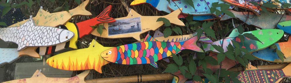
Music to lighten the heart.
We are on the train back to Bangor.
“I’m absolutely shocked”, says the First Mate.
“At what?”, I say, trying hard to think of any misdemeanour over the last 24 hours that I might have committed. Only eating the last slice of cheese comes to mind.
“At the way the two communities are still divided, even after twenty years”, she continues. “Imagine having to keep a wall between them in this day and age.”
The woman sitting opposite us leans over. “Ah, don’t be too hard on them”, she says. “Underneath, the people of Northern Ireland have hearts of gold. They’d drop everything and go and help one of the other side if they were in trouble. Once the problem is solved, they then go back to fighting each other.”
There’s some sort of logic there, if you look for it and believe it. We have no idea whether she is Republican or Unionist, Catholic or Protestant, but perhaps there is hope yet.
