Ancient Norwegians, the salted-cod city, and a deserted fishing village

“Yes, I am from Kristiansund”, says Lars. “Born and bred. It’s not the most exciting city, but it’s pleasant enough. Apparently it is where the first Norwegians are supposed to have lived, at least according to the archaeological evidence. It was first named Christiansund after the Danish-Norwegian King Christian VI in 1742, but the name was changed in 1877 to Kristianssund, then to its present spelling of Kristiansund in 1889. People often confuse it with Kristiansand in southern Norway, so we usually refer to it as Kristiansund N to indicate it is the northern one. We are heading back there now.”

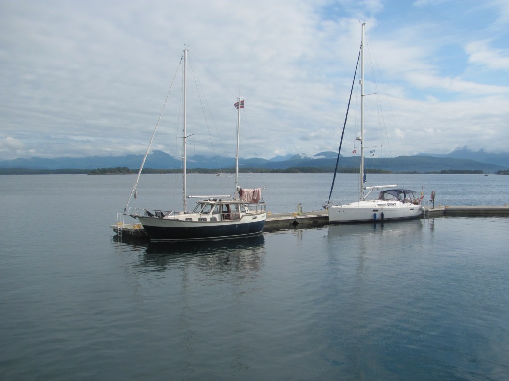
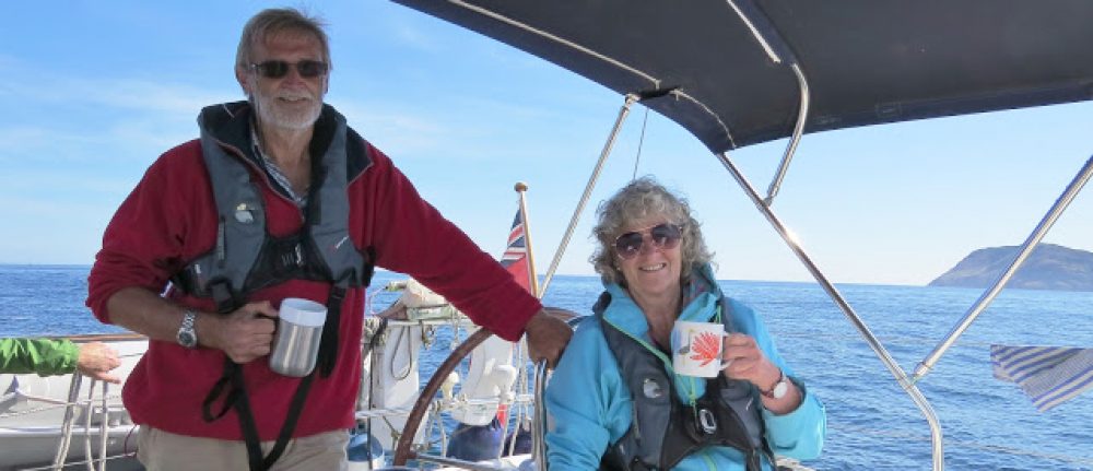
Lars is the skipper of the boat tied up next to us at Håholmen. We are chatting to him as he gets ready to leave.

“We are still debating whether to get there by the outer route or to go round the island of Averøya”, I say.

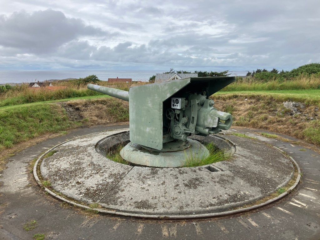
“Both are fine”, he says. “But if you go around Averøya, you’ll go under the ‘Atlantic Road’, the road that connects many of the islands between Bud and Kristiansund. We are very proud of it. Some people think that it is a work of art – its sweeping arches and graceful curves are supposed to complement the natural landscape. It’s worth seeing.”

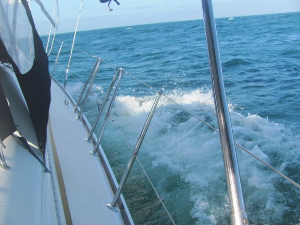
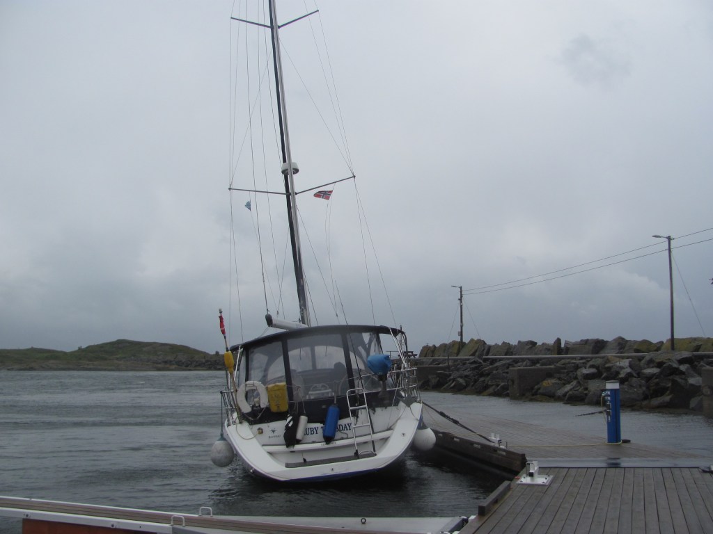
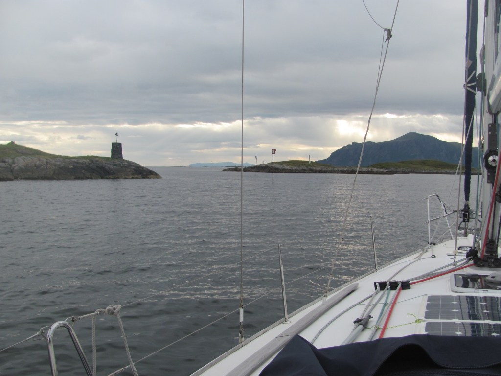
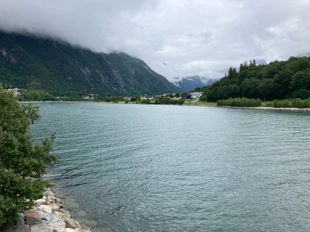
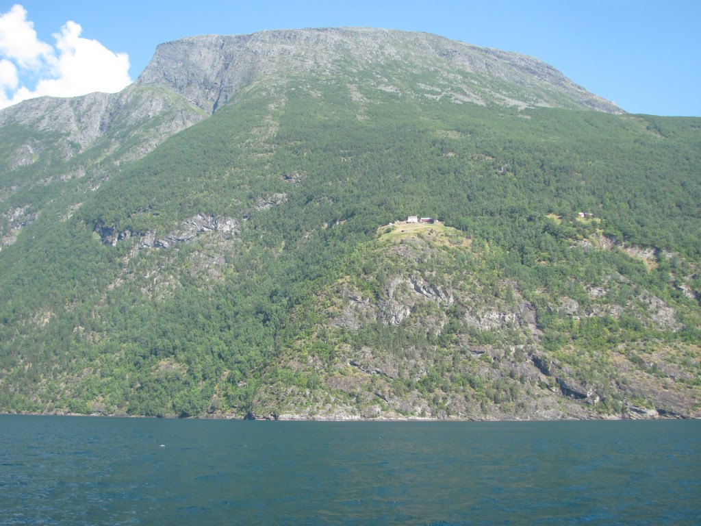
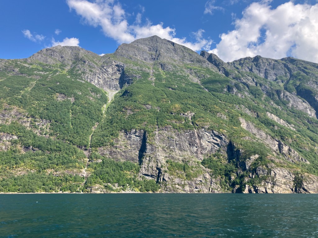
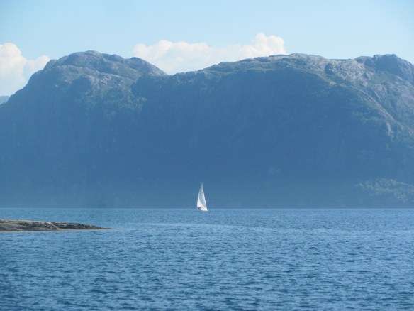
We leave a few hours after him, carefully following the perches marking the southern channel out of Håholmen. Soon we are at Storseisundet Bridge, the main bridge of the Atlantic Road. There is a strong current against us which buffets us from side to side, but we slowly make it through into Kornstadfjorden.

Approaching Storseisundet Bridge of the Atlantic Road.

There isn’t much wind, so we drift along at 2½ knots, Kornstadfjorden giving way to Kvernesfjorden, which in turn becomes Bremsnesfjorden. Soon the sun comes out, and we relax in its warmth.

Lars’ comment that the first Norwegians had lived around Kristiansund has intrigued me, and I think back to the book that I have just finished reading, Ancestral Journeys: The Peopling of Europe, by Jean Manco. In the case of Norway, the ice sheets had prevented anyone living there for thousands of years, but as the ice retreated around 12,000 years ago, two groups of hunter-gathering people had begun to move in – one group originating in south-east Asia and migrating along the northern extent of the ice across Russia, and the second migrating northwards from continental Europe through Denmark. Sure enough, they met in Norway roughly where Kristiansund is nowadays.

“I wonder if that means you can see a difference in their descendants in Kristiansund?”, asks the First Mate.

“It wasn’t really a clear cut border”, I say. “There was a lot of intermarriage, and of course people from both groups moved in both directions along the coast. But the ones in the north were the ancestors of the Saami people of today. In the south, it is more complicated, because the hunter-gatherers gave way to the Neolithic farmers around 3500 years ago bringing agriculture as they spread across Europe from the Near East, then later by the Indo-European peoples from Central Asia, who brought their language that became the basis of most of the European languages we hear today.”

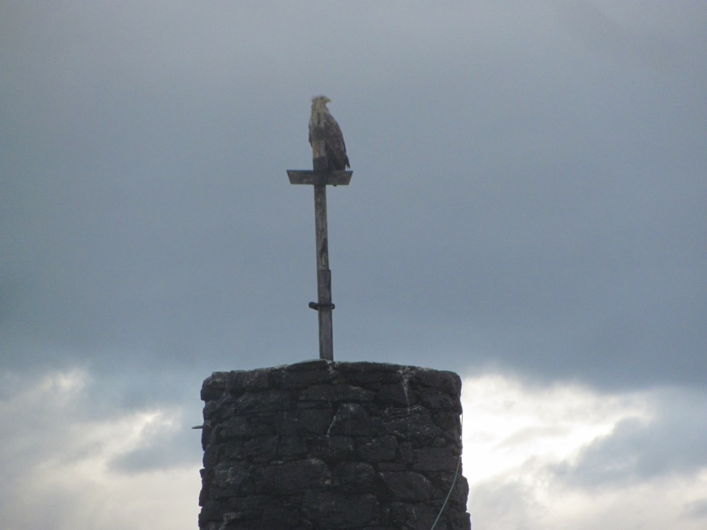
“Fascinating stuff”, says the First Mate. “So immigration has been going on for a long time, hasn’t it? Look, there’s a sea eagle in that tree.”

Wary sea-eagle.

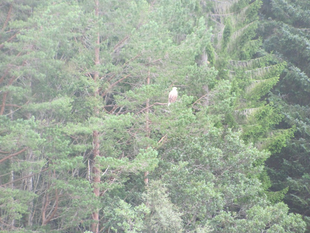
The eagle lets us take a picture of her, then flaps off languidly.

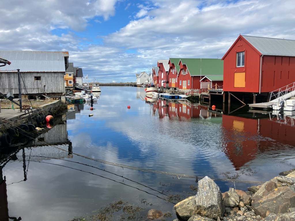
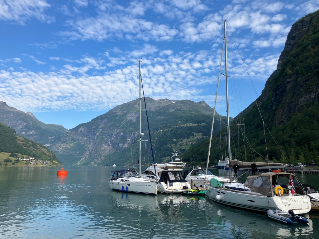
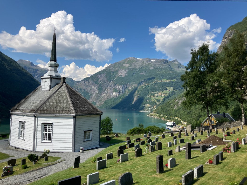
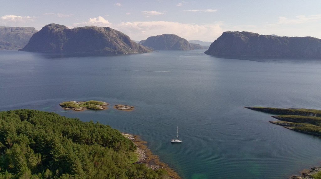
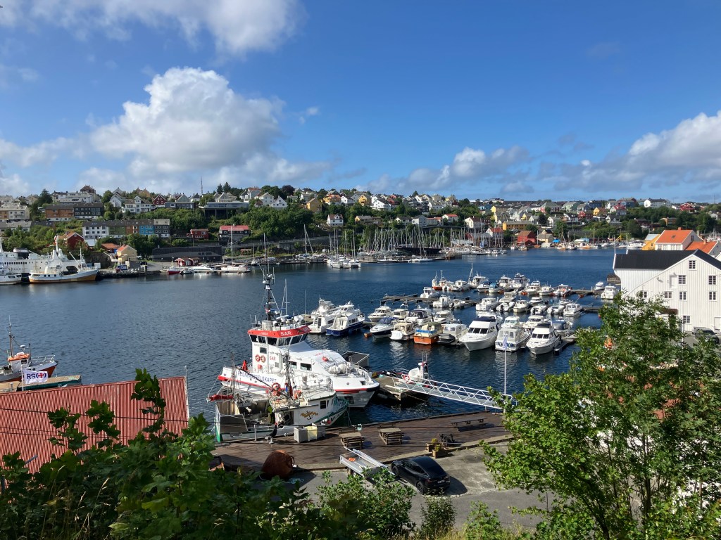
We eventually reach the Kranaskjæret Gjestehavn in Kristiansund. Lars is already there. He comes to give us a hand tying up.

“So you made it then”, he says. “Welcome to Kristiansund, the ‘salted-fish capital’ of Norway. It’s famous for its klippfish – you should visit the Klippfish Museum if you get a chance. It’s just over there, across the harbour.”

Kranaskjæret Gjestehavn, Kristiansund.

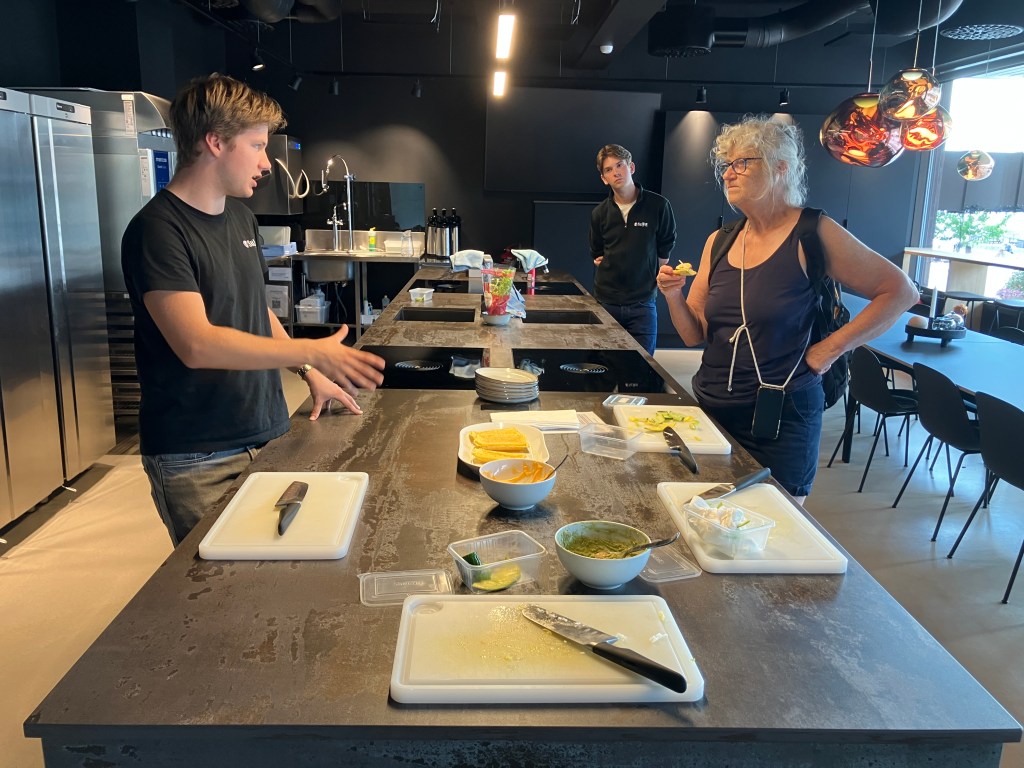
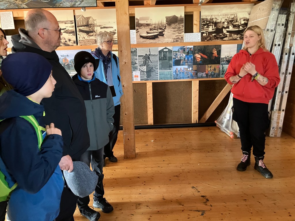
The next morning we walk around to the Klippfisk Museum.

“Hi”, says the young man behind the desk. “Welcome to the Klippfisk Museum. Would you like to have a guided tour? It’s included in the price, and you also get a free bowl of bacalao to try afterwards.”

“It sounds like a good idea”, says the First Mate. “I always think that you learn a lot from these guided tours. You can ask questions if you don’t understand things. Especially when things are in Norwegian. Where do we meet the guide?”

“I’m your guide”, the young man says. “I’ll do my best. It’s just you two. My name is Arne, by the way.”

Klippfisk is basically any white fish that is salted and then dried in the sun”, he tells us. “Traditionally, they were laid out on rocks, hence the name klippfisk. Klipp translates as ‘cliff’ in Norwegian. Most of the time the fish used is cod, but it can also be pollack, saithe, or ling. Once it is dried, it will keep for several years.”

Klippfisk.

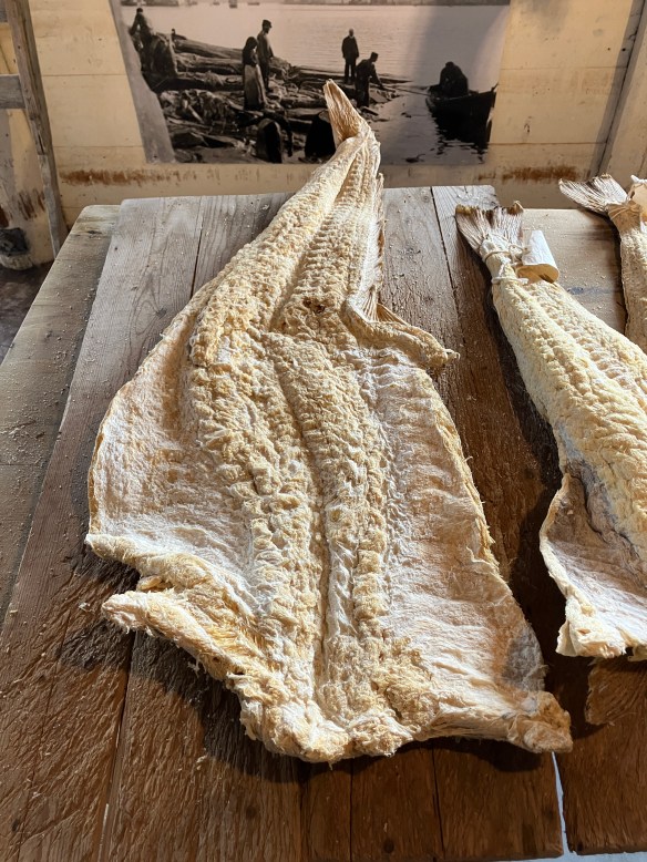
“The technique was developed in Spain, and was introduced to Norway in the late 1600s by Dutch merchants”, he continues. “Later the Scots also got in on the act – indeed, this very building we are standing in was built by a William Gordon from Cullen in 1749. He settled here and became fabulously wealthy buying and selling klippfisk. When he died, he left his wife and daughter £42 million, an absolute fortune in those days.”

“And not too bad these days either”, says the First Mate. “I think I need a new fishing rod. I’ve only caught one fish on this trip!”

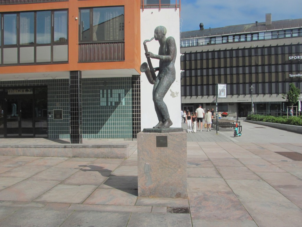
“Good luck with that!”, laughs Arne. “But we shouldn’t forget the workers. Most of the hard work of salting and drying the fish was done by women – there is a statue honouring one of the Klippfiskkjerringa, or fish women, in the harbour. You should look out for it.”

A Klippfiskkjerringa, or fish woman (the one on the right).

“Was klippfisk all eaten here in Norway, or was it exported?”, I ask.

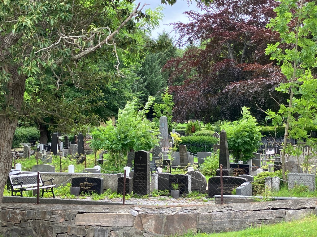
“It was exported all over the world, but the main markets were, and still are, Portugal, Spain, Brazil and Philippines. They are Catholic countries, and fish was an acceptable substitute for meat during Lent. Ships used to take the klippfisk to the Iberian Peninsula on the way out and fill their holds with soil for ballast on the way back. It was then emptied to make room for the next load. They say that most of the soil in the Kristiansund cemetery is Spanish soil.”

“A small part of Norway that will be forever Spain” (with apologies to Rupert Brooke).

“How do you cook it?”, asks the First Mate. “It looks too dry and hard to eat it as it is.”

“Absolutely”, says Arne. “You need to rehydrate it by soaking it in water for a couple of days, replacing the water two to three times a day. That softens it and makes it much less salty. The classic Norwegian dish is boiled klippfisk with creamed peas and potatoes topped with a light cream sauce. However, another dish is bacalao, developed in Portugal, which is made by frying onions, garlic, and peppers in olive oil, adding tomatoes, sliced potatoes, olives, seasoning it with bay leaves, chilli and pepper, then pouring it over layers of the fish and simmering it until it is flaky and the potatoes are done. That’s also very popular here in Norway.”

Bacalao.

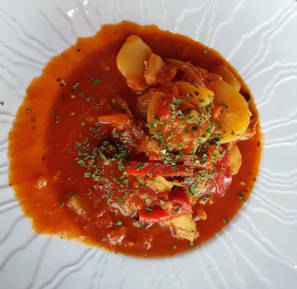
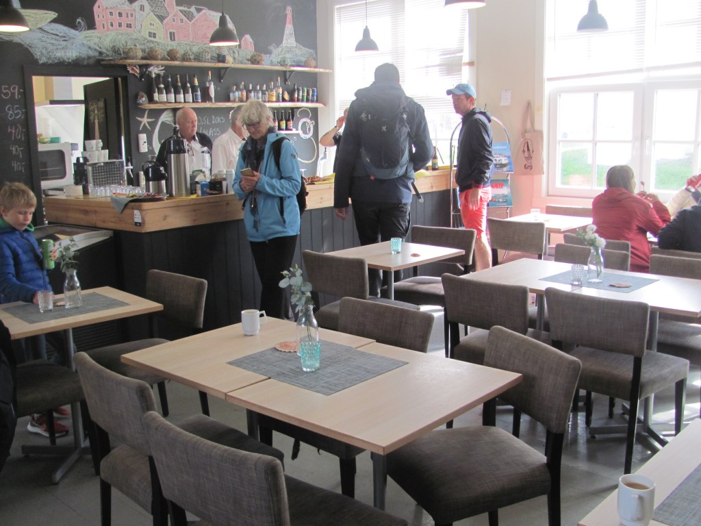
After the tour is over, we sit in the café and taste the small bowls of bacalao that he gives us.

“I read somewhere that the Portuguese have developed it much more since then”, says the First Mate in between spoonfuls. “By adding lots more ingredients, such as eggs, cream, or chickpeas, and either grilling, frying, or baking it, and using different spices, such as coriander or parsley. So much so that they are said to have 365 different varieties – one for every day of the year!”

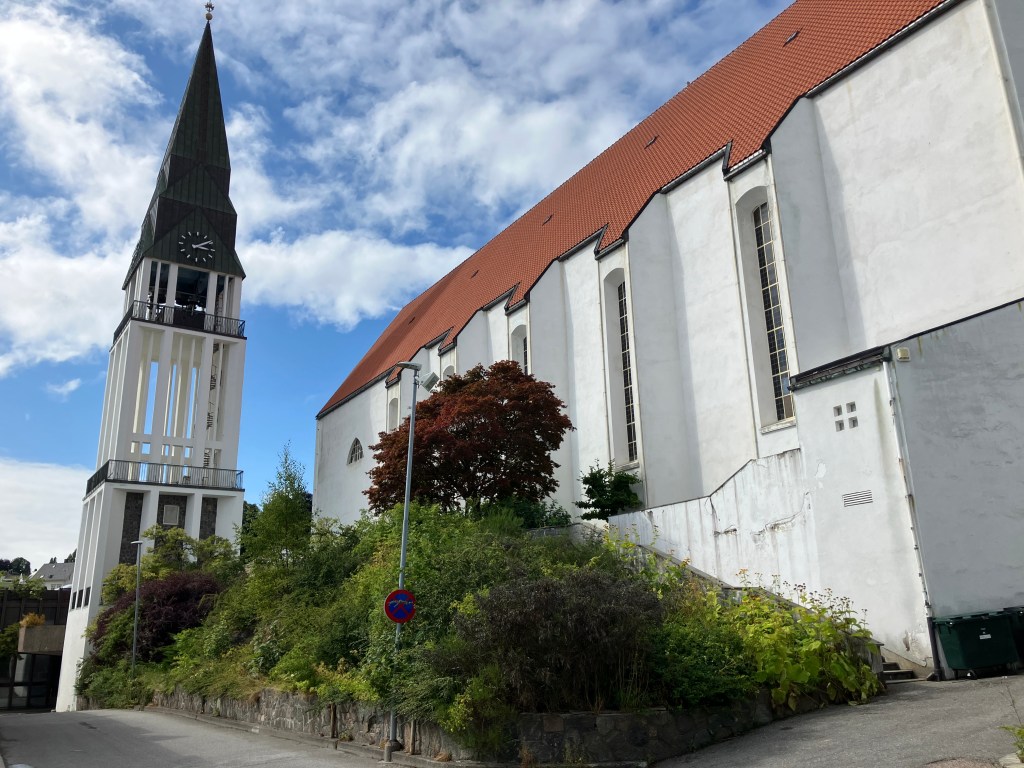
In the afternoon, we decide to walk up to the Varden viewpoint overlooking the city. On the way, we pass a impressive looking modern building.

“It looks like a block of flats”, I say. “I wonder who lives there?”

Block of flats?

“It’s supposed to be a church”, says the First Mate, consulting the guide book. “Built in 1964 after its predecessor was destroyed by bombing in WW2. The most modern and daring one in the whole of Norway. Apparently it is worth having a look inside.”

Inside Kirkelandet Church.

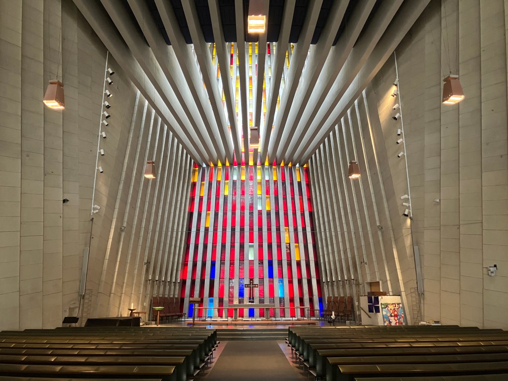
“The theme is called ‘Rock Crystals in Roses’”, she whispers, once we are inside. “There are 320 coloured glass windows, and when the light strikes them, there is a burst of colours. The dark blue ones at the bottom represent man’s sinfulness, while the red, orange and white ones as you go up represent the process of enlightenment.”

Whether you believe the symbolism or not, it is certainly impressive. The ceiling beams and the side columns all contribute to the airiness and focusing of one’s attention on the chancel at the front.

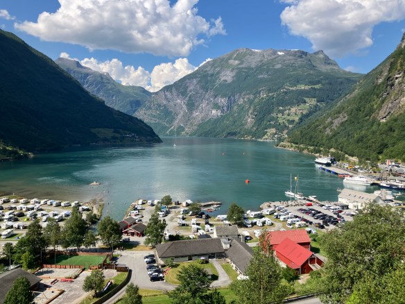
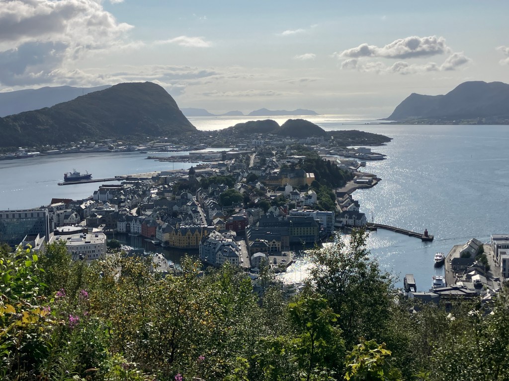
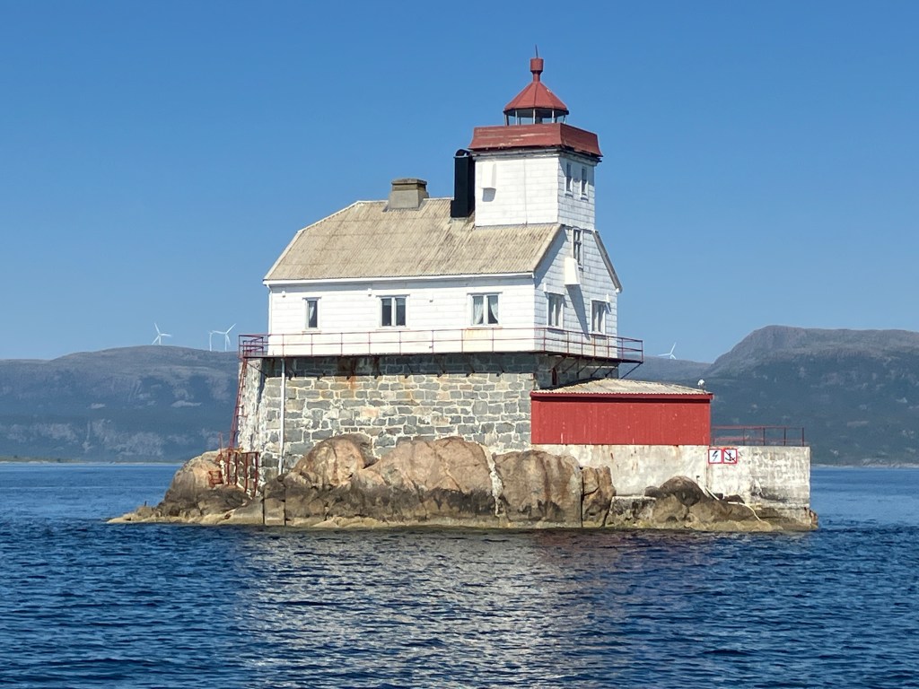
We eventually reach the lookout tower at the top of the hill. Entry is free. A woman opens the door at the bottom for us.

Varden watch tower.

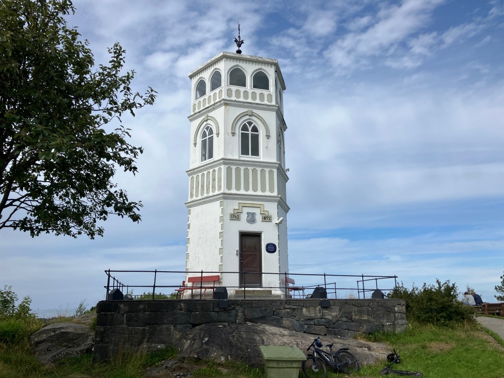
“It was originally built as a watch tower to see ships coming to Kristiansund during the Napoleonic Wars”, she tells us. “Later it was the base station for an optical telegraph between Kristiansund and Trondheim. Be careful not to slip on the stairs. They are quite steep.”

The view from the top out over the city is magnificent. The walls between the arched windows are painted to give a panorama.

View over Kristiansund from the top of Varden watch tower.

In the morning, we walk down to the waterfront to catch the Gripruta, the ferry across to the island of Grip.

“It’s definitely worth seeing”, Andy had told us. “But there is no room in the tiny harbour for a sailing boat to tie up. You are best to take the ferry across.”

We had tried to book places on it yesterday, but the sea had been too rough and the ferry service had been cancelled. Today, however, it is running.

On our way to Grip island.

The trip takes about forty minutes each way. We are surprised by the number of people boarding, and surmise that some of them must be ones like ourselves who would have gone the day before but couldn’t. When we arrive at island, we are organised by a young woman who was on the ferry, whom we had thought was one of the passengers.

Hanna tells us about the history of Grip.

“My name is Hanna”, she tells us. “I am your guide today. My grandmother used to live on the island, and I can remember visiting her here when I was a child. So I have a personal connection with it. Nowadays it doesn’t have a permanent population, but most of the cottages are owned by former residents or their descendants.”

Cottages and harbour on Grip island.

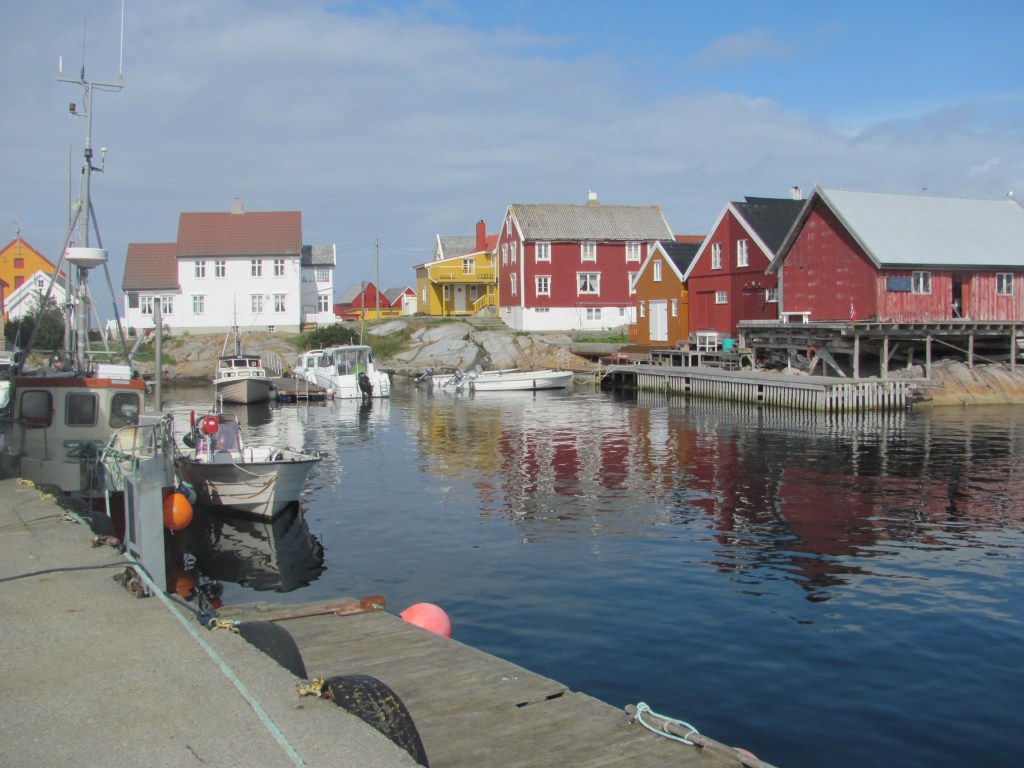
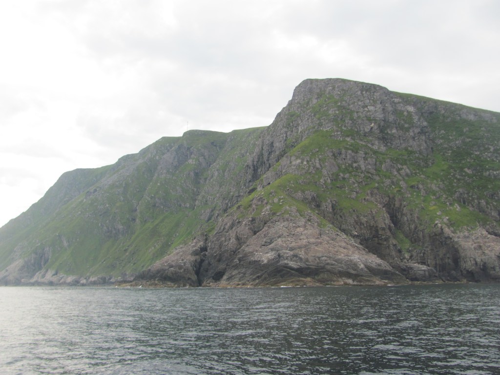
“The island has been an important fishing community since around 900 AD. It became quite wealthy through exporting fish during Hanseatic times, and although the population did fluctuate due to the vagaries of fishing it probably always had a permanent population of around 200-300 people. But this could swell to 2000 people during the summer when fishermen would base themselves here rather that Kristiansund to be closer to where the fish were. However, the population eventually dwindled, and the last permanent residents left in 1974.”

Grip island.

“How did the island get its name?”, someone asks.

“Good question”, answers Hanna. “No-one really knows for sure, but one theory is that it came from the Old Norse word Gripar, meaning ‘to catch’, possibly referring to the fishing activities.”

“Does anyone own it?”, asks another person.

“Well, the first owner was the Archbishop of Norway”, she answers. “But in the 1500s, the King Christian III of Denmark seized it along with much other property of the Catholic church. It remained crown property until it was bought by a merchant called Hans Horneman in the early 1700s. Unfortunately this also gave him the fishing rights round about, and the fishermen had to sell him their catches at prices that he determined. They were more-or-less his vassals. These days it is owned and administered by the local municipality. Now if you just walk this way, we can see the church.”

Grip church on the highest point (10 m) of the island.

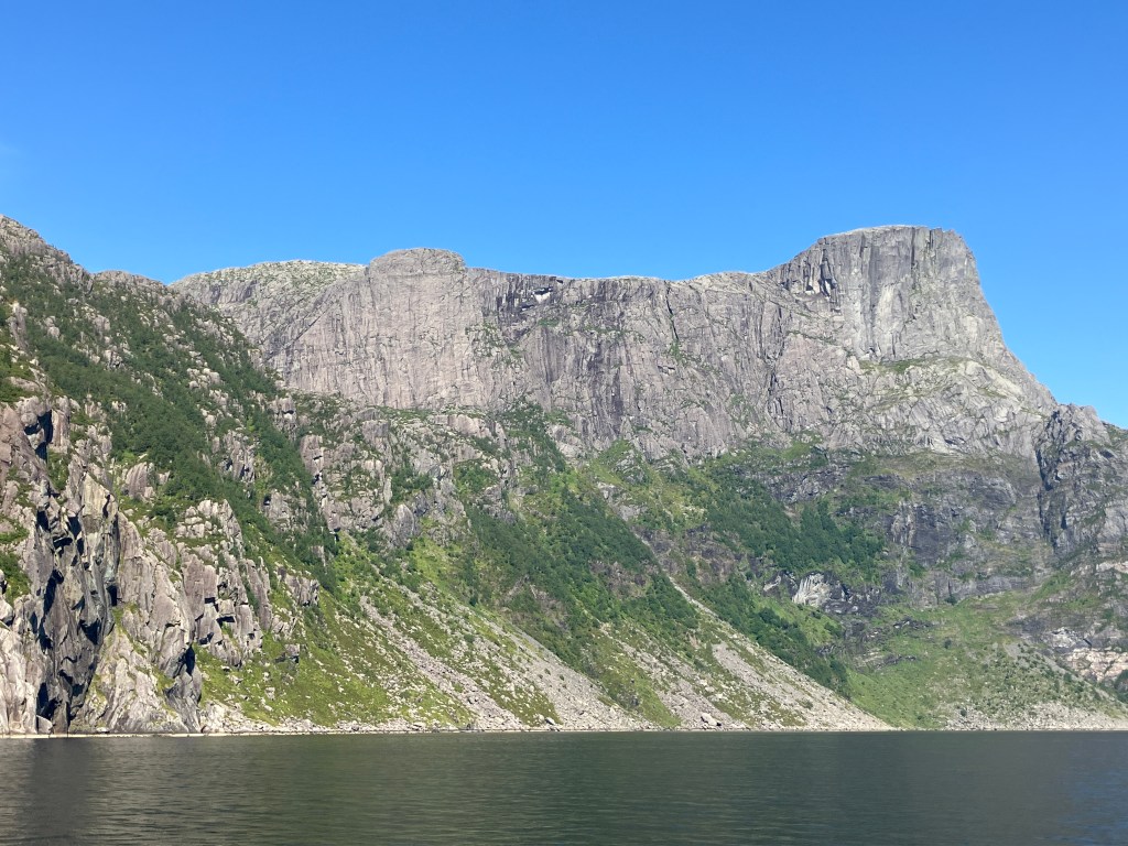
“The church was built around 1470 AD on the highest part of the island, an impressive 10 m above sea level”, she continues. “The idea was that any violent storm wouldn’t reach it. It seems to have worked – there have been some very severe storms over the years, often destroying several houses, but the church has remained standing.”

Paintings on the walls of the stave church.

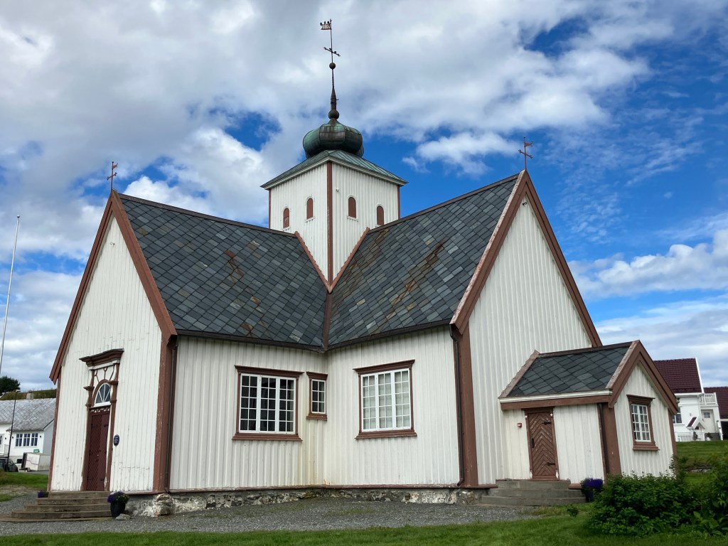
The church is one of the stave churches that we had become familiar with by now, with the added distinction of being one of the youngest of such churches in Norway. At the front is the altar and a triptych.

The triptych in Grip church.

“The story is that the triptych was made in the Netherlands, but was given by a Princess Isabella of Austria”, Hanna tells us. “She was only 14, but was on her way to marry the King, accompanied by the Archbishop of Norway. The ship she was on encountered a severe storm and nearly sank. However, it did survive, which Isabella put down to the Archbishop being on board, so she gave the paintings to the Norwegian Church by way of thanks.”

We move on to the power station and fire station of the island.

“The island’s electricity comes from two diesel generators that run from 0700 in the morning to 2300 at night”, she tells us. “And the fire station has the world’s smallest fire engine.”

The fire station (left) and the power station (right).

“And over there is the Old Schoolhouse”, she continues. “Inside, you can still see the platform where the schoolteacher would stand. Nowadays, the building has been converted into a bar and café, and you can post letters there. Coffee, tea and snacks are also available.”

Old Schoolhouse on Grip (the one in blue).
Inside the Old Schoolhouse.

“It’s certainly all very picturesque”, says the First Mate as we carry our cups of coffee out and sit in the warm sunshine. “But I am not sure that I would like to have been brought up here. It’s a bit too cut off from the rest of the world.”

“If you had been brought up here, you wouldn’t have known anything else”, I say. “You’d probably be quite happy.”

Back to the bustle of modern life.

Surviving Storm Floris, a notorious passage, and the Last Viking

“I think we should press on”, says the First Mate over breakfast. “Storm Floris is coming from the south-west in a couple of days, and we don’t want to be caught out. As nice as Molde is, it is rather exposed to the southwest and there’s not much protection in the harbour.”

She has a point. Storm Floris is approaching the UK and gusts of up to 90 miles per hour are being talked about. It’s only a matter of time before it reaches Norway. We really don’t want to be sailing in that.

“We can get to Bud today”, I say. “And then try and get around the Hustadvika before it comes. We could then shelter in the tiny island of Håholmen. Alternatively, we could stay in Bud itself – I’ve heard that it is quite well-protected.”

The Hustadvika is another of the officially designated ‘exposed or dangerous areas’ in Norway, and consists of a cluster of rocks, skerries, and small islands open to the vagaries of the Atlantic Ocean. Like the Statt and Godø, a benign weather window needs to be found to traverse it safely. Storm Floris doesn’t sound like it would be one of those.

Leaving Molde.

We set off. Once we are round the Julneset point and into Julsundet, we catch the wind from the southwest, and have an exhilarating sail past the islands of Otrøya and Gossa right up to Bud. We have had a month of glorious sunshine, and while we wouldn’t have wanted to see the fjords in any other way except that, it had meant that there was very little wind for sailing. It is great to be able to stretch our wings again.

Sailing again.

When we arrive in Bud, there is another British boat tied up to the landing. It turns out to be a father and daughter.

Tied up in Bud harbour.

“We’ve been up to the Lofoten Islands”, the daughter tell us. “Now we are on our way back again. We need to get the boat back to the west of Scotland where we keep it, but I have leave my Dad to do it on his own from Ålesund as I need to be back to work next week. I’m a vet.”

“I’m used to sailing by myself”, says the father, anticipating the question from the looks on our faces. “So it’s not a big deal, although I will miss her company. She’s a good sailor. But this Storm Floris coming is going to delay things a bit. I’d be sailing right into it.”

We spend the next day exploring Bud. It’s a small picturesque fishing village with a supermarket, café, church, and museum. It’s claim to fame is that it was where the last independent Norwegian Privy Council met to vote in 1533 to secede from the Kalmar Union with Denmark and Sweden, and to become an independent country and reject the adoption of Lutheranism as the national religion. Unfortunately that didn’t end well, and Norway ended up in being a province of Denmark for nearly 300 years.

Bud harbour.

“It’s amazing to think that if they had succeeded in seceding, Norway would still be a Catholic country today”, says the First Mate. “And not Lutheran like the other Scandinavian countries.”

Bud church.

We come to the coastal walk north of village. The sun is shining, there’s no wind, and it’s hot. We climb one of the rock outcrops and look out over the Hustadvika, the route we will be taking northwards.

Looking out over the Hustadvika from Bud coastal walk.

“It’s so calm and peaceful now”, says the First Mate, wiping her brow. “It’s hard to believe that a violent storm is on its way.”

In a sense, we could have set off this morning, but we had heard from some other sailors we are in touch with that our intended destination, Håholmen, is low-lying and quite exposed, so we had decided that discretion is the better part of valour, and that we would sit out the storm in Bud instead.

The peace and quiet is suddenly shattered by a frenzied cacophony of seagull cries up ahead. Several seem to be harrying another large bird, swooping and diving at it from all angles.

“It’s a sea-eagle”, I say. “They are warning it to stay away. Perhaps it lives near here, out on the skerries.”

We end up on top of the small hill overlooking the town where German troops built gun emplacements as part of a series of fortifications called the Atlantic Wall to resist an Allied invasion. As it turned out it was never used in action, and may have even contributed to Germany’s defeat by diverting troops for its operation away from mainland Europe.

WW2 fortifications.

The storm is forecast to reach us sometime in the night. We have been keenly following the havoc that it is causing in Scotland, knowing that we would be in for something similar. Already there are some preliminary strong gusts. I double up on the mooring ropes just in case one breaks or works itself loose.

Storm Floris on its way.

“I’ll put some rubber snubbers on as well”, I say. “That’ll stop sudden jerks stressing out the ropes. You can batten down the hatches.”

“I don’t think we have got any battens”, says the First Mate.

“I didn’t mean it literally”, I say. “I just meant to make sure all the windows and skylights are shut. It’s nautical-speak.”

Storm Floris.

As predicted, Storm Floris hits us in the early morning. I am awoken by the sound of the halyards whipping against the mast and the boat listing alarmingly to port as the winds howl over the harbour breakwater and catch the top of the mast. Luckily the breakwater protects the hull from the worst of the force, although from time to time, plumes of spray come hurtling over it, drenching the boat and joining the rivulets of rain already coursing down the canopy tent.

Ruby Tuesday listing from the wind.

We eat breakfast huddled in the cabin, listening to the wind whistling through the rigging. Outside we see a seagull struggling to fly against the wind, making no progress at all, giving up, and going with the flow. I check the windspeed to find that it is up to 42 knots. That’s a Force 9 gale. And that’s in the harbour – what is it like out at sea?

Windspeed up to 42 knots!

In the afternoon, I notice that I have forgotten to take down the courtesy flags and that they are starting to work their way loose. When there is a lull, I clamber out onto the fore-deck and manage to retrieve two of them, but the Scottish one has somehow managed to get itself stuck on the port spreader. Without climbing up, there is nothing I can do except pray that it will somehow hang on.

It doesn’t. Two hours later it is gone. I have a quick scan around the harbour on the off-chance that it might still be floating on the water or have blown onto a jetty, but nothing.

After two days of incessant lashing, the storm dies down. We consult the BarentsWatch website and calculate that the sea should have calmed down enough the next morning for us to attempt the Hustadvika. We have decided to do the inner passage through the rocks and skerries, the so-called Stoplane route, which although requiring greater care in navigating our way through narrow gaps, is more protected from the Atlantic swell.

We awake early and cast off. There is still some residual swell left over from the storm, but it is not rough. We wend our way through the twisting route, making sure that we approach each marker pole on the correct side. Jagged rocks pass only metres away from our hull. We eventually reach the narrowest part, between the two Stoplane islands that give their name to the passage, where the marked channel is only two boat-widths wide.

Navigating through the Hustagvika inner route.

Eira looks at the boat approaching. It is the same one that she had seen a few days earlier on her visit to Romsdalfjord, and again when the seagulls had harassed her.

I know who you are, she thinks. I have seen you before. But you are in my world now. Your kind may have driven us out from the land you have colonised in Romsdal, but this is our domain. Yet still your minds are set on bending nature to your will, of claiming the seas as your own. You say that we have no right to your livestock, why then do you assume you have rights to our fish? Have you forgotten that once there was enough for all; now your numbers and your machines take almost everything and leave little for the rest of us? But we are all part of nature, you are not set to rule over us. If you can’t or won’t learn that, the Doom will return; but this time it will be for us both.

White-tailed sea-eagle.

“Look, there are two sea-eagles on that pole”, exclaims the First Mate, pointing to one of the markers. “One’s just flown off.”

“They are beautiful creatures”, I say, trying to take a photo at the same time as I attempt to manoeuvre the boat through the narrow gap . “Especially when they fly. So big. I wonder what she is thinking about?”

“Deep philosophical thoughts, I am sure”, she answers.

Our route through the Hustadvika.

Eventually we reach Håholmen and find a berth at the small harbour.

The island of Håholmen.

Several people are milling about as though they are waiting for something.

“The boat back to the mainland is coming soon”, explains a neighbour. “A lot of people come over for the day, have a walk around the island, something to eat and drink, then go back in the evening.”

“Unfortunately, the restaurant is fully booked for tonight”, the receptionist at the hotel tells us. “It’s very popular. You need to book well in advance. But there’s a couple of videos you might be interested in in the small museum at the back. One’s of the history of the island, and the other is of the things that the previous owner, Ragnar Thorseth, got up to. If you want to see them, let me know and I can switch them on for you.”

We decide to have a cup of tea and then see the videos. On the way back to the boat, we meet another British couple.

“We’re sailors too”, says the woman. “But our boat is in Greece. We’re on a car tour through Norway, as it is too hot to be in the Mediterranean at the moment. We’re staying at the hotel. The food here is great – we ate at the restaurant last night. But we have decided not to go tonight, so you could have our table if you like. I’ll talk to Reception.”

A stroke of luck! We had heard good reports of the restaurant, and had been keen to try it. Soon we are booked in for the 6pm sitting.

We find our way to the small museum at the back. The receptionist turns on the video projector.

“Håholmen was founded in the 1700s and soon become a hub for fishermen and traders”, the first film tells us. “Around 1900, it was purchased by a Bård Bergseth, who lived here with his family, and maintained the fishing industry. In the 1990s, it was taken over by his grandson, Ragnar Thorseth, who turned it into a hotel and conference centre.”

Ragnar Thorseth is a larger-than-life Norwegian adventurer, not all that dissimilar to his more well-known countryman, Thor Heyerdahl, we learn from the second film. In the 1960s, he had rowed single-handed from Norway to Shetland in an open rowing boat. Later, in the 1980s, he had built a replica Viking trading ship, the Saga Siglar, and had sailed around the world in her. He also managed to pack in a trip by boat through the Northwest Passage, an overland trip to the North Pole, and overwintering on Svalbard with his family. His exploits earned him the name of ‘The Last Viking’ in Norway.

Ragnar Thorseth rowing from Norway to Shetland.

“He still keeps coming to the island from time to time, even though it is now owned by Classic Norway Hotels”, the receptionist says as she comes to turn off the projector. “He lives on another island a bit further south from here. In fact he was here just a couple of weeks ago. In his Viking replica ship. He’s quite an amazing character.”

Remains of the Saga Siglar.

At 1800, we find ourselves at the restaurant. Knowing the history of the island, how could we have anything but fish? The First Mate goes for the monkfish; I decide to have the klippfish.

“Klippfish is a white fish, usually cod, that has been split, salted and then left to dry in the sun”, the waiter explains. “It is a traditional dish in this area. I can guarantee you will like it.”

He’s right. It’s delicious, with potatoes, minted green pea purée, cured pork belly bacon, and beurre blanc sauce, all rounded off with almond cake for dessert.

“I’m not sure that I am going to make it back to the boat”, says the First Mate. “I think I have eaten too much.”

“I’ll see if I can find a trolley”, I say.

A rock concert, a town of roses, and a new song

“There’s a rock concert on for the next three days”, says the captain of the boat tied up in front of us. “Rauma Rock. It’ll be really loud. We were here last night, and we could hardly hear ourselves think until about four in the morning. But the music was good. There will be even more boats coming tonight. It will be packed.”

Andalsnes harbour.

We are in the tiny harbour of Andalsnes near the top of Romsdalfjord. There had been no berths free when we had arrived, and we had rafted up to another small yacht while we decided what to do. It was then that we had noticed that a large stage had been constructed on the quayside, with the twanging of guitar strings warming up emanating from it.

Rauma Rock warming up.

“I don’t really want to be kept awake all night”, says the First Mate. “I am at that age where I need my sleep. But it would be somehow nice to hear some of the music.”

“Me too”, I say. “My hearing is bad enough as it is with old age, without finishing it off completely. Why don’t we go and anchor a little bit further up, where can still hear the music, but it isn’t quite so loud? And we wouldn’t have to pay either!”

The last sentence is the clincher.

“Good idea!”, she says. “But let’s have a quick look at the town first to see what it is like.”

The First Mate explores the town centre, while I take a walk down to the Rauma river running through it.

Town Hall, Andalsnes.
Rauma River in Andalsnes.

“Well, the town was pretty average”, she says, when we meet again. “I didn’t find it very inspiring.”

Later we motor a little further along the shoreline of the fjord and drop the anchor.

“Perfect!”, says the First Mate as we sit on deck with our glasses of wine watching the gondolas taking their passengers to the top of Mount Nesaksla, and listening to Rauma Rock getting underway. “That’s much more enjoyable.”

Listening to Rauma Rock from a distance.

“Andalsnes was one of the places that my great-great-grandfather visited”, I say. “Or at least Veblungsnes, which was the main settlement in those days. Since then, Andalsnes grew to be a town, while Veblungsnes remained a village. The Rauma river divides the two. In his letters he talks about the striking wonders of the Rauma river, but he says that he doesn’t have time to describe them.”

“The guide book says that the Rauma is famous for its salmon fishing, the emerald-turquoise colour of its water, its towering mountains, deep gorges, and sheer cliffs, and its waterfalls at Vermafossen and Slettafossen”, says the First Mate. “It was the inspiration for scores of Romantic artists, writers and explorers.”

“It would be nice to go and see it”, I say. “But we’ll never get in to the harbour now with all the boats that have been arriving.”

“We’ll have to come back another time”, says the First Mate.

In the morning we set off back along the Romsdalfjord. I keep a sharp eye out for sea-eagles.

Scanning the cliffs for sea-eagles.

Far above, wheeling on the updraft from the cliffs, Eira looks down on the waters of the Romsdalfjorden. She doesn’t come here often these days, instead spending most of her time with the other sea-eagles on the islands and skerries at the mouth of the fjord where the fish are plentiful. But from time to time she likes to revisit her birthplace and recall the stories that her father Clew and her mother Aran used to tell of Cuillin, the last of the great sea-eagles of Skye, who had flown alone from there to Romsdal to save her kind. And of her daughter Mourne who had returned to Skye with her motley collection of vagrants to repopulate those islands.

Out of the corner of her eye, she sees a boat heading for the tip of Okseneset and the shapes of two humans. They won’t be able to see her, she is too high and against the sun. She does not fear them in the same way that her parents had done – the Doom that she had heard in the old stories had passed now and there seemed to be a new understanding between her kind and the humans.

And yet, from time to time there was a niggling feeling in the back of her mind that the Doom had not gone completely. To be sure, few of the Romsdal eagles died these days by being shot or poisoned, but she had heard that there were increasing numbers flying into the high towers with rotating blades that had appeared in Møre og Romsdal. And then there was the rumour that was going around the Pairs that the eggs being laid were hatching earlier in the year, there seemed to be more rain than she remembered in her younger days, and the weather appeared to fluctuate more between extremes. But surely humans couldn’t be blamed for that, could they? Clever as they seemed to be, they were just too small and insignificant to be able to change the forces of Mother Nature herself, the might of the winds and rain sweeping in from the Atlantic, the strength of the sun’s light bringing warmth and life to the earth. Surely only Haførn, the mother of them all, had the power to do that …?

As she circles, she sees another sea-eagle gliding over the island of Sekken. She recognises from his flight that it is Arvid, her mate. She dips her great wings and flies to meet him, the humans in their small boat disappearing from her view.

Sea-eagle.

“Are you day-dreaming again?”, the dulcet tones of the First Mate interrupt my reverie.

“I was hoping to see a sea-eagle”, I say. “I was just thinking of the book I re-read over the winter – The Stonor Eagles by William Horwood. It’s about how sea-eagles went extinct in Scotland in the 1930s through the farmers shooting them to stop their sheep from being attacked, and how they were reintroduced in the 1970s from Norway. Romsdal was one of the areas that they brought them from. I read somewhere that you do see them here.”

“I imagine that there would be more down towards the ocean”, says the First Mate. “That’s where the fish are, after all.”

We arrive at the town of Molde on the northern shores of Moldefjord, and head for the small municipal marina. It’s sweltering. A woman in a tank top and shorts helps us tie up.

“That’s my boat just in front of you”, she tells us. “I live on it throughout the summer and then go back to my apartment for the winter. It’s kind of like a summer cottage, but on the water. I don’t sail far – there are enough beautiful places to visit around here.”

Tied up in Molde town marina.

After a cup of tea, we decide to explore the town centre.

“It’s a pity we weren’t here a couple of weeks ago”, says the First Mate. “We could have gone to the Jazz Festival. They have one every year.”

Molde is well-known for its Jazz Festival.

“Look, here’s the Salmon Centre”, I say, pointing to a building in the town square. “We should go and have a look at it.”

“It’s free entry”, says the girl at the reception. “And that includes a free sample of raw salmon, which you can use to make your own snack with taco shells and various dips.”

For the next little while we are absorbed in creating our own culinary delights, learning about the life cycle of the salmon from ‘roe to plate’, how the cages are made and installed, and how it is becoming more sustainable, including ways to prevent farmed salmon escaping to mate with wild salmon and weakening their gene pool.

Learning how to create our own salmon delicacy.

“That was fascinating”, I say, as we emerge. “I now know more about salmon than I ever thought I would.”

“Yes, it was”, says the First Mate. “Come on, let’s have a coffee and cake. Look, there’s a nice looking place over there. We can sit outside. You grab a table, and I’ll go and choose the cake and order.”

“Earl Grey tea for me, please”, I say.

“A nice little watering place.”

“Well, this is a nice little watering place”, says the minister to his companion as they sit down. “I enjoyed the walk around the town this morning. Such lovely weather. And what a nice smell from all the flowers they grow.”

“Molde is famous for that”, responds Mr Fairlie. “Especially the roses. Their fragrance is everywhere.”

Molde roses.

“I had a look at the new church”, says the minister. “Apparently the old one burnt down four years ago, and they just finished building a new one last year. I must confess that I like the look of the old wooden one I saw in pictures better than the new one. All red-brick now.”

“I suppose it will be more fire-proof, at least”, says Mr Fairlie. “That’s always the problem with wooden buildings in this part of the world. It’s only a matter of time before they get burnt down.”

Molde’s present day Domkirke (successor to the redbrick one!).

“And I have to say that I was impressed at the beautiful resting place of the departed here”, continues the minister. “With its small mounds of earth crowned with the loveliest flowers. The graves are tended with the fondest care and mothers come and sit by their loved ones’ dust for hours, with a book in hand or plying the needle, engaged on some piece of useful or fancy-work.”

Molde cemetery.

“Here we are”, says the First Mate, bringing a tray with the coffee, tea and a cheesecake. “What a nice spot. We can sit and watch the boats coming and going. But why are you putting in pictures of the cemetery? That’s a bit macabre.”

“My great-great-grandfather went to see it”, I say. “I thought I should too. He seemed to like that sort of thing.”

“You seem to be enjoying this cruise, at least?”, says Mr Fairlie.

“Immensely, but I have to admit I never feel relaxed on a boat”, says the minister. “Ever since I lost my younger brother Andrew at sea.”

“I didn’t know you had a younger brother”, says Mr Fairlie. “What happened?”

“He was on his way out to New Zealand”, replies the minister. “Another brother of ours, James, was already out there farming near Dunedin, and Andrew was intending to join him. He was a minister like myself, and had been in Canada but had fallen out with some of his superiors there. I don’t know what about. He always liked his drink and was a bit of a hothead, so maybe it was something to do with that.”

“So he was looking for a fresh start in New Zealand?”, asks Mr Fairlie.

“Yes, that sort of thing”, says the minister. “He was on board a ship called the Burmah sailing from London to Lyttelton. It seems it might have been overloaded, as in addition to the passengers, it was carrying a consignment of high-class horses and cattle. But it never arrived in Lyttelton. Another ship fourteen days out from New Zealand reported passing it in the Southern Ocean, and also that they had seen icebergs in the area at the time. So we are guessing that the Burmah must have hit an iceberg and sank.”

“What a story”, says Mr Fairlie. “Your poor brother. To have all his hopes dashed when he was so close to realising them. It’s a salutary reminder of the perils of sea travel.”

“Yes”, continues his companion. “But the story doesn’t end there. One or two years later some ship’s timbers were washed up on a beach to the south of Dunedin with the letter ‘B’ written on one of them. The supposition at the time was that it was from the Burmah.”

“And it’s sad to think of your brother James already in New Zealand waiting patiently for Andrew to arrive”, says Mr Fairlie. “Looking forward to seeing a member of his family again, then the slow realisation each passing day that his brother may not be coming. But never really knowing for sure.”

“No closure”, says the First Mate, as she takes the last of the cheesecake. “As we might say today. It’s a poignant story. But I can understand how your great-great-grandfather felt about the sea. I never feel at ease with it myself.”

“Who does?”, I think to myself.

In the evening, we sit on deck and eat our dinner. Suddenly three men from one of the neighbouring boats come over.

The music makers?

“We’ve been composing songs to amuse ourselves”, one says. “We’ve made one about your boat. We wondered if you might like to hear it?”

He presses the Play button on his portable stereo. A Scottish folk song plays.

Ruby Tuesday

She was born on the Clyde where the river runs wide,
Painted red like the fire of the morning tide.
With her sails full of dreams and her heart on the sea,
Ruby Tuesday’s the name, and she’s calling to me.

From whisky shores and bagpipes’ cry,
She’s chasing sunsets, kissing the sky.

Oh
Ruby Tuesday, rolling with the waves,
From Scotland to Molde, where the fjord light plays.
We’ll sing and we’ll dance as the moon shines through,
On a deck full of laughter and a sky so blue.

The gulls sing along, and the wind hums a tune,
As we sail through the night by the light of the moon.
There’s a fiddle on board, and the stories run wild,
Of whiskey and freedom and the heart of a child.

She’s got no fear of the stormy skies,
‘Cause
Ruby’s a queen with fire in her eyes.

Oh
Ruby Tuesday, rolling with the waves,
From Scotland to Molde, where the fjord light plays.
We’ll sing and we’ll dance as the moon shines through,
On a deck full of laughter and a sky so blue.

Raise your glass to the Northern light,
We’re sailing strong through the soft midnight.
Every mile that we leave behind,
Brings us closer to peace of mind.

Oh
Ruby Tuesday, you’re my guiding star,
From Scotland to Molde, no journey’s too far.
With the wind in your sails and the sky so true,
Every song that I sing, I’ll be singing for you.

It’s brilliant. Not completely factually accurate, but who cares about details? We’re touched.

Alpine farming, behind a waterfall, and a renewed acquaintance

“According to the harbour guide, there’s supposed to be a hammerhead on the pontoon”. says the First Mate, peering through the binoculars. “But I can’t seem to see it. That would have given us plenty of room, but there seems to be just the pontoon. And it’s taken up with motor boats. We may have to raft up alongside.”

We are approaching the town of Geiranger at the top of Geirangerfjord, another UNESCO World Heritage site. We had set off in the morning from Sandshamn, and had had a pleasant sail up Storfjord then Sunnylvsfjorden, with the wind funnelling along the fjord behind us, before turning left into the short Geirangerfjord. In the distance, we see an army of campervans lining the waterfront, all with their skylights open in a vain effort to keep cool.

Approaching Geiranger.

“Yes, there was a hammerhead here last year”, says the owner of the motorboat we raft up to. “But it was destroyed by the ice over the winter and they haven’t got around to replacing it yet. But I am quite happy for you to tie up alongside. You can get to the pontoon over the swimming platform at the back here. By the way, there is a thunderstorm due shortly if you haven’t heard already.”

Rafted up in Geiranger.

We hadn’t heard. Nothing was mentioned about it in the weather reports we had received.

“They are very spontaneous”, he says. “It’s because of all the heat we’ve been having.”

Sure enough, fifteen minutes later, the wind starts to blow fiercely and the heavens open. As if choreographed, all the campervan skylights slam shut as one. We just make it into the cabin without getting wet, and watch and listen in trepidation as torrential rain falls and lightening cracks overhead. The windspeed indicator reads 33 knots.

Waiting out the thunderstorm.

“I hope our mast isn’t the tallest thing around”, says the First Mate.

“I think the buildings over there are taller than our mast”, I try and reassure her. “Hopefully, the lightening will go for them first.”

Thirty minutes later, it is all over. The sun comes out, and the skylights on the campervans open again in unison.

“Phew, that was pretty intense while it lasted”, says the First Mate.

Geiranger.

In the morning, we walk up to the Norsk Fjordsenter, where there is an exhibition on the mountain farms in the area. We had often seen these mountain farms clinging perilously to the steep cliffsides as we passed far below in the fjord, seemingly cut off from the rest of the world, with many not even visibly linked to the sea. As we had seen grass but rarely livestock, we had wondered what they actually farmed and how they transported their produce to the markets.

A mountain farm. How do they get there?

“Traditionally these mountain farms kept goats”, a panel in the exhibition tells us. “Pastures on the steep fjord sides provided grazing for them. The farmers produced brown and white goat cheeses and goat’s milk butter, all made according to traditional methods. Nowadays these farms may also keep sheep, cattle and Norwegian fjord horses.”

Mountain goats.

We taste some of the brown goat’s cheese.

“I can’t say I like it that much”, says the First Mate. “It’s a bit sweet for me.”

In one particular farm, the only route to it involved a short pitch of vertical rock that could only be passed with a ladder. The story goes that when the tax collector came to assess and collect the farm’s taxes, the farmer would pull the ladder up so that he couldn’t ascend any further, and he would have to go away empty-handed.

Tax avoidance, mountain farm style.

“I suppose the farmer thought he wasn’t getting much benefit from the state, so why should he contribute to its funding?”, says the First Mate. “There’s a certain logic to that.”

Life was precarious. Landslides and avalanches would sometimes sweep away entire farms, carrying the people with them. The worst of these was in the neighbouring Tafjord in 1934, when 2 million cubic metres of rock broke off and plunged down into the fjord below, causing a massive tsumani with waves up to 62 m in height and killing 40 people.

“Did you read that the next one they reckon will occur is at Åkerneset?”, says the First Mate. “Didn’t we pass that on the way in?”

We had indeed. A massive crack several hundred meters long and slowly widening each year threatens to collapse into Sunnylvsfjorden. Projections indicate that it could generate tsunami waves up to 70–80 meters high, drowning towns like Geiranger, Hellesylt, and Stranda within minutes. Luckily it is heavily instrumented to give warnings of its imminent collapse.

I shudder. “Perhaps we ought to get going”, I say. “I wouldn’t want to be underneath it when it goes.”

The next massive landslide?

“You can walk up to one of the former farms that overlooks Geiranger town”, the woman behind the desk tells us. “It’s more for tourists these days, and there’s a restaurant there, but it gives you a good idea of what life was like in these remote mountain farms. You can then also walk on further to the waterfall if you like. You can even go in behind the waterfall for a memorable experience.”

“There’s a plateau more than 1000 feet up the side of the mountain behind us”, says Mr Fairlie to his older companion over breakfast. “And there’s a new road up to it that they have just completed this year. If you wish, we could take a stolkejarre and driver up there and see how they farm. There’s also a good view of the fjord on the way up.”

“I should like that”, says the minister. “As much as I like sea air, I need to avail myself of fresh air from the land for a short time.”

“Well, there will be plenty of that up there”, says Mr Fairlie.

“There’s a funeral on at the church today”, the driver of the stolkejarre warns them. “We may be delayed somewhat as the mourners arrive. The road around it is narrow and there isn’t much room for vehicles to pass.”

Geiranger church.

We take the footpath up to the farm. The funeral traffic is completely blocking the road into the town, and there is a considerable tailback. We squeeze past the best we can and start climbing the stone steps up the hillside to the farm.

“Wow, that was steep”, pants the First Mate. “I am really looking forward to having an ice-cream at the restaurant.”

It’s closed. There is a sign saying that the funeral wake is being held there. The same cars that were blocking the road far below are now all crammed into the small restaurant car-park.

Luckily we have some sandwiches and water, so we find a shady spot under a tree and rest before carrying on. Behind us some mountain sheep are chewing the cud for their lunch.

Mountain sheep.

The elderly gentleman and his younger companion are already sitting there.

“We’re on a cruise around the fjords”, they tell us. “We have a day here in Geiranger, so we decided to take a side trip up here. It does one good to stretch one’s legs and to enjoy the views. It’s such a beautiful country. We are from Scotland.”

“Amazing”, I say. “That’s where we live. And we are also cruising around Norway. What a coincidence!”

We finish our lunch, say goodbye, and push on to the waterfall. It’s impressive.

The Storsæterfossen.

We clamber down the rocky path to the side and edge our way gingerly along it until we are under the waterfall. It is a surreal feeling as tons of water thunder past us every second.

Behind the Storsæterfossen.

“It’s lucky there is a guide rail to hold on to”, I say. “It’s a sheer drop down there. I wouldn’t want to fall over.”

Soon we are damp from the spray in the air.

“Come on”, says the First Mate. “Take your photos, and let’s go. I’m getting quite wet.”

There is no sign of the elderly gentleman and his companion as we retrace our footsteps back down the path.

“They have probably gone back to their ship”, I say. “The ones we had lunch with. By the way, did you notice that the elder one looked a bit like me?”

“What on earth are you talking about?”, asks the First Mate. “We had lunch with a young German couple who were touring Norway in their car. Are you losing it, or is this just your vivid imagination again?”

On the way back down again.

The next morning, we cast off and motor slowly back along the route we had followed up to Geiranger.

“Look”, shouts the First Mate from the bow as she tidies up the ropes. “There’s the Seven Sisters waterfall. But there only seem to be five at the moment. I read somewhere that the number of sisters depends on how much rain there has been.”

Seven Sisters waterfall, Geirangerfjord.

Unusually, the wind is favourable when we reach Sunnylvsfjorden, and we are able to enjoy a pleasant sail back down the fjord with the genoa only. Normally in the fjords, because of the funnelling effect, the wind always seems to be against us, no matter which direction we are heading and which wind direction has been forecast.

A boat is coming up fast in front of us.

“It’s the Hurtigruten”, I say, peering through the binoculars. “It’s going to pass us to port.”

The Hurtigruten is the iconic Norwegian coastal express service operating between Bergen and Kirkenes near the border with Russia in the far north. Not only does it act as a daily passenger and cargo service, it is also possible to take scenic cruises on it.

“You are pronouncing it wrong”, says the First Mate. “It’s ‘Hurtig-ruten’, not ‘Hurti-grutin’. It means ‘Fast Route’, just like in German.”

The Hurtigruten.

In the late afternoon, we break our journey at the delightful little anchorage of Honningdal.

“It’s such a lovely peaceful spot”, says the First Mate dreamily, as we sip our wine in the cockpit in the evening. “With stunning views of the mountains and the fjords. If only those geese over there would stop being so noisy with all their honking, we could enjoy the peace and solitude.”

“Well, I suppose they are part of nature as well”, I say.

Honningdal anchorage.

“Those sheds on the shore look like they have Boris Johnson haircuts”, I say, pointing to a cluster of boatsheds on the other side of the small inlet. “I think I might send the drone over there and get a shot of them.”

“Careful you don’t hit the power wires”, warns the First Mate.

Does Boris Johnson live here?

We eventually arrive in Ålesund. There aren’t any spare berths at the small marina, and we have to raft up to another sailing boat with a Swiss flag.

“You look familiar”, says its skipper. “I think that we have met somewhere before. And I recognise your boat’s name. Ruby Tuesday. Out boat is called Sol Vita.”

We rack our brains. He gets there first.

“It was in Hanko in Finland”, he says. “Last year. Don’t you remember there was an armed forces flag day? My name is Christoph and this is Solvita. The boat is named after her, by the way.”

My memory stirs. “And we were both visited by the coastguard people as we were the only two foreign boats there”, I say. “They checked our VAT status, being a UK-registered boat. Then they went over to you on the other side of the pontoon.”

“We followed your route around the Baltic States”, Christoph says. “We nearly caught up with you in Riga in Latvia – we were in another marina, but we came to your boat one day to see if you were in, but you weren’t unfortunately.”

“That was probably the time we left the boat and took the bus down to Vilnius in Lithuania”, says the First Mate. “What a pity we missed you.”

“We left the boat in Latvia over the winter”, says Solvita. “I am actually Latvian. This year we have sailed from there, around Sweden and Norway, right to the top of Nordkapp in the far north of Norway. Now we are on our way back again. ”

We’re suitably impressed. That’s about 3600 nautical miles as the crow flies, not counting all the little bays, inlets and fjords they must have gone into. We are lucky if we manage to do half that in a season.

“We do do a lot of long passages”, says Christoph, seeing the looks of astonishment on our faces.

In the afternoon, we take the path to the top of the Aksla hill overlooking Ålesund. There are supposed to be 418 steps. I’ll take their word for it. The view from the top is stunning.

Ålesund from the Aksla viewpoint.

Later we are invited to Sol Vita for drinks.

“I studied law and then medicine at university”, Solvita tells us. “But I couldn’t really settle to a job in those areas. I had always enjoyed sailing ever since I was a little girl, and since I met Christoph I moved to Switzerland to be with him. We have been sailing every summer since then. A couple of years ago I had a go at writing a book. All in Latvian, I am afraid. It’s called ‘Purva migla’, or ‘Bog Fog’ in English, and is about a girl with a dark past who is trying to find herself. She travels far and wide in her quest, but starts to realise that the answers to the question of her past lie back where she came from.”

“It sounds interesting”, says the First Mate. “I like those sorts of books. You should translate it into English sometime.”

Escaping the storm, a Devonian wonder, and a clenched fist

“It’s right behind us”, I call out to the First Mate. “It looks like we are going to get wet.”

We are coming into the small harbour of Leirvik on the northern shore of the vast Sognefjord. A storm is chasing us from the south, and we are trying to get to shelter and tied up before it reaches us. About 200 m behind us we can see the ruffling of the water’s surface as the wind reaches it, our world reduced to a writhing mass of greys and blues. Raindrops begin to fall around us, spattering on the cockpit cover and the cabin roof.

For the last hour or so, we had seen the heavy dark clouds gather over the mountains to the south, and watched them with trepidation as they moved slowly across the fjord, wondering when it would be our turn to be engulfed. This looks like it might be it. But somehow it misses us. At the last moment it veers off towards the east, leaving only the perturbed water and the few raindrops in its wake.

Storm clouds gathering.

“We’re not off the hook yet”, the First Mate shouts back, looking at the radar map on her phone. “There’s another one coming in. I’d say we have about ten minutes to get there.”

I push the throttle lever forward. We enter the small inlet, avoiding the salmon farms to starboard, and motor through the narrow marked channel leading to the harbour. Out of the corner of my eye, I can see the clouds appearing over the surrounding hills. Luckily there is a free space. We loop the lines around the cleats on the pontoon, quickly connect the power cable, pull down the sides of the cockpit tent, and retreat inside as the heavens open and the torrential rain starts.

“Phew, that was close”, I say. “I am glad that we didn’t get drenched. There’s something very nice about being warm and dry inside, listening to it pelting down outside.”

The rain stops in the early morning. We have a leisurely breakfast, top up with fuel, and set off northwards through Tollesundet. The wind is fitful, sometimes filling the sails and giving us a pleasant sail, other times dying to nothing so that once again we have to run the engine.

Catching the wind while you can.

“This topography plays havoc with the wind”, I grumble, as we take a line between the islands of Skorpa and Sula. “It always seems to be against you, whatever way you are going.”

“Just be thankful for the magnificent scenery”, says the First Mate. “And that we have the weather to be able to see it.”

In the late afternoon we reach the delightful little anchorage of Hatløy.

“Let’s stay here for the night”, says the First Mate. “It’s such a fantastic view. And there is no-one else – we have it all to ourselves.”

“Sounds a good idea”, I say. “It’s designated as a nature reserve and landing is prohibited from April to July for the nesting season, but we can stay on board.”

We drop anchor and chill out. A heron screeches from the reeds at the water’s edge, two ducks paddle by, looking expectantly for titbits. A cormorant flies overhead. There is a splash as a fish jumps and disappears again. It’s idyllic.

Anchored at Hatløy.

We carry on northwards the following day. The landscape widens, with more sea room and less feeling of being hemmed in by steep fjord sides. Nevertheless, it is still impressive. We pass the imposing bulk of Alden island with its Norskehesten mountain.

Alden island.

Norskehesten apparently means ‘Norwegian horse’”, says the First Mate. “But I can’t really see a horse in it. Perhaps from another angle. But it certainly is impressive. And look at the way the rock is twisted in this one we are just passing now. It looks a bit like a Swiss roll.”

Swiss roll mountain?

We eventually reach the bustling harbour of Florø. On the way in, we pass the iconic Stabben lighthouse.

Stabben Lighthouse.

“We don’t need to stay too long in Florø”, says the First Mate. “I just have the washing to do and we can stock up on provisions. Then we should press on to Maløy while this good weather lasts.”

The Fisher Boy of Florø.

The next day we enter the Frøysjøen fjord. As usual, there isn’t much wind, and what there is is against us, so we have to motor until we turn eastwards where we are able to catch it on just enough angle to unfurl the sails. Even though we are only able to make three knots, we find it relaxing to sit back and enjoy the scenery without the noise of the engine.

“There looks to be a nice little anchorage coming up”, I say. “Hennøysund. Tucked in behind an island. We can stay there the night.”

“Sounds good to me”, says the First Mate.

It is good. Surrounded by high mountains on each side, it feels as though it is just us and nature. That’s if we ignore the occasional muffled throb in the main fjord on the other side of the island of ship engines carrying cargo or passengers from Florø to Maløy.

“Even in Norway with its small population, you never feel far from ‘civilisation’”, I muse.

Anchored in Hennoysund.

In the morning, just around the corner from our anchorage, we find we are dwarfed by a massive cliff rising straight out of the sea.

Hornelen Sea Cliff.

“It’s the Hornelen Sea Cliff”, says Mr Fairlie in awe. “Nearly 3000 feet high. The highest sea cliff in Europe, by all accounts. Devonian sandstone. At one stage it was a sedimentary river basin. Then when the Baltica plate collided with North America, it was forced upwards.”

“Ah, you and your natural processes trying to explain everything”, says the minister. “I’d forgotten that you had a passing interest in geology. You’ve been reading too much of James Hutton’s ramblings.”

“Well, I have to admit I am a strong admirer of the work of our countryman”, rejoins his companion. “Through observation of the country around him, he came to the conclusion that the components of the land were once formed by the tides and currents under the sea into a consolidated mass, and then raised up out of the deep by unimaginable forces. And if that is true in Scotland, then it must also be true in Norway.”

“But where is God’s hand in all this?”, chides the minister. “Isn’t he the Creator of all things?”

“Far be it from me to disagree with such a learned man as yourself”, answers Mr Fairlie. “But as with any craftsman, He makes use of the natural laws to produce what He wants. It is the calling of geologists such as Mr Hutton to determine what those laws are.”

“Well, whatever its cause, it makes one feel humble just to contemplate it”, says the minister, looking again at the cliff. “We don’t have anything so spectacular in Scotland. I suppose people must have climbed to the top?”

“Apparently, you can walk to the top”, says the First Mate. “There’s a marked path you can follow. There’s a little harbour around the corner you can start from. It takes about four hours to get to the summit.”

“Shall we tie up and have a go?”, I say, tongue in cheek.

“Ten years ago I would have said yes”, she replies. “But now my knees aren’t up to it.”

Mine are the same.

“If the steamship were to stop, I would do it”, says Mr Fairlie. “But I don’t think that there is any chance of that. We need to get to Maløy by tonight. But it was worth seeing. Perhaps I might come back sometime.”

“Rather you than me”, says the minister. “I’m too old for that sort of thing now.”

We eventually arrive in Maløy and find a place in the small marina. There is a huge cruise ship tied up across from us.

Cruise ship, Maløy.

“I suppose that is the modern equivalent of the cruise steamship that your great-great-grandfather was on”, says the First Mate. “But I have read that Norway is bringing in tough regulations in 2026 that will require cruise ships and tourist boats to be zero emissions, particularly in the UNESCO World Heritage fjords like Nærøyfjord and Geirangerfjord. I wouldn’t imagine that they would have worried about that in 1889 with their coal-fired ships belching smoke and other nasty gases.”

“That’s true”, I say. “And I read somewhere that they will even be using sniffer drones to check up on emissions from cruise ships in the fjords. But I wonder how it will affect sailing boats like ours? It’s not easy to use the sails only in the fjords, what with the fallvind and the like.”

“I guess we will have to replace diesel engines with electric ones eventually”, she says. “Some sailing boats are already doing that.”

“And a lot of the ferries that we see around us are already electric”, I say. “Or at least hybrid. They are taking it all very seriously. Good on them.”

The next day we sail for the island of Silda, to the north of Maløy.

“It’s hard to believe that this was the site of a battle between the British and the Norwegians in 1810 during the Napoleonic Wars”, I say, remembering something I had read in the travel guide. “Two British frigates engaged with some Norwegian gunboats based at the pilot station on Silda. The British captured two of the Norwegian boats, while a third was scuttled by its crew.”

“Hey, keep your eyes on where we are going!”, shouts the First Mate as we enter the tiny harbour. “You almost hit that boat!”

Strategically placed at the end of the breakwater is a shapely young woman who seems to have mislaid her clothes. She seems blissfully unaware of the effect of her presence on the psychology of sailors who have been too long at sea. Not that that applies to me, of course.

“I was just concerned that she might be feeling the cold”, I shout back.

Feeling the cold?

Discussion over dinner that evening centres on the challenge tomorrow.

“I have to say that I am not really looking forward to rounding the Statt”, says the First Mate. “I’ve heard so many horror stories about it, it’s making me scared.”

The Statt is a peninsula that juts out into the Atlantic ‘like an angrily clenched fist’, as the Cruising Guide puts it. It is notorious for being dangerous in certain conditions, so much so that an escort service is provided for small boats wanting to round it. In fact, work has started on drilling a tunnel through the base of the peninsula large enough so that ships can sail through it and don’t have to go around it. With the Norwegian penchant for tunnel-building, I am surprised that it hasn’t already been built. Cost, I assume.

“We’ll be OK”, I say, not feeling as confident as I try to sound. “It’s just a question of picking your weather window. And with all this calm weather we have been having, there’s been nothing that could have made it rough.”

We study every weather app we can lay our hands on. One particular one gives the wave heights and wind speeds at the headland at three-hourly intervals. I painstakingly work these out for the week ahead trying to find a slot that has small waves and a southerly wind to blow us north around it as well as following the north-flowing current. Nothing is ideal, but there is a window that is relatively calm, albeit with a wind from the north.

“At least the wind is very low, so I think it should be OK”, I say. “We’ll just have to motor around it. Otherwise, we will have to wait a whole week before the wind changes to the south, and who know what the waves will be doing by then?”

“I hope you are right”, the First Mate says, not very enthusiastically. “How high does it say the waves will be?”

“It’s predicting a maximum wave height of 1.3 m”, I say. “That’s from the top of the wave to the bottom of the trough. And a 0.7 m significant wave height, which is the average of the top third of all waves. That’s not too bad. It’s a bit like the wash from a speed boat passing us. A bit bouncy, but tolerable.”

We set off in the morning. The sky is overcast, but at least there is not much wind. The sea is calm, but as we approach, the waves grow slowly in height, and Ruby Tuesday starts to plunge into each successive wave. The clouds thicken and seem to grow darker. A gust of wind rocks us from side to side. Or is it my imagination?

Eventually we reach Kjerringa, the peak at the outermost corner of the promontory. This is where two currents meet and the water is confused, with waves from one stream interacting with waves from the other. Ruby Tuesday pitches and rolls, not sure what is happening. Luckily it doesn’t last long, and we are soon back in more straightforward water.

Kjerringa, on the end of the Stattland penensula.

“We’re over halfway now”, I say.

Slowly but surely the waves subside. Before long we are turning the corner eastwards again, and the water suddenly becomes smooth and the sun comes out.

“It really does generate its own microclimate out there”, says the First Mate. “I read that somewhere, but I didn’t really appreciate it.”

“Well, at least we made it”, I say. “We can relax now.”

“For the time being”, says the First Mate. “We still have two more designated ‘dangerous sea areas’ to go. Godø and the Hustadvika.”