Kirkwall

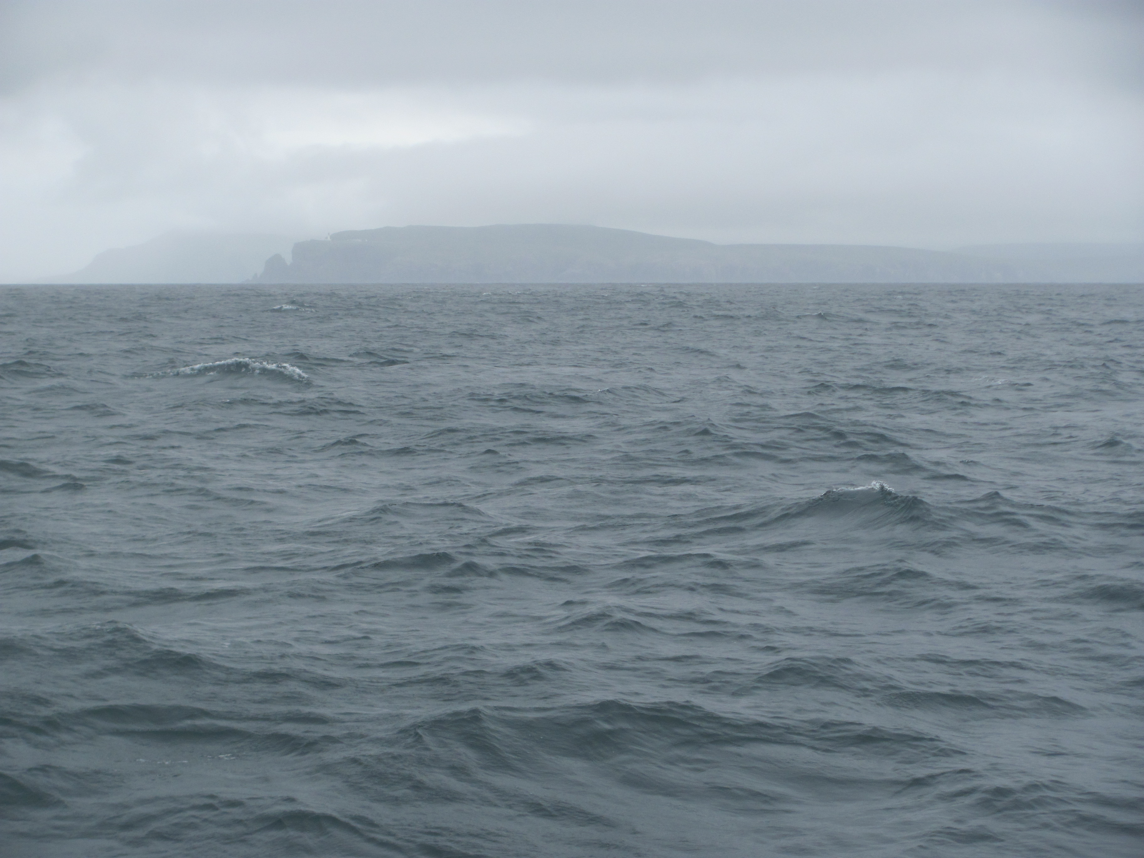
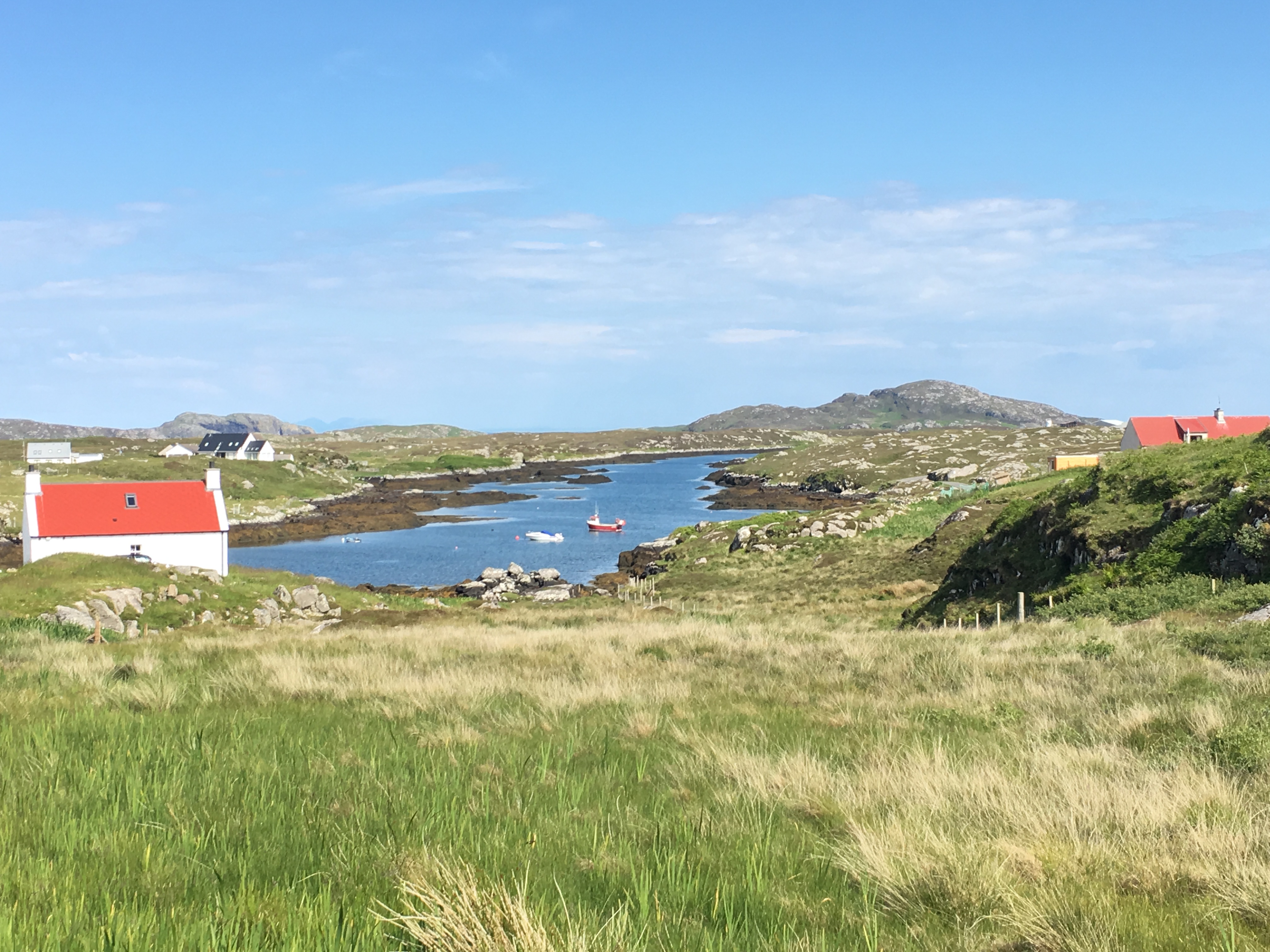
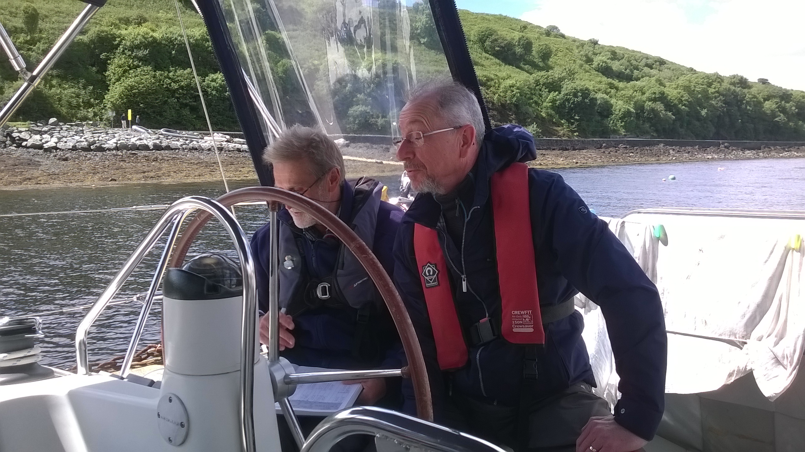
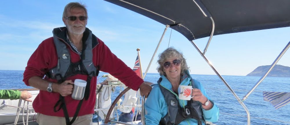
We decide to move on to Kirkwall. Sailing around Orkney is challenging, not least because of the complexity of the tidal flows around the islands. However, by careful timing, they can be made use of to help in making the journey quicker. Armed with the Tidal Atlas of Orkney and Shetland that I had purchased in Stornoway, I spend an evening working out the speed, times and directions of the flows along the clockwise route around Orkney Mainland and reckon that they can carry us all the way to Kirkwall by leaving Stromness on the last of the ebb tide at 0600 the next morning.

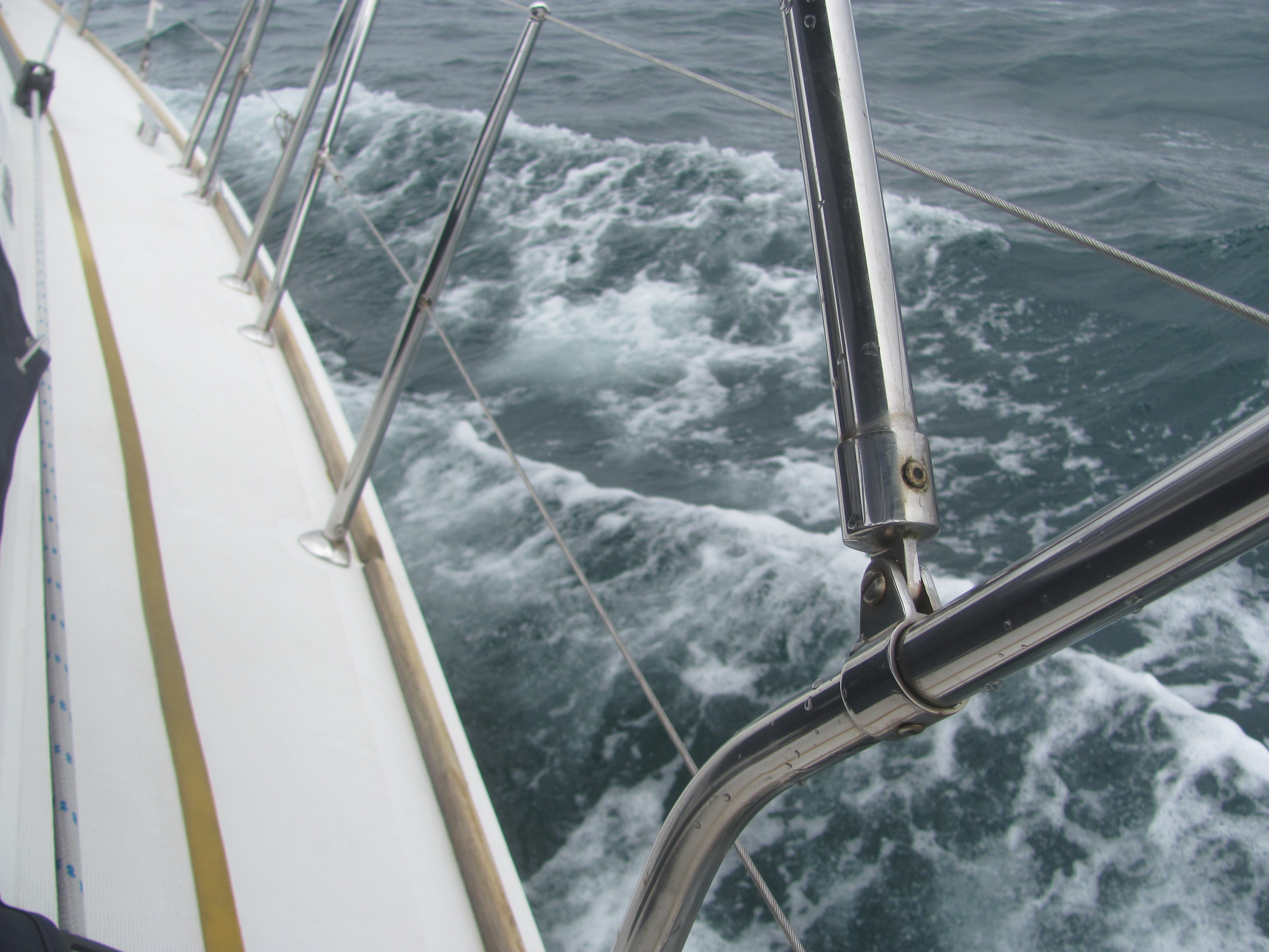
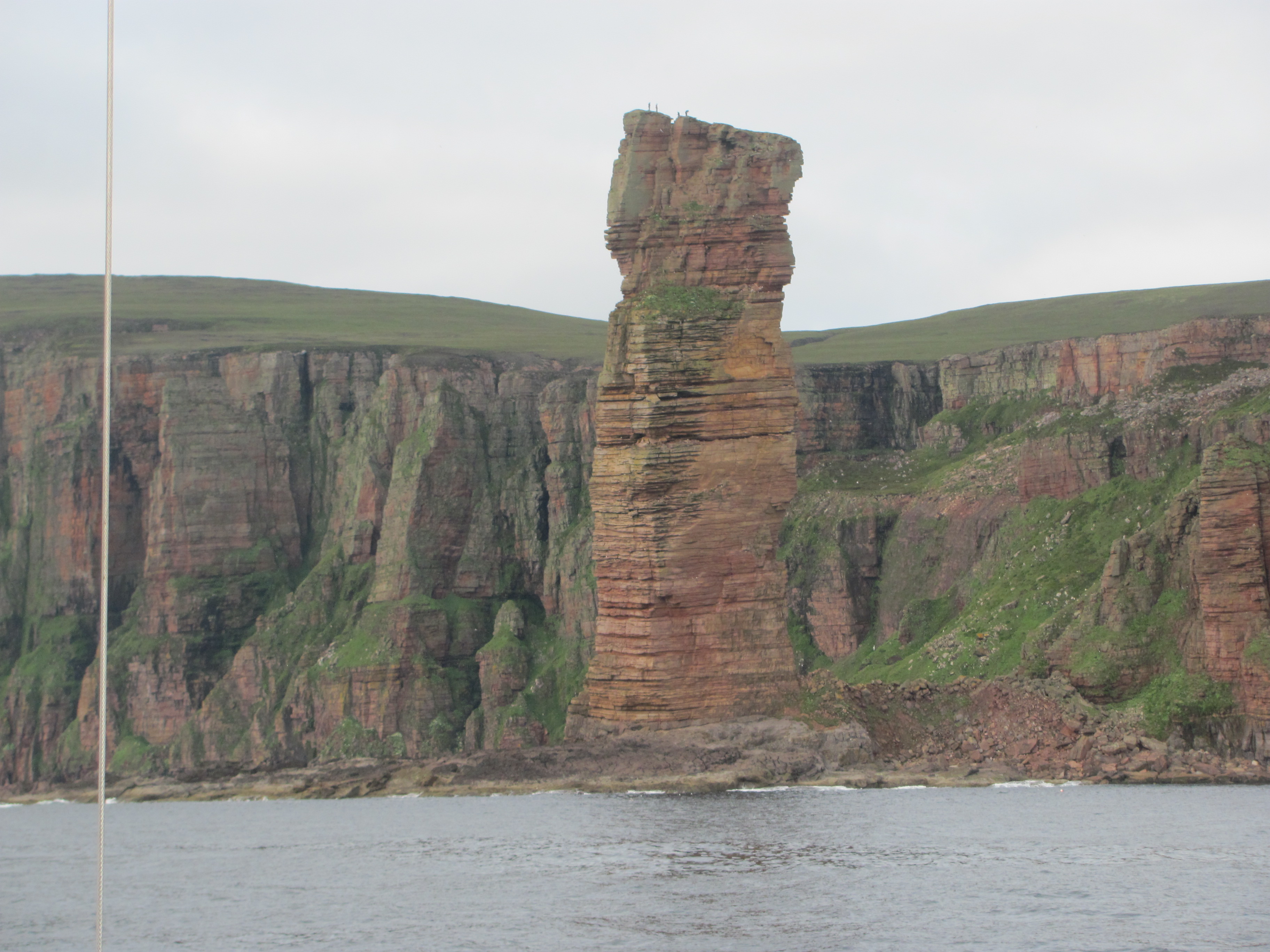
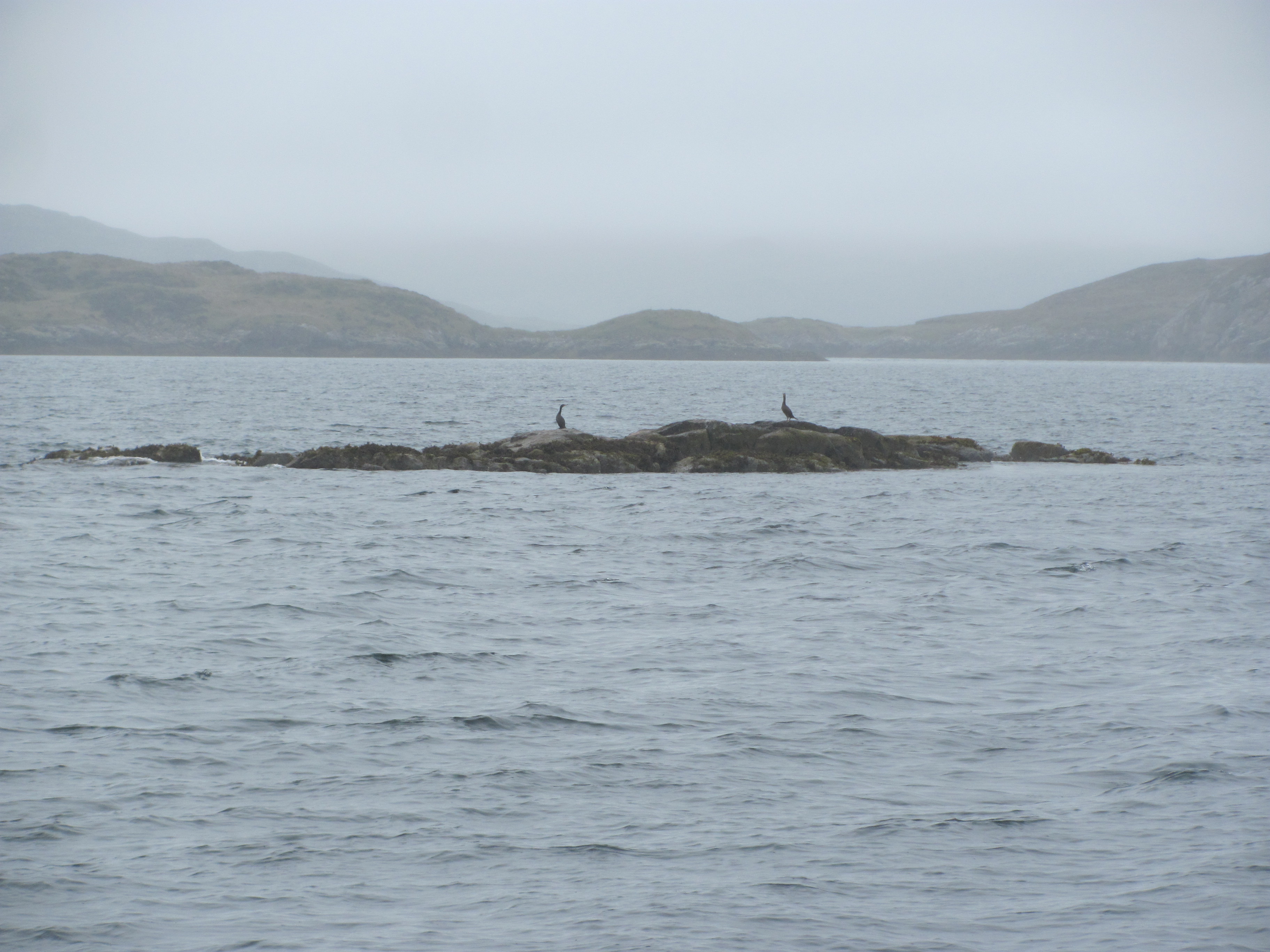
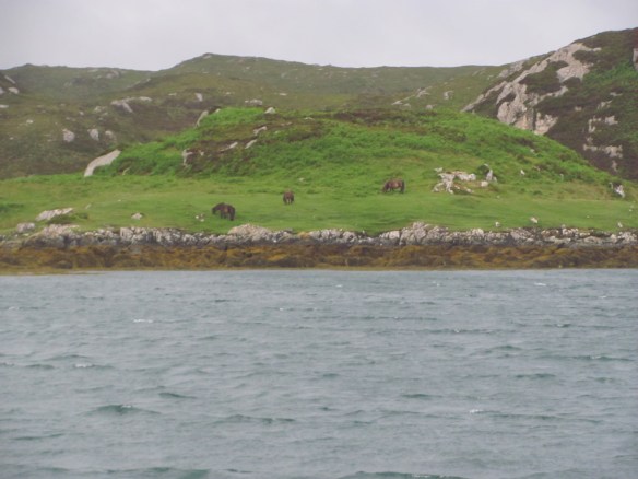
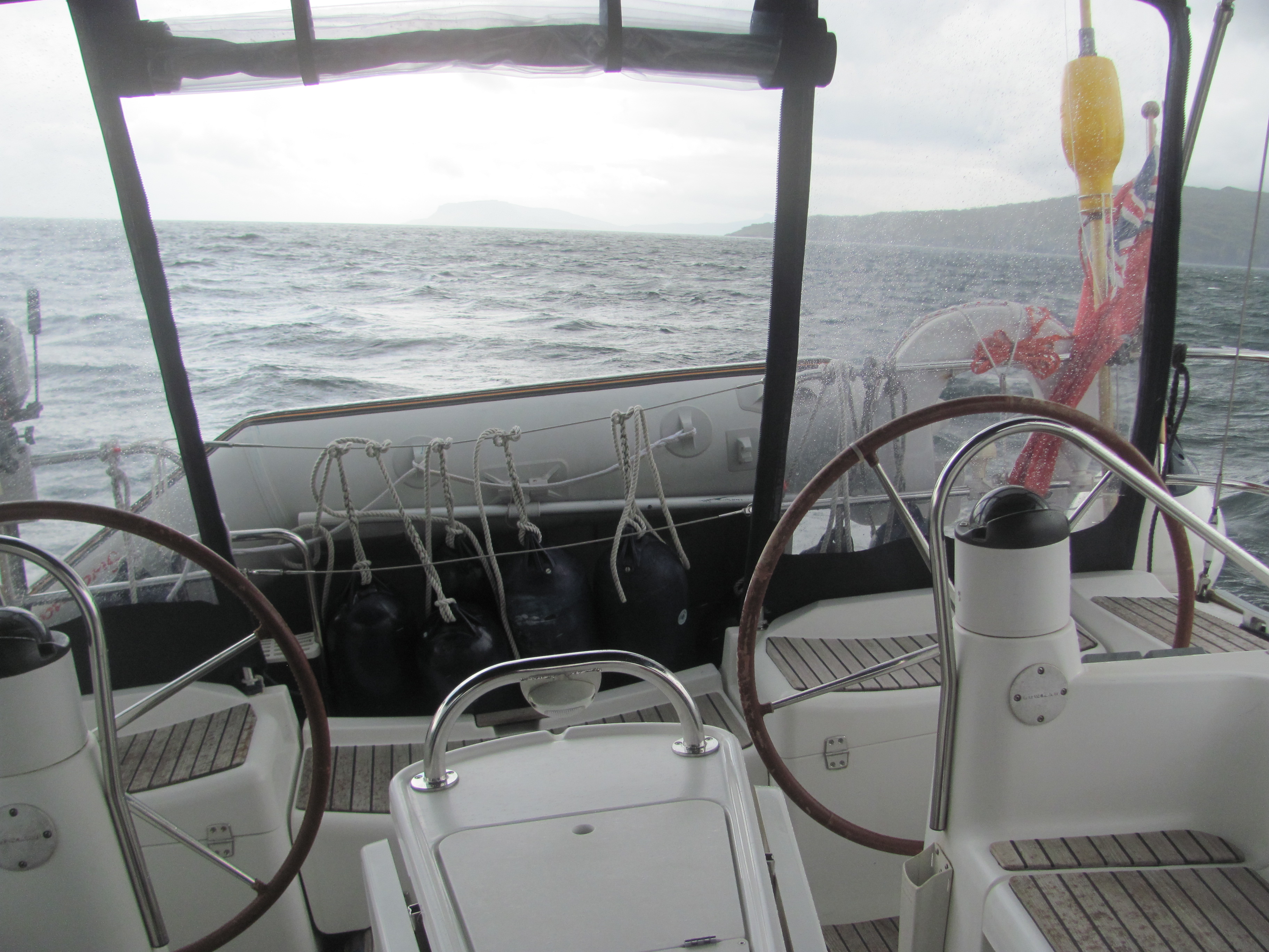
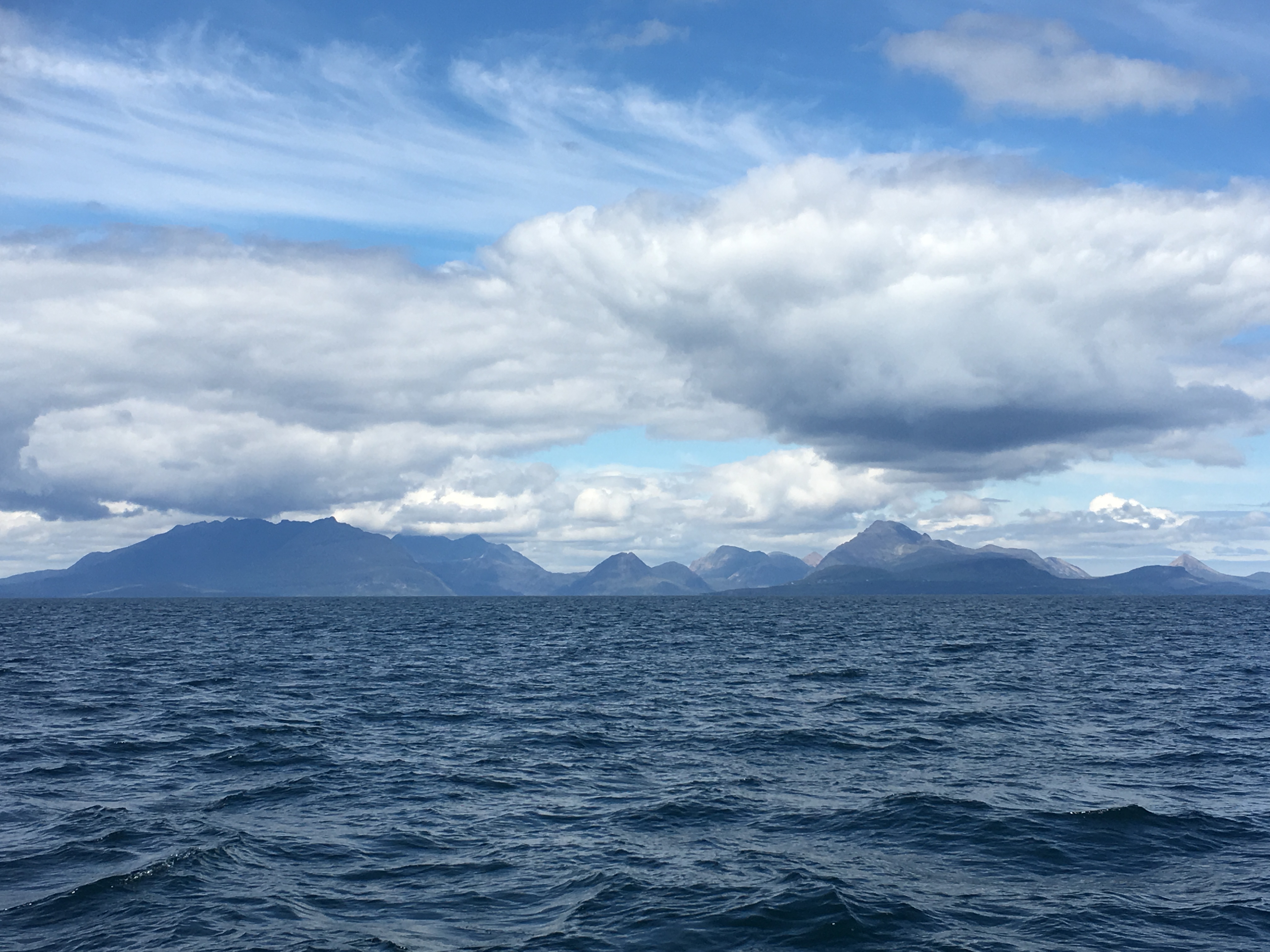
Sure enough, bleary-eyed, we are carried out of Hoy Sound by the west flowing current at around 9 knots. We pass the Experimental Wave Zone where there is research going on to generate power from tidal action, and head north. As expected, the tidal flow changes so that we are carried north to Brough Head lighthouse. The wind is from the south-west, directly behind us, so we only have the mainsail out, still making good speed. A pod of dolphins follows us for a short time then disappears. We arrive at Brough Head and turn to starboard, where the flow now takes us eastwards into Eynhallow Sound. From there, it is an exhilarating sail down the Sound at 10 knots dodging all the rocks, skerries and shoals inconveniently put in our way by some malign gamester.

Our track from Stromness to Kirkwall.

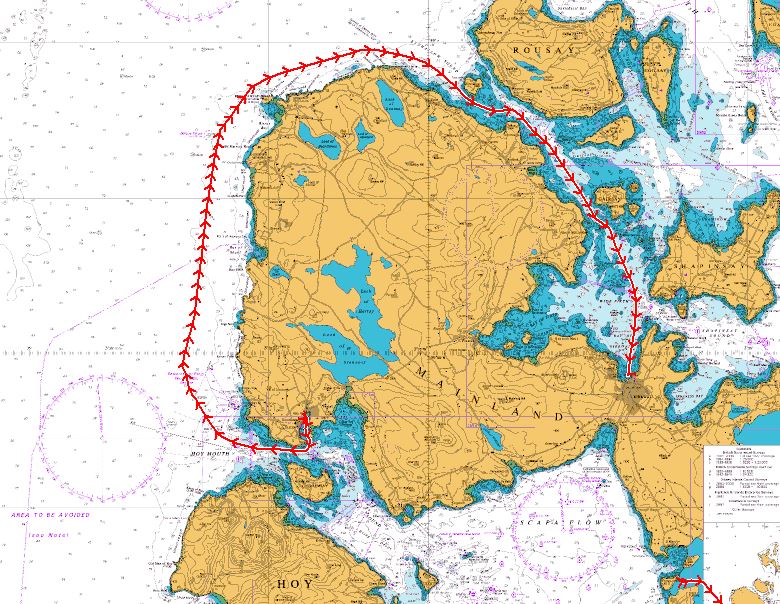
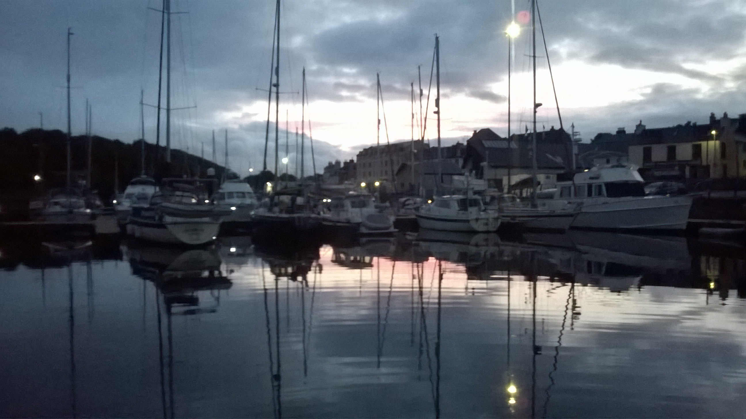
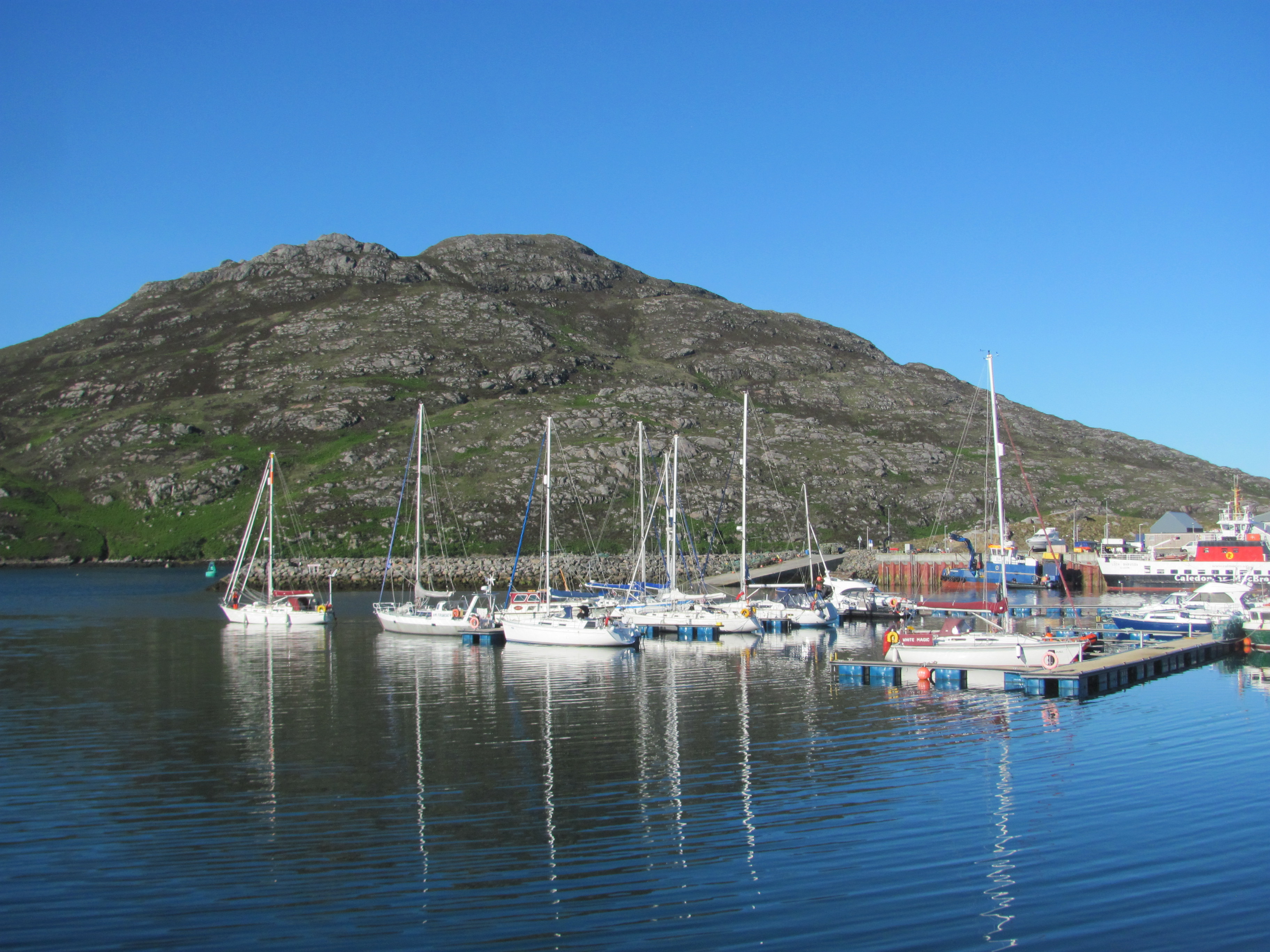
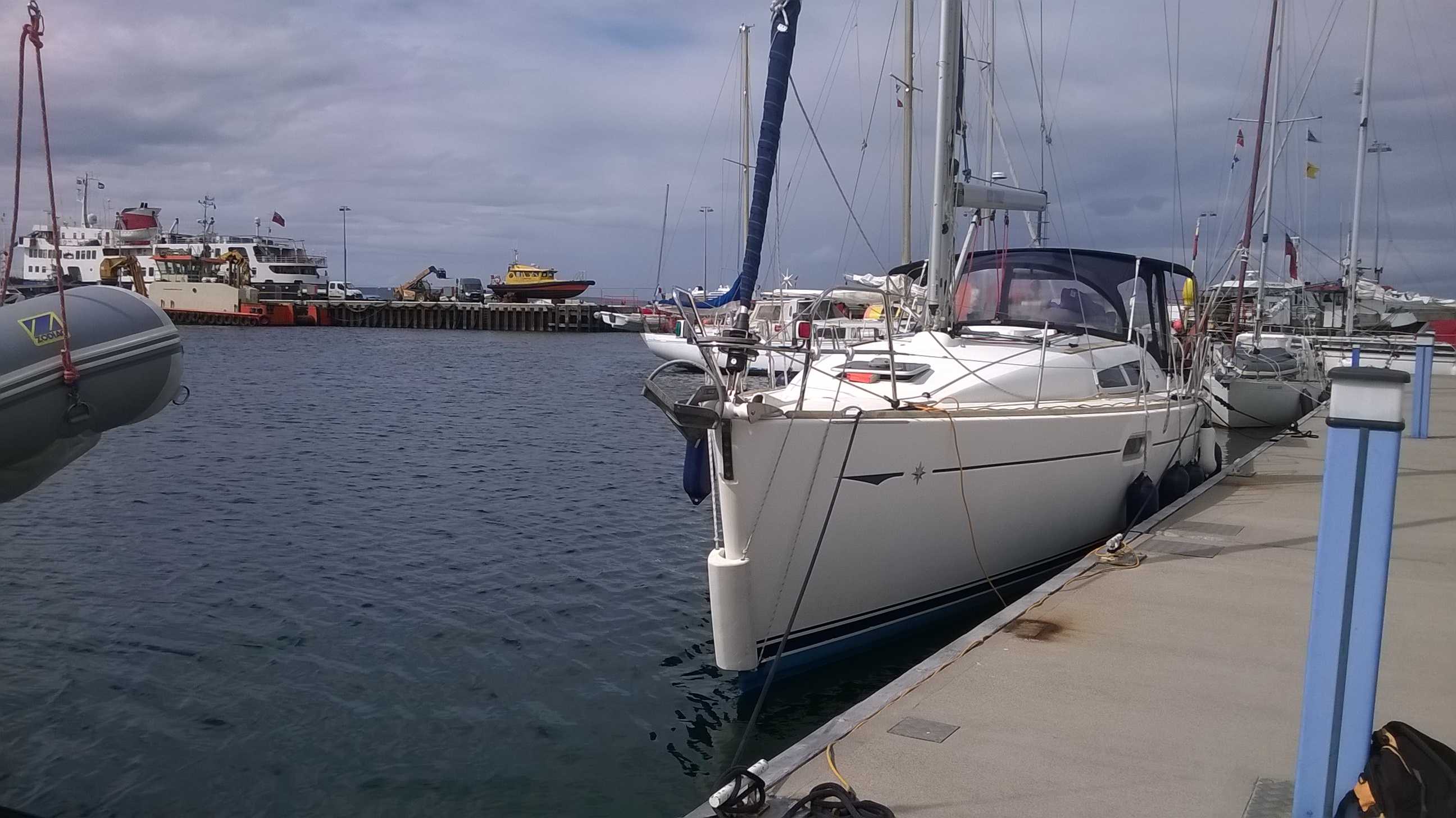
We make it through safely and motor the last little bit into Kirkwall marina, where we tie up.

Tied up in Kirkwall Marina.

In the morning, we meet Dr Peter Martin, a former colleague of mine. Peter is now working for the Agronomy Institute at the University of Highlands and Islands in Kirkwall, and is doing research on bere, a traditional type of barley grown in Orkney, Shetland and Scandinavia. We drive out to his experimental plots on the Island of Burray. On the way, he tells me about bere.
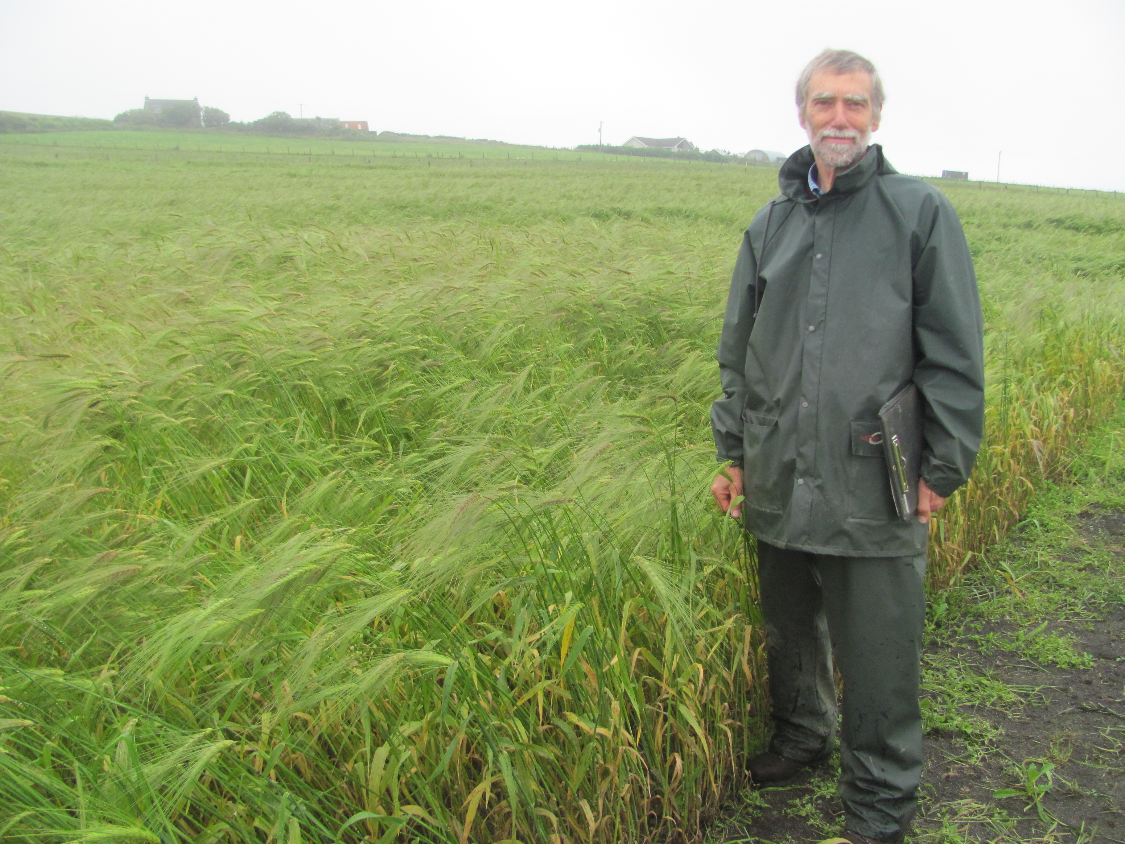
Dr Peter Martin, Agronomy Institute, UHI.

Bere was probably introduced from to Orkney in the 8th cent by the Norsemen”, he says. “It is a six-rowed barley, meaning that it has six rows of grains on each head compared to the two rows on most modern barley varieties. Because more grains are crammed on to each head, each grain is smaller than in modern varieties. It has a very short growing season – it is often the last crop to be planted and the first to be harvested – farmers sometimes refer to it as the 90-day crop.”

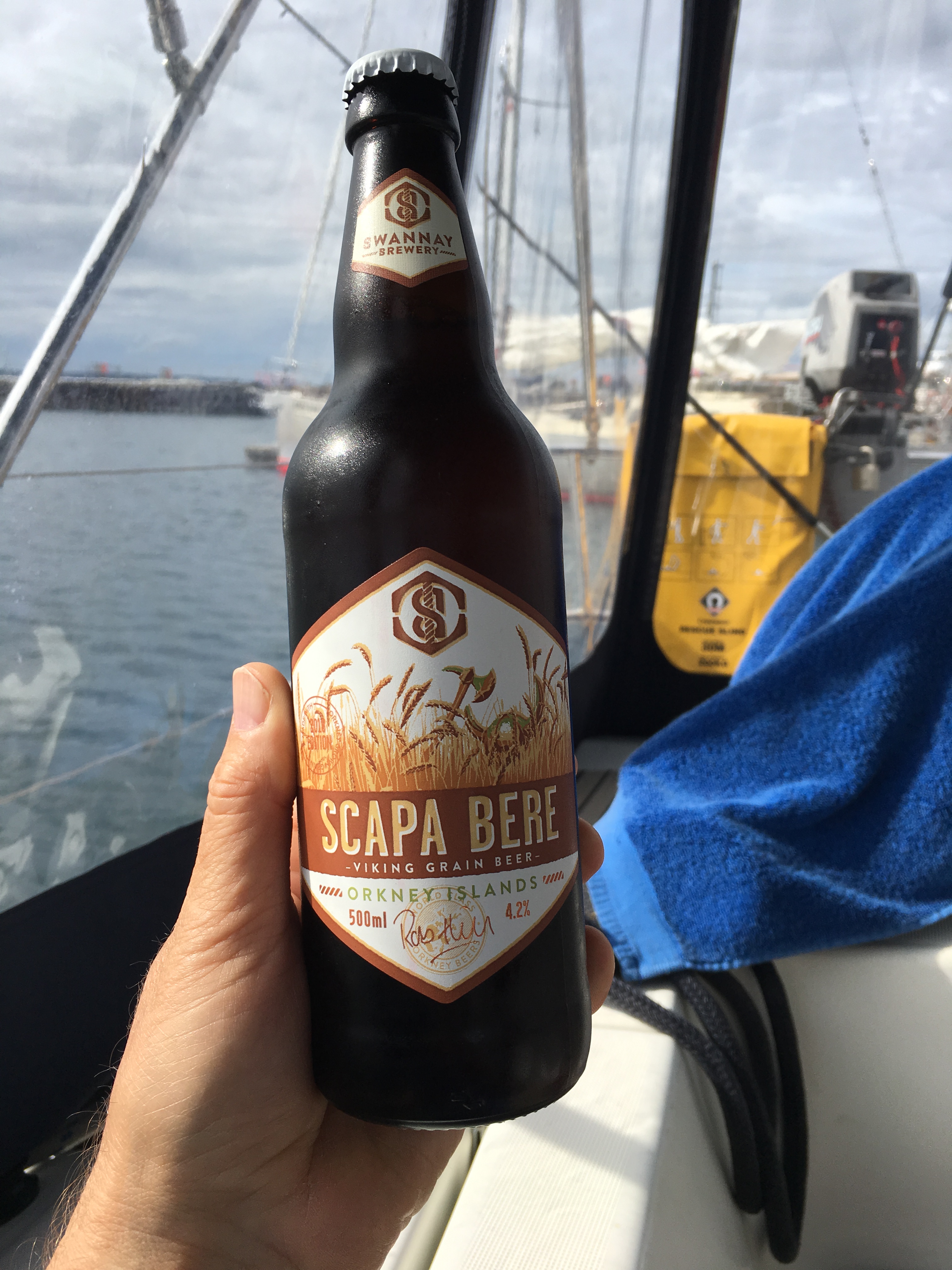
Peter and his team have been promoting the use of bere in a number of products including whisky and beer. The Bruichladdich distillery on Islay now has a line of whisky based on bere grown on Islay (the two distilleries on Orkney itself weren’t interested!), and there is a beer brewed from bere by the local Swannay brewery in Orkney. Meal is ground at the Barony Mills on the island of Birsay, and is made into bannocks and biscuits. Later, we buy a bere bannock to try it. It is fairly tasteless by itself, but is good with some strong cheese or the smoked mackerel we have in the fridge. We also buy some bottles of Scapa Bere – they are very drinkable with a slightly salty taste.

Beer made from bere.

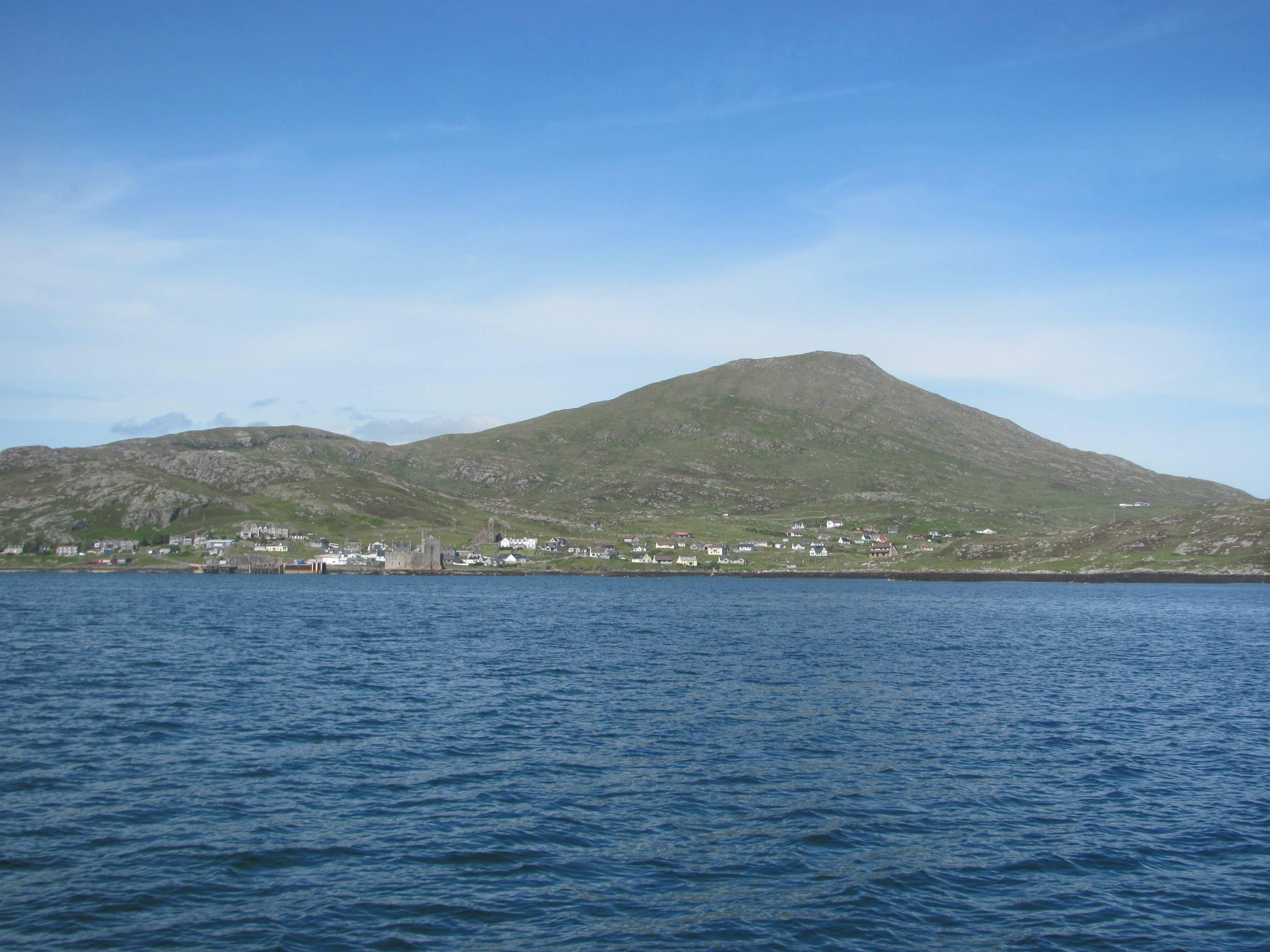
In the afternoon, it clears up and we decide to explore Kirkwall. The main feature dominating the town is St Magnus’ Cathedral, right in the centre. I had bought a copy of the Orkneyinga Saga while in Stromness which gives a good outline of the history when Orkney was ruled by Norway. St Magnus was one of the Norse Earls of Orkney, but perhaps uncharacteristically for a Norseman of those times, he was pious, gentle and kindly, and was more into singing psalms than waging war. Unfortunately, his co-earl Haakon (also his cousin) was just the opposite. Following a minor tiff between the followers of each one, they agreed to meet on an island in Orkney to sort things out, with each one bringing only two ships. Magnus, of course, kept his side of the bargain, but Haakon turned up with eight ships and captured Magnus. To keep the peace, Magnus offered to go into exile, but the Council of Chiefs decided that one Earl had to die. Haakon was pretty sure it wasn’t going to be him, so he ordered his standard bearer to kill Magnus. However, the standard bearer was so impressed by Magnus’ piety that he refused to do so, and Haakon had to get his cook to do it instead with an axe.

The story then moves to the next generation. Magnus’ nephew Rögnvald was granted his uncle’s part of Orkney by the King of Norway, but was resisted by Haakon’s son and successor, Paul Harkonsson, and the islanders. Rögnvald cunningly decided to win round the islanders by promising to build a magnificent cathedral, then he captured Paul and shipped him off to Caithness where he eventually had him killed. So Rögnvald got the whole of Orkney and the islanders got their cathedral, which was dedicated to Magnus, and everyone was happy. For a fleeting moment, a picture of current British politics enters my mind, but I dismiss it instantly as being an absurd comparison. At least, I think so.

Inside St Magnus Cathedral.

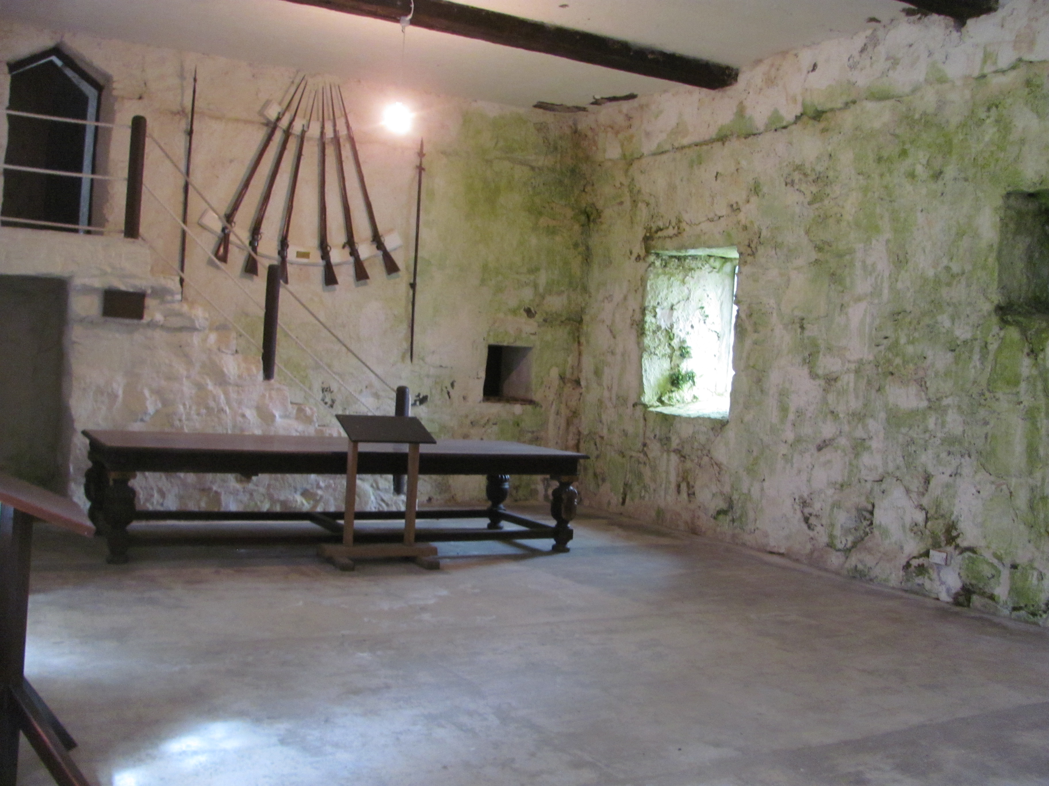
We walk across the road to see the Bishop’s Palace, which was built for the first bishop, William the Old, at around the same time as the Cathedral. Apparently, King Haakon of Norway (not the same Haakon as above) died here on his way back to Norway after being defeated in the Battle of Largs. His remains were buried in the Cathedral temporarily until the weather improved, then were returned to Bergen.

All that remains of the Bishop’s Palace …

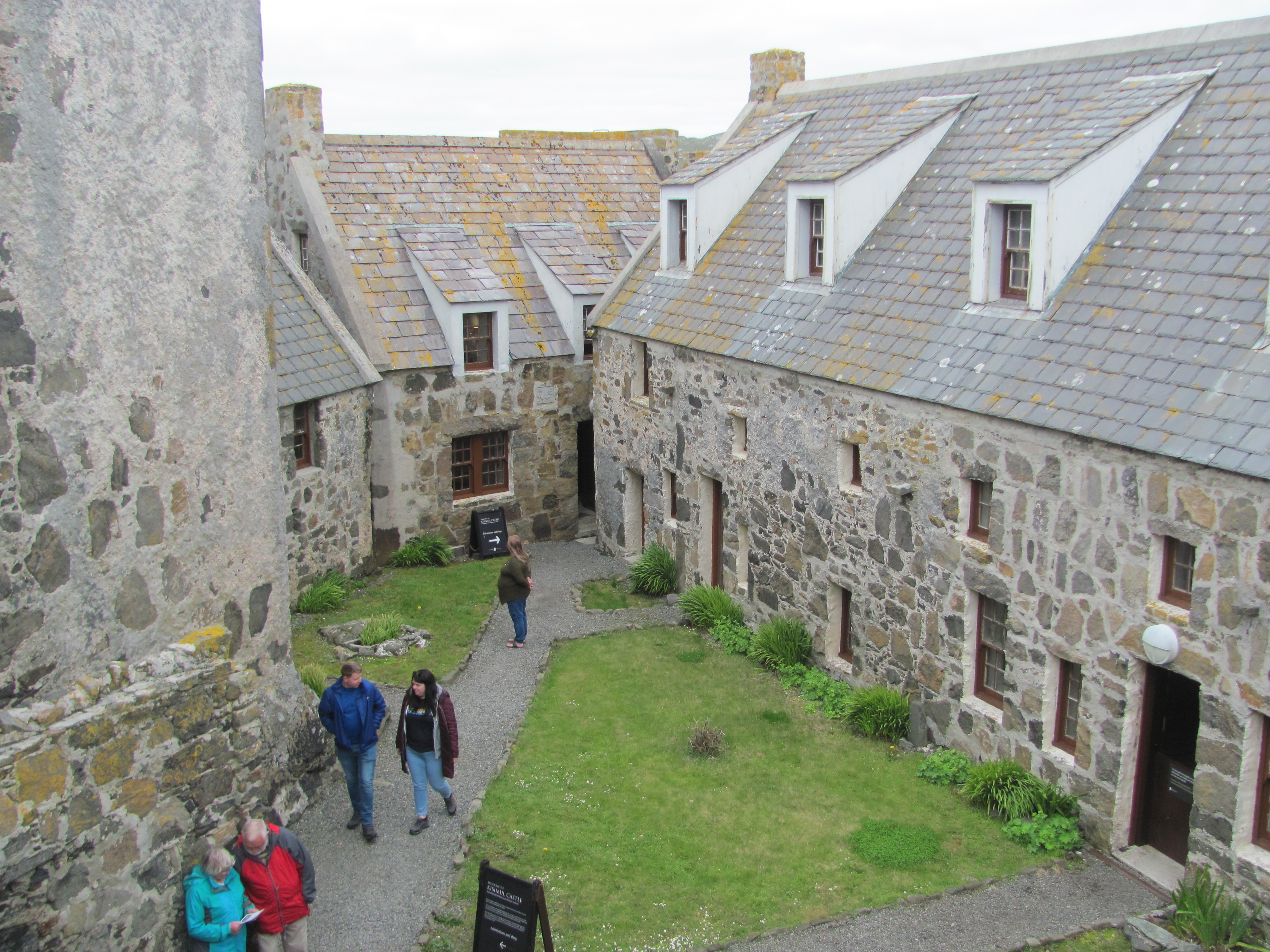
Just next to the Earl’s Palace is the Earl’s Palace. There is a sign saying that tickets must be purchased to enter the palace itself, but walking around the grounds is free. Being the tightwads that we are, we decide on the latter and walk on. I suddenly notice that the short stout lady in charge of the little kiosk where the tickets are bought is locking the door and rushing over at top speed to the palace doors.

… and of the Earl’s Palace.

“She’s probably spotted someone who hasn’t paid and is rushing over to catch them”, I say to the First Mate. “I don’t fancy their chances when they get caught. She looks like one of Earl Haakon’s descendants!”

There is no answer. I look around, but there is no sign of the First Mate. The Ticket Lady reappears, followed by a rather crest-fallen First Mate. The thunderous look on the Ticket Lady’s face laves no doubt in my mind that she would like nothing better than having the miscreant by the ear, frog-marching her to the gate, and telling her not to come back. It’s lucky she is only as half as high as the First Mate.

“I just wanted to have a quick look around the door”, says the First Mate in response to my querulous look. “I didn’t think anyone would be watching.”

I consider pretending that she is a mad tourist talking to one of the trees and is nothing to do with me, but relent. She has always had a thing for houses with turrets, after all.

“Just as well she wasn’t the Earl”, I say instead. “I think I would miss you.”

What the Earl’s Palace might have looked like.

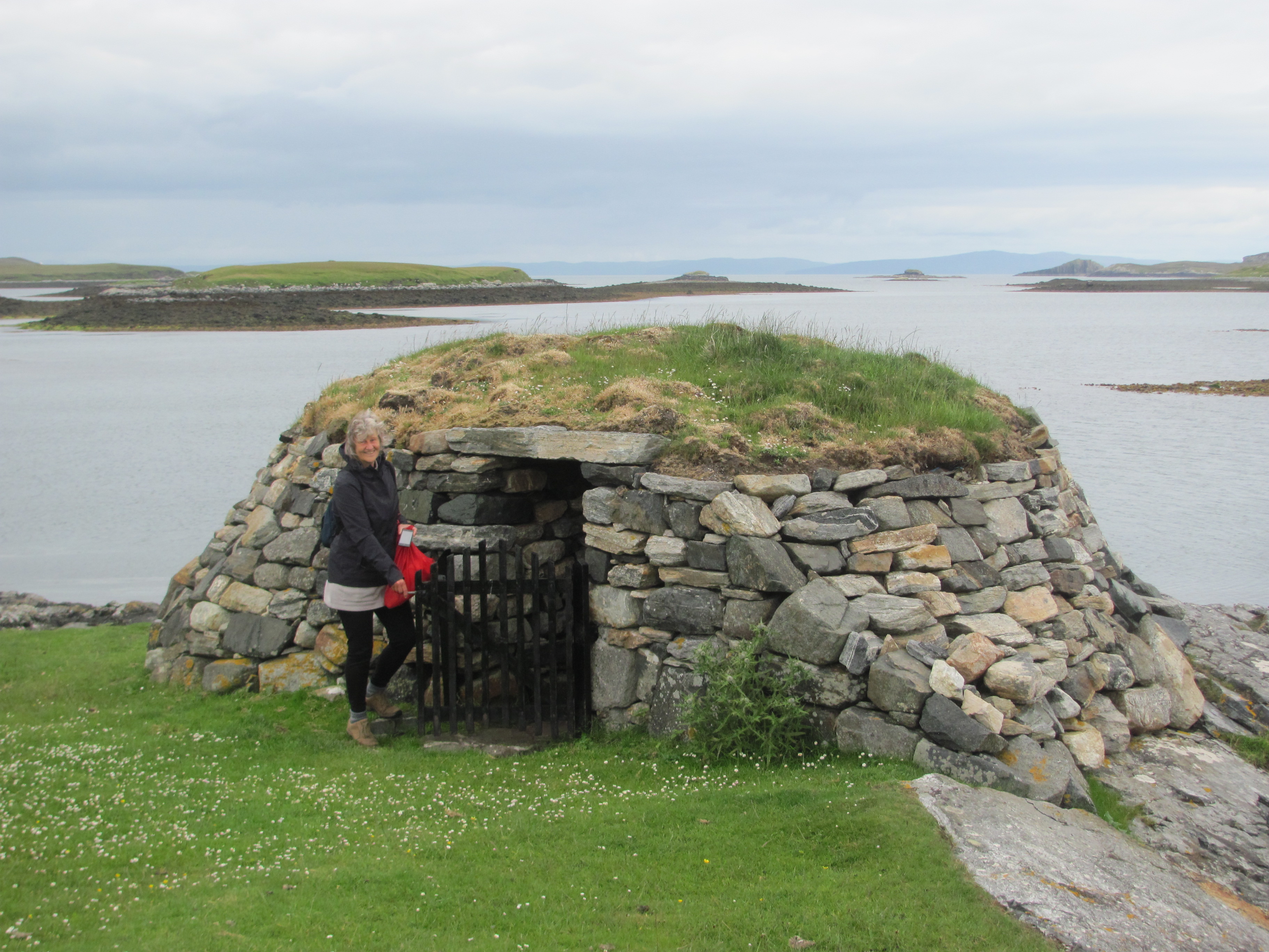
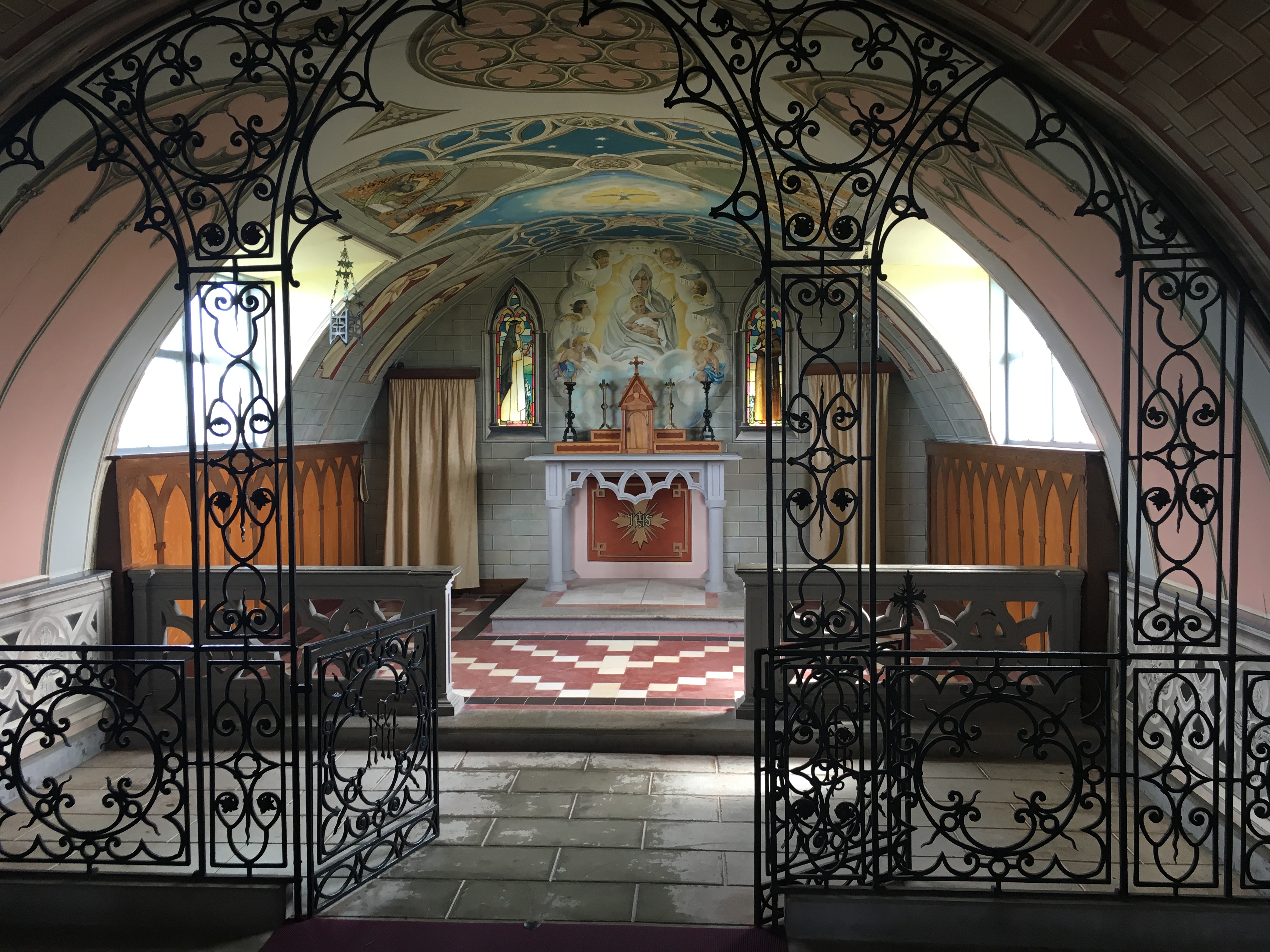
The next day we take the bus down to see the Italian Chapel. This was built by Italian prisoners-of-war captured in North Africa in WW2 and brought to Orkney to build the Churchill Barriers to prevent enemy ships from entering Scapa Flow. While they were here, they decided they needed a church so put two Nissan huts end to end, lined the inside with plasterboard, and used various odds and ends for the interior fittings – the baptismal font is made from an old car exhaust, for example. Whether you are religious or not, it is difficult not to be impressed with the ingenuity and the skill involved in the artwork, and not to realise that we have more in common with other Europeans than we have differences.

The Italian Chapel from the front.
Inside the Italian Chapel.

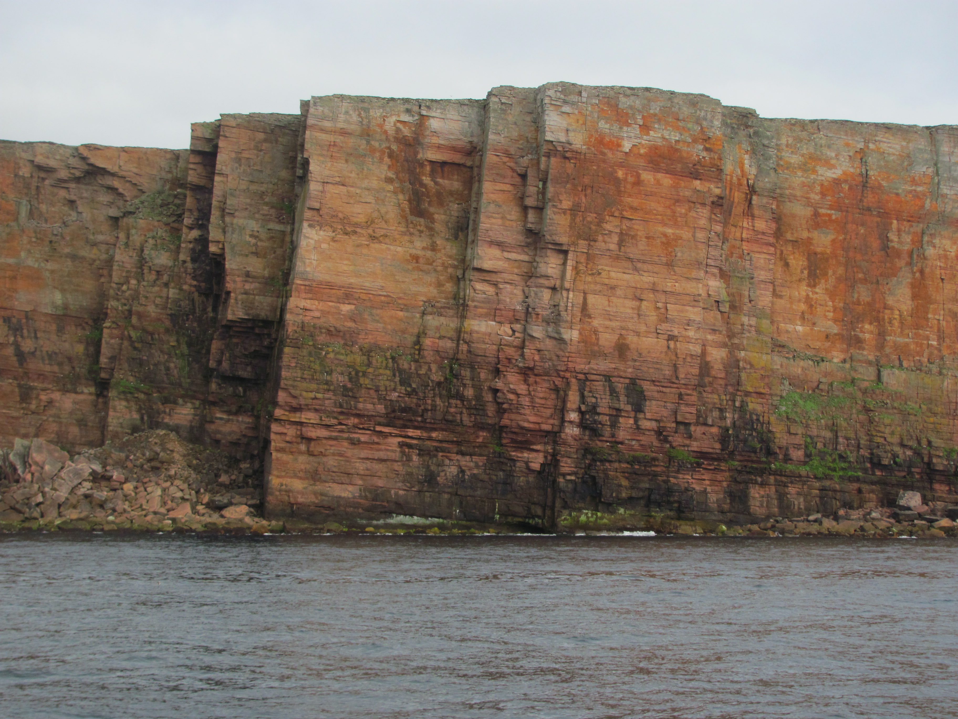
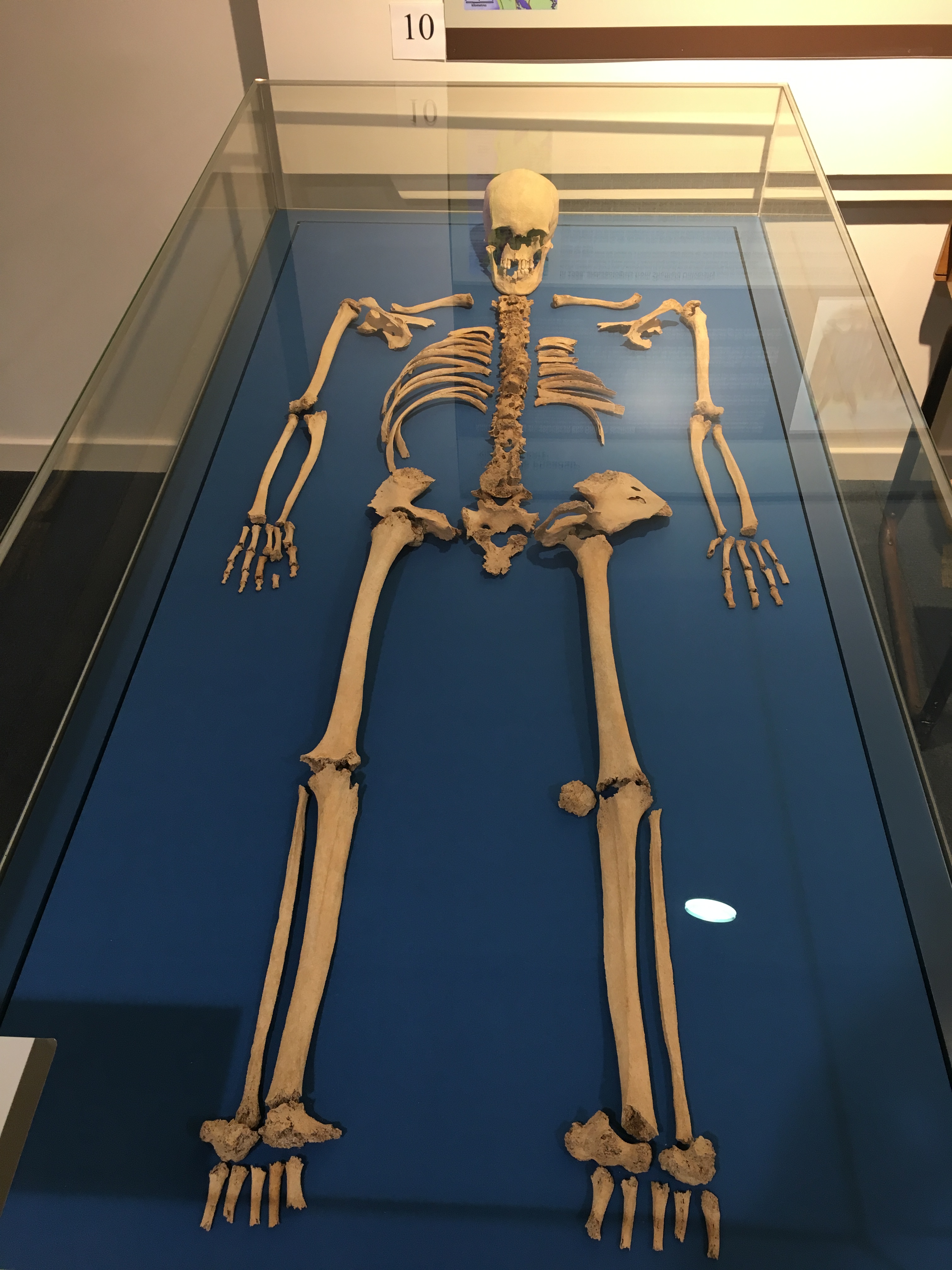
A little bit further on is the Orkney Fossil Centre. Since reading of the geology of Orkney on the way over, I am keen to see some of the Devonian fish fossils that had been found in the old sandstones. A feeling of awe engulfs me as we peer through the glass cases at the beautifully preserved skeletons, now part of the rock, but which were once living creatures in a massive freshwater lake. I find it difficult to really appreciate how long ago they lived – 400 million years is a long time. The Devonian is called the Age of Fishes; even though primitive plants and animals were just starting to colonise the land, it was a huge diversity of fish that dominated the lakes and seas. Among these were the tetrapods – those with four limbs – some of which used these to clamber on to the land and to become the ancestors of all animals with four limbs, including ourselves. Even more awe-inspiring is that, besides limbs, these fish had already evolved many of the other basic structures that we now possess – a primitive backbone, a skull containing a primitive brain, a hinged lower jaw, enamelled teeth, two nose holes, lungs, and blood containing urea. Even the plates making up our skulls are exactly paralleled in some of these Devonian fishes. We are peering down at our own ancestors!

Devonian fossil fish (Gyroptichius agassizi) from Lake Orcadie.
Hugh Miller.

My mind drifts back to Hugh Miller, one of the early discoverers of these Devonian fish fossils, not in Orkney, but from the same Lake Orcadie sediments in Cromarty further south. We had come across him when we had visited Cromarty in our smaller boat a few years previously, and had visited the house that he had lived in. Interestingly, Miller was both a geologist of some note as well as being an evangelical Christian. Through his geological work, however, he began to realise that the Earth was very old – indeed, many millions of years old and not just a few thousand years. Even though it was before Darwin published his Origin of Species, Miller also recognised that some fossils were descendants of other ones, and that somehow they had ‘metamorphosed’ from one to the other, but couldn’t quite bring himself to accept that humans were part of the same process. Or could he? He tragically died on Christmas Eve 1856 by shooting himself after suffering from depression brought about, many believe, by the mental stress in trying to reconcile his biblical beliefs with his scientific discoveries. Why is it often too difficult to change one’s beliefs even when presented with hard evidence to the contrary, I wonder?

Devonian fossil fish from Lake Orcadie.

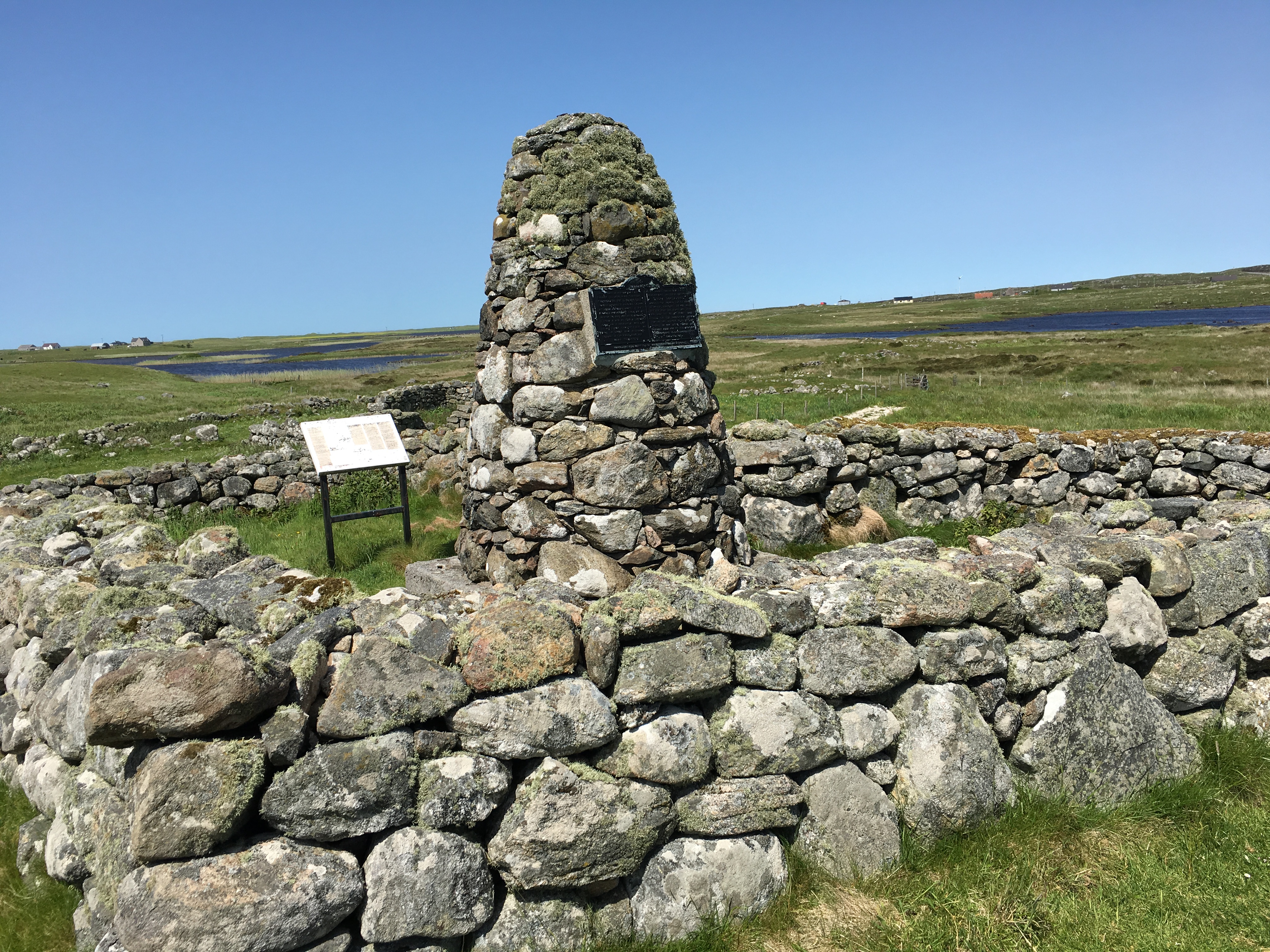
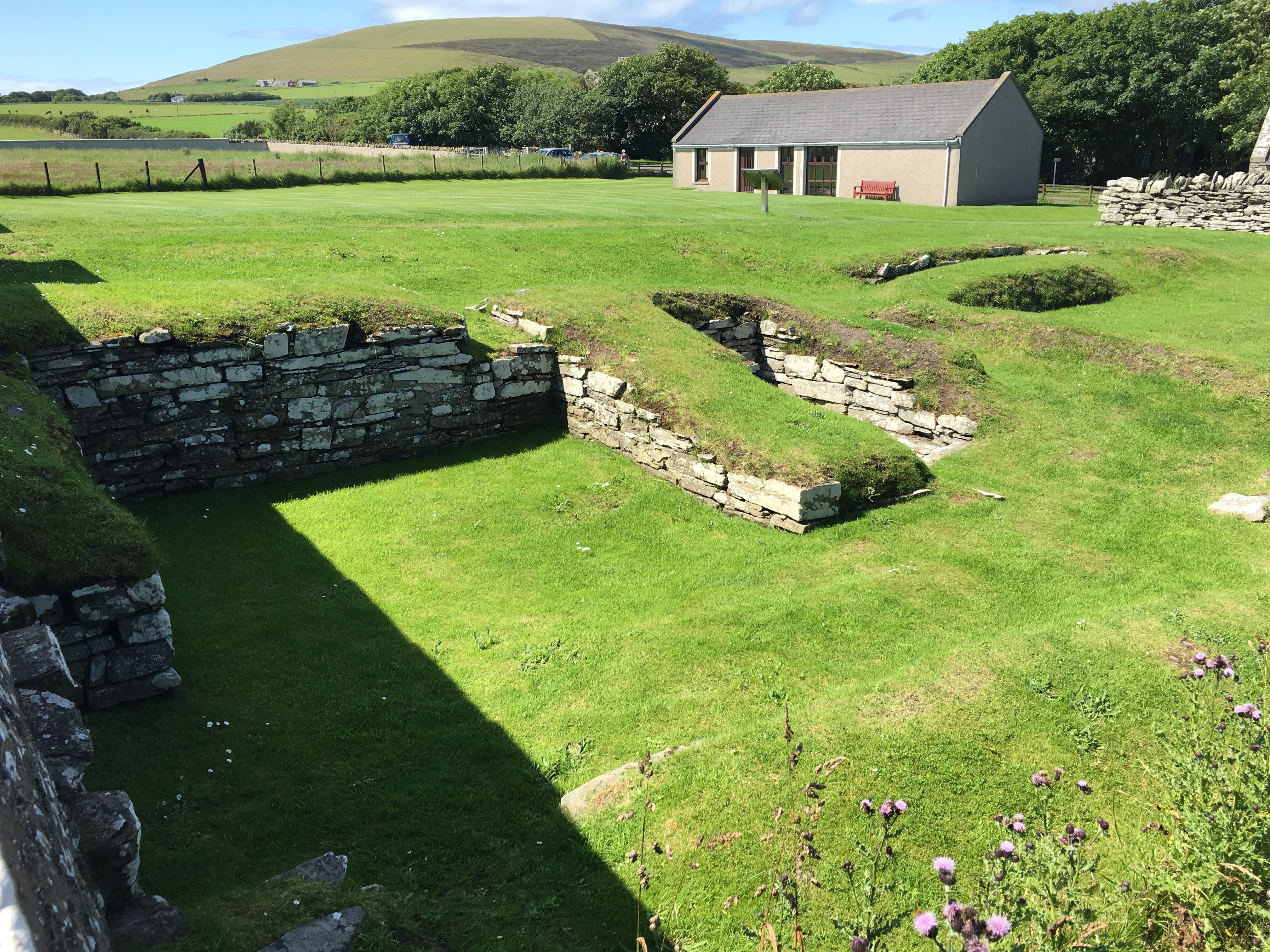
The next day, we take the bus to Ophir to visit the Round Church, the Earl’s Bu and the Orkneyinga Saga Centre. It drops us off in the village of Ophir, but it is a three-kilometre walk still further from there. Luckily it is a beautiful sunny day and it is a pleasure to amble along the quiet country lane down to the coast. Only one tractor passes us on the way.

We eventually arrive at the Saga Centre. It is a bit smaller than we expected, in fact so small that it doesn’t have any staff in attendance! There is a poster board display and a video that starts when you press a button. The video tells the history of the site in the 12th century. At that time, it was the Earl’s manor house (a bu is the main farm in the area), and the Round Church was built by the same Haakon mentioned above as a penance for having his cousin Earl Magnus killed.

Remains of the Round Church.

As you did if you were any sort of self-respecting Norseman, he had a dedicated drinking hall built next to the church, the foundations of which are still visible today. The story associated with the drinking hall is that some years later, Haakon’s son Paul Harkonsson (now the Earl himself) invited one of his vassals, Svein Asleifarson (who later became known as ‘The Ultimate Viking’ for his bloodthirsty exploits) to his drinking hall for a bit of a Christmas party. Apparently drinking one’s self under the table had a bit of a code – it all had to be fair, and you couldn’t drink less to stay sober than your drinking partners, in case you took advantage of their state and killed them, I suppose. One of Paul’s men, with the intriguing name of Breastrope, suspected Asleifarson of trying to stay sober and challenged him to drink more. Asleifarson vowed to take his revenge on Breastrope for this slight on his prowess, and later, when he had a chance, cracked him over the head, almost killing him but not quite. Breastrope lashed out, but in the confusion killed one of Paul’s kinsmen by mistake before dying himself. Leaving this trail of carnage behind, Asleifarson then managed to escape through a skylight and rode off on his horse and eventually escaped to Tiree. Needless to say, he wasn’t invited to one of Paul’s parties again for a while.

Remains of the Drinking Hall. Bottom left is the entrance where the grisly murder took place.

“Phew, they were a bloodthirsty lot in those days”, says the First Mate. “And it takes a bit of keeping up with who was the son of whom, and which cousin killed which brother, and all the rest of it. My head hurts. Let’s get back to the boat and have a glass of wine.”

“As long as you don’t accuse me of drinking less than you”, I say. “Breastrope’s head also hurt a bit as a result of him saying that.”

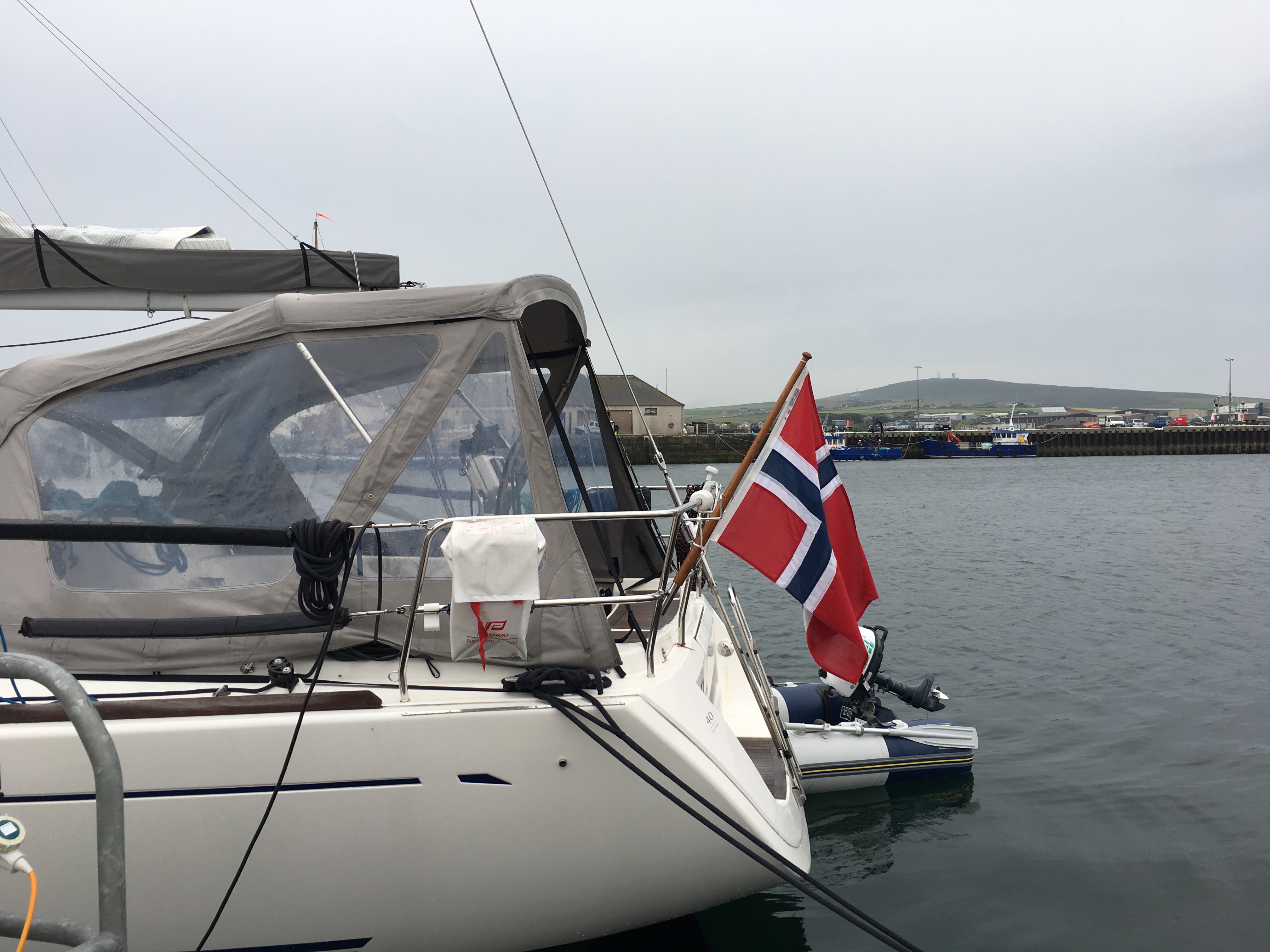
When we get back to the Kirkwall marina, we find we are the only UK-registered boat on our pontoon. All the others are Norwegian. I wonder if it is a secret Viking invasion by the descendants of Svein Asleifarson to regain control of Orkney after Brexit and the UK disintegrates. As we walk past each boat, I have a quick check to see if I can spot any battle-axes and helmets with horns, but don’t see any. Perhaps they are hidden under the floorboards. I tell the First Mate to make sure our claymores are easy to reach in the night, and lock the door just to be sure. She looks at me strangely.

A modern-day Norseman?

We leave Kirkwall the next day on the way down to Wick in Caithness, but decide to anchor overnight in East Weddel Sound between Mainland Orkney and Burray to break the passage. Again, we need to calculate the tides correctly to catch the east-flowing tide from Kirkwall to the island of Copinsay then the flow southwards.

Our track from Kirkwall to East Weddel Sound.

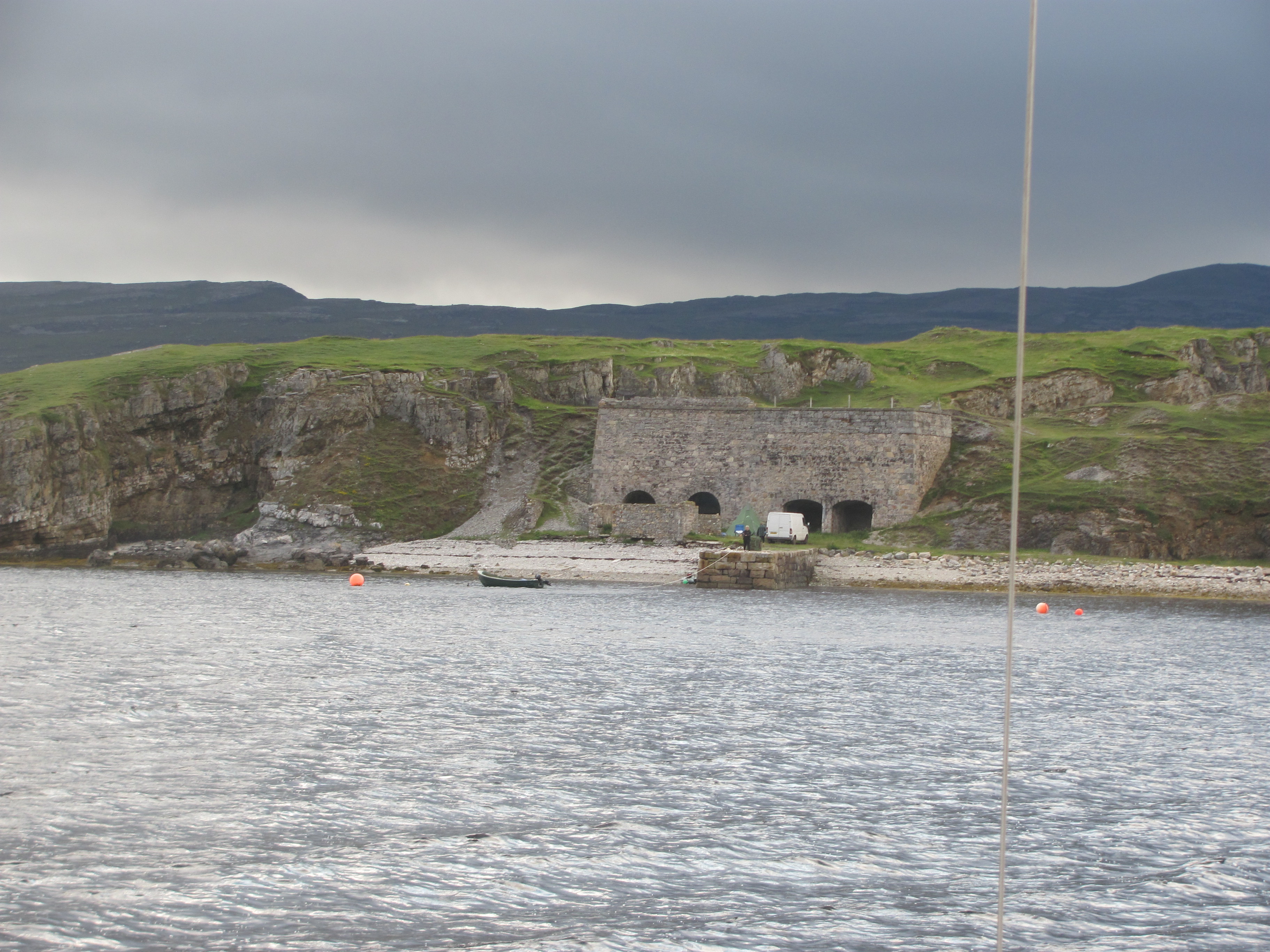
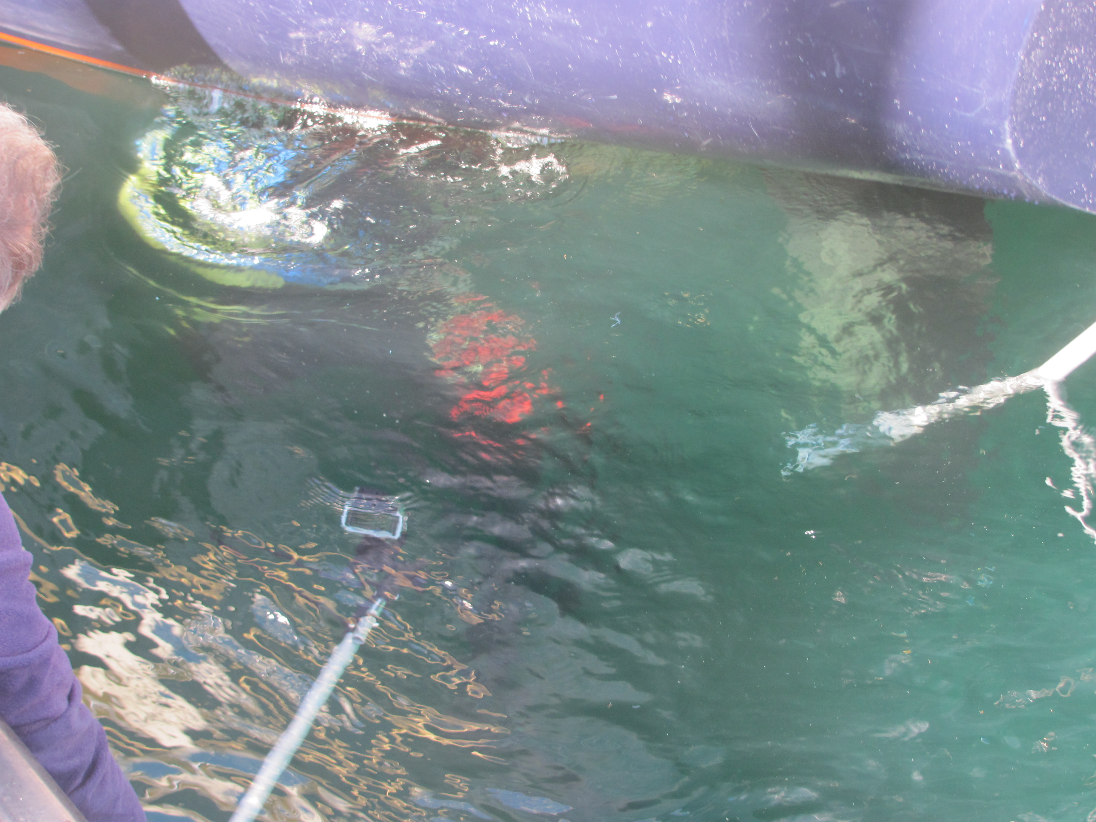
We arrive in the Sound in the late afternoon and anchor near one of the rusting blockships that were sunk deliberately to prevent access by German submarines to Scapa Flow during WW2. Just in case there is still wreckage on the seafloor that might trap our anchor, we rig a trip line with a buoy floating on the surface.

Rusting blockship in East Weddel Sound.

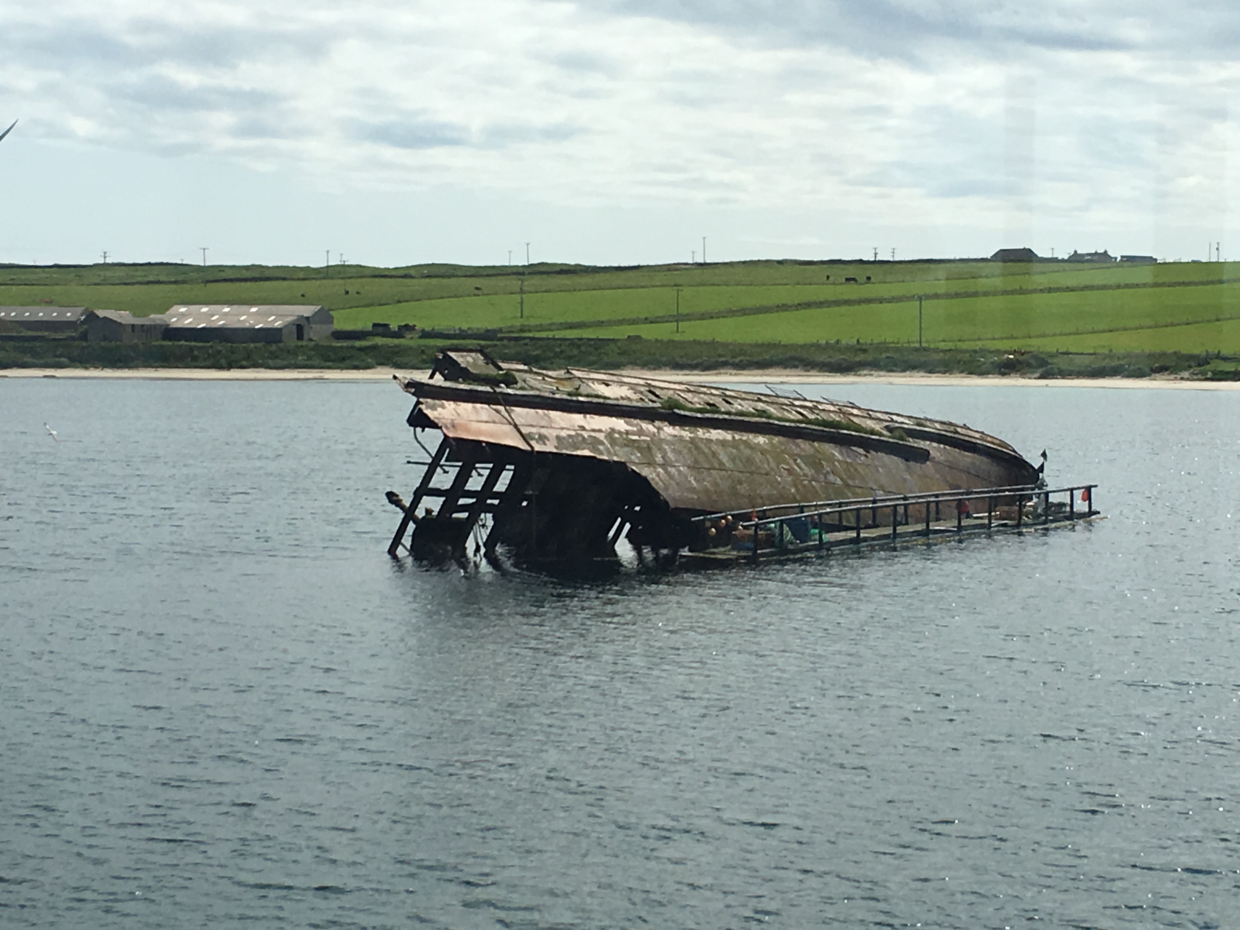
I am conscious that it was here that the German U-boat U-47 under Kapitänleutnant Günther Prien had managed to slip through a narrow route between the blockships at high tide just after midnight, and in the glow of the northern lights had torpedoed the Royal Oak, one of the main British battleships in Scapa Flow. He had actually fired three torpedoes at the Royal Oak – the first had hit but had caused little damage and the crew on board had thought it was some internal explosion, the second missed altogether, and it was only the third that struck amidships and did the damage. The ship sank in 13 minutes, with a total of 834 men losing their lives. Amazingly, amid the confusion, the U-47 managed to escape out the same way it had come in. It is not lost on me that our own track would have crossed the track that the U-47 had taken.

Inward and outward routes taken by U-47. We anchored just south of Lamb’s Holm.

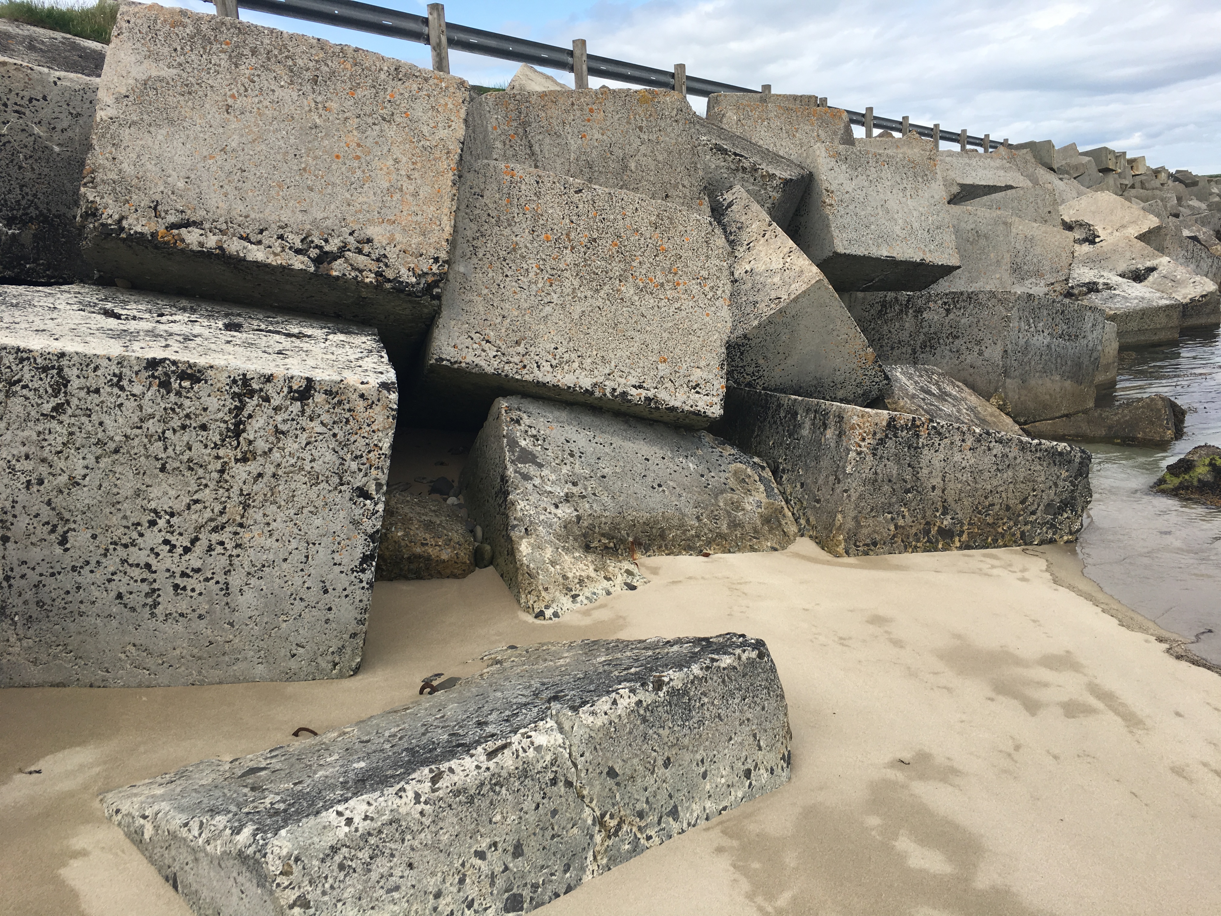
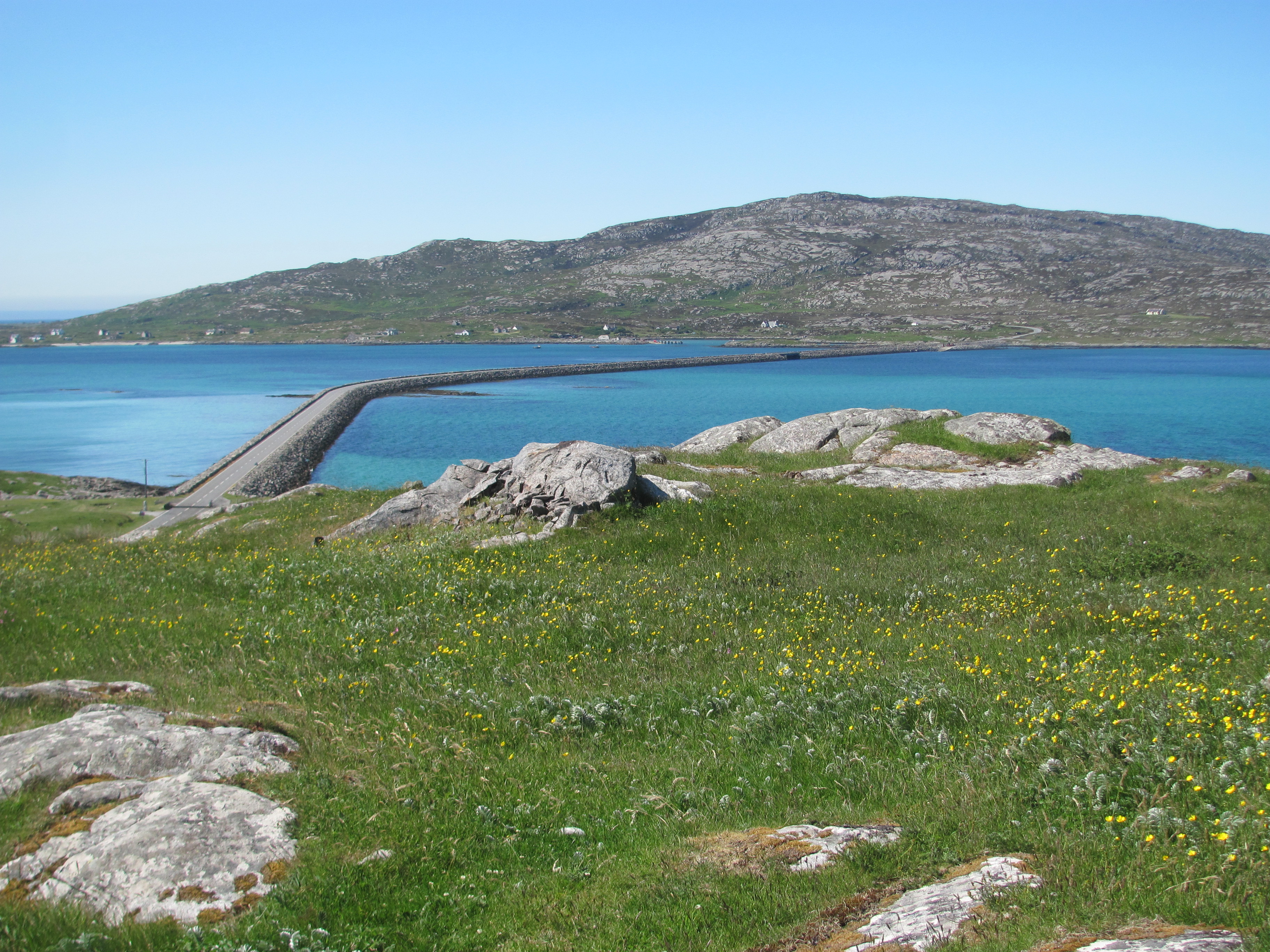
Although it was a bit like shutting the stable doors after the horse had gone, Churchill subsequently ordered the construction of concrete barriers across the gaps between many of the islands, which are still there to this day. Although this blocked off sea routes, it transformed society on the islands, linking people together much more closely than before.

Part of the Churchill barrier between Lamb’s Holm and Mainland Orkney.

Stromness

In the morning, we unload the bikes and cycle up to the Skara Brae site. We stop halfway to admire the view. Compared to the Outer Hebrides, we are surprised at how green and lush the landscape is – fields of ripening barley interspersed with shimmering blue lochs and isolated farmhouses, the aroma of cow manure wherever we go, all give a feeling of plenty, of years of human cultivation. A landscape that may not have changed all that much since Neolithic times.

Orkney landscape.

“Did you see that lamb caught in the fence back there?”, the First Mate says, catching up.

I hadn’t.

“What do you think we ought to do?”, she asks. “Perhaps we should tell the farmer.”

There is no sign of anyone. We knock at the door of the next house. A woman answers. We tell her about the lamb.

“It’s not mine, but I will tell the farmer. He goes past here several times a day”, she says.

Feeling we have done as much as we can, we continue on, down a hill, round a small loch, and eventually reach the Visitor Centre, where we have a bite to eat at the café before starting to explore the excavations.

The old man crawls through the entrance tunnel and emerges into the outside world. Blinking his eyes in the bright sunshine and breathing deeply of the sea air, he sits on the stone slab and looks out over the bay. He is the last one now, the last of what once was a thriving community. All the others have gone, one by one. He remembers the laughter of the children as they played on the beach, the gossip of the women complaining about their menfolk as they did their daily chores, the young men arriving back with their catch of fish. He looks over to where the plots of barley and wheat once grew, plots that he had helped to cultivate, but all overgrown with weeds and bracken now. The cattle, the sheep, the pigs that had provided meat, milk, wool and companionship were no more. He feels sad at the loneliness; the world has moved on, but he has stayed here with only his memories for company.

Artist’s depiction of how Skara Brae might have looked in Neolithic times.

It had all started with the building of the Great Ring over in Brodgar, when the Powerful Ones had come looking for young men to help build it. They had gone, eager to be involved in creating something for the gods, promising to come back, but never doing so. His own two sons had gone, but had found wives in Stanness and settled down there. To be fair, they did come back from time to time, bringing him produce from their farms, telling him stories of their neighbours, the festivals at the Ring, trying to get him to come and live with them. He had been to the winter solstice festival once, and had watched the Holy Ones performing the rituals, the young ones making their vows to each other, but he hadn’t really enjoyed the singing, dancing and sacrifice of the animals. Did the gods really want all that sort of thing?

View out over the Bay of Skaill from Skara Brae.

We are inside a reconstruction of one of the houses of the village. I am trying to imagine what might have been running through the mind of the last inhabitant of the remarkable Neolithic village we are exploring. First constructed around 3100 BC, it was inhabited for 600 years until it was abandoned in 2500 BC. It had grown over that period, with new houses being added over the tops of the old ones, the numbers of inhabitants eventually reaching 100 people. Each house is remarkably similar to each other –  there is a large central room with a hearth at the centre, and beds demarcated by stone slabs to each side of the hearth. Opposite the doorway is a large stone dresser, and in the walls small shelves are set. Some houses even have tiny side rooms with drains which might have been lavatories. It reminds me somehow of the Fred Flintstone comics we had read as children.

Inside a reconstructed Neolithic house.

“It’s pretty amazing, isn’t it?”, says the First Mate. “How do you think they slept in these beds? Were they were much shorter in those days?”

“Apparently they were pretty much the same size as us”, I say, recalling something I had read. “I guess they must have curled up somehow. There would probably have been grass or seaweed covered with furs to make it softer.”

“Well, I still think I would have problems sleeping”, she says.

Neolithic bedplace.

We follow the path around the tiny village, looking down at each house in turn. The thought crosses my mind as to whether I would be able to communicate with any of the inhabitants of these houses, even if we could speak in the same language. Would we have any common ground in our world views? Crops and livestock are probably much the same now as then, but even those may have been embedded in a spirit world that I don’t have.

Neolithic house seen from the top.

From Skara Brae, we walk up to the nearby Skaill House, a stately home built in 1620 and part of the Breckness Estate. It was one of the previous Lairds living here, William Graham Watt, who had discovered Skara Brae.

Skaill House.

It is interesting to see how the other half lived. The First Mate envies the dinner set, while I am impressed with the library.

Dining room in Skaill House.
The library in Skaill House.

On the cycle ride back, the First Mate notices that the lamb is still stuck in the fence. “Come on, let’s see if we can get it free”, she says.

“Fine with me. Off you go”, I say, seeing the thistles in the field and aware of my bare feet.

“I can’t do it. Please, go over and see if you can get it free. Please, please.”

Past experience has shown that I have no option except to do what I am told. I climb over the fence, nearly getting hooked in the barbed wire. Sure enough, on the other side I put my foot into a thistle. Somehow I didn’t see it. As I try to pull some of the thistles out, I notice that my other foot has just missed some sheep dung. I count to ten and walk along the fence line towards the lamb, but as soon as I get near, it deftly twists its head free and runs off to the rest of the flock. I retrace my steps, avoiding the thistle and dung.

“Well done”, says the First Mate. “My hero”.

The grass is greener …

The next day we cycle out to Stenness where more Neolithic monuments are located. We have had to book to see the Maeshowe chambered cairn as entry is only on a guided tour, with a bus taking is from the Visitor Centre in Stenness. The others on the bus are a large group of Swedish tourists who have just unloaded themselves from another bus. When we get to the cairn, we are escorted by young Italian tour guide who is really an archaeology student but is doing this as a summer job. I notice I am the only native English speaker, and ponder on the slight incongruity of learning British history from an Italian archaeology student. But why not after all? He has obviously read his textbooks, as he does quite a good job.

The Maeshowe chambered cairn, Stenness.

We stand inside the main chamber of the cairn while he tells us about the history of the cairn. The mound was built around 2500 BC, and consists of a main chamber with three little side chambers off the side walls. Entrance is through a small passageway constructed to be directly in line with the setting sun at the winter solstice so that the internal chamber is lit up by the sun’s rays. I remember back to the Barpa Langais chambered cairn on North Uist we had seen and remember that its entrance faced the east and sunrise. Perhaps there were sunrise and sunset sects even in Neolithic times?

Plan view of the Maeshowe burial chamber.

I think about the people who had built it. Why had they done so at this particular time in history? What spiritual significance did it have for them? What sort of rituals did they perform here? Did it somehow provide access into the Otherworld? Over the winter, I had read the book Inside the Neolithic Mind: Consciousness, Cosmos and the Realm of the Gods by David Lewis-Williams and David Pearce. The idea they put forward is that in hunter-gatherer times, people conceived the cosmos as being in three tiers. Shamans were able to enter in to this cosmos through caves and holes in the ground, the lowest tier, and travel between tiers and influence the gods who inhabited them to bring success in hunting. Of course, this gave the shamans enormous power. With the advent of farming, and the cultivation of livestock, animals lost their mystique for the new farmers, and consequently the shamans lost much of their influence. In an attempt to maintain it, they coordinated the construction of giant monuments like Maeshowe as artificial caves acting as portals to the Otherworld. We’ll probably never know for sure if it is correct, but it is as good a theory as any.

The guide tells us that the little side rooms off the main chamber were used to store the bones of people who had died for a time. In some cases, they would take the flesh off first, other cases, the whole body would be placed there. Even when bodies were present, the main chamber would still be entered by the living. I wonder if the cairn somehow provided a link between the people, their ancestors and the land.

He shows us the Norse rune graffiti carved into the walls. The story goes that in the 12th century, a band of Norsemen lost in a snowstorm had broken into the cairn and taken shelter there overnight. While they were there, they had carved various messages in Runic script into the flagstones of the chamber. Once the tomb was open, probably other Norse went in there as well. The Swedish tourists guffaw loudly at the translations of some of the carvings of their Norse ancestors boasting of sexual conquests. Some leave nothing to the imagination.

Norse runes (in Kirkwall Museum).

The bus takes us back to the Visitor Centre and we collect our bikes. We turn left at the crossroads in Stenness and cycle for about a kilometre to the Stones of Stenness, a ring of stones constructed around 3000 BC with a ditch and an earth bank surrounding it. There were originally 12 stones, although now there are only four left. Apparently, in the 19th century the farmer who owned the land got fed up with people coming to see the ring and holding the odd neo-pagan festival within them, so he decided to dynamite them out of existence! Luckily (or unluckily, depending on whether you are an optimist or a pessimist), he managed to destroy only one before the authorities realised what was going on and managed to dissuade him from destroying the others. How could someone actually do that to a piece of priceless heritage, I ask myself. It’s amazing he didn’t get prosecuted.

The Stones of Stenness.

We jump on the bikes again, and carry on up the road between two freshwater lochs, Loch of Stenness and Loch of Harray until we reach the Ring of Brodgar. It is big – there were originally 60 stones in a circle of 104 m in diameter when it was built between 2500-2000 BC – now there are only 27 still remaining. Outside the ring is a circular ditch around 3 m deep and 9 m wide which has been cut into the underlying bedrock – no mean task, when you consider that it would have all been done by hand with wood, bone or stone tools – no metal around at that time. Clearly it was a communal effort, and it demonstrates the power the leaders must have had to be able to command large amounts of labour from all over Orkney to come and contribute. Were they forced or did they come willingly?

The Ring of Brodgar with the Loch of Harray in the background.

The boy watches in fascination as the fires are lit. The flames reach into the sky, beaconing to the gods. As the sun sets behind the Hills of Hoy, the blues and reds of twilight appear, reflected in the waters each side of the Ring. The children bring their pots of grain to the centre of the Ring, the knives flash, blood from the sacrificial sheep and cattle flow; the gods are pleased with the offerings from their people. This year the harvest will be good – they will see to that. The Stones stand tall and dignified on the boundary of the Ring, each one representing an ancestor of the people. They are also pleased that their descendants prosper. Dressed in white to symbolise purity, the young couples approach the Holy Ones gathered around the hearth in the centre of the Ring and make their pledges – their marriages will be happy and productive and more people will be born, continuing the circle of life. As the darkness falls, the music, the singing and the dancing begins – more and more people previously drinking bere ale and talking quietly now clamber across the ditch to join in. The boy feels a surge of pride – these are his people, his ancestors, his land – he belongs here, this is his home, he is not alone.

“We need to get going”, says the First Mate. “We still have to see the Ness of Brodgar. Who was this Brodgar chap, by the way?”

The Ness of Brodgar is a few minutes back the way we came. It is an ongoing archaeological dig, and we join a guided tour group going around the site. We watch fascinated – the dig is a hive of activity wherever we go. Teams of people in lines on their hands and knees scrape the earth forensically and the most minutest of finds is tagged and stored before moving on. Gradually, the walls and floors of various buildings are emerging into the light again after millennia of being hidden under the soil. The quality of the workmanship of the buildings is stunning – the stones fit next to each other perfectly with hardly any gaps, and in places even traces of pigment is still seen. We try and imagine the whole complex in vivid colour rather than the dull grey stone we see now.

Excavations at Ness of Brodgar.

Most of the work is being done by volunteers – archaeology students wanting to gain practical experience, amateur archaeologists, archaeology professors on summer leave, and the like – none are paid except the few professional archaeologists supervising the project. They have very little funding – most is from donations from the public – but there is a real air of camaraderie and enthusiasm that they are doing something worthwhile in bringing the past to life again.

Volunteer archaeologists uncovering clues at Ness of Brodgar.

Afterwards, we meet Anne Mitchell, the Finds Supervisor, who is the sister of a friend of ours back home. She is enthusiastic as she tells us about the site.

Anne Mitchell, Finds Supervisor.

What they are uncovering seems to be some kind of temple complex – people didn’t live in it continuously but only for certain periods. They think that it might have been connected somehow with the Ring of Brodgar – perhaps people came there from afar to attend the ceremonies and this is where they stayed. The stone it was built from may have come from quarries that are now submerged – the water level has risen since then. Strangely, the complex went out of use in 2200 BC, but is seems to have been on purpose – there is evidence that a huge feast was held in which 400 cattle were killed. Was it a sacrifice to avert some perceived threat? A transfer of power to a new set of leaders? Or perhaps a new belief system? We can only speculate.

A Neolithic temple complex comes to light.

While we are talking, a young digger comes up with a small soil-covered shape in her palm and asks Anne how it should be classified. To me it looks like any other piece of soil one might dig up in the garden, but to the trained eye, it obviously has some significance.

“Label it as Organic Miscellaneous”, she says.

The digger returns to her excavations. I wonder if the nondescript piece might contain the clinching evidence that unlocks the secrets of what the site was used for in Neolithic times.

Precise stonework on a newly excavated building.

Back in Stromness, we decide to go to the museum. There is an exhibition on the scuttling of the German Fleet in Scapa Flow at the end of the First World War, and we spend an absorbing couple of hours learning the details. The Fleet was interned in Scapa Flow while Armistice negotiations were going on, but the negotiations were going badly for the Germans. The Admiral in charge of the Fleet, Ludwig van Reuter, suspected that the Allies would take the ships and divide them amongst themselves, so rather than let that happen he decided to pull out the plugs and sink them. Out of a total of 74 ships, 52 were sunk. Although technically they had broken the terms of the Armistice, the self-respect of the German Navy was restored to some extent. The British were also secretly relieved, as it meant that the German ships couldn’t be divided amongst the other Allies so that they would maintain their own naval superiority! Most of the wrecks have now been salvaged; the few remaining are popular dive sites.

Scuttled German battleship in Scapa Flow.

The other exhibition is on a chap called John Rae, a name that had cropped up often as we had explored Stromness. He was a local son, had studied medicine, then joined the Hudson Bay Company in Canada as a surgeon. He became famous for his ability to survive and travel long distances in the wild, living off the land with minimal equipment, and used his skills to discover the last section of the Northwest Passage. He also set off in search of the ill-fated Franklin expedition and learned from the Inuit what had happened to it. Unfortunately he also found that the last survivors of the expedition had resorted to cannibalism to survive, which didn’t endear him to the British establishment, and he never received any recognition for his achievements in comparison to other explorers such as Livingstone. That seems to have been put right now with a statue in the main street of Stromness.

Dr John Rae, Orcadian explorer in Canada.

“I think I have just about had enough history for one day”, says the First Mate, back at the boat. “Let’s have a glass of wine.”

I have to agree. There has been a huge amount to take in. We sit in the cockpit and watch the sun go down over the hill behind Stromness. A retired fisherman comes past and stops for a chat. He detects my New Zealand accent and waxes lyrical.

“I was in the merchant navy when I was younger, you know”, he says. “I travelled the world and New Zealand was one of the places that I stopped off at. Lovely country. In fact, my daughter lives out there now with her husband and family. We visited them at Xmas time.”

Even though he is retired, he hasn’t stopped fishing and is off out now in his wooden boat to try and catch some crabs and lobsters. Most of them go over to Norway, he tells us. Orkney has strong links with Norway, and the islanders sometimes feel they have more in common with the Norwegians than they do with the rest of Britain. Indeed, several of the signs we have seen on Orkney are bilingual – English and Norwegian.

The topic of Brexit comes up.

“Och, it’s a complete mess”, he says. “Don’t like it at all. It’s made the country a laughing stock in the world. So many of our markets are in Europe and that will all stop. The majority of people on Orkney voted to remain. Perhaps some of the fishermen catching white fish voted to Leave, I don’t know. We would be better off working with our neighbours rather than against them. Anyway, I had better go – the tide won’t wait.”

A few minutes later, we hear a boat engine start further down the pontoon and see him heading out of the harbour entrance. He has life sorted, I decide.

The fisherman’s wooden boat.

Cape Wrath and Loch Eriboll

We decide to make a break for Orkney. The weather charts are showing that a high pressure cell is over Ireland and moving gradually northwards over Scotland, and that there will hardly be any wind for several days. At least tomorrow, there is some wind from the north-west and the sea state is slight to moderate, so we decide to go for it. It’s either that, or cooling our heels in Stornoway for maybe another week. Stornoway is a nice place, but we have explored most of it before. Clive, Bardi and Gracie are heading for Lochinver tomorrow, so it is a parting of the ways. We go out for dinner with them and agree to keep in touch.

Planned route across the North Minch to Loch Eriboll.

The CCC Sailing Directions advise us that we need to be at Cape Wrath at the time the tidal stream starts to flow eastwards, which we calculate to be at 1400, so we have to leave Stornoway at 0400 to get there in time. We rig the slip lines the night before, so all we have to do in the half light of dawn is to unplug the shore-power and release the lines. We leave the sleeping town and motor out to the entrance to the harbour and hoist the sails to start our 75 NM north-easterly voyage across the North Minch, part of the ancient seaway that once stretched from Ireland to Scandinavia.

Leaving Stornoway at dawn.

Not long after leaving, we are met by a pod of dolphins who escort us for 10-15 minutes until they peel off in another direction. Puffins, guillemots, kittiwakes and razorbills bob on the water, appearing and disappearing behind the waves. The odd gannet plunges now and then into the depths after a tasty morsel. We are starting to see more and more skuas now – these ‘bonxies’ are the bullies of the sea-bird world and even steal fish from the mouths of other sea-birds. Several times we see smaller birds like kittiwakes ganging up on a skua waiting nearby and chase it off with a lot of squawking on both sides.

Puffin.

Time slows down, punctuated only by the hourly need to fill out the logbook. We lapse into our own worlds. The First Mate goes downstairs to have a nap.

Ogmund Crouchdance stands in the prow of his longship, Rauðr Týsdagr, and signals to the steersman to adjust the heading to starboard a few degrees. He grimaces with pain – if anything, the wound in his arm is getting worse. He’ll need to get it seen to when they get back to Orkneyjar or else he will lose it. They are approaching the Turning Point, when they will have to turn north-east, and he doesn’t want to waste time by rounding it too far out even if it means turning into the wind.

Rauðr Týsdagr is the same boat that one of his ancestors had used to sail to Iona and massacre the monks there 450 years earlier. Well, to be fair, the boat had been rebuilt several times, with new hulls, new masts, new sails, new oars, but there was no doubt it was the same boat –the name hadn’t changed at all, named after the great red-haired god of combat, Tiw.

Rauðr Týsdagr.

It hadn’t been a good week. They were on their way back from Largs, where they had tried to teach the pesky Scots a lesson or two for trying to take ownership of the Southern Isles. They had sailed from Norway a few weeks earlier with the largest fleet ever to leave its shores. If that wasn’t going to instil a bit of respect into that bunch of savages, then nothing would. With the crops planted, Ogmund had been eager to leave Orkdal for the summer and join the venture to help King Haakon. There was also the chance for a bit of raping and pillaging, something he was never averse to.

It had all turned out a bit of a mess really. They had assembled the fleet in the shelter of the Holy Island, but a storm had blown up out of nowhere and dashed several of the longships on the rocks. Luckily Rauðr Týsdagr had escaped the worst, and Ogmund had taken his Norsemen on land and to the top of a small hill where they had the advantage of height over the Scots gathering below. All had been going well, until some of his men had charged off down the hill to attack the Scots. However, this had misled the main group of his comrades into thinking they were fleeing the enemy (as if a Viking would ever do that anyway), and they had ran back to the boats again. There had been a lot of scrappy hand fighting during he had nearly had his arm hacked off by an over-exuberant Scot. But in the end, the Scots had run off and the Norsemen had bundled into their boats and sailed them back out into the Firth. In the morning, there was no sign of the Scots, so they had collected their dead and set sail back to Orkneyjar. Ogmund reckoned his side had won, but he wasn’t quite so sure if the Scots had been taught a lesson or not. It seemed a bit of an anti-climax to bring a huge fleet just to have a small skirmish.

And now they were trying to get back to Orkneyjar. It was all pretty late in the season, and the danger was that the freezing north winds would start and prevent them from making any progress.

The Battle of Largs, 1263.

“You are dreaming again”, says the First Mate, her nap over. “Can’t you ever focus on the present?”

I am about to chain her to the mast for such insubordination, but realise just in time that we are actually in the 21st century and can’t do that sort of thing now. I had been trying to imagine what a Viking commander might have been thinking on his way back to Orkney after the Battle of Largs in October 1263. Despite it being a fairly minor confrontation, with both sides claiming victory, it actually marked the end of Viking rule over the Western Isles and their amalgamation into Scotland. Quite momentous in the long run.

Following the Viking seaway.

We prepare to round Cape Wrath. The wind will be directly behind us, and we decide to keep just the mainsail out and furl the genoa as it will be in the wind shadow. If that is not enough, we can think about goose-winging with the genoa poled out the other side.

Getting ready to change course around Cape Wrath.

Cape Wrath – the very name inspires fear, where the sea-gods show their anger at trespassers into their realm. The most north-westerly point of mainland Britain, it is the place where two tidal streams meet – the one coming around the east of the UK, the other from around the west. The resulting confluence can result in a maelstrom of whirlpools and eddies and dangerously high waves and overfalls if the combination of wind and tide are unfavourable. Ironically, the name Wrath actually doesn’t describe its temperament – it derives from the Old Norse word hvarf, meaning ‘turning point’. It was the point that the Vikings coming from Norway and Orkney would take a left to head off down for some raping and pillaging on the west coast of Britain.

Approaching Cape Wrath.

Most of the rocky peninsula is owned by the Ministry of Defence, who use it as a firing range to allow aircraft to shoot at the cliffs. Before leaving Stornoway, I had called the Range Officer to check if there were any firings scheduled for that day, but was informed by the answering machine that there were no firing scheduled for the whole of July. So that was OK then. At least we wouldn’t have a repeat of last year’s episodes at Lulworth Cove or Milford Haven.

We wonder whether we are crazy – most circumnavigators of Britain take the short-cut through the Caledonian Canal from Fort William through to Inverness, thereby avoiding the Cape. But it is too late now – we are there, and there is no point in turning back. We take a line about three miles out and steer east. The long swells previously coming in on the beam are now from behind, making Ruby Tuesday pitch up and down more as they surge underneath us. In the mist off to starboard, we can see the cliffs of Cape Wrath, waves breaking on the rocks at their base and sending plumes of foam skywards. Seagulls scream demoniacally around us, resentful of our presence. We feel as if we are on the edge of the known world. Beyond here there is nothingness.

Riding the swells as we round Cape Wrath.

But we are safe and make progress, arriving in Loch Eriboll in the late afternoon. Our plan is to anchor in a small inlet called Rispond Bay just inside the entrance, but unfortunately there is another yacht there with the same idea, and together with it and a few fishing boats there isn’t enough room for us. We motor on further down the loch to our second choice, Ard Neackie, a small would-be island joined to the mainland by a shingle spit. We find a spot to anchor on the south side that is quite sheltered from the north-west wind, and sit and sip our wine watching the sun go down behind the mountains at the top of the loch, and wondering aloud what the history is of the four lime kilns over on Ard Neackie. Overall, we feel quite pleased with ourselves – we had just made it around Cape Wrath, the scourge of mariners!

Looking up to the top of Loch Eriboll.
Lime kilns on Ard Neackie.

We leave the next morning around 0900. The morning light catches the cliffs at the entrance to the loch and accentuates the layering of the sediments and the caves undermining their bases.

Rock strata and caves at the entrance to Loch Eriboll.

We set the autopilot and let Ruby Tuesday steer herself, albeit keeping a good watch out for other boats and nasty things in the water. We pass numerous container ships heading in both directions, and amuse ourselves with trying to guess where they might be off to, then check to see who was closest using the AIS, which tells us all sorts of useful information about them. Some of them pass quite close and we can see the huge numbers of containers stacked up on top of each other.

Container ship passing in front of us.

“Do you think our radar would pick up a container floating in the water?”, says the First Mate. “I read somewhere that 10,000 containers fall off ships worldwide every year.”

“I’m not sure”, I answer. “I remember reading that the number that actually float is quite small, and that they sink to the bottom quite quickly.”

“I suppose it depends on what is in them”, she says. “And how water tight they are. ”

“There was an article in one of the sailing magazines once”, I recall. “The theory is that they won’t float just below the surface – they will either float upright in the water where you can see them if they have something buoyant in them like polystyrene packaging, or else they’ll sink straight away.”

I hope that the writer of the article know what they were talking about. But the First Mate has a point, and we add floating containers to the lobster pot buoys that we are continually on the look out for. Hitting a floating container would be a serious recipe for having a bad day. I scan the water in front of us for any hazards. There doesn’t seem to be anything.

The hours pass, the hot sun beating down on us and burning our faces. Eventually, the clouds above Orkney appear above the horizon. We can’t see the land yet, but know that it has to be somewhere. I suddenly think of how the first Maori must have felt as they approached New Zealand – the first thing they saw was the long white cloud above the land, the origin of the name Aotearoa.

I decide to have a quick scan of my “Land of Mountain and Flood” and read up on the geology of Orkney. Apparently its rocks were formed in Devonian times, around 400 million years ago. At that time, it was part of the super-continent of Laurentia south of the equator and probably was about the same latitude and longitude of where the Kalahari Desert is nowadays. There had just been a massive mountain building event called the Caledonian Orogeny that had occurred when three continental plates had collided. At the base of these mountains was a vast basin which filled with fresh water to form Lake Orcadie. Amazingly, this lake lasted for 10 million years or so (although it did dry out from time to time), during which time the mountains were eroded down with much of the sediment ending up at the bottom of the lake. Fish lived in the lake, and when they died fell to the bottom. If the conditions were right, their bodies were preserved in the sediments in the deeper parts of the lake where there was little oxygen.

Eventually, Lake Orcadie filled up with sediment completely, in places 4 km thick, and disappeared. Over millions of years since then, the rock was compressed to form sandstones and mudstones. While this was happening, the continent of Laurentia was moving northwards at about 2 cm per year, splitting as it went to form the Atlantic Ocean, with what had been Lake Orcadie ending up on the eastern side of the split. I find all that just mind-boggling. Two centimetres a year doesn’t sound much, but over 400 million years that comes to around 8000 km, which is about right, I suppose.

Because the sandstone was bedded down in layers, it can be split easily along these layers to form nice flat ‘flagstones’ which can be used for all sorts of things, particularly building.

“Look”, shouts the First Mate suddenly. “I can see Orkney.”

Approaching the cliffs of Hoy.

I put down the book. Sure enough, land has appeared on the horizon. Through the binoculars we can make out the cliffs of Hoy, one of the islands of Orkney. The hills on Hoy are surprisingly steep, which comes as a surprise – I had always thought of Orkney as being flat and fairly featureless, but these are anything but. In the soft light of the afternoon sun, the cliffs look like a multi-layered rainbow cake. As we get closer, we see skuas, guillemots, gulls and kittiwakes wheeling and gliding on the up-currents. On the top, there are four walkers silhouetted against the sky.

The sandstone cliffs of Hoy.

Soon we can see the Old Man of Hoy, a giant sandstone sea-stack on a lava base just off the coast, pointing like a finger to the sky. I read later that it is a very recent feature – only 250 years ago it was a headland, and between then and now it has been eroded into the stack we see today. Not long ago, it even had two ‘legs’ with a hole between, but one of them has now been eroded away and it is only a matter of time before the remaining one does too and the whole stack comes crashing down. Already cracks are starting to appear.

The Old Man of Hoy.

We arrive at Hoy Sound, the western entrance to Scapa Flow, through which we need to pass to reach Stromness, our destination. Here we need to get the tides right, as the flow through can be as much as 8 knots in each direction, and it would be impossible to make any progress, and indeed could be quite dangerous, if the flow was in the wrong direction. As it is, we are about mid-tide of the easterly flow, so it should carry us through without any problems. If we had got the timings wrong, we would have had to wait somewhere safe until it changed again.

We gather more and more speed as the current grabs hold of us. We are in its control, there is nothing that we can do now. It reminds me of going through the Strangford Narrows in Northern Ireland last year, but this time we reach 12.6 knots compared to the 11.4 knots then. That’s fast!

Rushing through Hoy Sound at 12.6 knots!

For ten or fifteen minutes, we ride the current like a bucking bronco; eddies and whirlpools appear and disappear as the water competes for space in the narrow sound. I begin to worry that we might get swept past the entrance to Stromness harbour at that speed. We crab as best we can across the fast-flowing stream, past the beacon marking the shoal coming out from the Skerry of Ness, and eventually manage to make it to some calmer water. The harbour awaits. We have made it!

Tied up for the night in Stromness marina.

Scalpay and Stornaway

We leave Lochmaddy harbour and continue northwards. The wind is coming from the north-east, so we have to sail as close-hauled as we can. We get to Rodel, with its 16th century Church of St Clements and Roineabhal, the anorthosite mountain, towering behind, and need to take a tack to pull away from the shore. We had visited Rodel in 2015 in our small boat and moored in the pool that can only be entered and exited at high tide. However, we had heard that the hotel at Rodel has now closed, that the three visitors moorings there are not maintained, and that there is ground tackle that has been left, making it difficult to anchor. It was good that we saw it when it was still a delightful place to stay.

Church of St Clements with Roineabhal, the anorthosite mountain behind. (Taken in 2015.)

As we prepare to tack again, the wind shifts around to the east more and we continue on a close reach parallel to the shore.

The mountains of Harris appear as we approach Scalpay.

As we approach Scalpay, we radio ahead to see if we can buy fuel from the fuel berth before we tie up. We are told that ‘Captain Bob’ will be waiting at the Fisherman’s Pier for us. Sure enough, as we get closer, we see a gentleman with a luxuriant white beard at the fuel pump. He helps us to tie up to the pier and we fill up.

Filling up with fuel at Scalpay Fisherman’s Wharf. (Not Captain Bob!).

Clive and Bardi are already there before us. Clive has gone off shopping, and Gracie, their dog, is waiting plaintively on the foredeck for his return. She isn’t too happy when he is away. When he gets back, we invite them over for a drink.

Gracie pining.

The next day, it is foggy, and we decide to stay one more day. Just next to the harbour, there is a small restaurant called The Bistro. Unprepossessing as it looks from the outside, it has quite an enviable reputation internationally, so we ring them to see if we can reserve a table for dinner. Unfortunately, they are completely booked out for the evening, but at least lunch is possible. We go for that. The coronation chicken with fresh home-baked bread is excellent – their reputation is well-deserved.

The Bistro, Scalpay Harbour.

“Come on”, says the First Mate after lunch. “Let’s go for a walk to work that off. There’s a good one in this little book I picked up in the Tourist Office. The Scalpay Heritage Trail. It goes out to the lighthouse.”

It is misty, but we set off hoping it will clear. At least it isn’t raining. The path starts at a group of three houses just off the road to Tarbert, where we pass through a gate and take the gravelled track to the left up to a small loch. From there we follow the shoreline around to the left. It is boggy and from time to time we need to cross streams swollen with the recent rains. We stop and admire the reeds growing in the water at the side of the loch.

Loch an Duin, Scalpay Heritage Trail.

Soon we are out of sight of the houses and feel the full desolation of the landscape. The clouds hang heavy and ponderous. The ancient rocks loom over the water and vegetation, ignoring us as we clamber over them like flies. The dark greens of the heather and the russets and beiges of the grasses give the impression of an old sepia photograph, emphasising the timelessness of the scene. Not a sign of another human anywhere. We could be the only people on earth. Or even on an earth before people existed.

Scalpay Heritage Trail.

We come to a flock of sheep grazing on the slopes.

Sheep at Loch an Duin, Scalpay Heritage Trail.

“I hear you are getting a new Prime Minister soon”, says one. I think that it is just my luck to find a talking sheep, and one that follows politics at that.

“Yes”, I say wearily. “And it is not that the whole country wants him either – only the party membership of 160,000 are allowed to vote for him. Whoever it is, both candidates have pledged to take the country out of the European Union by the end of October. Disaster.”

“Ah well, you have us to partly blame for that”, says the sheep, with a smile.

“You?”, I say.

“Well, the flock, I mean”, she continues. “We figured out that it is only EU subsidies that keep sheep farming going in this part of the world, so that our young ones are born and bred only to be taken away to be slaughtered just for you lot to be able to have a nice Sunday lunch.”

“Oh yes, we know all about that,”, she says, seeing the look of incredulity on my face. “Anyway, we managed to convince our farmer to vote for Brexit so that those damned subsidies would stop, he wouldn’t be able to continue farming, and us sheep would be free to roam this land as we wish.”

“But how did you manage to convince the farmer to vote against the very thing that is keeping his business sustainable?”, I ask.

“Ah, that was our master stroke”, answers the sheep. “We managed to convince him that all the paperwork he had to do with the EU was dragging him down, and that he would be better off free from such encumbrances. It worked a treat, I have to say. Off he went down to the polling station and voted to Leave.”

“And what does he think now, three years later?”, I ask.

“Well, I think it has dawned on him slowly that we managed to put one across him”, she continues. “He doesn’t know if the UK government will continue to subside him for much longer, and more to the point, how he will be able to compete against all the cheap imports of meat from countries that don’t have such stringent regulations. So he thinks he will probably go out of business. Anyway, if you don’t mind, I have to get back to the flock now. Good luck with Boris or what’s-his-name!”

She runs off down the hillside, leaving me to marvel at the cunningness of their plan. It might even work. And I had always thought that sheep weren’t very bright.

We eventually reach the cloud layer and the visibility drops to a few metres. It is difficult to see the next waymark and we lose the path several times. The mist feels clammy and penetrating, and to top it all, it starts to rain. Before long we feel wet, cold and miserable.

Lost in the mist.

“I don’t like this too much”, says the First Mate. “We can’t see anything and my feet are freezing.”

We trudge on further. I am glad that the walk was the First Mate’s idea as it means that I don’t get the blame. After what seems like ages, the lighthouse emerges from the gloom and we see the road leading to it. There is a van parked in a small layby. At least we are now back with other humans.

The Eilean Glas lighthouse appears out of the fog.

“Let’s get on to the road,” says the First Mate. “It will be easier to walk on.”

We take a short cut across some boggy area to reach it and sink to our knees in water.

“Why on earth did you choose this way?”, says the First Mate.

“You wanted to get to the road”, I say.

“I didn’t mean to get my feet completely wet”, she complains.

As it is so miserable, we decide not to walk down to the lighthouse itself, but follow the road back towards the village. Eventually the rain stops. On the way, a mobile fish van passes us bringing fish to the remoter reaches of Scalpay. My first thought is that bringing fish to a fishing community is a bit like carrying coals to Newcastle, but I quickly realise that there are other occupations on the island besides fishing. Midge-disposal, for one …

The Scalpay midge disposal company.

We leave Scalpay the next day, heading for Stornoway. Two cormorants on sentry duty mournfully watch us go. The fog is low, and we can’t see much of the land we are passing, but at least at sea level we can see enough to avoid other boats. We motor out to the Eilean Glas lighthouse that we were aiming at on our walk yesterday, switch off the engine, pull the sails out, and turn north.

Cormorants watching us leave.

We are pleasantly surprised at the amount of bird life on this part of the coast. Lots of guillemots, razorbills, puffins, gannets, and of course, the ubiquitous seagulls. We even see a minke whale at one point.

Puffins bob on the water.
A gannet takes to the air.

As we approach Stornoway, we see a fisheries patrol vessel appearing out of the mist heading in the opposite direction. We relax; the only fish we have on board are the special offer ones that the First Mate had bought in the Coop in Lochmaddy and are now secure in their packaging in the freezer compartment. They’ll never think of looking in there if they board us.

Fisheries patrol vessel.

We have been to Stornoway before, so we don’t intend to stay long. Just enough to have a look at what’s new in the town and do a few essential jobs.

Washing day!

We pop into the exhibition on the 100th anniversary of Iolaire disaster in the Town Hall put on by the Stornoway Historical Society. When we were here last, in 2015, we had stopped at the Iolaire monument on the outskirts of Stornoway, a memorial to the men from Lewis who had drowned on returning home in 1919 after having survived the trenches of the First World War. They were within sight of Stornoway when the ship, the Iolaire (G: Sea Eagle), had struck a group of rocks called the ‘Beasts of Holm’ and sank. One man had managed to get a line across from the stricken ship to the shore, and had saved many of the men, but in all 205 drowned in view of the lights of home. The cruel tragedy is burned deep into the psyche of the Lewis people, as most families on the island lost at least one man in the disaster.

The Iolaire.

I shudder. We had passed the Beasts of Holm on the way in to the marina yesterday. It is a vivid reminder of the risks involving in going to sea, and a warning to take care on our own voyages ahead.

Lochmaddy

There is a strong wind blowing from the north as we approach the pontoons in Lochmaddy harbour. It is also just on low water near the spring tide, so that the depth is almost the lowest it will be. There are no free berths on the outer fingers of the pontoon, but there seems to be one on the main pontoon. The First Mate calls out to a couple sitting in the cockpit of their boat whether they know if there is enough water for a 2 m draft, but they don’t hear her. I decide to give it a go anyway. We make it in with some help from the couple, and then try and pull Ruby Tuesday forward a metre or so by hand to give more room to the boat behind, but she won’t budge. I check the depth sounder and find it reading zero. It seems that we have grounded! Luckily, the tide is now rising and within ten minutes we are floating free again. I hope that there has been no damage to the keel, but a local fisherman assures us the bottom is silt and mud.

I check the tide tables and find that the spring tide is still two days away, and that it will drop lower still. With the bottom of the keel just touching now, another 20 cm might mean undue stress with the weight of the boat resting on it. It is OK for the moment, but we can’t leave it there, so decide to move to another spot on the other side of the main pontoon, albeit with a narrower entrance. Not the easiest operation with a big boat in a strong wind.

Ruby Tuesday at the Lochmaddy pontoons.

The drama over for the time being, I look at the woman who has helped us. Something in my memory stirs; there is something familiar about her. Recognition dawns.

“Mandy!”, I blurt out.

“I thought you looked familiar too, but couldn’t remember from when”, she says. “It’s been a long time!”

She is a former colleague whom I last saw in Indonesia nearly 20 years ago. We had explored the rice fields of Sumatra together along with a number of others working on the same project. It’s a small world. She has a background in AI, but is now a writer. Her partner, Bill, was a prime mover in one of the first community buy-outs in Scotland, when crofters put their resources together and bought the North Assynt Estate from the owner.

Mandy and Bill.

Over a cup of tea, Mandy tells us about her latest book, the Walrus Mutterer, one of a trilogy. It is set in Iron Age times and is based on the archaeological finds at High Pasture Cave on Skye, thought to be the centre of some sort of religious worship. She tells us of how she went on an expedition to Svalbard and wandered amongst the walrus there so she could experience the sights, smells and sounds to be able to write about it authentically. She has some copies of the books on their boat, so we buy them for some reading on the next rainy day.

Mandy’s new books.

That evening, we eat at the Lochmaddy Hotel overlooking the bay. Another couple come in, who we recognise as having been tied up on the other side of the pontoon to us. There are no tables left, so the First Mate invites them to share ours. They introduce themselves as Clive and Bardi, and have sailed all the way from Bristol where they live. They are travelling as far north as Stornoway, then back down again along the mainland coast. We find out later that they have sailed around the world, spending time in New Zealand, and that we have a mutual sailing friend who has sailed halfway around the world as well. It’s certainly been a day for realising how small the world really is!

Clive and Bardi and us.

The next day, we decide to take the local bus that goes clockwise around North Uist just for sightseeing. As the bus pulls up to the stop at the ferry terminal, we see that the bus driver is a woman, and also that we are the only two passengers. She asks us where we want to go.

“Nowhere in particular,” we say. “We really just want to get a feel for the island by doing the round trip.”

“No problems, she says. “Jump in and since there are no other passengers, I will give you a sightseeing tour of the island and tell you all about it.”

On the bus around North Uist.

She is as good as her word. Her name is Katherine, and she was born and bred in North Uist. However, her father had originally come from Devon, had been in the army stationed on the island, and had met her mother here and had decided to stay. She has two daughters, one of whom is very musical and plays the bagpipes. She runs the bus company, her father repairs the buses, and her husband is one of her drivers. We ask her how the bus business is going.

“Och, it’s not that easy”, she says. “We wouldn’t be able to keep going if it wasn’t subsidised by the government as an essential rural service. We only cover about a third of our costs from fares over a year. We have a three-year contract that is coming up for renewal next year. We’ll be bidding again.”

We slow down behind two cyclists who are taking up much of the single lane road by riding abreast.

“These cyclists”, she says with a sigh. “They think they own the road. If only they would ride one behind the other, they wouldn’t be so bad.”

We don’t mention we are cyclists, and make a mental note never to ride abreast on these narrow roads. Or any road, for that matter. As if they heard her talking, the cyclists realise they have a bus behind them, and start to ride single file. Katherine changes down a gear and accelerates past them. “Och, they are not all bad”, she says with a cheery wave to them. There is something very likeable about her.

We stop at a junction to meet the other bus coming up from Benbecula, driven by Donald, Katherine’s husband. All the bus drivers are in touch with each other and coordinate the buses coming from different parts of the island to get people where they want to go. Katherine tells us that Donald is from Edinburgh, but moved to North Uist when they got married. He loves it here, but perhaps won’t stay for all of his life. Katherine too thinks a change later in life would be good. New Zealand might be nice.

A single mum and her five-year old son transfer from the other bus. They are going camping together and all their gear takes up two seats. The woman herself takes up another two seats and the little boy another one. There isn’t much space left in the bus. Just as we are setting off, the little boy remembers that he left his rucksack in the other bus. Luckily it hasn’t left yet, so the rucksack is retrieved and we get going. A couple of stops later, the woman and her son get out. We wish them a happy camping trip and hope that the midges won’t bite.

Further on, we pass a small loch on the left with a tower in the middle of it. On the horizon is a rambling farmhouse in a state of disrepair.

The folly in Loch Scopaig. The site of a future space port?

“The tower in Loch Scopaig is only a folly”, Katherine tells us, “Built in Victorian times. No one has ever lived in it. In any case, it will be coming down soon when the space port gets built. Same with the house.”

“Space port?”, we chorus. “What space port is that?”

“Oh, they want to develop this area as a place to launch rockets and satellites”, she says. “The locals have mixed feelings about it – apparently it will bring 70 jobs, but who wants to live next to a rocket firing range?”

Further on, we pass Katherine’s house. “That’s where we live”, she says. “And over there is where my Dad keeps the buses in good shape”, pointing to a long low shed on the other side of the road. The view out over the brooding North Uist landscape has an elemental beauty of its own. We can see why they like it here, but are not sure we would like it for ourselves.

North Uist landscape near Katherine’s house.

“We still use peat for heating the house”, she continues. “Some people still go out and cut it by hand, but most of it is mechanised these days.”

Peat drying after being mechanically harvested.

“Have you seen the statue of Hercules the Bear yet?”, she says suddenly. We confess we haven’t.

“Ah, you have to see that. Tell you what, I’ll drop you off near to it, you can walk up and see it, then walk along to the chambered cairn next to it, and I can pick you up again on my return journey in and hour and a half’s time.”

She drops us off at a signpost with a paw on it. We walk up to a carpark and follow a track to the left along a small woodland until we come to the rangers’ hut. A small path leads from there up to a clearing on the edge of the wood where there is a wooden carving of Hercules.

Hercules the bear.

Hercules was a grizzly bear that had been bought by a wrestler in 1974 and trained  as a sparring partner. He became famous for his performances in the ring and was soon in demand by the film industry, eventually starring in several movies. In 1980, he had been brought to North Uist for the making of an advertisement for Andrex. He had had a busy day of shooting, and as it was very hot, his owner decided to allow him a swim in the sea. Unfortunately most of Hercules’ swimming had been done in freshwater lakes, and he wasn’t used to salty seawater. He panicked, broke his leash, and swam off into the distance. Of course, his distraught owners mounted a search, but couldn’t find him anywhere. Then nearly a month after he went missing, a walker found him in the patch of woodland 20 miles away, safe and well, albeit somewhat hungry as he had not eaten a thing since then, not even a sheep or a lamb. The owners saw this as a mark of his good upbringing, although with his pampered lifestyle it is more likely he didn’t have a clue how to kill anything!

Of course, all this didn’t do Hercules’ film career any harm at all. He was in still greater demand, even starring in the James Bond film, Octopussy. Even Ronald Reagan wrote him a letter. When he died, Hercules was buried just near the statue on North Uist when he had been found.

Hercules’ resting place.

We walk back to the road, along a bit, then up to the Neolithic chambered cairn, Barpa Langais. This was built about 5000 years ago, around 3000 BC, about the same time as other monuments were being built for burials and rituals.

Barpa Langais.

When we reach it, we sit for a moment and try to imagine the landscape as it might have been then. The blanket bogs of peat that we see now would not have been here; instead the area would have been heavily wooded with numerous clearings where the people lived and farmed. The cairn on the hill would have dominated the landscape and probably functioned as a ceremonial focus for community life.

Landscape view from Barpa Langais.

I pretend to be an archaeologist and pull out my compass and measure the direction that the door is facing. It is exactly eastwards. I guess that it must have been towards the sunrise in the morning at some auspicious time of year. My act seems to be convincing, as two French tourists ask me if I know what the cairn was for. I tell them that it was probably a kind of community centre where Neolithic people came together and may have buried their leaders there. They seem impressed. I feel glad I had read the information board in the car park first.

East-facing entrance to the cairn.

We walk back down to the road, just in time for Katherine to pick us up on her return journey from Balivanich and take us back to Portmaddy.

In the evening, we walk out to the Sponish Peninsula, following the small path that leaves the town at the Sherriff’s Office and Court House. We wend our way through a number of small sea inlets, hoping that we might catch a view of some otters, as apparently they can be seen here, but no luck. We come to a bridge which we were told had been condemned, but it looks safe enough, so we gingerly cross it one at a time. It sways a bit in the middle, but otherwise we make it safely across.

Suspension bridge to Sponish peninsula.

On the other side we come across a small hut on a little knoll overlooking the bay. The sign says that it is a camera obscura, so always willing to try something out, we push open the gate and slowly feel our way into the narrow curved passageway. As our eyes slowly adjust to the darkness inside, we see there are two seats built into the wall and sit down. After a couple of minutes, a hazy picture forms on the wall opposite which we recognise as the view out over the bay. There is a small pinhole lens build into one side of the hut which projects the image onto the far wall. On a brighter day, it would probably be better.

The Sponish camera obscura.

On our way back, we see the kelp boats returning. These are long wide boats with a small outboard engine on the back that go out at low tide with a couple of men on board with sharp rake-like tools that they use to cut the kelp at low tide, load onto the boat, and bring it back to the harbour. There the kelp drains overnight, and in the morning is loaded into a lorry with a forklift and taken to a factory a few miles away where it is processed into alginate used in the pharmaceutical industry and as a thickener in the food industry. Harvesting kelp has been a traditional industry on the island for centuries, and was often the fall back activity for ex-crofters after the Clearances. Nowadays there is a quota set for the amount that can be sustainably harvested each year.

Bringing the kelp in.
Kelp outside the factory waiting for drying and processing.

The winds are favourable tomorrow, so we decide to bid Lochmaddy goodbye, and continue our voyage northwards. We have enjoyed it here and met some interesting people. We motor out to the entrance of the loch and anchor there so that we can get an early start in the morning to catch the north flowing tidal current, and are rewarded by a beautiful sunset over the hills of North Uist.

Sunset over Lochmaddy.

Loch Skipport, South Uist

I lie on the foredeck in the sun, listening to the sound of the bow slicing through the water and looking up to the top of the mast where the sails billow out in graceful curves, marvelling at the unseen power of the air filling them. The First Mate is at the helm, keeping an eye out for the dreaded lobster pot buoys. The wind is slight and from the southwest, directly from behind. We are ‘goose-winging’ to catch as much wind as possible, the genoa poled out to one side, and the mainsail out to the other, with a ‘preventer’ attached to stop it from accidentally gybing. We are making about four knots in a six knot wind, which is not too bad, I suppose.

Symmetry.

We had left Lochboisdale after lunch with the idea of making some progress northwards and finding a sheltered anchorage on the way where we could sit out the strong south-westerly winds that are forecast for tomorrow and possibly the next day. On the charts, Loch Skipport looked a good place.

Planned route from Lochboisdale to Loch Skipport.

Off to our port side, we see the peaks of Ben Mohr, Ben Choradail and Hecla rising out of the haze. Loch Skipport is just beyond Hecla somewhere.

Ben Mohr, Ben Choradail and Hecla.

“Look, look”, calls out the First Mate suddenly, pointing to something off our port quarter. At first, there seems to be nothing, but then I see the unmistakable dorsal and tail fins of a basking shark circling around the stern. I rush to grab the camera, but as usual, it is too late. The fins disappear and we don’t see them again. We think about turning around to see if we can spot it again, but decide to carry on.

We enter Loch Skipport, heading for the upper reaches of the loch where there is supposed to be a good anchorage behind the imposing bulk of Hecla, ‘serrated’ in Old Norse, sheltered from south-westerlies. We round a small island and find that our anchorage is occupied by a large fish farm, with no space to drop the anchor without running the risk of swinging into the cages. Our Sailing Directions must be out of date.

Fish farming in Loch Skipport.

We turn around and go back to another anchorage we saw on the way in, Caolas Mohr. There the holding is good, and we relax for the evening sipping our glasses of wine, watching the sun go down and absorbing the tranquillity. A gannet plunges like an arrow into the water, and appears bobbing on the surface a few moments later, looking around to regain its bearings. We can’t see if it has caught a fish or not. A heron flies over in long graceful strokes, heading for the shore where it lands, folds its wings away, and begins looking for food in the newly exposed seaweed. A flock of seagulls appear and wheel and dive on the up-currents and downdrafts.

Seagulls wheeling on the updrafts.

Youthful memories come back of sitting on a tractor ploughing a field during my summer holidays. Behind, on the freshly turned furrows of soil, seagulls gather to pick out juicy earthworms and other soil inhabitants as they are exposed. Even over the roar of the engine I can hear their piercing cries. I have just read Jonathan Livingston Seagull, by Richard Bach, which tells the story of a seagull who becomes fed up with day-to-day seagull activities of looking for food and squabbling with other seagulls, and decides to perfect his flying, his passion in life. He practises and practises and eventually gets very good, flying at tremendous speeds and to extreme altitudes. However, it comes at a cost – he is ostracised by the seagull community and has to leave. One day he flies higher and higher and finds other seagulls whose aim is to take their flying to even higher levels. He realises that he now has the freedom to be his true self, which makes him very happy for a while, but eventually he feels that he can’t be complete unless he passes on his expertise and skill to others. He returns to his seagull community and gathers together a group of other outcasts who also want to fly.

It is a simple little story, but it was one of those books that all your friends had read, and I had had to too. In my impressionable youth, I had found it quite inspiring – doing what one wanted to do in life and not following the crowd. Recently I re-read it, including a previously unpublished fourth part that Bach had added to it since the original version. It is 400 years after Jonathan had returned to the flock, and although the current seagulls pay lip service to his teachings, it is more through ritual rather than putting them into practice. One seagull, Anthony, sees the futility of it all, and decides to kill himself by flying at top speed into the sea. Just at the last moment, he is saved by Jonathan himself, flying alongside him. Obvious biblical overtones, and I am not sure it adds a lot to the story over the original.

The seagulls continue to wheel on the updrafts below Hecla. I look at each one to see if there is a Jonathan Livingston Seagull in the making. Perhaps there is, but it is not obvious. Only time will tell.

“Why are you looking so intensely at those seagulls?”, says the First Mate.

“Just seeing if any stand out from the crowd”, I say.

She looks sympathetically at me. He’s losing it, she thinks. “I think that it must be time for dinner”, she says. “Here, you can peel the potatoes.”

The high winds come in the night. We are awoken by the noise of the halyards beating against the mast, so I stumble outside and tie them to the pulpit at the bow instead. It is quieter at least, but the howling of the wind through the shrouds still keeps us awake.

The morning dawns overcast. At least the anchor seems to have held. Behind us, Hecla is wreathed in cloud. It reminds me of Lord of the Flies. It is easy to imagine that the gods are angry with the mortals down below. I wonder what we have done wrong to deserve this.

Hecla wreathed in cloud.

The wind continues for two days. We read and catch up on emails. Amazingly, we are able to pick up a 4G signal, even in this remote place. At one point, we see two walkers silhouetted on a ridge below Hecla. Otherwise, we are the only humans in this isolated place. Or the world, for all we know. In the afternoon, wild ponies come down to the shore to graze the lush grass. They are the well-known Eriskay ponies, but are also common on South Uist. It seems that they almost went extinct in the 1970s, but are now recovering. In the past, their tolerance to harsh conditions was key to the crofters in the area being also able to survive through subsistence agriculture.

Eriskay ponies in South Uist.

After two days of winds, we become a little bored. I amuse myself by going downstairs and slowly counting the number of bananas that the First Mate bought in Lochboisdale. There are three. An hour later, I go down and count them again. There are still three. That evening I rearrange them and count them again. Still three. I am amazed at how I can while away a whole afternoon with simple pleasures.

We have three bananas.

In the evening, we see a sea-eagle, the first of our trip. It flies overhead, surprisingly harried by two seagulls. With the sea-eagle being the largest bird in the British Isles, I am surprised that the seagulls want to take it on. Strength in numbers, I suppose. Or perhaps one of the seagulls was a Jonathan?

White-tailed eagle.

In the morning, I have one banana for breakfast. Now there are only two left.

Lochboisdale, South Uist

There is a strong south-westerly wind blowing as we try and edge our way into Lochboisdale marina in the late afternoon. We have just arrived from Barra and are looking forward to a relaxing cup of tea and afternoon snack. Fortunately there are a few other boats there already, and the owners kindly help us to tie up. Even so, the wind blows us sideways and we end up on the opposite side of the finger pontoon from where we intended. Luckily there is no other boat there, and some strategic manoeuvring with the lines gets us where we want to be.

Lochboisdale marina.

In the morning, we decide to take the community bus down to Eriskay to make up for bypassing it in the boat. We need to ring the bus company and request that they come to the marina, which they are happy to do. The other passengers turn out to be an eclectic mix of locals going shopping or visiting relatives in the next village, tourists from the ferry, and backpackers with bulging rucksacks. We seem to be the only sailors. We all manage to cram in somehow, even though the First Mate’s elbow keeps digging me in the ribs at every bump we go over. I make a note to get her some elbow pads for her next birthday.

Clambering on to the local bus.

We pass through several small crofting villages. I am not quite sure if village is quite the right description – individual crofts seem to be dotted more or less at random over the landscape reminiscent of Scandinavia, and names given to places where there seem to be a slightly higher concentration of houses. Baile is the Gaelic translation, so perhaps that is a better word to use.

The Baile, Eriskay.

In a little while, we cross the causeway linking South Uist to Eriskay. This was built in 2000, and is part of a scheme to link all of the Outer Hebrides with an integrated transport system of roads and ferries. It is now possible to drive all the way from South Uist, through Benbecula and North Uist, to Bernaray in the Sound Of Harris. Ferries complete the rest. It has all helped to rejuvenate the economy of the islands.

The causeway between South Uist and Eriskay.

The bus drops us off just opposite the community centre in Eriskay. The next bus comes in two hours’ time and the one after that in four hours, so we have the choice of how long to stay. We are both feeling peckish, so we start off by walking down to the Am Politician pub near the beach for something to eat. The pub is named after the ship that sank in the Sound of Eriskay during WW2 with 336,000 bottles of whisky on board. Needless to say, this didn’t displease the islanders one little bit, and for the following few weeks they did all they could to retrieve as many of the bottles as they could. The problem was that no duty had been paid on them, and consequently the Customs and Excise weren’t too happy. They succeeded in catching some of the men red-handed and eventually tried them and gave them jail sentences, but they soon realised the futility of this, particularly as some of the local police were also involved in the ‘rescue’ and were reluctant to do anything about their fellow-islanders. Eventually, the customs people had the remains of the ship blown up so that no more bottles could be retrieved. The whole story is the basis of a book by Compton MacKenzie and an Ealing comedy film, both called Whisky Galore.

The Am Politician pub on Eriskay.

We sit outside and eat our soup and bread. A cool breeze begins to blow off the sea, but we decide to stay and enjoy the view. Just in front of us is a white sandy beach, which is where Bonnie Prince Charlie was supposed to have landed at the start of his ill-fated attempt to become the King of Scotland. We joke that he probably chose that beach as being the one that is most like the beaches in France when he arrived from, and would make him feel most at home.

Bonnie Prince Charlie’s beach.

We walk through the machair at the end of the beach and up onto the road over to the other side of the island. Machair is a natural grassland that is unique to the west coast of Scotland and parts of Northern Ireland, and is high in calcium from seashells that have been brought ashore by waves and then broken up.

Machair pasture.

On the way we pass a house with a magnificent view out over the Atlantic. It looks idyllic, but we wonder what it is like in the winter or during an Atlantic storm – it must cost a lot to heat, with all that glass. It doesn’t have a turret, so the First Mate is not so keen on it.

Stunning view out over the Sound of Barra.

Below us we see the little harbour, consisting of just a pier and a stone breakwater, where the ferry from Barra comes into. In the distance, we can see the wake of a powerboat in the Sound of Barra, which we surmise might be the ferry on its way. A few cars are starting to pass us on the road on their way down to the harbour.

Harbour for the Barra-Eriskay ferry.

Eventually, we come to the little anchorage on the other side of the island that we had seen on the way up from Barra, called Acairseid Mohr. There are a couple of fishing boats tied up to the pontoons. In the middle of the harbour are two visitors’ moorings which we could have tied up to if we had come in. A few isolated houses dot the hillside around it. In the brilliant sunshine, it is an idyllic little spot, and we wish that we had taken the opportunity to have stayed there a night. But at least we are seeing it now.

Acairseid Mohr, Eriskay.

We make our way back to the baille and sit in the sun outside the Eriskay shop and have an ice-cream while we wait for the bus back to Lochboisdale. A girl with an eastern European accent comes out of the shop with a cup of tea and sits in the shade. An old man with a white beard, belt and braces sits next to her. They laugh and talk. She is travelling around the Outer Hebrides by herself and had slept in her tent on the beach last night. She wants to see some sea-eagles. The old man shows her on a map where the best place to see them is, quite a long walk from here. She finishes her tea and sets off in that direction, rucksack on her back.

“Brave girl, travelling alone, and telling everyone where she is going”, says the First Mate.

The Eriskay shop.

The next day we decide to take the bus up to the Kildonan Heritage Centre, north of Lochboisdale on the road to Benbecula.

Kildonan Heritage Centre.

The man blinks back tears from his eyes as he watches the woman’s body being lowered into the recently dug pit. They had had only a short time together and now she had gone. He thinks back to the time they had met on one of his father’s trading journeys to the Kingdom of Fortriu, bringing fish from the coast in exchange for farm produce from the plains of the east. There had been laughter in her eyes then as he had given her fish to try, and she had spat it out, hating the strange taste. They had married and she had returned with him to Dal Riata. She had settled in, learning the language of his people, bearing his children, keeping house for him, grinding the grain for bread, and using her skills with the animals, but she had never felt completely at home.

The past winter had been cold, colder than anyone in the village could remember, even the old ones. At first the woman had been the stronger one – finding what little wood remained for the warmth-giving fire, then transporting peat from the men had cut it and left it to dry. Then she had started coughing, a deep hacking cough that had kept him and the children awake during the night. He had burnt more peat in the hearth to try and warm the house for her, but the smoke had seemed to make things worse. Then she had stopped eating, just lying there on their bed, her brown eyes looking at him with sadness. Then, in the night, she had called him and had asked him to take care of the children as she was going on a long journey. She didn’t know when she would see them again. In the morning she had gone.

He steps forward and puts the white pebble in her cold hands. She had always liked that pebble, the one that she had brought with her from Fortriu and kept ever since, saying that it reminded her of home. He watched as the other men place the stone slab over her tomb and cover it with cobbles from further down the beach. As they do so, a white-tailed eagle appears, swooping low over the small group of mourners before turning out to sea. It has come to take her soul away, he thinks. At least, if the Irish missionaries were right, she had gone to heaven where she would be looked after. And he would see her again when it was his turn.

Burial of Kilphedder Kate, c. 700 A.D.

“Shall we go and have lunch now?”

The dulcet tones of the First Mate bring me abruptly back to the present. I am looking at the remains of a woman whose grave had been recently discovered near Kilphedder, a few miles away from the Heritage Centre, and trying to imagine the circumstances of her death. The archaeologists have worked out that she had died in about 700 AD and was buried in a square grave, unusual in that area, that she wasn’t from the area, that she had arthritis, that her teeth were worn, and that she didn’t eat seafood. What kind of woman she had been, I wonder? How did she see the world? Did she have a family? What had been her loves and hates? We’ll probably never know, but it doesn’t do any harm to imagine. After all, she had been a living person once. I wonder if my bones will be on display in 1300 years’ time. Would people then be asking the same questions about me?

Remains of Kilphedder Kate.

Just across from the Heritage Centre is the site where Flora MacDonald, the woman who helped Bonnie Prince Charlie, was supposed to have been born. I decide to walk over to the monument there. A farm track leads from the main road down past some farm buildings to a small knoll where the remains of a stone house lie, in the middle of which is the cairn announcing that the famous lady was born nearby.

The site of Flora MacDonald’s birthplace.

I am so engrossed in reading the plaque, that I don’t notice that a bull and his harem have appeared from somewhere and cut off my escape route. The bull looks a mean one, judging from the narrowing of his eyes when he spots me coming down from the monument. I rack my brains trying to remember whether you should not make eye contact with bulls or whether you should try and stare them down, so rather than risk making the wrong choice, I scuttle back to the monument and shut the gate behind me. The bull paws the ground and some of the cows come up to investigate. I soon realise that I can’t stay here forever, and decide to try and make a run to a stone fence several metres away, and make my way along it on the other side. By this time, however, the cows are all around the monument and looking at me suspiciously, but I make it through them and clamber over the fence. The bull snorts. I crouch down and crawl my way along the fence, hoping I am out of sight, until I reach the farm track further up. I look back at the bull and punch the air in triumph. He is grazing and not even looking at me.

Bull and cows.

“You took a while”, says the First Mate back at the Heritage Centre.

“I nearly got gored by a bull”, I explain. “I was lucky to escape with my life.”

“Did you? Do you want to finish off this pot of tea? I don’t want any more”, she says. Somehow I feel that she is not taking her near-widowhood seriously enough.

Barra

We leave Carbost at around 0530, heading for Barra in the Outer Hebrides. There is a strong wind from the south-east which is in our favour, and we speed along at 7 knots. Gradually Skye fades into the haze and the faint shapes of the Outer Hebrides begin to appear on the horizon. There is a long swell coming in from the Atlantic and Ruby Tuesday rears and plunges her bow into each successive wave, loving every moment of it.

Leaving Skye behind …
… and approaching the Outer Hebrides, the land that time forgot.

As we approach, I dip into my “Land of Mountain and Flood” to remind me of the geological events that led to the formation of the Outer Hebrides. The rocks here, gneisses, are amongst the oldest rocks on earth, having formed three billion years ago – in terms of a human lifetime, it is almost impossible to comprehend how old that is. The mountains we had seen on Skye at 60 million years old are mere infants in comparison. Even more mind boggling is that these rocks were formed nowhere near here  – originally they were part of the Laurentia supercontinent, most of which is North America now, and they are more similar to rocks in Canada and Greenland than they are to other rocks in the rest of Britain. There would have been no life on land at this time – presumably the landscape would have looked like a desert today – the only life at all being a few single-celled organisms in the seas.

Geological map of the Outer Hebrides.

It seems that these rocks originated from molten rock in the earth’s mantle reaching the surface through volcanoes which were then eroded down to produce sediments that accumulated at the bottom of early oceans. These were subsequently buried deep in the earth’s crust and transformed over the next 1000 million years by the great temperatures and pressures into the light and dark banded gneiss that we see today. Some of these may have been up to 30 km deep, but were gradually lifted up to the surface again by tectonic movements. Then around 1700 million years ago two ancient continents collided, forcing up the crust which was gradually metamorphosed and folded to form the basis of the mountains of the Outer Hebrides. These were again gradually worn down by erosion over the next 500 million years or so. Then at around 1100 million years ago, a major fracture developed called the Outer Hebrides Fault, and the two sides ground against each other to crush and deform the surrounding rocks, which today starts in Lewis and runs all the way south through the Uists to Barra, sometimes on the land, sometimes offshore.

A nice piece of gneiss metamorphised by tremendous temperature and pressure.

More recently, the Outer Hebrides were covered on and off by vast ice sheets that scoured the surface into what we see today. As the ice melted, grassland vegetation became established, and as soil began to form and the climate warmed still further, this was replaced by forests of oak, hazel and birch about 8000 years ago. Then as the climate cooled again, and possibly aided by stone-age farmers, the trees disappeared and were replaced by the acid peatlands common throughout the islands.

Treeless Hebridean landscape.

My thoughts are interrupted by a dolphin jumping out of the water just next to us. Then another, and another, then several more. A whole pod has joined us and seem determined to show off their skills. The sea around us seems alive as they twist and turn on both sides and underneath the boat, spurred on by the knowledge that they have an appreciative audience. They accompany us for perhaps about five miles before disappearing quietly back into their own world. Even though we have seen dolphins often before, there is always something awe-inspiring about seeing them so close and imagining there is an affinity between us and them. It is tempting to think they are also curious about us, other sentient creatures aware of their own existence.

Dolphins on the port quarter!

The wind veers around to the south and south-west, so we adjust the sails so that we are sailing close-hauled almost directly into it. Unfortunately, this means that we can no longer aim directly for Barra and we have to take a couple of long tacks to get closer to our destination. In the mid-afternoon, however, with just a few more miles to go, the wind drops completely, the sails flap uselessly, and we have to motor the last few miles into Castlebay.

Arriving in Castlebay, Barra.

In the morning, I sit in the cockpit and drink my early morning cup of tea. Strong winds from the north have been blowing all night and are predicted to carry on for most of the day. Despite being sheltered by Sheabhal mountain rising up behind Castlebay, and the short reach between us and the shore, waves are being whipped up and slap noisily against the side of Ruby Tuesday. Overhead a seagull battles against the wind, but despite all its efforts it remains in the same place, and eventually peels off to take shelter somewhere else. A tall ship has tied up next to us – it wasn’t there when we went to sleep last night, so they must have arrived very late.

A new neighbour.

Suddenly a small fishing boat with two men in it appears and ties up to the pontoon. Some of the other sailors gather around it. Intrigued, the First Mate ambles over to investigate, and discovers that they are selling fresh scallops collected this morning. She buys a dozen for lunch and brings them back in a bucket of sea water to keep them until their execution. I feel a bit sorry for them until one spits water at us.

Lunch!
Herring girls.

In the afternoon, we visit the Heritage Centre. When we arrive, we are the only ones there, and the young man behind the desk tells us that after we have looked around we can have a coffee and a biscuit included in the price. A lot of effort has gone into collecting and showing the history of island life. We learn that the past economy of the island was dependent on fishing, with large numbers of boats operating out of Castlebay and bringing their catch into the processing sites just near where the marina is now. The remains of some of the old quays are still there. We tried to imagine the hustle and bustle as the catches were unloaded, the women would begin the gutting, cleaning and slicing the fish, packing them into boxes to export to the mainland. The season for all this was in June and July, then they would move northwards to Orkney to work, then Wick, and, surprisingly, down to Great Yarmouth in England, before returning back to Barra for the winter.

In the evening, we go to the Castlebay Bar for a drink and find that there is a local ceilidh band on. It is too loud to talk, so we sit and listen. Some of the young folk dance in the area in front of the band. We realise just how old we are getting when we prefer to sit it out.

Live music in Castlebay Bar.

The next day we get out the folding bikes and cycle around the island. We decide to go anti-clockwise which we find requires a steep climb out of Castlebay before anything else. Halfway up, we wonder if it is a mistake, but conclude that it is probably best to get the steep bit out of the way while we are still fresh, rather than at the end.

Struggling to the top.

Eventually, and a little out of breath, it has to be said, we reach the top of the saddle between Sheabal and Beinn nan Caman and are rewarded by a magnificent view over the Sea of the Hebrides across to Skye in the north and Rum and Canna to the east. The ride down to the little village of Breibhig makes up for it, but we lose all the height we have painfully gained.

View out across the Sea of Hebrides. Skye in the background.

Despite following the shoreline, this becomes the pattern – a series of ups and downs, past beautiful little bays and inlets and loose clusters of crofts. The thought is not lost on us that we are passing over some of the oldest rocks on earth.

Beautiful bays and really old rocks.

Eventually, we come to North Bay, a small village where most of the fishing on Barra is now based. There are a number of boats in the harbour and a fish processing plant on the little knoll overlooking the harbour.

North Bay harbour.

Here the road bends round to the west. Just a little bit further on, we reach a junction leading down to the famous Barra airport where the planes land on a sandy beach at low tide. Just as we are contemplating whether to go and see it, we see an aeroplane climbing steeply into the air from behind a small hill and we realise that we have just missed its take-off. If we had only left half-an-hour earlier, we might have seen it.

Traigh Mohr, otherwise known as Barra Airport.

As we continue, the landscape gradually changes from rocky little bays and numerous inlets on the east coast to more expansive sloping machair pasture and sweeping sandy beaches. It is no coincidence that all the cemeteries are on this side of the island – it is much easier to dig six feet into sand rather than into rock!

Beach on west coast of Barra.

Eventually, we come to the Barra Beach Hotel and decide to stop and have a drink. The hotel is really designed for residents only rather than casual walk-ins, but they feel sorry for the two sweaty cyclists before them and tell us that the bar is opening in 30 minutes. But we have to open an account and put the drinks on it, and pay at the reception when we leave. It all seems a bit of a palaver, but we decide that we need the drinks and want to enjoy the view out over the Atlantic Ocean, so we wait. It is worth it.

Since we arrived in Castlebay, we have been fascinated by Kisimul Castle in the middle of the bay. The castle was the family seat of the MacNeil clan, but they had had to sell it and the island of Barra in 1838 to pay their debts. The castle fell into disrepair with much of its stone being taken for ballast for fishing boats. Just a hundred years later, in 1937, it was bought back by the clan chief, Robert MacNeil, an American architect, who spent the rest of his life renovating it. Then in 2000, his son leased it to Historic Scotland for a £1 a year and a bottle of whisky, who have carried on the refurbishment work.

Kisimul Castle, Barra.

The first time we try to visit it, it is closed because of the weather, which we find is due to the conditions being too rough for the little boat that takes visitors across.

Sorry, castle closed today!

The next day is calmer, and the small boat is running, so we join the queue of a half-a-dozen other people waiting at the small pier opposite the post-office. The small boat makes the run across every half an hour, the cost of which is included in the entry fee.

Boat to Kisimul Castle.

Inside is quite a surprise – somehow crammed into the restricted space within the walls there is a small courtyard in the centre, a great hall, a living hall with a large fireplace, bedroom, a tower, and a small chapel. There is even a fresh water well, a pretty useful feature for those inside to be able to withstand a lengthy siege.

Inside Kisimul Castle.
The Great Hall, Kisimul Castle.

We climb the tower and walk around the battlements and look over to the Castlebay village on Barra proper. I try and imagine what is must have been like to be standing up here for real and repelling the enemy.

View of Castlebay village from the battlements of Kisimul Castle.

Rum and Skye

“It’s a pity that the castle isn’t open. I wouldn’t have minded seeing inside it”, says the First Mate.

“It’s those turrets again”, I joke. “You just want to see what it is like living in a house with turrets.”

“Nah, not really”, she responds. “Too much cleaning. How do you suppose they kept a place that size clean and tidy?”

We are sitting outside the community café in the sun on the island of Rum, after an exhilarating sail over from Mallaig. It is Sunday, and nothing is open on the island, although we have been told that the small shop at the side of the community hall will open at 1700 for a while. Inside the community hall, a group of people are playing a board game. They are concentrating so hard they hardly notice we are there.

Sitting ouside the community cafe, Kinloch, Rum.

“There were 40 staff employed in the castle at one stage”, I say, remembering something I had read somewhere. “And 14 of them were gardeners. All right if you can afford it, I suppose.”

Kinloch Castle, Rum.

The castle in question is Kinloch Castle. It was built by one of the previous owners of Rum, George Bullough, who had also built the mausoleum on the west coast of the island we had seen on the way to Canna the previous week. With money no object, he had imported red sandstone from Annan, soil for the gardens from Ayrshire, and had employed 300 masons and craftsmen from Lancashire, all of whom were even given extra wages to wear kilts. The castle had every modern convenience of the time – electricity generated by a hydro scheme, central heating, and even an orchestrion, a musical instrument that could replicate an orchestra! There was also a golf course, bowling green, squash court and heated greenhouses. In today’s money, it took around £15 million to build. All of this was for a residence that was only used for three months during the summer, with the Bulloughs spending the rest of the year at their other properties in Perthshire, London, and on the Continent. The local people were treated like peasants – apparently they were required to get off the road and hide when anyone from the castle went past. Visitors to the island were also discouraged – so much so, it became known as the ‘Forbidden Isle’.

Rum, the ‘Forbidden Isle’.

On the way back to the pier, we meet the couple who are from the one other boat anchored in the Loch. He tells us that his name is David Rainsbury (‘Like Sainsbury’s, but with an ‘R’ rather than an ‘S’, he says), and that he writes articles and provides photographs for the Practical Boat Owner magazine. Things are not as good as they used to be when they would pay his flights and accommodation to go our to exotic places to test a brand new boat for a week. Now he is expected to pay for his own flights, as the perk is having free accommodation on the boat for a week. It would be even worse with Brexit, he thinks, as he won’t be able to work in an EU country any more. We have a good chat and set the world to rights. They are heading south, back to the Liverpool, where they keep their boat.

We leave Loch Scrisort the next morning and motor until we catch the wind from the south west. It is gusting at 30 knots, so we reef the sails heavily. Even so, with only a tiny amount of sail out, we whizz along at nearly 7 knots.

Leaving Loch Scrisort, Rum.

Soon we are passing Kilmory Bay on our port side. It reminds me of the book I read earlier in the year, A Rum Affair by Karl Sabbagh, on the great botanical hoax carried out on Rum by a John Heslop-Harrison. Despite being already a well-recognised professor of botany, it turned out that he secretly took seedings of rare plants to the island, planted them near Kilmory Bay, and then later, organised expeditions there to ‘discover’ them. Some of his colleagues became highly suspicious at the plants turning up where they shouldn’t, and one of them even visited Rum clandestinely and found evidence that the plants in question had been hand planted with a trowel and even that clumps of them contained weeds from Heslop-Harrison’s own back garden!

One might well ask why he had perpetrated the hoax, but it seems that he had wanted to gain ‘an immortal place in the annals of British botany’ by proving a theory he had had that ice had not covered the Scottish islands during the Ice Ages. But that doesn’t really explain why an eminent academic would want to risk his reputation and legacy to try and prove such an outlandish idea when there is so much evidence to the contrary. Surely he must have known that he would be found out eventually? A rum affair indeed.

It starts to rain heavily. Even though we have the bimini up for shelter, the rain comes in from the side and very quickly the cockpit is soaking wet. The First Mate takes shelter inside, promising to make a hot cup of soup for me if I stay out. Someone has to be on watch, so I grin and bear it, looking forward to my hot soup.

Making our way through heavy rain, somewhere betwen Rum and Skye.

An hour later, I am still waiting. “Sorry”, calls the First Mate. “I forgot.” In the old days, crew were keelhauled for less, I remind myself through chattering teeth.

We arrive at Carbost in Loch Harport in the late afternoon. There is a place left at the pontoon, so we tie up. There is a piper there in full kit playing a stirring tune on his bagpipes. At first we think that they must have heard that we were coming and that it is a welcome for us, but we realise that it is a farewell to another boat which is just leaving.

A piper piping us in?

“They were in the pub last night when we were playing music, and I promised them I would pipe them off if they bought me a beer”, the piper explains. “By the way, we are playing again tomorrow tonight, so why don’t you come?”

The next morning, Barbara and Roy come down to the boat for lunch. They are old friends from Bedford days and are holidaying on Skye at the same time as we are passing, so we have made plans to meet up. Their children grew up with ours, so we spend time catching up with what each one is doing now they are independent.

Catching up on all the news.

Their daughter, Nina, is planning to row the Atlantic next year as part of the Talisker Challenge and to raise money for charity. It seems very apt given that we are moored just right next to the Talisker Distillery itself.

Talisker distillery.

“Do you think she will really do it?” we ask Roy.

“I think she will”, he says. “She is a pretty determined lass when she decides to do something.”

We are impressed. “Perhaps we could sail alongside her in Ruby Tuesday?”, I tease the First Mate. She looks at me disdainfully.

That night we stay with Barbara and Roy in their holiday cottage. In the afternoon, we decide to walk to the ruins of Caisteal Uisdean (G: Hugh’s Castle). This castle was built by Hugh MacDonald, who, by all accounts, was a bit of a lad. Believing that his father had been killed by his Uncle Donald, the chief of the MacDonald clan, he embarked on a quest for revenge, first of all by stealing cattle, stirring up battles between different branches of the clan, and eventually piracy against Donald’s ships. None of that seemed to work too well, and so, at his wits end, he hit on a cunning plan to invite Donald to his castle for a housewarming party, during which he would have him murdered. What could go wrong?

The guests arriving at Hugh’s castle.

Even though Hugh probably had other qualities, the ability to plan doesn’t seem to have been one of them, as unfortunately he got his invitations mixed up. The instructions to the murderer got sent to Donald, whose invitation in turn went to the murderer. Not overly impressed, Donald had him captured, imprisoned him in the dungeon of Duntulm Castle further up the coast, and fed him only on salty beef and fish with no water until he died of thirst and joined all the other ghosts in the castle. Not a pleasant way to go!

Hugh’s Castle, Skye.

On the walk back, we pass a number of polytunnels on the shoreline. Someone jokes that they are probably for growing cannabis, but they turn out to be for making salt from sea water. Apparently Skye salt is for sale throughout the island. The First Mate promises to buy some the next time she is shopping.

Salt factory, Skye.

We have dinner that evening in the Sligachan pub. Mainly a watering hole for walkers and climbers, there is a relaxed ambience there, and the food is good. A story we had heard the last time we were here comes back to me of a Gurkha soldier who had once run from the hotel to the top of nearby Glamaig, 775 m in height, and back again in 75 minutes, unheard of in those days, so much so that the MacLeod chief had refused to believe that it was possible, and challenged him to do it again to prove it. The poor Gurkha set off again, and this time managed to do it in just 55 minutes!

Dinner in the Sligachan pub.

The next day, Roy and Barbara are keen to do some sailing, so we decide to take a spin out to McLeod’s Maidens, three sea-stacks that are supposed to represent the wife and daughters of one of the McLeod chieftains who were drowned near here.

Learning the ropes.

I think to myself that the largest stack has a passing resemblance to Queen Victoria, but perhaps most women’s dresses looked like that in those days.

The McLeod’s Maidens from the sea.

We come back along the cliffs on the east side of Loch Bracadale hoping that we might see some sea eagles, but we don’t see any. They must have seen us coming.

No sea-eagles today.

In the evening, we have a drink in the pub in Carbost, the Old Inn. It is packed out, with standing room only, as there is live music on tonight. The musicians are all local, the piper on the pontoon amongst them. The atmosphere is great and the music inspiring. There is something satisfying about seeing Gaelic music and traditions being kept alive.

Music at the Old Inn, Carbost, Skye.

Mallaig

The forecast is for strong north-easterly winds the day after tomorrow and lasting for a few days. We discuss with one of the neighbouring boats about what to do. They are making a run for Loch Harport on Skye to shelter there. We hum-and-hah about staying in Canna, as the harbour is relatively well protected from all wind directions except the east. The only problem is that there is not an awful lot to do in Canna if the weather is bad and if you have already done the sights. In the end we decide to run for Mallaig, which gives reasonable shelter, and wait it out there. There are at least pubs and shops to indulge ourselves in.

Strong north-east winds forecast right over the west coast of Scotland.

The next morning, as we leave Canna, a solitary sheep watches us from a promontory at the harbour entrance.

“Wool ye nae come back again”, I think she says. “This island belongs to us.”

“Mint sauce”, I respond. She disappears. She knew what I meant.

Wool ye nae come back again?

There isn’t much wind and we drift in the current at about 1 knot. We are in no hurry as long as we reach Mallaig that evening, so there seems little point in motoring. It is warm and sunny, so we read our books and listen to a CD by Fiona MacKenzie that the First Mate had bought in the Canna shop. It fits with the location and mood we are in.

Relaxing …

Deep in the dark underground caverns of Muspell, the fire-world, Surtr the fire-god and his fire-dwarfs continue their work, toiling ceaselessly to smelt metal out of the molten rock. The fires they tend have made their faces black and their skin dry and leathery, moistened only by the rivulets of sweat that run down their bodies. Surtr is fated to do battle with the Æsir at Ragnorök, the final battle of the gods, and kill the god Freyr before summoning the flames that will consume the world. He will also die. But first he must create a sword with the power to overcome Freyr. A sword the like of which the world has never seen before and will never see again.

Surtr the fire-god.

A dwarf pours the molten metal from the crucible into the mould. Surtr waits for it to cool, then begins to beat it into shape on the anvil. As he does so, sparks fly up and spurt from the gap at the top of the cavern. The dwarves hiss and shriek in a frenzied accompaniment as they fashion their own blades, their smaller sparks finding their escape through cracks in the roof of the cavern. Surtr beats the blade faster and faster, his Jötunn magic giving it the power he needs to overcome Freyr. The sparks fly hotter and higher, pouring out on the surface of the earth and coalescing into a molten stream flowing down the sides of the mountainside. Surtr is pleased – he knows that the blade now has the power to defeat the Æsir. He lays it down to cool – he is tired; it is now time to rest and gain strength for the last great battle.

The fires die down and the forge falls silent as Surtr and his dwarves slumber until the dawn of the Day of Ragnorök.

We are passing the Isle of Skye off to our left, the craggy peaks of the Cuillin forming the rim of the now extinct volcano. I have been recalling the Norse myths and legends I loved reading as a child.

Looking across to Loch Scavaig and the remnants of the Skye volcano.

The modern explanation, of course, is that the Skye volcano was formed as the Atlantic Ocean started to split about 60 million years ago, creating a rift through which molten lava spewed out to form a string of volcanoes – Skye, Rùm, Ardnamurchan, Mull and Ailsa Craig. Since then they have been pushed eastwards as the Atlantic Rift widened and are now dormant. The original volcano was more than 3000 m high, but the cones and craters have long since been eroded away, and what we can see now was the floor of the magma chamber of the volcano. While the lava was still molten in the chamber, the heavier minerals settled towards the bottom and cooled slowly to become gabbro, which became the sharp jagged rocks of the Black Cuillin. Further to the east, later volcanic activity melted the crust to form granite, which forms the Red Cuillin and because they are more easily erodible, are more rounded in shape.

The jagged peaks of the Skye Black Cuillin …
… and the smoother, rounder peaks of the Red Cuillin.

“PAN-PAN, PAN-PAN, PAN-PAN”, says the VHF radio suddenly. We sit up – it seems like someone might be in trouble.

“Stornoway Coastguard. Station calling pan-pan, go ahead”, says the VHF again.

“Stornoway Coastguard, this is yacht Nidea, Nidea, Nidea. We have a net wrapped around our propeller and can’t start the engine”, continues the VHF. (Nidea is not the boat’s real name.)

The clarity of the call suggests that Nidea is not far from us. We scan the sea around us, but can’t see anything. There is a boat off our port quarter about three miles away, but we can see from the AIS that it is not Nidea.

There is a lengthy interchange between Nidea and Stornoway Coastguard. It transpires that it is south of Loch Scrisort on Rum and is going to try and make it to Mallaig under sail. Not an easy ask with the lack of wind. The lifeboat at Mallaig will come and tow them into harbour when they are close. We again scan the sea with our binoculars. We can pick up Loch Scrisort itself about six miles away, but the only boat we can see is north of the loch and heading into it. Nothing matching Nidea’s description.

The VHF goes silent, although from time to time there is a call from Stornoway Coastguard to enquire on Nidea’s progress. They seem to be moving at least.

Just off the Point of Sleat, we see a boat about a mile off our starboard beam with her spinnaker out. She is not showing up on the AIS, and it takes us a few moments to realise that she is Nidea. They seem to be making good progress, but lower their sails when they are about a mile away from Mallaig harbour.

We reach the green buoy just at the entrance to Mallaig harbour, but are told to wait until the ferry leaves in about five minutes. As we do so, we see the lifeboat leaving to go out to Nidea. Just as we are tying up, we see both boats come into the harbour – within a few minutes, the lifeboat has expertly placed Nidea alongside the end of the pontoon we are on, untied her, and is back in her normal berth.

The lifeboat rescues the powerless Nidea.

The skipper contacts the local diver, and before long he is underneath the water looking at what has happened.

The diver goes down …

A little bit later he surfaces with a large piece of fishing net that he has cut away from the propeller.

… and brings back a large chunk of fishing net.

Talking to the skipper later, it seems that he had motored through a patch of floating seaweed without realising that underneath lurked the fishing net waiting to entrap his propeller. We shudder, as it is something that could happen to anyone – the seaweed floats everywhere, and we ourselves had motored through it from time to time, the propeller normally shredding it to pieces. Something to be wary of in the future in addition to the ubiquitous lobster pot buoys!

We stay in Mallaig for a few days waiting for the winds to die down. The high is centred over Iceland and seems to be just sitting there. Although the harbour is sheltered, there is a swell coming from the north and the boats rock up and down violently. Fortunately we are facing the wind, which helps to deflect some of it.

Making sure that Ruby Tuesday is tied up securely.

We get to know Sebastian. Sebastian is a seal that has discovered he can make a living from hanging around the harbour and feeding off bits of fish that are thrown off the fishing boats. We don’t know that his name is Sebastian, but it seemed to fit him pretty well. We even see him devouring an octopus one day.

Sebastian the seal.