We decide to make a break for Orkney. The weather charts are showing that a high pressure cell is over Ireland and moving gradually northwards over Scotland, and that there will hardly be any wind for several days. At least tomorrow, there is some wind from the north-west and the sea state is slight to moderate, so we decide to go for it. It’s either that, or cooling our heels in Stornoway for maybe another week. Stornoway is a nice place, but we have explored most of it before. Clive, Bardi and Gracie are heading for Lochinver tomorrow, so it is a parting of the ways. We go out for dinner with them and agree to keep in touch.

The CCC Sailing Directions advise us that we need to be at Cape Wrath at the time the tidal stream starts to flow eastwards, which we calculate to be at 1400, so we have to leave Stornoway at 0400 to get there in time. We rig the slip lines the night before, so all we have to do in the half light of dawn is to unplug the shore-power and release the lines. We leave the sleeping town and motor out to the entrance to the harbour and hoist the sails to start our 75 NM north-easterly voyage across the North Minch, part of the ancient seaway that once stretched from Ireland to Scandinavia.
Not long after leaving, we are met by a pod of dolphins who escort us for 10-15 minutes until they peel off in another direction. Puffins, guillemots, kittiwakes and razorbills bob on the water, appearing and disappearing behind the waves. The odd gannet plunges now and then into the depths after a tasty morsel. We are starting to see more and more skuas now – these ‘bonxies’ are the bullies of the sea-bird world and even steal fish from the mouths of other sea-birds. Several times we see smaller birds like kittiwakes ganging up on a skua waiting nearby and chase it off with a lot of squawking on both sides.

Time slows down, punctuated only by the hourly need to fill out the logbook. We lapse into our own worlds. The First Mate goes downstairs to have a nap.
Ogmund Crouchdance stands in the prow of his longship, Rauðr Týsdagr, and signals to the steersman to adjust the heading to starboard a few degrees. He grimaces with pain – if anything, the wound in his arm is getting worse. He’ll need to get it seen to when they get back to Orkneyjar or else he will lose it. They are approaching the Turning Point, when they will have to turn north-east, and he doesn’t want to waste time by rounding it too far out even if it means turning into the wind.
Rauðr Týsdagr is the same boat that one of his ancestors had used to sail to Iona and massacre the monks there 450 years earlier. Well, to be fair, the boat had been rebuilt several times, with new hulls, new masts, new sails, new oars, but there was no doubt it was the same boat –the name hadn’t changed at all, named after the great red-haired god of combat, Tiw.
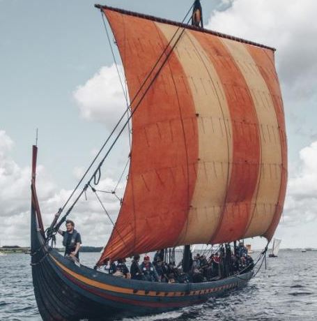
It hadn’t been a good week. They were on their way back from Largs, where they had tried to teach the pesky Scots a lesson or two for trying to take ownership of the Southern Isles. They had sailed from Norway a few weeks earlier with the largest fleet ever to leave its shores. If that wasn’t going to instil a bit of respect into that bunch of savages, then nothing would. With the crops planted, Ogmund had been eager to leave Orkdal for the summer and join the venture to help King Haakon. There was also the chance for a bit of raping and pillaging, something he was never averse to.
It had all turned out a bit of a mess really. They had assembled the fleet in the shelter of the Holy Island, but a storm had blown up out of nowhere and dashed several of the longships on the rocks. Luckily Rauðr Týsdagr had escaped the worst, and Ogmund had taken his Norsemen on land and to the top of a small hill where they had the advantage of height over the Scots gathering below. All had been going well, until some of his men had charged off down the hill to attack the Scots. However, this had misled the main group of his comrades into thinking they were fleeing the enemy (as if a Viking would ever do that anyway), and they had ran back to the boats again. There had been a lot of scrappy hand fighting during he had nearly had his arm hacked off by an over-exuberant Scot. But in the end, the Scots had run off and the Norsemen had bundled into their boats and sailed them back out into the Firth. In the morning, there was no sign of the Scots, so they had collected their dead and set sail back to Orkneyjar. Ogmund reckoned his side had won, but he wasn’t quite so sure if the Scots had been taught a lesson or not. It seemed a bit of an anti-climax to bring a huge fleet just to have a small skirmish.
And now they were trying to get back to Orkneyjar. It was all pretty late in the season, and the danger was that the freezing north winds would start and prevent them from making any progress.

“You are dreaming again”, says the First Mate, her nap over. “Can’t you ever focus on the present?”
I am about to chain her to the mast for such insubordination, but realise just in time that we are actually in the 21st century and can’t do that sort of thing now. I had been trying to imagine what a Viking commander might have been thinking on his way back to Orkney after the Battle of Largs in October 1263. Despite it being a fairly minor confrontation, with both sides claiming victory, it actually marked the end of Viking rule over the Western Isles and their amalgamation into Scotland. Quite momentous in the long run.

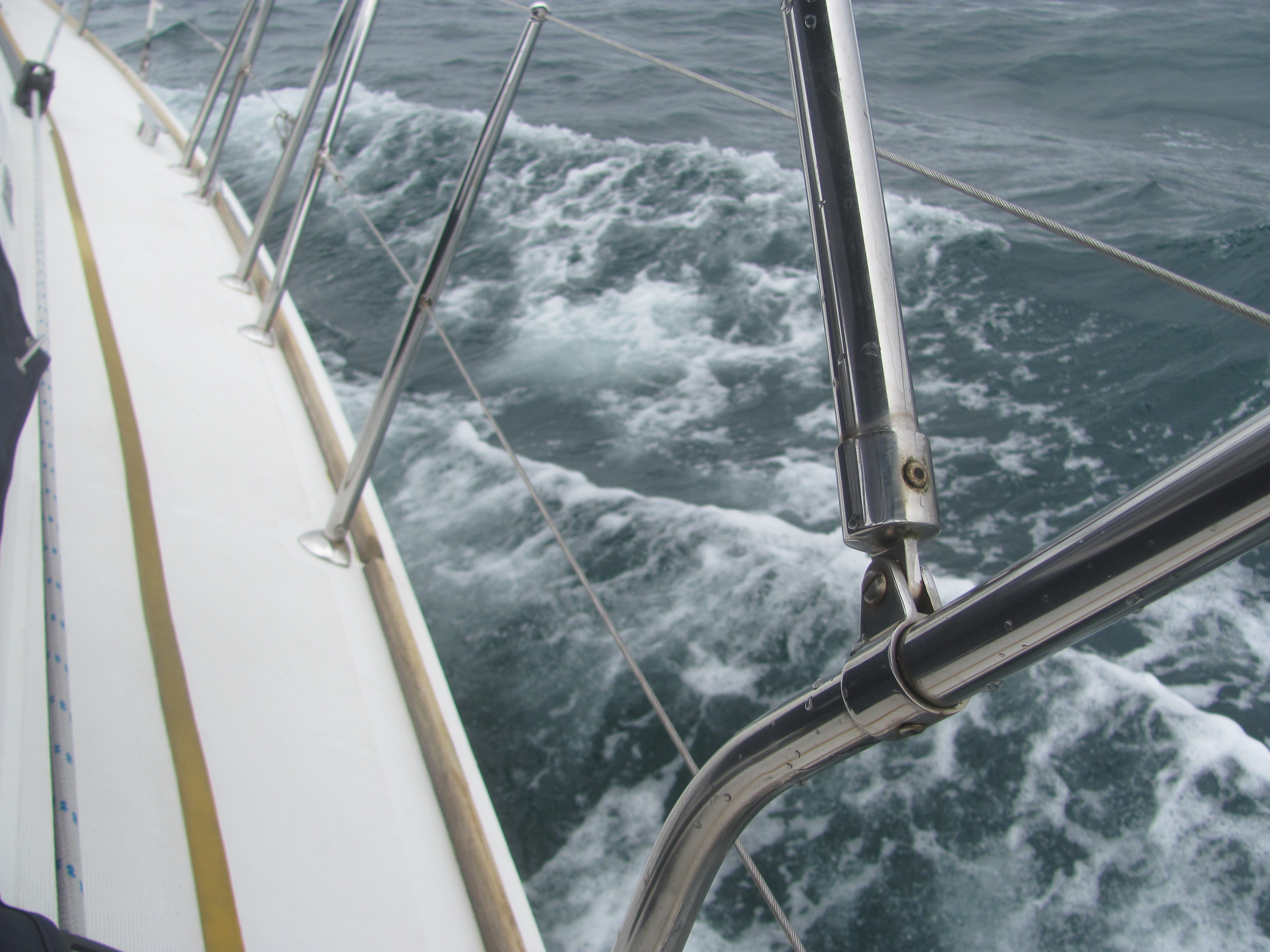
We prepare to round Cape Wrath. The wind will be directly behind us, and we decide to keep just the mainsail out and furl the genoa as it will be in the wind shadow. If that is not enough, we can think about goose-winging with the genoa poled out the other side.

Cape Wrath – the very name inspires fear, where the sea-gods show their anger at trespassers into their realm. The most north-westerly point of mainland Britain, it is the place where two tidal streams meet – the one coming around the east of the UK, the other from around the west. The resulting confluence can result in a maelstrom of whirlpools and eddies and dangerously high waves and overfalls if the combination of wind and tide are unfavourable. Ironically, the name Wrath actually doesn’t describe its temperament – it derives from the Old Norse word hvarf, meaning ‘turning point’. It was the point that the Vikings coming from Norway and Orkney would take a left to head off down for some raping and pillaging on the west coast of Britain.
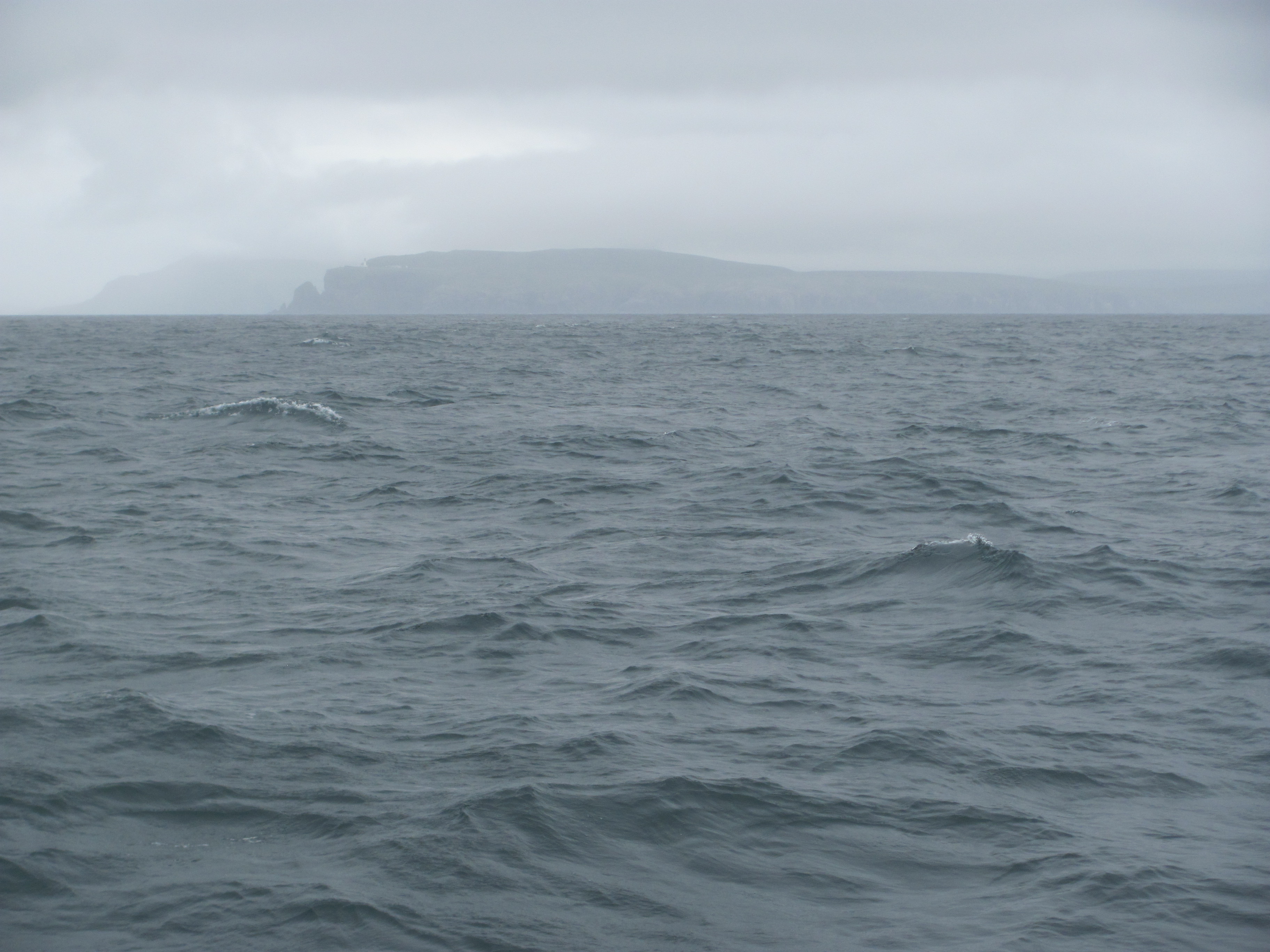
Most of the rocky peninsula is owned by the Ministry of Defence, who use it as a firing range to allow aircraft to shoot at the cliffs. Before leaving Stornoway, I had called the Range Officer to check if there were any firings scheduled for that day, but was informed by the answering machine that there were no firing scheduled for the whole of July. So that was OK then. At least we wouldn’t have a repeat of last year’s episodes at Lulworth Cove or Milford Haven.
We wonder whether we are crazy – most circumnavigators of Britain take the short-cut through the Caledonian Canal from Fort William through to Inverness, thereby avoiding the Cape. But it is too late now – we are there, and there is no point in turning back. We take a line about three miles out and steer east. The long swells previously coming in on the beam are now from behind, making Ruby Tuesday pitch up and down more as they surge underneath us. In the mist off to starboard, we can see the cliffs of Cape Wrath, waves breaking on the rocks at their base and sending plumes of foam skywards. Seagulls scream demoniacally around us, resentful of our presence. We feel as if we are on the edge of the known world. Beyond here there is nothingness.
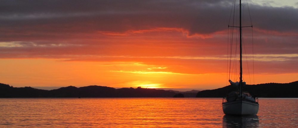
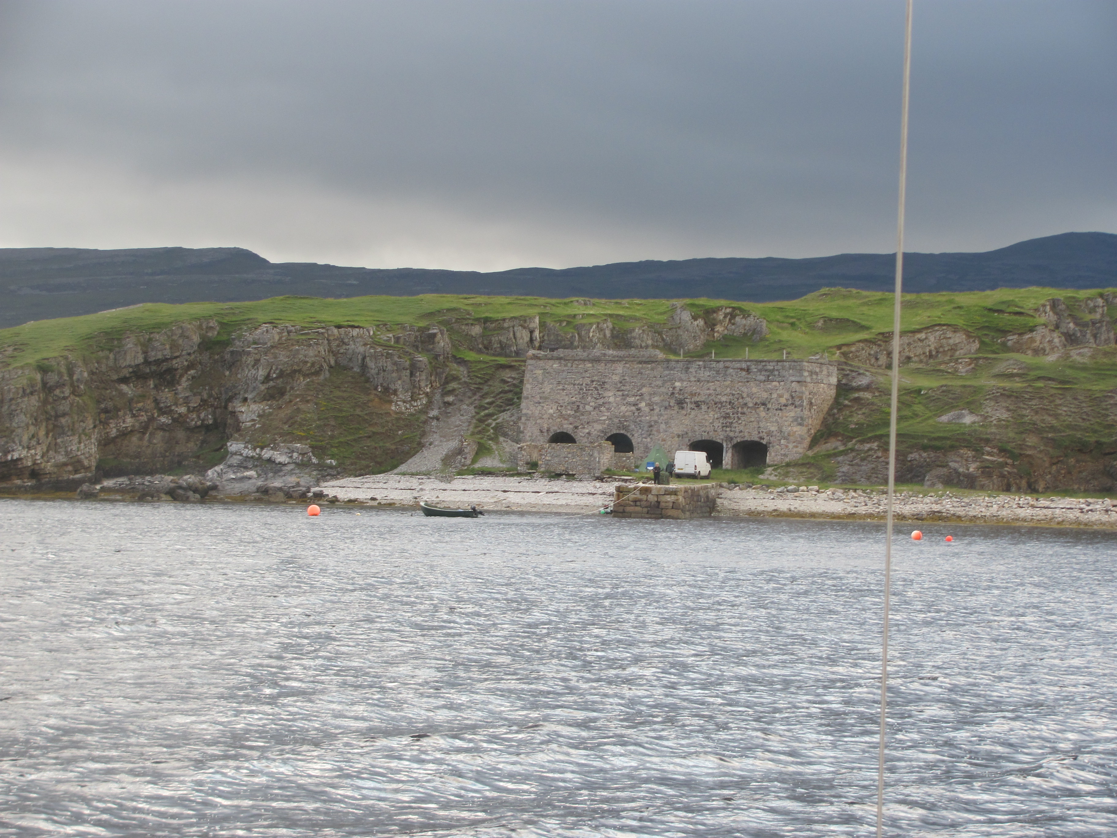
But we are safe and make progress, arriving in Loch Eriboll in the late afternoon. Our plan is to anchor in a small inlet called Rispond Bay just inside the entrance, but unfortunately there is another yacht there with the same idea, and together with it and a few fishing boats there isn’t enough room for us. We motor on further down the loch to our second choice, Ard Neackie, a small would-be island joined to the mainland by a shingle spit. We find a spot to anchor on the south side that is quite sheltered from the north-west wind, and sit and sip our wine watching the sun go down behind the mountains at the top of the loch, and wondering aloud what the history is of the four lime kilns over on Ard Neackie. Overall, we feel quite pleased with ourselves – we had just made it around Cape Wrath, the scourge of mariners!

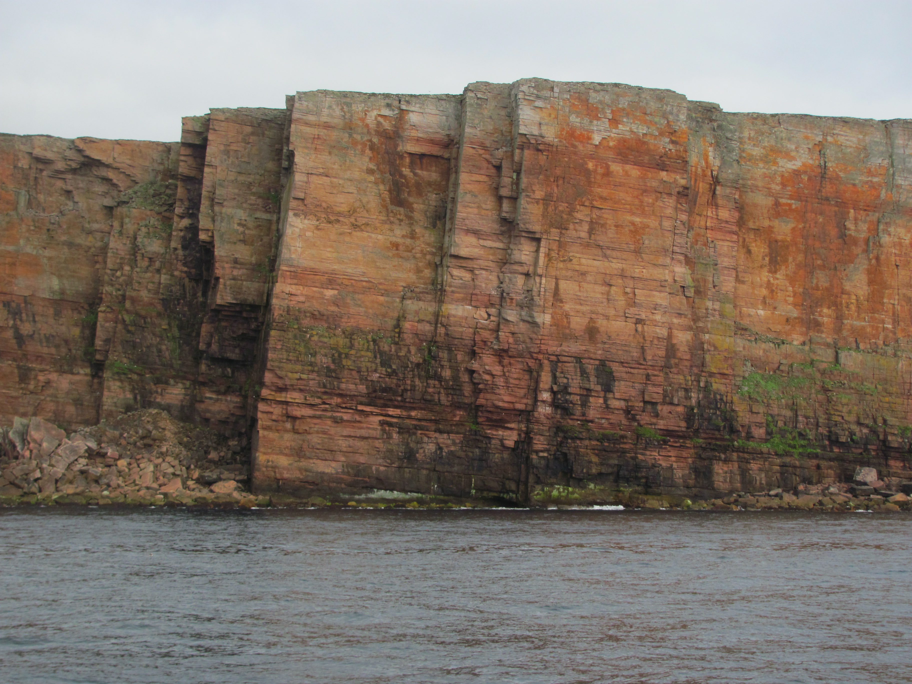
We leave the next morning around 0900. The morning light catches the cliffs at the entrance to the loch and accentuates the layering of the sediments and the caves undermining their bases.

We set the autopilot and let Ruby Tuesday steer herself, albeit keeping a good watch out for other boats and nasty things in the water. We pass numerous container ships heading in both directions, and amuse ourselves with trying to guess where they might be off to, then check to see who was closest using the AIS, which tells us all sorts of useful information about them. Some of them pass quite close and we can see the huge numbers of containers stacked up on top of each other.
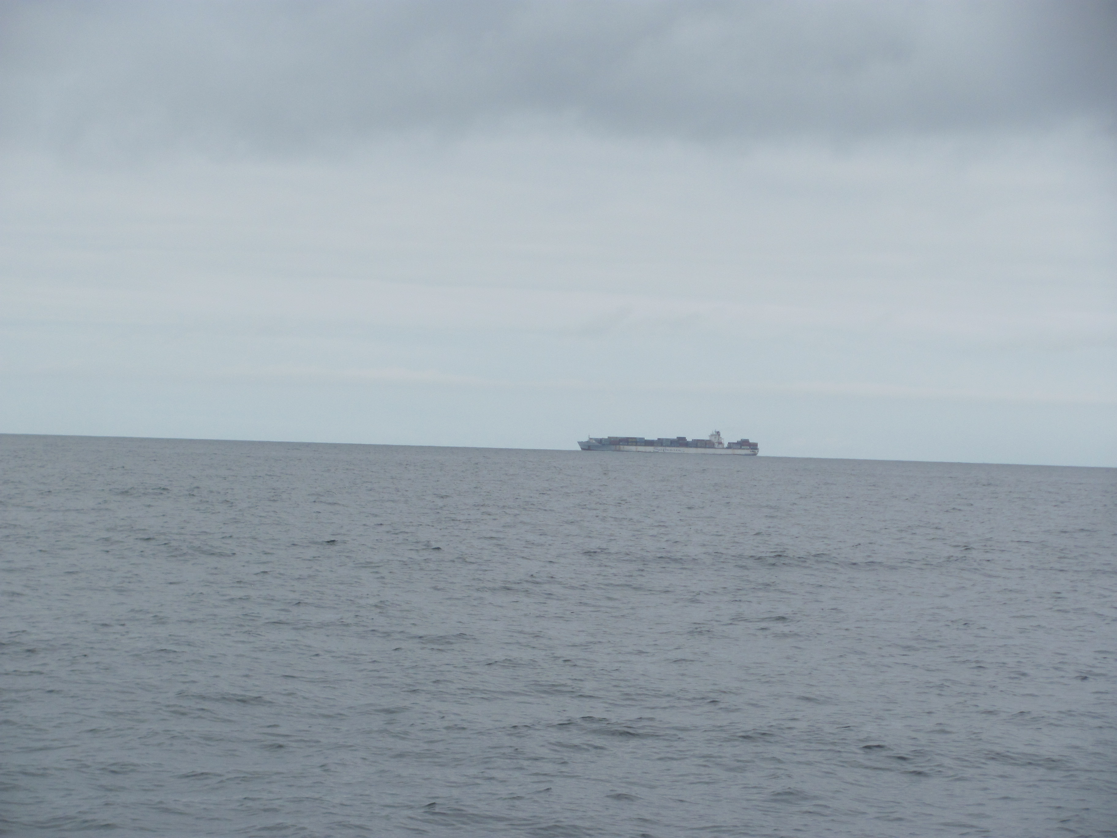
“Do you think our radar would pick up a container floating in the water?”, says the First Mate. “I read somewhere that 10,000 containers fall off ships worldwide every year.”
“I’m not sure”, I answer. “I remember reading that the number that actually float is quite small, and that they sink to the bottom quite quickly.”
“I suppose it depends on what is in them”, she says. “And how water tight they are. ”
“There was an article in one of the sailing magazines once”, I recall. “The theory is that they won’t float just below the surface – they will either float upright in the water where you can see them if they have something buoyant in them like polystyrene packaging, or else they’ll sink straight away.”
I hope that the writer of the article know what they were talking about. But the First Mate has a point, and we add floating containers to the lobster pot buoys that we are continually on the look out for. Hitting a floating container would be a serious recipe for having a bad day. I scan the water in front of us for any hazards. There doesn’t seem to be anything.
The hours pass, the hot sun beating down on us and burning our faces. Eventually, the clouds above Orkney appear above the horizon. We can’t see the land yet, but know that it has to be somewhere. I suddenly think of how the first Maori must have felt as they approached New Zealand – the first thing they saw was the long white cloud above the land, the origin of the name Aotearoa.
I decide to have a quick scan of my “Land of Mountain and Flood” and read up on the geology of Orkney. Apparently its rocks were formed in Devonian times, around 400 million years ago. At that time, it was part of the super-continent of Laurentia south of the equator and probably was about the same latitude and longitude of where the Kalahari Desert is nowadays. There had just been a massive mountain building event called the Caledonian Orogeny that had occurred when three continental plates had collided. At the base of these mountains was a vast basin which filled with fresh water to form Lake Orcadie. Amazingly, this lake lasted for 10 million years or so (although it did dry out from time to time), during which time the mountains were eroded down with much of the sediment ending up at the bottom of the lake. Fish lived in the lake, and when they died fell to the bottom. If the conditions were right, their bodies were preserved in the sediments in the deeper parts of the lake where there was little oxygen.
Eventually, Lake Orcadie filled up with sediment completely, in places 4 km thick, and disappeared. Over millions of years since then, the rock was compressed to form sandstones and mudstones. While this was happening, the continent of Laurentia was moving northwards at about 2 cm per year, splitting as it went to form the Atlantic Ocean, with what had been Lake Orcadie ending up on the eastern side of the split. I find all that just mind-boggling. Two centimetres a year doesn’t sound much, but over 400 million years that comes to around 8000 km, which is about right, I suppose.
Because the sandstone was bedded down in layers, it can be split easily along these layers to form nice flat ‘flagstones’ which can be used for all sorts of things, particularly building.
“Look”, shouts the First Mate suddenly. “I can see Orkney.”

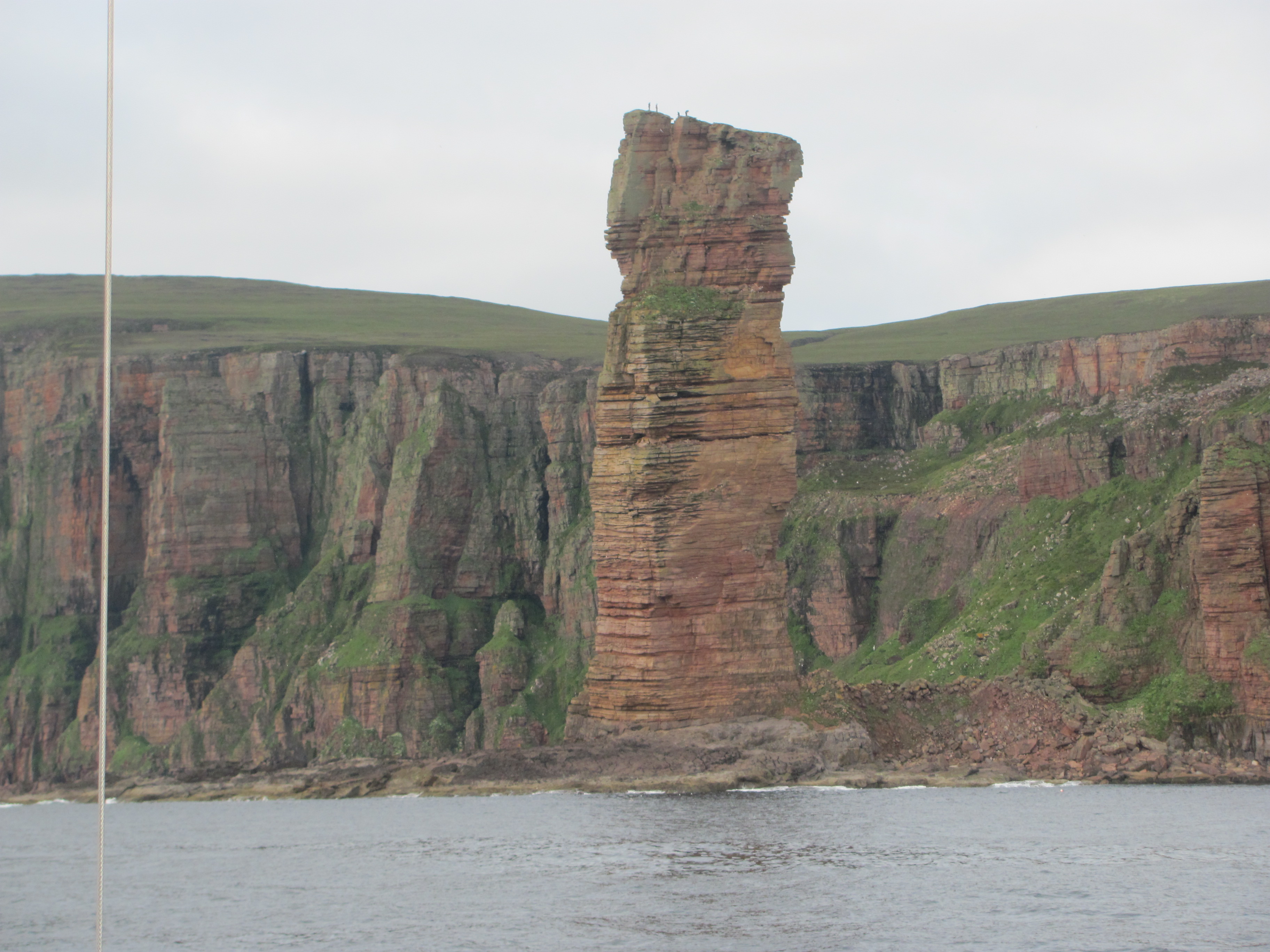
I put down the book. Sure enough, land has appeared on the horizon. Through the binoculars we can make out the cliffs of Hoy, one of the islands of Orkney. The hills on Hoy are surprisingly steep, which comes as a surprise – I had always thought of Orkney as being flat and fairly featureless, but these are anything but. In the soft light of the afternoon sun, the cliffs look like a multi-layered rainbow cake. As we get closer, we see skuas, guillemots, gulls and kittiwakes wheeling and gliding on the up-currents. On the top, there are four walkers silhouetted against the sky.
Soon we can see the Old Man of Hoy, a giant sandstone sea-stack on a lava base just off the coast, pointing like a finger to the sky. I read later that it is a very recent feature – only 250 years ago it was a headland, and between then and now it has been eroded into the stack we see today. Not long ago, it even had two ‘legs’ with a hole between, but one of them has now been eroded away and it is only a matter of time before the remaining one does too and the whole stack comes crashing down. Already cracks are starting to appear.
We arrive at Hoy Sound, the western entrance to Scapa Flow, through which we need to pass to reach Stromness, our destination. Here we need to get the tides right, as the flow through can be as much as 8 knots in each direction, and it would be impossible to make any progress, and indeed could be quite dangerous, if the flow was in the wrong direction. As it is, we are about mid-tide of the easterly flow, so it should carry us through without any problems. If we had got the timings wrong, we would have had to wait somewhere safe until it changed again.
We gather more and more speed as the current grabs hold of us. We are in its control, there is nothing that we can do now. It reminds me of going through the Strangford Narrows in Northern Ireland last year, but this time we reach 12.6 knots compared to the 11.4 knots then. That’s fast!

For ten or fifteen minutes, we ride the current like a bucking bronco; eddies and whirlpools appear and disappear as the water competes for space in the narrow sound. I begin to worry that we might get swept past the entrance to Stromness harbour at that speed. We crab as best we can across the fast-flowing stream, past the beacon marking the shoal coming out from the Skerry of Ness, and eventually manage to make it to some calmer water. The harbour awaits. We have made it!


Wow, impressive, you made it! I had no idea the Old Man of Hoy is at risk. We’d better get there asap!!
>
LikeLike
Hi Birgitta, yes, made it around. Quite lumpy, but we stayed out from the Cape where it was less turbulent. Hopefully the Old Man of Hoy will be there for a bit longer yet, but you never know. Just don’t be underneath when it falls though!
LikeLike
Glad to hear that you arrived safely. Brings back good memories of the journey we had but in reverse order!
LikeLike
Hi Anne, yes, we got around Cape Wrath OK, a bit bumpy, but no problem really. Finding Orkney very interesting.
LikeLike