A deep ocean trench, an egg-shaped boat, and an anthropological adventurer

“Oh, no”, says the First Mate, peering through the binoculars. “”There’s someone else already there. I was hoping that we would have it all to ourselves.”

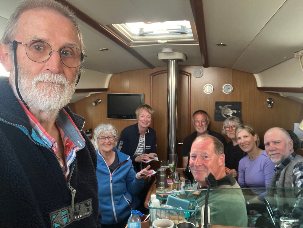
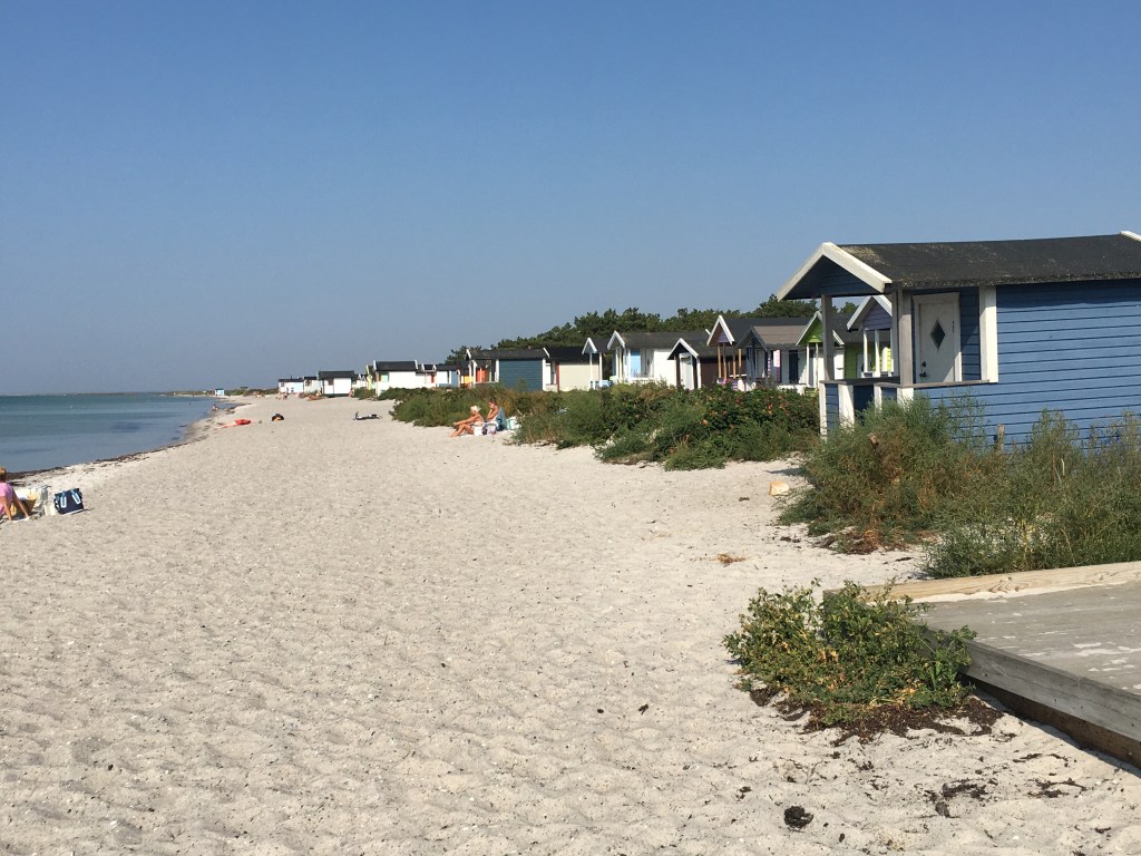
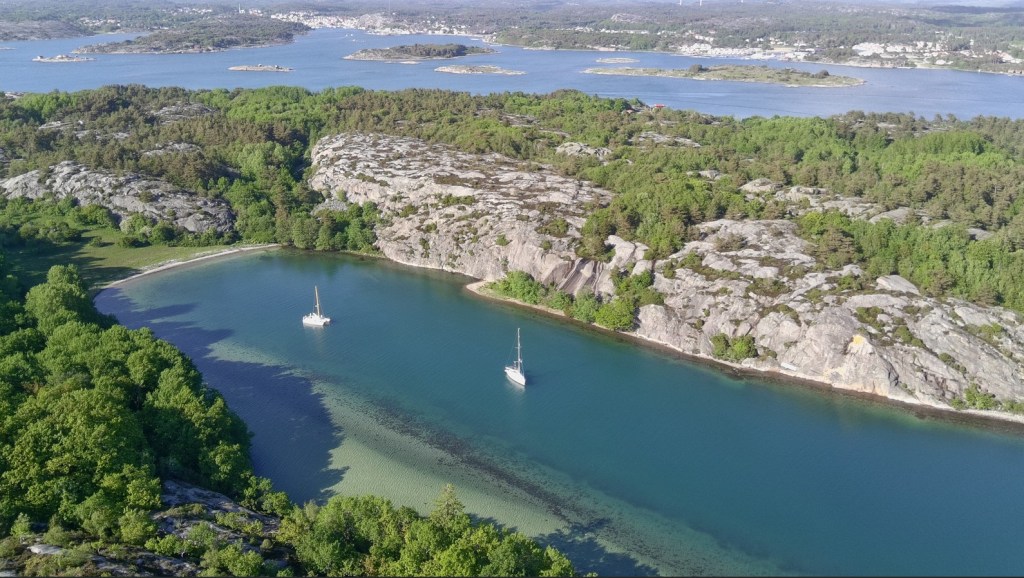
We had set sail from Smögen that morning. The other ‘foragers’ had already dispersed – Hekla had already left for Norway across the Skagerrak as they had to be in Bergen within a week to meet their daughter, Aloucia had decided to have a couple of days on Väderöarna (the Weather Islands) before doing the same, and Amalia was heading for Strömstad for a change of crew. We are meandering our way northwards so that we can visit our friends Ståle & Gunvor north of Oslo. On the way, we had seen a small bay that looked ideal for anchoring overnight.

“Never mind”, I say. “We can anchor a bit away from him and pretend he isn’t there. At least it isn’t packed with hordes of boats.”

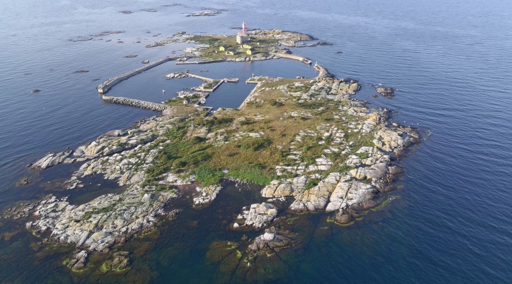
We drop anchor in the middle of the small bay. It is idyllic. A steep cliff drops precipitously to the water on one side and lush green woodlands cover the gentler slopes on the other. Not a house, car, or even a telephone pole are to be seen. We could be the only people alive. Apart from the sole occupant of the other boat, of course.

Anchored in Otterön bay.

We cook dinner and bask in the warmth of the last sun of the day before turning in.

In the morning, I awake and lie watching the patterns of light dancing on the ceiling for a few moments. I make myself a cup of tea, and go out on deck. The other boat has already gone, and we are alone. A small gulp of cormorants fly overhead in formation, disappearing over the cliffs. Further down the bay, two swans come in to land, their feet swooshing across the surface before they settle down into the water, shaking their wings dry before folding them.

I pick up the book I am reading at the moment. It is the latest of John Gray’s, entitled The New Leviathans. Bleak but stimulating, he discusses the end of the liberal democracy era and its Enlightenment concepts of individualism, equality, universalism, and meliorism – the idea that things will always improve. Only 30 years ago, with the fall of the Soviet Union, the feeling in the West was that these ideas had triumphed over everything else, that liberal democracy was the pinnacle of human government, and that all that still needed to be done was to make every country believe that. Not so, says Gray – so many terrible things have happened since then, and the West and its freedoms are visibly crumbling with the rise of right-wing extremism, authoritarianism, and religious nationalism. The role of these new forms of government are more to protect citizens, or subgroups of citizens, rather than to protect basic freedoms. What’s more, he argues, all these -isms are just words with no substance; the reality is that it is just people going about making decisions for their daily lives. Such words, however, are dangerous as they make people do things in the name of ideologies.

“Breakfast time”, come the dulcet tones of the First Mate from down below. “I’ve put on the coffee. You can make the toast.”

I put down the book and go inside. Why am I reading this rather than enjoying the beautiful scenery around me, I ask myself. But I know I’ll continue reading it when the next chance comes.

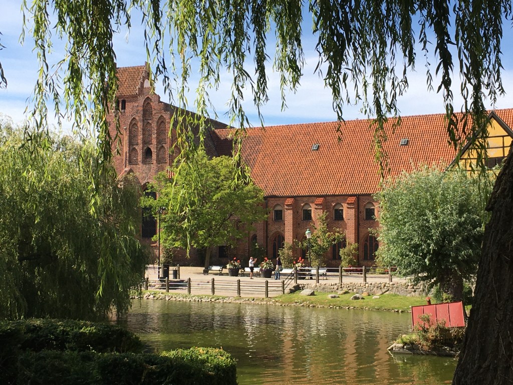
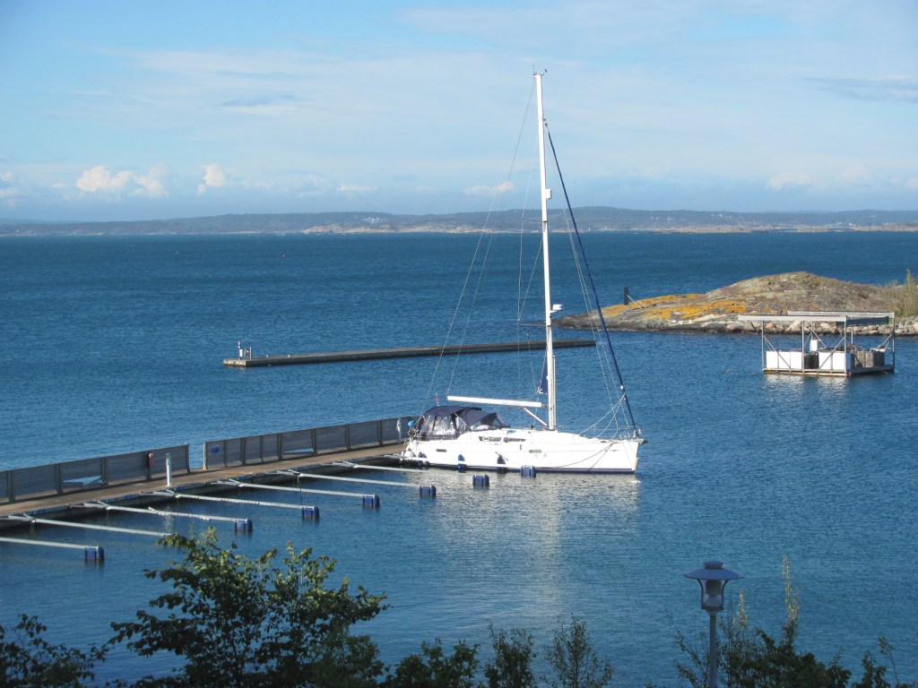
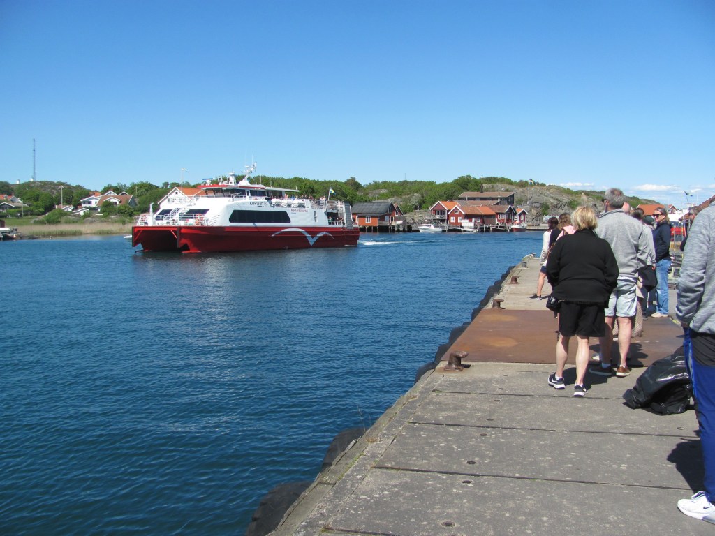
After breakfast, we push on to the Koster Islands, about 12 miles west of Strömstad. We arrive at Ekenas, the main harbour. There is a strong current through the narrow channel in which the marina is located, and it is not easy to tie up. The neighbours help us, but somehow we still manage to nudge the pontoon and take a small chip out of Ruby Tuesday. I am not very happy.

“Come on”, says the First Mate, obviously seeing the look on my face. “Let’s go and get an ice-cream. That’ll cheer you up.”

Tied up at Ekenas on the Koster islands.

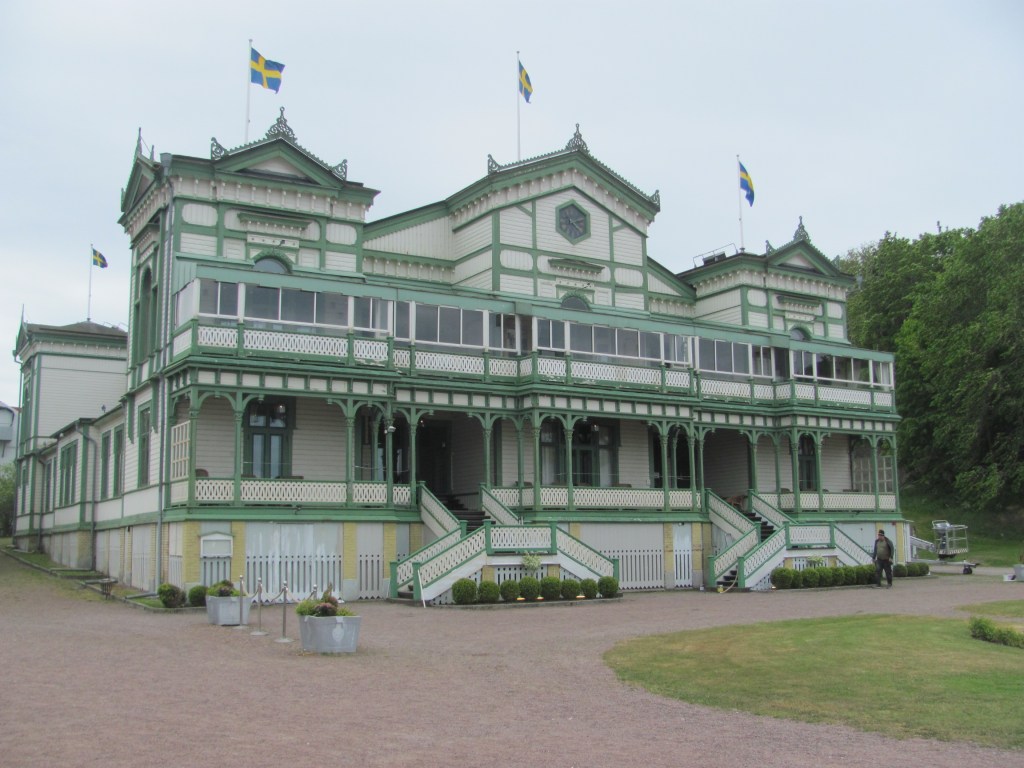
Near the ice-cream shop is a wooden building labelled the Naturum. It’s a kind of museum, and free. An enthusiastic woman greets us at the door.

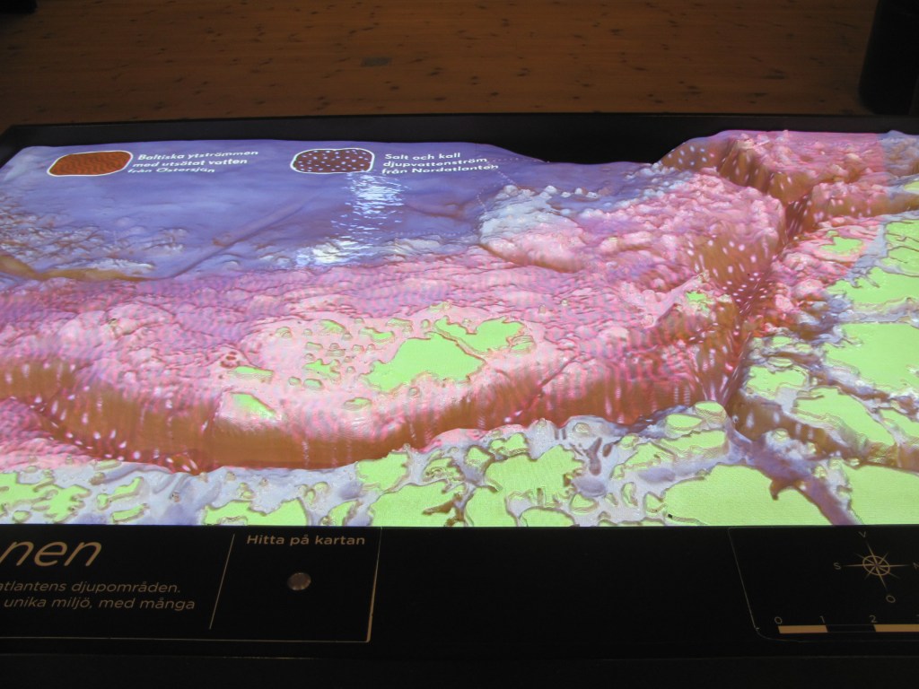
“Welcome to the Naturum”, she says. “I’m your guide. I am studying ecology at university. You can learn all about the natural history of the Koster Islands here. Did you know they’re perched on the edge of the Norwegian Trench?”

We have to admit that we hadn’t heard of the Norwegian Trench.

“It’s a deep trench that curves all the way around the south of Norway, up to the Oslofjord, then a bit down the west coast of Sweden just past the Koster Islands”, the Enthusiastic Ecologist explains, leading us to a scale model lit with pulsating lights. “It’s up to 700 m deep in places, and up to 95 kilometres wide. A current flows along it bringing water from the Baltic to join the Norwegian Coastal Current along the west coast of Norway. These pulsating lights show you the currents.”

Model of the Norwegian Trench and its currents.

We tell her that we are planning to sail across to Strömstad, and from there across to Risør in Norway.

“Well, you’ll be sailing over it both times”, she says. “In fact, the deepest part of it is actually just off Risør. Keep an eye on your sonar – the edge of it comes up very suddenly like a cliff, so you can’t really miss it.”

It’s fascinating stuff. I read that evening that the Norwegian Trench is unusual for oceanic trenches in that it has been created entirely by erosion and glacial processes about 1 million years ago rather than by tectonic plates moving over each other as most other ocean trenches are.

In the morning, we unload the bikes, and set off to explore the islands. We come to the grocery store in the centre of South Koster, which judging by the amount of people, seems to be some sort of communal meeting place.

The supermarket on South Koster island.

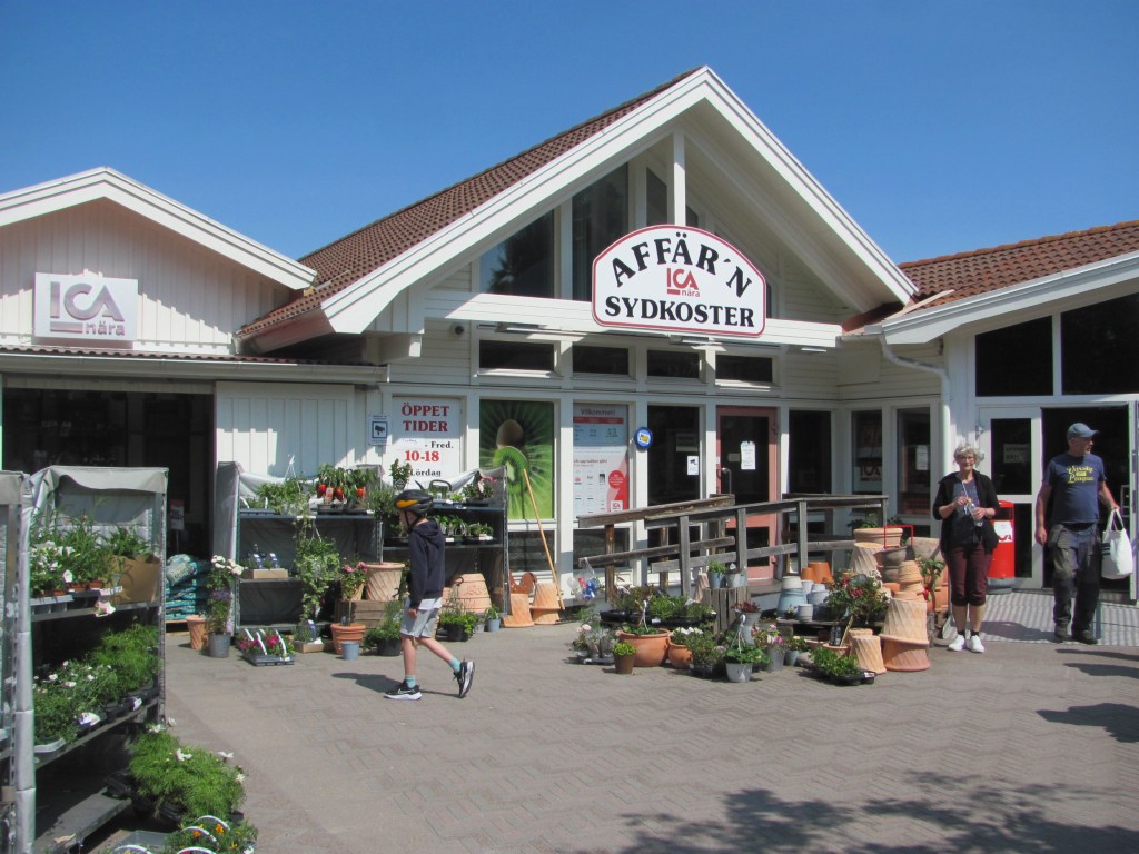
“Let’s get lunch here”, says the First Mate. “I’m famished. I’ll go in and get something to eat and drink. You stay here and find a table and look after the bikes.”

She comes back out with some sandwiches and orange juice.

The bread in the sandwiches is dry and they taste old.

“The packet says they are best before June 30”, says the First Mate. “That’s a month away. They should be OK.”

I notice on the packet that they were made on May 2. Not only that, they were made in Italy!

“I can’t believe it”, she says. “Made in another country a month ago. No wonder they taste funny.”

“Don’t beat yourself up”, I say. “At least the orange juice tastes good.”

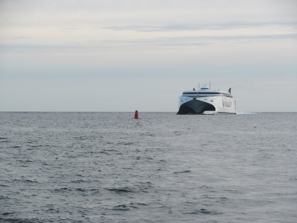
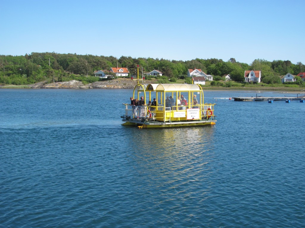
We eventually reach the village of Långegärde on the edge of the narrow channel that divides South Koster from North Koster. The electric ferry from the mainland has just arrived and is disgorging its passengers. We had seen it several times before when it stopped at Ekenas where we are tied up – with almost silent engines apart from a faint hum, it had seemed to creep up on us without warning and rock our boat violently with its wash. But all credit for being sustainable.

The electric ferry arrives at Långegärde.

There is a small chain ferry that goes from one side of the channel to the other. We join the queue.

“The last ferry goes at 1630”, a woman in the queue tells us. “If you miss it, you can get the main passenger ferry back again, but it doesn’t go until 1900. You’ll have a bit of a wait.”

The chain ferry from South Koster across to North Koster.

On the other side, we continue our cycle ride through beautiful green forests until we come to the small harbour of Vettnett. There isn’t a lot there apart from children fishing, but it is beautiful.

“We’d better get back”, says the First Mate. “I think we should try and catch the 1630 chain ferry. I don’t really want to wait around until 1900.”

We make it just in time, and are soon back on the South Koster side.

“You can actually work the chain ferry yourself”, the university student operating it tells us. “But you need to have been trained and to have a license. Lots of people who live on North Koster do just that and are not tied to timetables.”

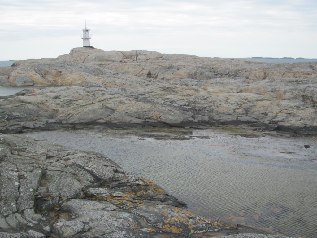
On the way back to the boat, we stop and climb the path to the highest point on the Koster Islands, Valfjäll, rising to the awe-inspiring height of 50 m. But there is a good view of the archipelago from the top.

Valfjäll, the highest point on South Koster.

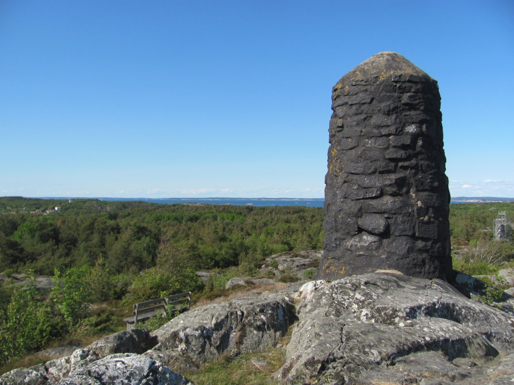
“I read that you can even see the Weather Islands from here”, says the First Mate, pointing southwards.

I strain my eyes, and just manage to see a slight smudge on the horizon. I clean my glasses to get a better view.

The Weather Islands seem to have disappeared.

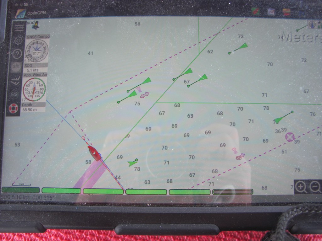
In the morning, we sail over to Strömstad on the mainland. I keep an eye on the depth underneath us. Sure enough, as the Enthusiastic Ecologist said, it plummets suddenly from about 20 m near the harbour to more than 200 m as we cross the Norwegian Trench.

“I don’t like that very much”, says the First Mate. “All that water underneath me.”

“We learnt when we were kids that you can drown in a foot of water”, I say. “It hardly matters if it is 20 m or 200 m underneath us. Better instead to make sure that we don’t fall overboard.”

Arriving in Strömstad.

We have decided to leave Ruby Tuesday in Strömstad and take public transport to Oslo, have a couple of days there exploring the city, then carry on up to Gjørvik in the centre of the country where our friends, Ståle and Gunvor, live. We had considered sailing up the Oslofjord to Oslo, but had been advised by a number of people that while sailing up the fjord is not very difficult, sailing back again is, mainly because the predominant winds are from the south and we would be battling them all the way. As we still needed to make it to the west coast of Norway, a not inconsiderable distance, we decided this was good advice.

The First Mate finds an AirBnB in Oslo for a couple of nights, and books tickets on FlixBus.

“We need to get the local 111 bus out to the E6 motorway to catch the FlixBus”, she says. “There’s only 10 minutes between one and the other. Let’s hope the local bus is on time.”

It is, and soon we are whizzing along the E6 on our way to Oslo.

“The AirBnb is in Rosenhoff”, says the First Mate, when we arrive. “We need to catch a tram there. If we buy a 24 hour Oslo Pass, we can use it on all public transport to go exploring tomorrow as well. It also includes free entrance to museums and art galleries.”

In the morning, we take a ferry across to the Bygdøy peninsula where the Fram and Kon-Tiki museums are located.

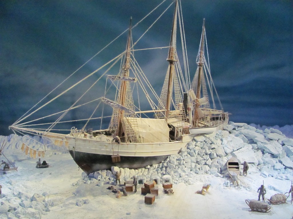
The Fram was a purpose-built ship for polar exploration. Its hull was ingeniously designed in an eggshell shape so that the ice would force it upwards rather than crushing it, effectively ending up floating on the surface. The rudder and propeller could be retracted so that they wouldn’t be damaged by the ice. It was specially insulated and stocked so that the crew could live on it for up to five years.

The egg-shaped hull of the Fram.
The propeller and rudder could be retracted to avoid ice damage.

“The Fram was commissioned and used first by the Norwegian polar explorer Fridtjof Nansen in 1893”, a panel tells us. “It was used to test his theory that there was an east-west current across the north pole. By trapping the Fram in the ice around the Siberian islands, they found that it emerged into the North Atlantic Ocean after three years, partly proving the theory, although it didn’t cross the actual North Pole.”

The Fram locked into the ice.

“It was also amazing that the same boat was used by Roald Amundsen when he reached the South Pole in 1911”, says the First Mate over a coffee later. “He was originally planning to be the first to reach the North Pole, but was beaten there by the American explorer Robert Peary, so he secretly changed his mind to aim for the South Pole. He didn’t even tell his crew until the last minute of the change in plans.”

Roald Amundsen, 1872-1928.

“And in doing so, he beat Scott’s British expedition there by five weeks”, I say. “I remember learning about it at school, as Scott had stopped in New Zealand on his way to stock up. Unfortunately, they all died on the way back. It’s the stuff of a heroic British legend, even though they failed. Now, drink up, and let’s go and see the Kon-Tiki museum. It’s just across the way.”

The Kon-Tiki is a raft built of balsa wood that was used by the Norwegian explorer Thor Heyerdahl to test the theory that the inhabitants of the the Polynesian islands could have originated from people who travelled by boat from South America using the Humboldt Current to carry them. He built the Kon-Tiki in Peru in 1947, and by reaching the Polynesian islands of Tuomotu, showed that it was at least feasible.

The preserved Kon-Tiki made from balsa wood.

“It’s a great story”, says the First Mate, “but did you read that genetic and language information collected since have all but proved his theory to be false, and that Polynesians have their origins in South East Asia. Most reputable anthropologists nowadays dismiss his theories completely.”

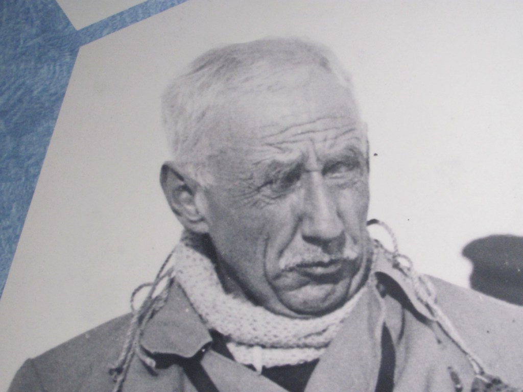
“It didn’t seem to deter him, though”, I say. “Another of his theories was that the Ancient Egyptians could have sailed across the Atlantic to trade with the inhabitants of the Americas. So he built another raft called the Ra out of papyrus. After one failure, he rebuilt it and managed to sail from Morocco to the Caribbean in 1970, again proving that it was at least possible. I remember keeping a scrapbook on it when I was at high-school.”

Thor Heyerdahl’s Ra II made from papyrus.

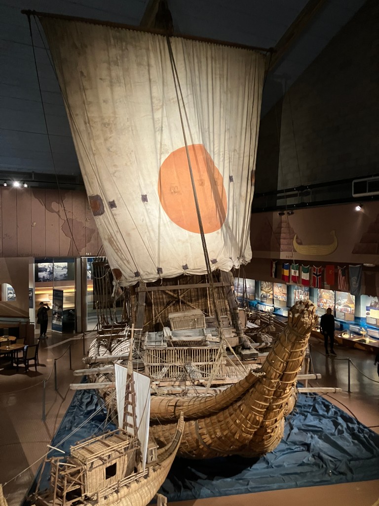
“He certainly had an adventurous life”, says the First Mate. “It’s a pity after all that that none of his ideas turned out to be right.”

“That’s how science works”, I say. “People come up with different ideas, put them to the test, consider all the evidence, and either discard, modify or adopt them. Unfortunately, Heyerdahl’s mostly ended up in the dustbin. But you never know what will happen in the future.”

The best job in the world, a transvestite thief, and a sustainable sea harvest

“It’s the best job in the world”, says the woman, as she climbs out of the small single-seater, electrically-powered vehicle with glass doors. “I used to have a higher paying job, but I have been doing this for about five years now, and couldn’t wish for anything better. I know everyone on the island, and they all know me, and I feel as if I am doing something useful. And this little thing here protects me from the elements and means that I don’t have to walk everywhere.”

We are in the town of Marstrand on the west coast of Sweden, and are talking to the postwoman of the island.

The best job in the world!

“These are the letters I have to deliver”, she continues, pointing to rows of envelopes arranged in a rack on one side of the cabin. “And the big parcels are in the back here.”

“Do you know where we can get some lunch?”, the First Mate asks her. “Everything seems to be closed today.”

“Yes, places close here when the weather isn’t so good, as not many tourists come over”, the postwoman says. “But I think that the bakery along the waterfront is open. You could try there.”

She climbs in her post-van, presses a button, and whizzes away over the cobblestones.

We find the bakery and order sandwiches and coffee. A brochure on the town is lying on the table.

“Marstrand was founded in the 13th century by the Norwegian king Håkon Håkonsson because of its strategic location, being ice-free, and its good shelter from all wind directions”, it tells me. “It developed as a fishing town, and made its wealth from herring, becoming known as the herring capital of Europe. At one time, the street lamps in Paris were all lit with herring oil from Marstrand. It became part of Sweden in 1648, which is when the fortress was built. The herring declined in the late 19th century, however, so Marstrand rebranded itself as a holiday resort attracting the rich and famous. Nowadays it is well-known for its water sports, particularly sailing, hosting many events.”

Grandeur of yesteryear.

The First Mate strikes up a conversation with some German tourists at the table next to us.

“There’s a nice walk around the island”, they say. “It starts just at the north end of the harbour. Here, you can use our map. We are finished with it. And don’t forget to see the Eye of the Needle.”

It’s not much of a day – grey and overcast, and a chilly wind is blowing, but we do want to see some of the island, so we set off.

“Look, here’s the Eye of the Needle they were talking about”, says the First Mate. “The Nålsögat. Apparently smugglers used to use it as a hiding place. I’m glad I didn’t have that extra bit of toast for breakfast this morning. I wouldn’t have fitted through. I don’t know how you are going to manage though.”

We have come to a place on the route where the path narrows to a tight gap between several large boulders. With a public path running right through it, I am not sure that it makes a good hiding place, I think to myself. Perhaps there wasn’t a trail there then.

Eye of the Needle.

Further on, we reach Skallens Lighthouse at the western most tip of the island, and sit on the rocks watching the crashing waves where the Kattegat and the Skagerak seas meet. The grey skies and the cold wind only add to the wild and elemental atmosphere of the place.

Patterns on the rocks in front of us make me think of the vast depth of time since they were created, certainly well before humans appeared on the scene. Was it a day like this that a marine creature hauled itself out of the sea to give rise to the diversity of land animals we see today?

Ancient patterns.

On the way back from Skallens Lighthouse, we pass Carlsten Fortress on top of the hill. Unfortunately, it is closed until the following weekend, when summer officially starts. However, we are able to get a glimpse of it from the path running around the walls.

The tower of Carlsten Fortress.

“After the Treaty of Roskilde in 1658 between Sweden and Denmark, Marstrand became Swedish”, a panel informs us. “Because Marstrand was becoming an important trade hub, King Karl X Gustav of Sweden had the fortress built to protect the town. However, this wasn’t entirely successful, as it was captured again by the Danish a couple of times after that. When it once again returned to Swedish hands, it was expanded several times and used for the last time in WW2. In 1993, it was declared to be no longer part of Sweden’s defence installations, but it has been maintained and is a tourist attraction nowadays.

Arriving back at the boat, we pass the Strandverket Art Museum, formerly an old fort. Unfortunately it is also closed until next weekend.

Strandverket Art Museum.

“The girls around here are certainly pretty tall”, says the First Mate, standing next to a figure just outside the entrance. “It must be all the fish and sea air they get.”

The long and short of it.

“The guide book says that the fort once housed a notorious Swedish master-thief called Lass-Maja”, I read. “He specialised in dressing up as a woman to fool his victims and to make it easier to escape. Sometimes he dressed as a lady’s maid, or a housekeeper, or a prostitute, even flirting with some of the men he was planning to rob. Eventually he grew to be so comfortable wearing women’s clothes, he carried on doing so in his spare time. However, one day his luck ran out when he stole some church silver, and he was tried and imprisoned here in Marstrand. His memoirs became very popular with the reading public in the 19th century, so much so that he was eventually pardoned by the king and released.”

“Who says that crime doesn’t pay?”, sniffs the First Mate.

“The geology of Sweden is quite fascinating”, says Spencer that evening, as we sip our wine. “It is part of the vast continent of Baltica, which formed around two billion years ago through the collision of three older tectonic plates which are now part of Russia, Ukraine and Scandinavia. Around 700 million years ago, the combined landmass was in the southern hemisphere, but it moved north about 450 million years ago to collide with the Scotland and Greenland plates, and later with the Siberian plate in the east to form the Ural Mountains. So Baltica has been around a bit. The rocks you were looking at this afternoon were probably formed around a billion years ago.”

“You know so much for a spider”, I sigh. “Especially as it all happened so long before your or my species even existed.”

“That’s the advantage of having my web connected to the World-Wide-Web”, he smiles.

With favourable winds the next morning, we set off northwards for Smögen. On the way we pass the picturesque fishing village of Mollösund with its white houses stacked neatly above the narrow channel between it and the neighbouring island.

Mollösund.

We stay a night on the car-free island of Käringön with its eponymous landmark statue of an ‘Old Woman’, supposedly giving its name to the island.

The ‘Old Woman’ of Käringön.

Eventually we reach Smögen. Andy & Anne and his family and friends are already there with their new boat Amalia, and give us a hand tying up. Bob & Fiona in Hekla of Banff, and Simon & Louise in Aloucia arrive not long after us, completing the quartet of boats. We had all met on the Cruising Association Rally in the Åland Islands in 2023, and had found that we have similar cruising routes planned in the following years. We had already seen Aloucia this year when she called in at Malmö to have her sails repaired.

The mariners arrive in Smögen.

Louise has arranged for us all to attend a course in Smögen on sea-foraging.

“We did a sea-foraging session while we were in South Africa over the winter”, she explains. “We learnt a lot about what you can and can’t cook, including kelp pasta. It was great fun, and they put us in touch with a Swedish woman in Smögen who runs sessions snorkelling for seaweed with outdoor cooking of whatever we find afterwards.”

We have arranged to meet the organiser, Linnea, at a carpark near the top of the harbour, just past the iconic fishermen’s huts.

Quintessential Smögen.

Louise leads the way, the rest of us following with our wetsuits, mask, fins and snorkels crammed into our rucksacks. Linnea is already waiting, busy unloading an eclectic mix of pots, pans, primus stoves, plastic boxes with tasty-looking food inside, and an assortment of neoprene boots, wetsuits, hoods, and gloves for those that don’t have their own.

“It isn’t much of a day”, she says, “But the place we are going is fairly sheltered from the winds, so it should be OK. It’s only about ten minutes’ walk from here.”

“I’ve been doing this now for several years”, she tells us on the way down. “I’ve also written a book and seaweed foraging. The sea is a tremendous resource, and we don’t really make enough use if it in a sustainable way. I’ll show you which species are good to eat, what they contain, how they are harvested sustainably and cooked. Most of them contain lots of nutrients – sea lettuce, for example, has fatty acids, magnesium, sodium, potassium, calcium, phosphorus, iron, iodine, and vitamins A, B, C, D and E. We’ll only pick what we will eat. Afterwards, you can help prepare lunch with me. And, of course, help me eat it!”

“There are also plants along the shore that you can eat”, she continues. “Look, these are violets – the flowers and leaves are quite sweet and make a good addition or a garnish to a salad. But you can’t eat the roots as they are toxic. And these are beach asters – the leaves are edible and can be added to salads, stir-fries, or used as a side dish. And here’s some sea beet – you can boil this like ordinary spinach. But now let’s get changed and we can see what we can find in the sea.”

Tasty wild violets.

We find places behind the rocks to struggle into our wetsuits that don’t seem to have changed in the same way that our bodies have since they were last worn, several years ago in my case.

“You can borrow these boots, gloves and hoods”, says Linnea. “It’ll be quite cold, so I think you will need them.”

I am starting to wonder if it was a good idea to sign up to the session. I don’t really do cold these days. But the others are all looking very enthusiastic, so I pretend to limber up as though I am raring to go.

Somehow we manage to squeeze ourselves into our wetsuits, carefully squashing all the bulgy bits in through judicious inhalations. My only worry is that getting out of it might be harder than getting in. We’ll cross that bridge when we come to it, though.

“Are you going to be able to walk down to the beach in that?”, says Andy cheekily.

In I get …

I clamber down the small ladder, and gasp as I jump into the water. It’s freezing. I almost jump back out again, as I feel it finding its way into the thin layer between the wetsuit and my skin. But I have done enough diving to know that it will only be a few seconds before my body heat warms it and it will become another insulating layer.

“This is sea lettuce”, says Linnea, clutching a mass of green foliage looking remarkably like the lettuce that outlasted Liz Truss. At least that’s what I think she is saying, as she is wearing her mask and snorkel, and speaks with a Swedish accent.

Linnea shows us sea lettuce and sugar kelp.

We spend the next hour or so swimming along a rock wall picking sugar kelp, oarweed, gutweed, bladder wrack, knotted wrack, saw wrack, bootlaces, Irish moss, and lavar, and putting them into little net collecting bags. Soon Linnea signals to us that it’s time to get out. None too soon, as I am starting to feel a little bit cold, especially from the small stream of water finding its way through the gap between my hood and wetsuit, down my spine, and out through one of my legs.

Foraging for seaweed.

Soon we are back in our warm clothes. Fortuitously the sun has appeared, and we bask on the rocks to get our circulations working again. Linnea, meanwhile, has the primus roaring, and is unpacking the food she prepared beforehand. We are each given jobs of cutting, slicing, frying, boiling, and spreading. My job is to cut the bladder wrack into strips and boil it.

Preparing the harvest.

Soon we are loading our plates with chunks of cod and cheese fried with sea lettuce, gutweed and tomato salad, kelp pasta, boiled bladder wrack seasoned with lemon and pepper, lashings of lavar, and numerous other tasty bits and pieces.

Satisfied sea foragers.

“This is absolutely delicious”, says the First Mate. “I am going for my third helping.”

“Be careful you don’t turn into a nervous wrack”, I say.

A near miss, a twisted torso, and different minds

“Look!”, shouts the First Mate, pointing to a steep cliff to our port side. “You can see Hammershus castle up there. It’s hard to believe that we were up there yesterday. It looks quite impressive even from down here.”

We had left Allinge in the morning, edging our way carefully out of the small harbour with its dog-leg entrance, and are just rounding the northern point of Bornholm Island. The wind is from the north-east, giving us a comfortable beam reach as we head for Ystad, back on the Swedish mainland. Between here and there, however, we must cross a Traffic Separation Scheme (TSS) for the big ships, which the rules say that we need to do at right angles to minimise the amount of time crossing it.

“It reminds me of the time we crossed the English Channel”, I say. “It was like being in a pinball machine – no sooner had we dodged all the ships coming from one direction, we had to face a whole lot more coming from the opposite direction. Let’s see if we can get across here without altering our course.”

“Be careful”, says the First Mate. “We don’t want to have an accident at this stage.”

Running the gauntlet (we are the red one!).

We manage to make it through the north-bound lane without too much trouble. But traffic in the southbound lane is heavy, and there are five ships in a cluster that we need to avoid. The AIS tells me that we will pass behind the first three comfortably, but that we will pass in front of the fourth one with just 15 m as the Closest Point of Approach (CPA). That is a little bit too close for comfort! Hoping that the wind might strengthen and give us a bit more speed, or even drop so that we slow down, I keep an eagle eye on the AIS as we cross, but the CPA remains obstinately the same. As our paths converge closer and closer, I chicken out and decide to heave-to. As the ship passes about 100 m in front of us, we can see some of the crew leaning over the guard rails and smoking.

“Phew”, breathes the First Mate in relief. “That was pretty close.”

“Yes, I even noticed that it was Gauloises they were smoking”, I say.

Dodging the ships in the Traffic Separation Scheme.

Once clear of the TSS we alter our course to the east. As luck would have it, the wind shifts and drops, as does our speed.

“We aren’t in any hurry”, I say. “Let’s just take it easy and enjoy the sunshine.”

At a stately three knots, it takes most of the afternoon before we reach Ystad, our destination for the night.

“Better look out for that ferry over there”, calls the First Mate, pointing to something on the horizon. “It looks like it’s heading for Ystad too.”

“There’s plenty of time”, I say. “It’s miles away.”

But it’s a catamaran and travelling fast. In a few minutes it is just behind us. It blows its horn to tell us to get out of the way. We motor as fast as we can to a red buoy, and take a line just outside it so that the buoyed channel is clear. The ferry slows down and cruises past us.

Getting out of the way of the ferry coming into Ystad.

Obsession is already there. We aim for the berth just behind her. Ingemar gives us a hand tying up.

“Ystad is a pretty enough place”, he says over a cup of tea. “It’s a former Hanseatic town, and the church and some of the old half-timbered houses are worth a look. It’s just a short walk into the centre of town from here. Ystad’s other claim to fame is that it is the place where the Wallander crime series is set.”

The First Mate has watched the Wallander series, but I haven’t. I make a mental note to try and see it on iPlayer over the winter.

In the morning, we walk into the town centre. We come across the Sankta Maria Kyrka, built in the 1200s in Brick Gothic.

Inside the Sankta Maria Kyrka.

“The guidebook says that the church still has a Tower Watchman”, says the First Mate. “His job is to climb the tower every night and keep an eye on the city. He blows a horn every 15 minutes from 2100h to 0100h to signal that everything is OK. If the horn doesn’t sound, it means that there is a problem, like a fire or something. It’s an old tradition from the 1700s that has been kept alive. Apparently, it has been the same family who have been doing it all that time.”

“I wonder what they do if he is sick or on holiday?”, I say.

Next to the church is the Latinskolan, or Latin School, that was used in medieval times to teach Latin to the sons of clergymen and the local elite to prepare them to go to university.

The Latinskolan in Ystad.

A little bit further on, we come to the Klostret I Ystad, or Greyfriars Abbey, originally a Franciscan monastery. There is a small museum attached to the side, but unfortunately it is Monday and it is closed.

The Klostret I Ystad.

“The book says that the Franciscan order wore grey habits”, says the First Mate. “Hence the Greyfriars name. They emphasised the simple life and travelled around the countryside preaching, caring for the poor and sick, and living off alms given to them by those who could afford it. The friary was a place they could come back to for meditation and contemplation.”

It’s lunchtime. We join the queue at a place called ‘Maltes Mackor’ that is famous for its tailor-made sandwiches, and eventually watch in mouth-watering anticipation as each of our sandwiches is ‘constructed’ with loving care.

Spoilt for choice (from Maltes Mackor).

“Well, it took a while”, says the First Mate, “but I have to say that it was worth it. They taste marvellous.”

After lunch, we explore the narrow streets flanked with half-timbered houses. Per Helsas Gård was a farmhouse built just inside the city walls following their curvature. Nowadays, it houses a number of craftsmen, with an open air café in the old courtyard.

Per Helsas Gård.

Pilgrändshuset is a residential house joined to a warehouse dating from around 1500 AD.

The Änglahuset is another farmhouse, so called because of the decorative angel figures under the eaves.

Änglahuset.

In the evening, we ask Ingemar over for a drink.

“Did you hear that the Falsterbo Canal is closed for us?”, he asks, as he sips his Weizen beer. “They are repairing it. It’s open for south-bound traffic this week, but not northbound, then next week they are switching around. Unfortunately, we both need to go through this week.”

Falsterbo Canal was built during WW2 to allow Swedish vessels to continue sailing to and from the North Sea while avoiding the mines laid in the Öresund by the Germans. It is still maintained, but is now mainly used for recreational boats wishing to take a short cut to avoid the long way round through the Öresund.

“Yes, I read that somewhere”, I say. “We are planning to go round the outside and perhaps stop in Skanör for a night.”

Our route around Falsterbo peninsula avoiding the canal.

Obsession leaves at 0700 in the morning. We are a bit more leisurely, and don’t get going until around 1000. The wind is from the port quarter, but shifts to directly behind after a couple of hours. Sailing with the genoa only, we still make around six knots. As we reach the Öresund and turn northwards, the wind strengthens. I take out the mainsail, put in two reefs, and we still manage to make more than eight knots on a close reach. I glimpse Obsession on the AIS far ahead, already past Skanör, heading for Malmö.

Making good speed.

“8.2 knots!”, says the First Mate. “We don’t often do that speed. And with a double reef too. But it was heeling a bit too much for my liking.”

We stop for a night at Skanör, then set off in the morning for Malmö.

The beach at Skanör.

“This will probably be the last sail of the season”, I say. “I feel a bit sad that it’s all over for another season.”

“Me too”, says the First Mate. “Better make it a good one then.”

And it is. The wind is still an easterly, and blowing 24 knots, so we sail double reefed again. Before long we have passed the Lillgrund windfarm to our port, and are approaching the Öresund Bridge.

Approaching the Öresund Bridge.

“Keep an eye out for Saga Norén”, I call out to the First Mate at the bow. “They might be making another episode of The Bridge. And try to ignore the dead bodies, especially the ones sawn in half.”

With the wind blowing, she doesn’t hear me. Probably just as well.

We pass under the Bridge and arrive at the Limhamn marina in Malmö. The harbourmaster has asked us to tie up to the second pontoon. Ingemar sees us arriving and comes to catch our lines.

“I’ve just been servicing my heat exchanger this morning”, he says over lunch. “You need to do it every couple of years or so, or else the small pipes inside it will get blocked up with scale. I have rigged up a pump and some tubes that circulate phosphoric acid through the sea water side of the exchanger for an hour or so. That dissolves all the scale, leaving it nice and clean again.”

Rather than having a radiator like cars do, the heat exchanger takes in sea-water and uses it to cool the hot coolant circulating through the engine. That way sea water doesn’t come in contact with the engine to cause corrosion.

Ruby Tuesday’s heat exchanger.

“When was the last time we did that?”, asks the First Mate.

I have learnt that by ‘we’, she always means me.

“We haven’t done it since we have had the boat”, I say.

“It would probably be a good idea to do it”, says Ingemar. “Just to avoid problems.”

There is also a small leak in the cooling system that I have been meaning to do something about, and the mixing elbow that combines the warm sea-water with the exhaust gases also needs to be checked, so I decide to remove the whole assembly from the engine and take it home to do everything together. I spend the next couple of days getting it off. Like everything in boats, some nuts and bolts are almost inaccessible, and there is very little space for me to manoeuvre in the engine compartment.

“You need to lose a bit of weight”, sniffs the First Mate unsympathetically. “It’s all those peanuts you have been snacking on. I wouldn’t be surprised if you get stuck in there. Make sure you’ve got your mobile handy so you can call me.”

I finally manage to get the heat exchanger and the mixing elbow off. I change the oil and replace the oil and fuel filters. We pack away the sails, and take down the spray hood, cockpit tent, and the bimini. The new dinghy is deflated, rinsed in fresh water, and stowed. Clothes and other fabrics are stored in the vacuum packs and the air sucked out with the vacuum cleaner. Everything is ready for the winter.

Ruby Tuesday ready for the winter.

“You know, we should take the opportunity to explore Malmö”, I say one evening. “Now that most of the winter preparations are done.”

“I was thinking the same”, says the First Mate.

The next morning, we cycle into town to explore. Malmö was founded some time in the 1200s when southern Sweden was actually part of Denmark. One story is that the name comes about from a young woman being ground up in a mill, but this is almost certainly untrue. In the 1600s, the city became part of Sweden under the Treaty of Roskilde. Then, in the 1800s, it was the first city in Sweden to industrialise, with the main focus on shipbuilding and textiles, but it was slow to adapt to the post-industrial period after the 1970s. However, with the opening of the Öresund Bridge, it has taken off again and is rebranding itself as a hi-tech, educational and cultural centre. In 2020, it was the fastest-growing city in Sweden, with 40% of the population coming from a non-Swedish background.

We come to a bronze statue of a number of people sitting on the back of a giant fish, by the Swedish sculptor Carl Milles. Called “Emigranterna“, it represents the large numbers of Swedish people who left their homeland to emigrate to the New World in search of a better life. Emotions of determination, hope and apprehension line their faces as they head for an unknown future.

Emigranterna.

“It’s ironic that large numbers of Swedish people left from here to go abroad to make a better life”, says the First Mate, “and now Malmö is the place that many immigrants arrive from third world countries to make a better life here.”

“Even more ironic is that there were tensions between the Swedes and the earlier settlers in America”, I say. “Especially the English-speaking ones, who saw them as culturally different in terms of language and religion. The Germans and Dutch didn’t like them much either, as they competed for jobs. But now they are well integrated into American society. What goes around, comes around.”

On the way back, we spot the ‘Turning Torso’, a 190 m high residential skyscraper built in 2005, and one of the tallest buildings in Scandinavia. It is the modern day icon of the city, replacing the shipyard crane that had previously been the Malmö icon, but since sold to South Korea.

“It’s certainly very eye-catching”, says the First Mate.

The ‘Turning Torso’.

—–

It’s the last day – the day that we are leaving to drive to Germany to see the First Mate’s family, and then back to the UK.

On the way back from the shower block, I see a quick movement of something black near the rocks of the breakwater. It’s a mink. It stops and regards me intensely. I stare back at it. For perhaps five minutes we regard each other with curiosity, neither of us moving. It doesn’t seem to be afraid, despite there being only two metres between us.

Our aquatic neighbour (from NatureScot).

What thoughts are going through its mind, I wonder? Do mink even have thoughts or a mind? Or emotions? Is it wondering what I am thinking? What would it be like to be a mink?

I think back to the essay written by Thomas Nagel “What is it like to be a bat?” that I had read during my student days. In it, he argues that consciousness has a subjective aspect that cannot be fully understood from an external, objective perspective. While we can study a bat’s brain physiology, we can’t fully grasp its subjective experience—what it is really like to perceive the world as a bat. We can imagine what it is like to be a bat, but that is still a human imagining what it might be like. Any attempt to reduce subjective experience to physical processes will always be incomplete.

And yet, there seems to be something shared in this brief encounter with the mink, even if it is just curiosity about the other. Is curiosity a shared experience? If so, there may be others. Or am I anthropomorphising?

“Come on”, calls the First Mate from the boat. “We need to pack the last things into the car and lock up. We’ve got a long journey in front of us.”

The mink scampers off to a gap in the rocks to re-join its world. I return to my world of other humans and their technology. The fleeting connection between very different minds is gone.

“See you next year”, I call after it.

Peace between neighbours, Bronze Age spirits, and a lonely outpost

“It’s only weed”, calls out a man on one of the boats tied up to the quay. “You’ll be able to push through it no problem.”

We have just arrived in the small harbour of Kristianopel, and are negotiating the entrance. The depth sounder has just told me that the depth under the keel is zero, meaning we are grounded. But it doesn’t feel like it and we are still moving slowly.

I ease the throttle forward and sure enough we keep going. No graunching sound of cast iron against rock, or even squelching against mud for that matter. On either side, we see the stringy tendrils of aquatic plants rising to the surface. Suddenly we have 0.6 m water clearance. Plenty! We tie up alongside our helpful advisor.

“We thought the same when we came in”, he says as he takes our lines. “We were almost going to anchor outside the harbour, but someone told us it was just weed. It’s only at the entrance.”

The village of Kristianopel.

We boil the kettle and take stock. Kristianopel’s claim to fame is that it once was a fortress town on the border between Denmark and Sweden in the days when Denmark was a major power and included much of southern Sweden. The Swedes weren’t particularly happy about this arrangement and mounted a series of attacks across the border. The Danish king, Christian IV, became fed up with all this aggression, and in 1606 decided to build a fortress to defend against these attacks.

“He named it after his baby son, Kristian”, says the First Mate, reading the guide book. “But added a ‘-opel’ to the end to make it sound a bit more sophisticated, like Constantinople.”

The fortress didn’t help matters for the Danes all that much, as only a few years later in 1611, the Swedish captured it and burnt it to the ground and destroyed the church. The Danish retaliated and the fortress changed hands several times over the next few years, but eventually the Danes were so exhausted that they sued for peace.

We go ashore and explore the village.

Kristianopel harbour.

“What a pretty little place”, says the First Mate. “It reminds me of the cute villages that we saw when we explored southern Denmark a few years ago.”

The fortress walls still exist in most places, and we walk along them trying to imagine life behind them in those days rather than the caravan park that it is nowadays. The occasional cannon pointing northwards towards Sweden and an ancient brazier for showing ships the way into the harbour help a little.

Walking along the Kristianopel fortress walls.
Brazier for guiding ships into Kristianopel.

“I read that the peace treaty was signed just north of here”, I say. “At a place called Brömsebro in 1645. There’s a memorial stone there. We could cycle up there tomorrow and have a look at it. There’s a smokery where we could have lunch.”

“Look, there’s a dual flag combining the Swedish and Danish flags”, exclaims the First Mate, pointing to a flagpole outside one of the houses. “I suppose you could take it to mean that Sweden and Denmark are now friends with each other.”

Dual Swedish and Danish flag.

“Or that the owners still can’t make up their mind whether they are Swedish or Danish”, I say. “So they hedge their bets!”

In the morning, we unload the bikes and cycle up to Brömsebro. It takes a bit to find the Peace Stone, but eventually we do, nestled in a small grove by a brook that used to demarcate the border between Sweden and Denmark.

The Peace Stone to celebrate peace between Sweden and Denmark.

“It’s not a very impressive border”, sniffs the First Mate. “You would have thought that they had chosen a river or something that could have been more easily defended. Look, I can jump from one side to the other.”

The words on the stone say ‘In memory of the peace in Brömsebro. De la Thuliere – Axel Oxenstierna – Corfitz Ulfeldt. The stone was raised in 1915.’

“It says in the guide book that the treaty was mediated by France”, I say. “De la Thuliere was the French ambassador, Axel Oxenstierna was the Swedish representative, and Corfitz Ulfeldt was the Danish representative. It was a big deal for Sweden, as the terms of the treaty now exempted its ships and traders from paying tolls to the Danes if they were passing through Danish territory, and they also added Gotland and the island of Øsel in modern day Estonia to Swedish territory. It marked the decline of Denmark and the start of the rise of Sweden as a Great Power in the Baltic.”

“I am always intrigued how empires come and go”, says the First Mate. “They always seem to overreach themselves and then can’t hold on to their territory.”

In the evening, we sit in the cockpit sipping our wine, and watch the swans and their young ones swimming serenely near the rocks just outside the harbour entrance.

“Something seems to be disturbing them “, says the First Mate suddenly. “Look, I think that it must be that big bird that has just landed on the rocks.”

“It looks like a golden eagle”, I say, looking through the binoculars. “No wonder the swans are upset. Golden eagles will eat the cygnets. It’s probably just waiting for its chance to grab one.”

The swans swim agitatedly towards the safety of the harbour, the little ones following their anxious parents. The golden eagle remains nonchalantly on the rock eying a cormorant, then flaps lazily off.

Golden Eagle (by Jarkko Järvinen).

Strong winds are forecast for tomorrow afternoon. We decide to try and reach the next small harbour, Sandhamn, before they start.

“Look!”, says the First Mate as we arrive. “Klaus & Claudia are here. I can see their boat Saare. And there is a space behind them where we can tie up.”

“We’ve been here a couple of days”, Claudia tells us. “After we left you in Stora Rör, we went to Kalmar, hired a car for a day, and explored Öland. After that, we sailed down here.”

“It’s quite sheltered here from the west”, says Klaus. “And we are on the right side of the pontoon. We should be blown off it with no screeching of the fenders rubbing all night long.”

—-

The shaman chants an ancient prayer to the spirit of the forest and guides the boy’s forefinger around the horse shape carved into the rock.

“The spirits are pleased with you”, whispers the shaman. ”Don’t resist them. Breathe deeply and allow their power to take over your being. You will be a great horseman and will protect your people against the enemies that will come. Just like your father before you.”

The boy feels the power of the animal surge through him, filling him with awe and connecting him to the OtherWorld, the land of his ancestors.

Bronze Age rock carving of horses.

“Now, you must make your own picture”, says the shaman, giving him the metal tool he has been carrying. “For those who follow after you to gain strength from. As those that have gone before you have done. Let the spirits guide you to release the shape that is within the rock.”

The boy hesitates only for a moment, but he knows exactly what he will draw. As the wind sighs gently through the pines, he begins to slowly and deliberately scratch at the rock with the tool until a shallow groove appears. His face furrowed in concentration, he continues his work throughout the afternoon until the light begins to fail. His back aching from the unnatural position he had taken to carve his picture on the rock, he stands up.

“I’ve finished”, he says.

Together they take in his creation.

“It’s Sol”, says the boy. “The giver and sustainer of life to us. I want her to look favourably on our people, and ensure that our crops grow, that our animals flourish, and that the forest remains our provider.”

“You have drawn wisely”, says the shaman. “Thousands of years hence, people will look at these pictures and mourn the loss of the ties to the spirit world that we have.”

Rock carving of the sun.

“Did you see the carvings of the ships?”, says a familiar voice. The mists of time dissolve in a flash.

It’s the First Mate. We are visiting the Bronze Age petroglyphs at Hällristningar på Hästhallen, just to the north of Sandhamn. We had cycled out with Klaus & Claudia after lunch, turned off the main road and walked to the rock outcrop in a small clearing. We had spent the last half-an-hour or so marvelling at the 140 carvings of ships, horses and riders, deer, sun wheels, soles of feet, and cup marks. I am imagining how they might have come to be there.

Dated to around 1000 BC, the figures portray religious rituals and aspects of daily life in Bronze Age Scandinavia. When the rock carvings were made, the area was the coastline; but it is now 25 meters above sea level.

Bronze Age rock carvings of ships.

Back at Sandhamn harbour, I see that another boat has arrived and has tied up on the other side of the pier to us. What’s more, it is flying a New Zealand flag.

“You’ve come a long way”, I say to the couple sitting in the cockpit.

“Well, we have just come from Germany where we have bought the boat”, the man says. “So not too far. But we are going to sail it back to New Zealand in a couple of years’ time after we explore Europe. My name is Ian, by the way, and this is Colleen.”

When they hear that I am also from New Zealand, they invite us aboard for a drink. It turns out that Ian is the son of a university lecturer who taught me when I was at university. It’s a small world!

The winds die down over night, and the next morning we sail for Utklippan, a remote group of three tiny islands off the south-east corner of Sweden. Stunningly beautiful, these islands are the site of a lighthouse built in the 1800s. The lighthouse was deactivated in 2008, deemed not to be useful for modern day shipping. The islands are now a Nature 2000 reserve, famed for their wildlife. The rectangular guest harbour has been cut out of the rock of the northern-most island, and is a popular stopping-off place for sailors.

Utklippan from the north.

When we arrive, Klaus and Claudia are already there. They are the only ones.

“I’ve never seen it so quiet”, says Klaus. “It’s usually much busier than this. I have seen boats rafted up three or four deep sometimes.”

In the late afternoon, a black RIB arrives and ties up just in front of us. In it are two people in uniform.

“We are the coastguard”, one tells us. “We see that your boat is from the UK. Can you show us your passports, please?”

I disappear below and manage to locate our passports and other permits. They show little interest in the First Mate’s German passport, but study my NZ passport intently. We had arrived in Sweden in April, but my Swedish Visitor’s Permit allows me to stay for six months from then, longer than the Schengen visa waiver of three months. Satisfied, they glance around cursorily, jump back in the black RIB, and are gone.

“It’s interesting that the Finns seemed to be more interested in whether the boat had had VAT paid on it, whereas here in Sweden, they are more concerned about our passports”, says the First Mate.

In the evening, we decide to have a joint dinner with Klaus & Claudia. They bring a lamb curry and rice, while we do a vegetable curry.

Pre-prandial refreshments..

Over dinner, the conversation turns to the upcoming elections in Thuringia and Saxony in Germany.

“All the indications are that the far-right Alternative for Deutschland (AfD) party will do well”, says Klaus. “There is real concern in Germany that this could lead to a return to the Nazism of the 1930s if they receive too much support.”

“We grew up having Nie weider, never again, drummed into us”, explains the First Mate. “So it is a bit of a shock when so many people support a far-right party.”

“It’s interesting that the AfD wasn’t always far-right”, says Claudia. “It was actually started in 2013 by a group of economists protesting against the bailouts to the southern Europe countries during the Eurozone crisis. They wanted these countries to leave the EU. It was only later that the party evolved towards the far-right when its various leaders jumped on the immigration bandwagon in an effort to gain votes.”

“It has its strongest support in the former Communist East Germany”, says Klaus. “But what is worrying is that a large number of young people, whom we expected to be progressive, support it too.”

After Klaus & Claudia have gone, I sit in the cockpit musing over what we had been talking about. Surely Nazism won’t reappear?

“I overheard your conversation”, says Spencer from his home in the canopy. “It’s interesting, as I was just reading the other day that the AfD won’t gain power as it is just an East German thing. You see, West and East Germans are very different people, and the differences go much further back than the Communist era. Right back to our old friends, the Teutonic Knights, in fact. It was because of them, and those that followed them, that the Baltic Germans developed a colonial mindset where they dominated the indigenous Balts and Slavs. When Hitler recalled them just before WW2, most relocated to eastern Germany, bringing their conservative right-wing worldviews with them. These views largely remain today, despite 50 years of Communist rule. So the AfD has a lot of support in the east, but it won’t gain much ground in the more liberal west.”

“Well, I hope you are right”, I say doubtfully. “But my concern is that too much immigration touches a raw nerve in both east and west Germany, which the AfD plays on. We’ll just have to see how it pans out.”

In the morning, as I drink my first tea of the day and do the crossword, there is a sound of voices outside. I poke my head out to see what is going on.

“We have come from the mainland to empty the rubbish bins”, says one of the voices. “I hope we didn’t wake you up?”

“How do you know when to come?”, I ask. “They might be empty and it would be a wasted journey.”

“Ah, but the bins are intelligent, you see”, he answers. “After someone has deposited something in there, it triggers a press and the rubbish inside is compressed. When the bin gets to around 80% full of compressed rubbish, it sends an email to our headquarters to tell us that it is nearly full. We then jump in a boat and come out to empty it. That way, the bins never overflow, and we don’t have any wasted trips. It’s all powered by this solar panel on top, see.”

Emptying the ‘intelligent’ rubbish bins on Utklippan.

After breakfast, we clamber into one of the small rowing boats provided on each island, and row over to the other island to explore the remains of the lighthouse station.

The Utklippan lighthouse.

Suddenly there is a massive series of thumps that reverberate throughout the island.

“What on earth was that?”, shouts the First Mate in alarm. “Did something fall down?”

“It sounds like heavy guns firing”, I say. “Perhaps the navy are practising.”

Sure enough, in the haze of the horizon we see a warship firing its guns, puffs of smoke being carried away by the wind.

Warships on the horizon.

“Crump … crump … crump”, go the guns. Then a few seconds later, another “Crump … crump … crump” in response, this time not quite so loud.

“There’s another ship that must be below the horizon”, I say. “We can’t see it.”

“I hope that they are only practising”, says the First Mate. “But what if the Russians have invaded Poland and this is the beginning of WW3? What would we do?”

“I suppose we could try defending the island with that cannon ever there”, I say doubtfully. “We might be able to hold them off for a minute or two, if we are lucky.”

Repelling the invaders.