We set off from Veere at 1000. Already there are quite a few boats out, and we join the stream. There isn’t much wind, but we unfurl the sails and move along at a sedate pace. We feel a bit like we are on a carousel as all the boats are going similar speeds and following the same course.

There is a good system of red and green buoys to follow – these are similar to the IALA system used at sea with red to the port side and green to the starboard side, but it all depends on whether you are going ‘upstream’ or ‘downstream’ – ‘upstream’ is the same, ‘downstream’ it is the other way around with red on the starboard and green on the port. To add to the confusion, in a lake it is not always clear which is ‘downstream’ or ‘upstream’. Luckily it is usually fairly clear from the map and from common sense where the actual channel is, so we find that the best way is to work out whether we are to follow green or red buoys for a stretch of water and stick to that. The problem even with that is that one colour can switch to the other, particularly at junctions, but this is usually marked by a buoy painted both red and green. Confused? So are we. I am glad I did that CEVNI course!

The wind picks up from the west, and the course changes to the south-east, so we have a good sail on a broad reach down to the Zandkreeksluis. This is the lock at the eastern end of the Veersemeer, and part of the Delta project, a giant construction project of locks and dykes to protect the Zeeland and South Holland landscapes from the sea, partly a response to the great North Sea flood of 1953. The dykes act as protection against storm water surges for several of the giant river estuaries from the sea and convert them into large brackish inland lakes. The Veersemeer and the Oosteschelde, where we are, are two of these.

We emerge from the Zandkreeksluis into the Oosterschelde. We need to head north to avoid a shallow patch directly in front of us, and with the wind still strong we speed along on a comfortable beam reach.
There is a sudden gust and the Zeeland Waterways map blows over the side before we can grab it. Catastrophe! It has all the buoy information on it that we need to find our route. We do a quick about-turn with the sails flapping uselessly as we turn in the wind. The First Mate keeps an eye on the map which is floating on the surface. Amazingly we are able to pull in close to it upwind – those man overboard exercises we did were all worth it, and we are blown down to it. The First Mate reaches over with the boathook and pushes it further underwater.
“Why did you do that?”, I ask. “I thought we were trying to retrieve it.”
“I know”, she says. “That’s what I was trying to do, but the boat was heaving too much and I just couldn’t get the boathook underneath it. I’m sorry.”
Too far away now to reach it or have another go, we watch the map sink lower and lower in the water until it disappears.
“Ah well”, I say. “These things happen. It doesn’t matter too much. We only needed it until we get to Willemstad, which is not very far now. Then we can use the maps in the official Staande Mastroute book. We just need to follow the buoys until then. It shouldn’t be too difficult.”
We regain our original route following the green buoys, and head around the top of the shallows. The wind is now on our starboard beam, and we whizz along at 8 knots. It is exhilarating. We are sailing again. Another boat is just in front of us doing a similar speed and we try to catch them up. Green buoy after green buoy flash past us. Ruby Tuesday feels like a racehorse just been given her head, and surges forward. The adrenalin rises. Little by little we start to overtake them. We start to draw level, when the other boat turns into the wind and slows down.
“Ha, they knew we would overtake them and have bottled”, I think to myself as we pass them.
A little bit further on, we slow and take stock. Something doesn’t seem quite right. The coastline should be bending around to the east and becoming narrower now, but it isn’t – it is going southeast and is still quite wide. There is some kind of marina in front of us, but there shouldn’t be. But how can that be – we have followed all the green buoys, so how can we have gone wrong? We stop and look at the chart plotter. It is difficult to make much sense of it with all the AIS routes superimposed on the map. It takes a few more minutes before it dawns on us that we are somehow in the wrong arm of the Oosterschelde and have about five miles to get back on our route. We had followed the wrong set of green buoys!
“Never mind”, says the First Mate. “At least we had a good sail.”
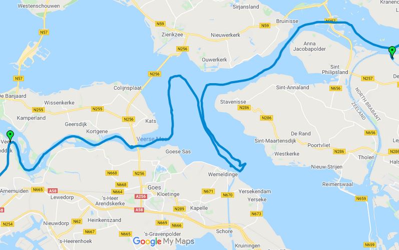
An hour and a half later, we are back where we were earlier in the afternoon. We continue on the right route this time, and eventually reach the Krammersluizen, another giant lock. I call the lockmaster on the VHF and tell him we have an air-draft of 18 m. We are told to go into the big lock for commercial boats rather than the smaller lock for sports boats. We end up behind a large freighter called Aloo.

“Perhaps they are carrying a cargo of potatoes from India”, I say to the First Mate.She doesn’t hear me because of the noise of the engines. It wasn’t much of a joke anyway.
“So where are we going to stay tonight?”, asks the First Mate, once we are through.
“I suppose we could stay in Colijnsplaat”, I answer. “That should be just round the corner here.”

We motor round the corner. There is no sign of anything.
“I think Colijnsplaat was just after the Zandkreeksluis”, says the First Mate. “This lock was the Krammersluizen.”
She is right. Colijnsplaat is miles behind us. Without the lost map, we are completely disoriented. It is starting to get dark. We will just have to find somewhere nearby. Luckily we have a pamphlet of local marinas that had just been relegated to the wastepaper pile that morning. The First Mate tries ringing a few of the closest. The first one says that he is too shallow for our draft. The second one says that he has a couple of available berths and that we should be able to get in with a 2 m draft.
We set a course for it. As we approach, we can’t see an entrance. All we can see is an expanse of woodland. The First Mate spots some buoys to follow. Slightly nervous after our experience in following green buoys earlier in the day, we nevertheless decide to give it a go. The depth drops to 0.5 m under the keel. The buoys lead to a small gap in the woodland that is fringed with reeds. We edge our way in slowly. The channel narrows and the depth goes down to 0.4, 0.3, 0.2 metres. Two ducks quack angrily and flap off in front of us. Still no sign of any marina. We are just about to reverse out, when the depth starts increasing again. 0.2, 0.4, 0.6 metres. We breathe a sigh of relief. The channel widens slightly and turns to port.
“I can see it”, the First Mate calls out suddenly from the bow. “It’s just to our left.”
A small harbour appears from behind the trees and reeds. Most of the boats in it are motor boats, but a couple are sail boats. We motor in slowly and find the first available berth. It’s a tight turn, but we somehow manage it without hitting any other boats or the quay. We have 0.2 m of water under the keel. Not a lot, but enough.
Just as we tie up, a man appears with a welcoming smile. He is the marina manager, and the one that we talked to earlier.
“What a beautiful place you have here”, says the First Mate while I adjust the lines. “It’s so peaceful.”
“Yes, it is nice”, he says proudly. “You can go for walks through the nature reserve over there. And just up there is a very good restaurant you can eat at. You can come up in the morning to sort out the paperwork.”
It rains in the night. I am woken up by the noise of the raindrops hitting the coach-roof. I lie awake listening to it before I drift off again. In the morning, the rain has stopped and the sun comes out. Everything is fresh and green.
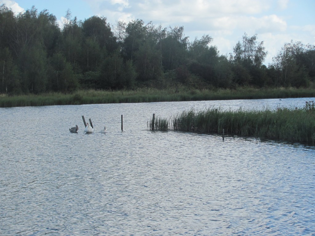
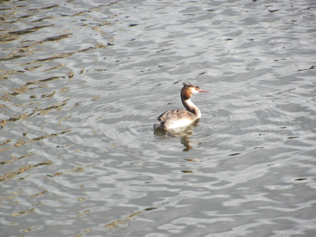
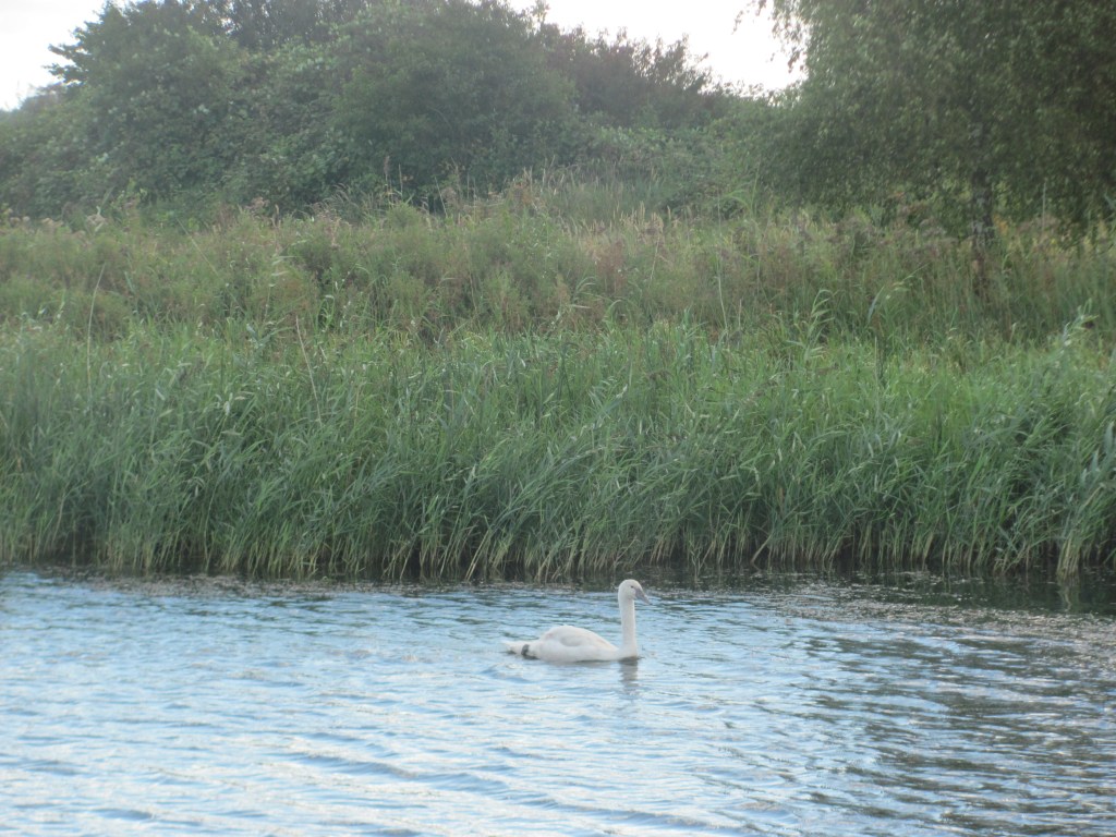
While the First Mate sleeps on, I have breakfast in the cockpit and soak up the atmosphere. Two grebes drift by, their beaks buried in their side feathers as they groom themselves. Swans sail elegantly along, their long necks darting from time to time into the water to pick up an insect that has fallen in. Over in the reeds growing at the side of the inlet ducks feed noisily, quacking quietly to show their satisfaction. A group of coots swim towards me quizzically as if expecting some of my breakfast. It is a scene of idyllic bliss, a small piece of nature in the midst of man’s activities, but also a place to escape from them temporarily. And we probably wouldn’t have found it if we hadn’t lost the map. Every cloud has a silver lining. Well, sometimes.
“This is a beautiful place”, says Spencer from the canopy frame. “It’s a pity that you humans don’t make more places like this. Why do you have to destroy everything and build your own things on it?”

“It’s a good point”, I respond. “The problem is that people like money to buy things, and to get money, they have to produce things that other humans want, and to produce those things, they have to clear land or extract minerals from the earth, and to clear land or extract minerals, they need to destroy these sorts of places.”
“But you change things so much”, counters Spencer. “Look at that huge estuary that we passed earlier in the day. That used to be the sea, with the tides rising and falling every day, currents sweeping in and out to keep it clean, and providing a home to lots and lots of different plants and animals for hundreds or thousands of years. Then you lot come along and decide that nature has not done a very good job here, and that you can do better. And what do you do? You build huge barriers to keep the sea water out, so that there are no tides, few currents and all those plants and animals have gone, to replaced by a different set. Who gave you the right to decide the fate of all those creatures?”

I am a bit taken aback by this monologue, not least because I hadn’t realised that Spencer was so knowledgeable about Dutch history, but also because I had just accepted the received wisdom that Dutch water engineering was a ‘modern wonder of the world’.
“And like you say”, he continues, “I’ll bet money was at the bottom of it all. When they decided to do it, I’ll bet the factored in all the human costs and benefits, but didn’t pay much attention to the costs and benefits to nature.”
I do a quick Google to check. Sure enough, it seems that human lives saved from the flooding were valued at €22 million each, which was added to the cost of flood damage to agriculture, towns, infrastructure and all the other things that humans value. On that basis, the costs of construction were more than paid for by the flood damage that was saved.
“Exactly”, snorts Spencer. “And what value did they place on the life of a shrimp living in the estuary before it was blocked off? Nowhere near €22 million, I’ll bet. But why not? Their life is just as important as a human one.”
“Well, yes, I see your point” I say defensively. “But I am sure they carried out environmental assessments before they started so they would have known something about how the ecology would change. And besides, there has always been change in nature. The earth itself is constantly transforming and habitats come and go. It’s always happened and always will. All humans are doing is speeding up the process a bit.“
“Ah yes”, he says. “But you humans are so puny compared to the Earth’s processes. What you don’t realise is that if you set yourself up against Earth and make an enemy of her, she will always win in the end. All your wonderful dykes and locks and canals are now under threat from climate change, which you yourselves have caused, and now hundreds of billions more Euros need to be spent on them just to cope with the sea-level rise. You have to work with nature and not against her. Anyway, I have to go now and do some engineering of my own – I see the corner of my web over there has come adrift. Toodle pip!”
I finish my muesli and do the washing up from the night before. There’s more to that spider from Scarborough than I thought.

I love Spencer. We need ‘Spencer the Spider Travels the World’ – a rather wonderful book with Spencer travelling around on a boat/train/bus (he doesn’t fly, obviously), telling the reader his magical mix of history and science and hard truths. Your winter project!
LikeLike
Yes, its been quite an eye-opener for Spencer. Have been planning to write something over the winter, but the First Mate keeps on getting household jobs lined up for me!
LikeLike
Loving reading your log and catching up on all your aadventures!! Laureen x
LikeLike
Hi Laureen, glad you enjoy the blog. Yes, we are having a good time. Weather has been great. Hope you are keeping well?
LikeLike